Order Total (1 Item Items):
Shipping Destination:

london the charles close society (42 results)
Feedback
Skip to main search results
Search filters
Product Type
- All Product Types
- Books (36)
- Magazines & Periodicals (No further results match this refinement)
- Comics (No further results match this refinement)
- Sheet Music (No further results match this refinement)
- Art, Prints & Posters (No further results match this refinement)
- Photographs (No further results match this refinement)
- Maps (6)
- Manuscripts & Paper Collectibles (No further results match this refinement)
Condition Learn more
- New (18)
- As New, Fine or Near Fine (13)
- Very Good or Good (8)
- Fair or Poor (No further results match this refinement)
- As Described (3)
Binding
Collectible Attributes
Language (2)
Free Shipping
Seller Location
Seller Rating
-

A Guide to the Ordnance Survey One-inch Popular Edition of Scotland.
Published by Charles Close Society., London, United Kingdom, 2000
ISBN 10: 1870598164 ISBN 13: 9781870598163
Language: English
Seller: Anthony Vickers Bookdealer PBFA, Selby, United Kingdom
Association Member: PBFA
Seller rating 5 out of 5 stars

Stapled Paperback. Condition: Very Good +. 44pp, bw illus.
-

Projections and Origins: Collected Writings
Published by London: The Charles Close Society, 2006., 2006
ISBN 10: 1870598261 ISBN 13: 9781870598262
Language: English
Seller: WorldofBooks, Goring-By-Sea, WS, United Kingdom
Seller rating 5 out of 5 stars
Paperback. Condition: Very Good. The book has been read, but is in excellent condition. Pages are intact and not marred by notes or highlighting. The spine remains undamaged.
More buying choices from other sellers on AbeBooks
New offers from � 33.50
Used offers from � 10.50
Also find Softcover
-

A Guide to the Ordnance Survey One Inch Fifth Edition
Published by Charles Close Society for the Study of Ordnance Survey Maps, London, 2000
ISBN 10: 1870598172 ISBN 13: 9781870598170
Language: English
Seller: Castle Hill Books, Llandrindod Wells, United Kingdom
Seller rating 4 out of 5 stars

Paperback. Condition: New. 48pp, illustrated new in glazed boards; Octavo.
-

Projections and Origins : collected writings of Brian Adams.
Published by London: The Charles Close Society, 2006., 2006
Seller: Cornell Books Limited, Tewkesbury, United Kingdom
Association Member: PBFA
Seller rating 5 out of 5 stars
First Edition
Condition: Good. First edition (softcover). 8vo (21cm by 15cm), [iv], 116pp. Text illustrations. Original laminated card wrappers. There is a bump to the upper corner; otherwise, this book is in very good condition. ISBN 1870598261.
-
A Guide to the Ordnance Survey One-Inch Map of Scotland, Third Edition in Colour.
Published by London: The Charles Close Society, 1991., 1991
Seller: Cornell Books Limited, Tewkesbury, United Kingdom
Association Member: PBFA
Seller rating 5 out of 5 stars
Map First Edition
Condition: Near Fine. First edition (softcover). 8vo (21cm by 15cm), 36pp. Original laminated card wrappers. This book is in very good condition. ISBN 1870598075.
-
Projections and Origins : collected writings of Brian Adams.
Published by London: The Charles Close Society, 2006., 2006
Seller: Cornell Books Limited, Tewkesbury, United Kingdom
Association Member: PBFA
Seller rating 5 out of 5 stars
First Edition
Condition: Near Fine. First edition (softcover). 8vo (21cm by 15cm), [iv], 116pp. Text illustrations. Original laminated card wrappers. This book is in very good condition. ISBN 1870598261.
-
The Birth of the Modern Ordnance Survey Small-Scale Map : the Revised New Series colour printed one-inch map of England and Wales, 1897 - 1914.
Published by London: The Charles Close Society, 2002., 2002
Seller: Cornell Books Limited, Tewkesbury, United Kingdom
Association Member: PBFA
Seller rating 5 out of 5 stars
Map First Edition
Condition: Near Fine. First edition (softcover). 8vo (24cm by 17cm), [v], 104pp. 6 colour plates, 27 b&w figures. Original laminated card wrappers. This book is in very good condition. ISBN 1870598199.
-
A Guide to the Ordnance Survey one-inch New Popular Edition.
Published by London: The Charles Close Society, 2000., 2000
Seller: Cornell Books Limited, Tewkesbury, United Kingdom
Association Member: PBFA
Seller rating 5 out of 5 stars
First Edition
Condition: Near Fine. First edition thus (softcover). 8vo (21cm by 15cm), 60pp. Original laminated card wrappers. This booklet is in very good condition. ISBN 1870598180.
-
A Guide to the Ordnance Survey one-inch Fifth Edition.
Published by London: The Charles Close Society, 2000., 2000
Seller: Cornell Books Limited, Tewkesbury, United Kingdom
Association Member: PBFA
Seller rating 5 out of 5 stars
Condition: Near Fine. Third edition (softcover). 8vo (21cm by 15cm), 48pp. Original laminated card wrappers. This booklet is in very good condition. ISBN 1870598172.
-
A Guide to the Ordnance Survey one-inch Popular Edition of Scotland.
Published by London: The Charles Close Society, 2000., 2000
Seller: Cornell Books Limited, Tewkesbury, United Kingdom
Association Member: PBFA
Seller rating 5 out of 5 stars
First Edition
Condition: Near Fine. First edition (softcover). 8vo (21cm by 15cm), 44pp. Original laminated card wrappers. This booklet is in very good condition. ISBN 1870598164.
-
A guide to the Ordnance Survey one-inch Third Edition Maps, in colour.
Published by London: The Charles Close Society, 2004., 2004
Seller: Cornell Books Limited, Tewkesbury, United Kingdom
Association Member: PBFA
Seller rating 5 out of 5 stars
Map First Edition
Condition: Good. First edition (hardback). 4to (30cm by 21cm), viii, 160pp. Text illustrations (including 8pp in colour). Original laminated boards, no dustwrapper (as issued). There is some bumping to the upper corners of the boards, else this book is in very good condition. ISBN 1870598210.
-
The Ordnance Survey One-Inch Map of England and Wales, Third Edition (Large Sheet Series).
Published by London: The Charles Close Society, 1988., 1988
Seller: Cornell Books Limited, Tewkesbury, United Kingdom
Association Member: PBFA
Seller rating 5 out of 5 stars
Map First Edition
Condition: Near Fine. First edition (softcover). 8vo (21cm by 14cm), v, 252pp. Original printed orange card wrappers. There is some sunning of the spine, else this book is in very good condition. ISBN 1870598032.
-
Popular Maps: The Ordnance Survey Popular Edition One-Inch Map of England and Wales 1919-1926
Published by Published by The Charles Close Society, London, 1999
ISBN 10: 1870598156 ISBN 13: 9781870598156
Language: English
Seller: Keoghs Books, Skipton, United Kingdom
Association Member: PBFA
Seller rating 4 out of 5 stars
Map First Edition
, xv, 411, [5] pages, blank pages for notes to rear, black and white maps, photos and diagrams throughout First Edition , pencil notes on one page to rear, book in near fine condition , dustwrapper in near fine condition , red cloth, gilt titles to spine, coloured endpapers, , 25 cm x 17.5 cm Hardback ISBN: 1870598156.
-

Popular Maps: The Ordnance Survey Popular Edition One-inch Map of England and Wales 1919-1926
Published by The Charles Close Society, London, 1999
ISBN 10: 1870598156 ISBN 13: 9781870598156
Language: English
First Edition
Hardcover. Condition: New. Dust Jacket Condition: New. 13 colour plates plus many other illustrations , some full page (illustrator). 1st Edition. New.
More buying choices from other sellers on AbeBooks
New offers from � 23.90
Also find Hardcover First Edition
-

A Guide to the Ordnance Survey One-Inch Seventh Series
Published by London : The Charles Close Society, 2004
ISBN 10: 1870598237 ISBN 13: 9781870598231
Language: English
Seller: Joseph Burridge Books, Dagenham, United Kingdom
Seller rating 5 out of 5 stars
Soft cover. Condition: New. 2nd Edition. 68 pages. The Seventh Series was the final stage in the development of the Ordnance Survey one inch to one mile (1:63,360) map before its replacement in 1974-6 by the 1:50,000 scale, and was the only completed uniform, or nearly uniform, map series to cover Great Britain at this scale. Though initially published between 1952 and 1961, its origins really lay in the 1920s, and in the desire to replace engraving and lithography by photo-mechanical methods for the production of the one-inch map. This booklet, orginally published in 1986, describes the origins and development of the Seventh Series and provides comprehensive sheet listings of its various editions and versions, together with the tourist maps derived from it. The present edition improves on its predecessors by correcting a few minor mistakes, adding some further details to the introductory essay, and adding a new section on changes to the design and specification of the maps.
-

The Birth of the Modern Ordnance Survey Small-scale Map: The Revised New Series Colour Printed One-inch Map of England and Wales 1897-1914
Published by London : The Charles Close Society, 2003
ISBN 10: 1870598199 ISBN 13: 9781870598194
Language: English
Seller: Joseph Burridge Books, Dagenham, United Kingdom
Seller rating 5 out of 5 stars
Soft cover. Condition: New. 95 pages, [13] pages of plates : illustrations, maps (some colour) ; 25 cm. Tim Nicholson has written a comprehensive study of this important series which changed the image of Ordnance Survey maps. The public were offered for the first time a map printed in up to five colours, folded in covers to fit in a pocket. The origins and impact of the new map are treated exhaustively in part one The Story of the Map. The second part reviews all Aspects of the map series and third part contains a listing of all known Map States. An essential source book for a neglected map series of considerable significance in the development of modern mapping in Britain.
-

Ordnance Survey Maps: A Concise Guide for Historians
Published by Charles Close Society, London, 1994
ISBN 10: 187059813X ISBN 13: 9781870598132
Language: English
Soft cover. Condition: New. Reprint. New.
-

Old Series to Explorer: A Field Guide to the Ordnance Map
Published by Charles Close Society, London, 2011
ISBN 10: 187059830X ISBN 13: 9781870598309
Language: English
First Edition
Soft cover. Condition: New. Many examples, many in colour (illustrator). 1st Edition. New.
More buying choices from other sellers on AbeBooks
New offers from � 33.90
Also find Softcover First Edition
-
Popular Maps - The Ordnance Survey Popular Edition One-Inch Map of England and Wales 19119-1926
Published by Charles Close Society, London, 1999
ISBN 10: 1870598156 ISBN 13: 9781870598156
Language: English
Seller: St Paul's Bookshop P.B.F.A., Peterborough, United Kingdom
Association Member: PBFA
Seller rating 4 out of 5 stars
First Edition
Hardcover. Condition: Near Fine. Dust Jacket Condition: Near Fine. 1st Edition. Popular Maps. Near-fine hardback copy in Near-fine jacket. BOOKS SENT IN DURABLE CARD BOXES. LISTING PHOTO DOES NOT NECESSARILY MATCH THIS COPY.
-

Military Maps - The one-inch series of Great Britain and Ireland
Published by Charles Close Society, London, 2004
ISBN 10: 1870598229 ISBN 13: 9781870598224
Language: English
Seller: St Paul's Bookshop P.B.F.A., Peterborough, United Kingdom
Association Member: PBFA
Seller rating 4 out of 5 stars
First Edition
Hardcover. Condition: Near Fine. 1st Edition. 1st 2004. Near-fine hardback copy in glazed covers. Quarto size. BOOKS SENT IN DURABLE CARD BOXES. LISTING PHOTO DOES NOT NECESSARILY MATCH THIS COPY.
-
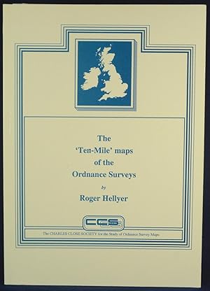
The 'Ten Mile' maps of the Ordnance Surveys
Published by The Charles Close Society, London, 1992
ISBN 10: 1870598121 ISBN 13: 9781870598125
First Edition
Paperback. Condition: Very Good. No Jacket. First Edition. Introduction by Yolande Hudson, who describes the book as "a fascinating tale of the development of a mere index map into a multi-purpose cartographic database which is familiar to us all today in its metric guise of the 1:625,000 Routeplanner". Blue and white card covers, prelims to p xii, then paginated 1-202. Publicity material for the Charles Close Society for the Study of Ordnance Survey Maps to the rear, with black and white reproductions of title pages of some o their publications. Condition: Covers a little worn, otherwise in excellent condition. Neat signature of previous owner to title page.
More buying choices from other sellers on AbeBooks
New offers from � 48.50
Used offers from � 28.50
Also find Softcover First Edition
-

A Guide to the Ordnance Survey One-inch Third Edition Maps,in Colour: England and Wales, Scotland, Ireland
Published by London : The Charles Close Society, 2004
ISBN 10: 1870598210 ISBN 13: 9781870598217
Language: English
Seller: Joseph Burridge Books, Dagenham, United Kingdom
Seller rating 5 out of 5 stars
Hardcover. Condition: New. 3rd Edition. viii, 160 pages : illustrations (some colour), maps (some colour) ; 31 cm This book contains a detailed history and description of these maps by Richard Oliver. It builds on the original monographs by the late Guy Mesenger, and includes much new information, both historical and cartobibliographical. Roger Hellyers meticulous cartobibliography covers all the third edition coloured maps series.
-

Mapping the Windmill: The Ordnance Survey in England
Published by London : The Charles Close Society, 2013
ISBN 10: 1870598296 ISBN 13: 9781870598293
Language: English
Seller: Joseph Burridge Books, Dagenham, United Kingdom
Seller rating 5 out of 5 stars
Hardcover. Condition: New. xi, 307 pages, 16 unnumbered pages of plates : illustrations (some colour), maps (some colour) ; 26 cm. The book covers the whole two hundred years and more of windmills on published OS maps, in dazzling detail. The illustrations dazzle too: there are 16 pages of plates, of both maps and mills, and many more illustrations in the text. Some of these illustrations do things with OS maps that have never been done before. Even those for whom hitherto windmills have been just another type of building will find here an absorbing study of quirkiness, inconsistency and shades of meaning that few can have expected. Though it is widely accepted nowadays that maps are not just maps, Mapping the Windmill breaks new ground in treating a facet of map depiction in minute detail. It is worth the attention of anyone who is interested in maps.
-
The Ordnance Survey in the nineteenth century - Maps, money and the growth of government
Published by The Charles Close Society, London, 2014
ISBN 10: 1870598326 ISBN 13: 9781870598323
Language: English
Seller: Wadard Books PBFA, Farningham, KENT, United Kingdom
Association Member: PBFA
Seller rating 4 out of 5 stars
Hardcover. Condition: Fine. Tells the story of the OS from its origins in the late eighteenth century to the completion in 1914 of the survey of the British Isles at the 1:2500 scale, There have been several histories of the Ordnance Survey: this one differs from all the others in that it wades into politics as well as maps in order to tell the story of he inception of the organisation the 'Battle of the Scales' and how the OS became an essential part of the nation's infrastructure. xxvii, 607pp illustrated in colour and black and white. Top edge of dustjacket creased and with a small closed tear. Book size 255x180mm.
-

Ordnance Survey Maps: A Concise Guide for Historians
Published by London : The Charles Close Society, 2013
ISBN 10: 1870598318 ISBN 13: 9781870598316
Language: English
Seller: Joseph Burridge Books, Dagenham, United Kingdom
Seller rating 5 out of 5 stars
Hardcover. Condition: New. 3rd Edition. 320 pages : maps ; 26 cm. 'This fully revised and updated edition, published October 2013,includes a greatly expanded list of towns with their mapping dates, improved data on the early 1:2500 mapping of counties, and further minutiae on points of detail , as well as an updated bibliography. '.
-
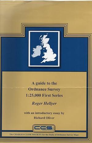
A Guide to the Ordnance Survey 1: 25,000 First Series: With an Introductory Essay by Richard Oliver
Published by London : The Charles Close Society, 2003
ISBN 10: 1870598202 ISBN 13: 9781870598200
Language: English
Seller: Joseph Burridge Books, Dagenham, United Kingdom
Seller rating 5 out of 5 stars
Hardcover. Condition: Very Good. vii, 334 pages : maps ; 31 cm.
-
Military Maps: The One-Inch Series of Great Britain and Ireland
Published by London : The Charles Close Society, 2004
ISBN 10: 1870598229 ISBN 13: 9781870598224
Language: English
Seller: Joseph Burridge Books, Dagenham, United Kingdom
Seller rating 5 out of 5 stars
First Edition
Hardcover. Condition: New. 1st Edition. x, 294 pages : illustrations, maps ; 31 cm Military maps contains listings by Roger Hellyer of all the gridded one-inch military map series of England and Wales, Scotland and Ireland, and, since the second world war, Great Britain and Northern Ireland. It is organised in two completely separate sections, the first describing those series carrying the War Office Cassini Grid, the second those carrying the National Grids of Great Britain and Ireland. There is a special section describing the military mapping of London in each part of the book. Richard Oliver's essay unifies the whole, bringing us first to the point where in the 1920s the War Office was provided with its own separate set of plates for the one-inch map. It then describes how civilian and military versions of the map diverge, reaching perhaps their widest point of separation in War Revision, then Second War Revision, then gradually come together again as National Grid one-inch mapping develops, finally to reunite in the present 1:50,000 Landranger. The history of one-inch military mapping in Ireland and later Northern Ireland is similarly described. The book is graphically illustrated by sixteen colour plates, eight monochrome plates, and seven index diagrams designed by Chris Higley. It has appendices including previously unpublished tables showing editions of GSGS 3907 and 3908, also sales copies, civilian printers and military printing units. This is supplemented by a concordance of military map numbers, a chronology, a bibliography and a diagram briefly showing the organisation of Military Survey, its predecessors and its successors, from 1791 to the present day.
-
OLD SERIES TO EXPLORER: A FIELD GUIDE TO THE ORDNANCE MAP
Published by LONDON THE CHARLES CLOSE SOCIETY, 2011
A VERY FINE SOFTBACK COPY. SCARCE.
-
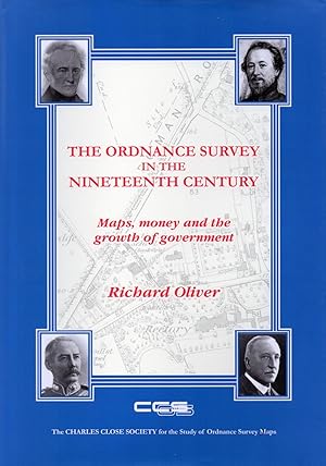
The Ordnance Survey in the Nineteenth Century: Maps, Money and Growth of Government
Published by London : The Charles Close Society, 2014
ISBN 10: 1870598326 ISBN 13: 9781870598323
Language: English
Seller: Joseph Burridge Books, Dagenham, United Kingdom
Seller rating 5 out of 5 stars
Hardcover. Condition: New. Dust Jacket Condition: New. xxvii, 607 pages : illustrations, maps ; 26 cm. The Ordnance Survey is sometimes spoken of as the producer of 'the best maps in the world'. This had to start somewhere, and this book tells the story of the OS from its origins in the late eighteenth century to the completion in 1914 of the survey of the British Isles at 1:2500 scale. There have been several histories of the Ordnance Survey: this one differs from all the others in that it wades into politics as well as maps in order to tell the story of the inception of the organisation, the 'Battle of the Scales' and how the OS became an essential part of the nation's infrastructure. Based on the author's doctoral thesis and many years' further research, this approachable but authoritative account includes reference to unpublished, and many hitherto unexplored, papers in The National Archives.