
Order Total (1 Item Items):
Shipping Destination:

a o p nicholson washington d c (28 results)
Feedback
Skip to main search results
Search filters
Product Type
- All Product Types
- Books (15)
- Magazines & Periodicals (No further results match this refinement)
- Comics (No further results match this refinement)
- Sheet Music (No further results match this refinement)
- Art, Prints & Posters (No further results match this refinement)
- Photographs (No further results match this refinement)
- Maps (13)
- Manuscripts & Paper Collectibles (No further results match this refinement)
Condition Learn more
- New (No further results match this refinement)
- As New, Fine or Near Fine (No further results match this refinement)
- Very Good or Good (25)
- Fair or Poor (1)
- As Described (2)
Binding
- All Bindings
- Hardcover (15)
- Softcover (No further results match this refinement)
Collectible Attributes
- First Edition (8)
- Signed (No further results match this refinement)
- Dust Jacket (No further results match this refinement)
- Seller-Supplied Images (9)
- Not Print on Demand (28)
Language (1)
Free Shipping
Seller Location
Seller Rating
-

REPORT OF THE COMMISSIONER OF PATENTS FOR THE YEAR 1854: AGRICULTURE.
Published by A. O. P. Nicholson, Washington, D. C., 1855
Seller: The Reading Well Bookstore, Delaware, OH, U.S.A.
Seller rating 3 out of 5 stars

First Edition
� 15.29
Convert currency� 34.15 shipping from U.S.A. to United KingdomQuantity: 1 available
Add to basketCondition: Very Good+. Dust Jacket Condition: No Dust Jacket. 1st Edition. Decorative cloth. There is split in the fabric of front cover close to the turn edge, along a stitched seam. There is light wear to the top and bottom of spine. Turn corners have been lightly bumped and have light rubbing. Front end pages are missing. There is light penciling on the title page. Previous owner's name at top turn corner of inside front board paper. Dated: Apr 9, 1887. 528 pages. Decorative Cloth.
-

Mortality Statistics of the Seventh Census of the United States, 1950
Published by A. O. P. Nicholson, Washington, D. C., 1855
First Edition
� 38.23
Convert currency� 28.91 shipping from U.S.A. to United KingdomQuantity: 1 available
Add to basketOriginal Cloth. Condition: Very Good. First Edition. Old embossed stamp on title pages and on pp. 15/16.
-
From the Western Boundary of Missouri to the Mouth of Trap Creek
Published by A. O. P. Nicholson, Washington, D. C., 1861
Seller: Back of Beyond Books, Moab, UT, U.S.A.
Association Member: RMABA
Seller rating 5 out of 5 stars

Map
� 22.94
Convert currency� 33.40 shipping from U.S.A. to United KingdomQuantity: 1 available
Add to basketMap. Condition: Good. Map No. 1 From the Western Boundary of Missouri to the Mouth of Trap Creek, disbound from the map volume XI of the Explorations and Surveys for a Railroad Route from the Mississippi River to the Pacific Ocean, from 1855 surveys. Browning, fold tears, and archival repairs. One of the less mountainous stretches of the railroad survey areas. Kansas City, Jefferson City, Nauvoo, the Mississippi River, and existing railroads are shown. Wagner-Camp 266c. ; 32" x 24".
-
Exploration of the Red River of Louisiana, in the Year 1852 (Report of the U. S. House of Representatives, 33d Congress, 1st Session)
Published by A. O. P. Nicholson, Washington, D. C., 1854
� 61.93
Convert currency� 27.24 shipping from U.S.A. to United KingdomQuantity: 1 available
Add to basketHardcover. Condition: Good. Dust Jacket Condition: No Dust Jacket. Edgeworn, with chipping at spine extremities. Wear along spine edges. Some staining / lightened discoloration at fore-edge of the boards. Front hinge cracked. Spine gilt completely faded. Pages foxed. Geology plate 2 and biology plate 18 are not present, as issued; all other plates present. A bit of light foxing here and there to plates, but overall, they are fairly clean. "Report of the secretary of war - Jeffn. Davis". The accompanying map volume is not present. ; EXH16C.
-
From the Mouth of Trap Creek to Santa Fe Crossing
Published by A. O. P. Nicholson, Washington, D. C., 1861
Seller: Back of Beyond Books, Moab, UT, U.S.A.
Association Member: RMABA
Seller rating 5 out of 5 stars
Map
� 26.76
Convert currency� 33.40 shipping from U.S.A. to United KingdomQuantity: 1 available
Add to basketMap. Condition: Good. Map No. 4 From the Santa Fe Crossing to the Coo-Che-To-Pa Pass, disbound from the map volume XI of the Explorations and Surveys for a Railroad Route from the Mississippi River to the Pacific Ocean, from 1855 surveys. Browning, fold corner holes, and one archival repair. One of the less mountainous stretches of the railroad survey areas, charting Nebraska and Kansas Territories along major rivers, with the Santa Fe Trail marked. Wagner-Camp 266c. ; 32" x 23 1/2".
-
Report of Decisions of the Commission of Claims under the Convention of February 8 1853 between the United States and Great
Published by A. O. P. Nicholson, Washington, D. C., 1956
� 72.64
Convert currency� 25.98 shipping from U.S.A. to United KingdomQuantity: 1 available
Add to basketHardback. Condition: Good. Dust Jacket Condition: No Dust Jacket. Britain transmitted to the Senate by the President of the United States August 11, 1856/dark brown cloth with designs on front &; 478 pages; Worn gold lettering on spine/tears at top spine and small tear at back outer edge and small hole on outer lower spine.
-
Riviere Des Lacs to the Rocky Mountains
Published by A. O. P. Nicholson, Washington, D. C., 1861
Seller: Back of Beyond Books, Moab, UT, U.S.A.
Association Member: RMABA
Seller rating 5 out of 5 stars
Map
� 30.58
Convert currency� 33.40 shipping from U.S.A. to United KingdomQuantity: 1 available
Add to basketMap. Condition: Very Good. Map No. 2 Riviere Des Lacs to the Rocky Mountains, disbound from the map volume XI of the Explorations and Surveys for a Railroad Route from the Mississippi River to the Pacific Ocean, from 1853-1854 surveys. Light browning, small fold corner tears. Showing the survey routes from the Missouri River to the Dividing Ridge of the Rocky Mountains. Wagner-Camp 266c. ; 25" x 37 1/2".
-
General Map of Explorations and Surveys in California
Published by A. O. P. Nicholson, Washington, D. C., 1861
Seller: Back of Beyond Books, Moab, UT, U.S.A.
Association Member: RMABA
Seller rating 5 out of 5 stars
Map
� 38.23
Convert currency� 33.40 shipping from U.S.A. to United KingdomQuantity: 1 available
Add to basketMap. Condition: Fair. A map disbound from the map volume XI of the Explorations and Surveys for a Railroad Route from the Mississippi River to the Pacific Ocean, from 1853 surveys. Fair condition only. Extensive tearing and breaks along folds; one section has completely separated from the rest of the map; . Chipping to edges; moderate toning and foxing. A north to south map from San Francisco Bay to San Diego and Yuma, with topographic detail in some of the coastal ranges and the San Bernadino Mountains. Wagner-Camp 266C. ; 23" x 74".
-
Part III. Illustrations belonging to Reports and Accompanying Message; Message from the President of the United States to the Two Houses of Congress, at the Commencement of the Third Session of the Thirty-Fourth Congress�
Published by A. O. P. Nicholson, Printer., Washington, D. C., 1856
� 152.92
Convert currency� 51.96 shipping from U.S.A. to United KingdomQuantity: 1 available
Add to basketHardcover. Condition: Good. No Jacket. 28.5 x 20.5 cm, 2 pp., 12 mostly folding maps). Partial list of maps by state or territory: Michigan, Wisconsin, Minnesota, Iowa, Arkansas, Louisiana, Florida, California, Territory of Washington, New Mexico, Kansas, Nebraska, Utah. Significantly water damaged, but maps otherwise in unusually good condition, not obviously brittle. Ex library with donation slip. Original blind stamped brown cloth with gilt lettering on front and spine.
-
Reports of Explorations and Surveys, to Ascertain the Most Practicable and Economical Route for a Railroad from the Mississippi River to the Pacific Ocean. Made under the Direction of the Secretary of War, in 1853-4, Volume III: Report of Explorations for a Railway Route, Near the Thirty-Fifth Parallel of North Latitude, from the Mississippi River to the Pacific Ocean [1853-4]
Published by A. O. P. Nicholson, Printer, Washington, D. C., 1856
� 187.33
Convert currency� 27.24 shipping from U.S.A. to United KingdomQuantity: 1 available
Add to basketHardcover. Condition: Good. Dust Jacket Condition: No Dust Jacket. Hardcover; leather spine and corner tips, over marbled paper. TOC states Parts I-VI, Appendices A-N, but the volume only contains Parts I-IV. Part I, "Itinerary": All 13 plates & Woodcuts present, including 9 colorized plates. Part II, "Report of the Topological Features and Character of the Country": All plates & woodcuts present, including 1 colorized plate (plus 1 additional colorized plate not called for). Part III, "Report Upon the Indian Tribes": All plates & woodcuts present, including 8 colorized plates. Also includes a section on various indian language vocabulary. Part IV, "Report on the Geology of the Route": All plates and woodcuts present; including 1 colorized. There is also an "Extracts from [Preliminary] Report" section at the front. There are 3 large, color fold-out charts at the rear: Geological Sections and Geological Map. The largest of the Geological Section chart has a crease and a closed tear on one edge. On the Volume title page, there is a printing error, omitting the "R" in "Report". Foxing to the smaller of the Geological Sections; light foxing to the other two, mostly in the margins and on the verso. Else charts clean. The binding is worn, but intact. Spine gilt completely faded. Foxing to the endpapers & page edges. Light foxing throughout. Leaves had been pressed between a few pages, causing some staining. Inquire for additional details, as needed. Other volumes from this series are also available. This is a large, heavy book; Priority and/or International may require shipping over and above standard costs. ; 26A; 11-3/4 x 9".
-
Reports of Explorations and Surveys, to Ascertain the Most Practicable and Economical Route for a Railroad from the Mississippi River to the Pacific Ocean. Made under the Direction of the Secretary of War, in 1854-5, Volume VI: Report of Lieut. Henry L. Abbot, Corps of Topographical Engineers Upon Explorations for a Railroad Route, from the Sacramento Valley to the Columbia River [1855]
Published by A. O. P. Nicholson, Printer, Washington, D. C., 1857
� 228.61
Convert currency� 27.24 shipping from U.S.A. to United KingdomQuantity: 1 available
Add to basketHardcover. Condition: Good. Dust Jacket Condition: No Dust Jacket. Hardcover; leather spine and corner tips over marbled paper. Consisting of Parts I - IV, plus Appendices A - F. Part I, "General Report": Lacking both maps. All 13 plates present, 12 of which are colorized. Pages 65-72 have been duplicated in error, including 2 of the plates. Part II, "Geological Report": All 4 plates present, 1 is colorized. Part III, "Botanical Report": All 16 plates present, 10 colorized. Part IV, "Zoological Report": All 16 plates present; 2 colorized. There is a page stating "Contents of Volume VII" inserted between the main title pages and the Volume VI title pages - I believe this is incorrectly bound-in. The binding is worn, but intact. Spine gilt faded, but just readable. Foxing to pages. The front flyleaf is creased/wrinkled. Leaves had been pressed between some pages, causing some staining. Inquire for additional details, as needed. Other volumes from this series are also available. This is a large, heavy book; Priority and/or International may require shipping over and above standard costs. ; 26A; 11-3/4 x 9-3/4".
-
![Seller image for Reports of Explorations and Surveys, to Ascertain the Most Practicable and Economical Route for a Railroad from the Mississippi River to the Pacific Ocean Made under the Direction of the Secretary of War, in 1853-4.volume IV [4] for sale by MW Books](https://pictures.abebooks.com/inventory/md/md1330934458.jpg)
Reports of Explorations and Surveys, to Ascertain the Most Practicable and Economical Route for a Railroad from the Mississippi River to the Pacific Ocean Made under the Direction of the Secretary of War, in 1853-4.volume IV [4]
Published by Washington, D. C. , A. O. P. : Nicholson, Printer [1854-1856], 1856
First Edition
� 317.15
Convert currencyFree shipping from U.S.A. to United KingdomQuantity: 1 available
Add to basketFirst Edition. Very good copy in the original gilt-blocked cloth. Professionally recased with the original spine laid back; very impressively finished. Remains particularly well-preserved overall; tight, bright, clean and strong. Scans and additional detail on request. ; 1 pages; Physical desc. : 1 vol. (various pagings) : ill ; 30 cm. Subjects; Natural history - West (U. S. ) . Indians of North America - West (U. S. ) . Geology - California. 3 Kg.
-
Report of Explorations in California for Railroad Routes, to Connect With, the Routes Near the 35th and 32nd Parallels of North Latitude. [House of Representatives, Ex. Doc, No. 91] Route for a Railroad from the Mississippi River to the Pacific Ocean. Made under the Direction of the Secretary of War, in 1853-54, According to Acts of Congress . . Volume V.
Published by A. O. P. Nicholson, Washington, D. C., 1856
Seller: G. F. Wilkinson Books, member IOBA, GRASS VALLEY, CA, U.S.A.
Association Member: IOBA
Seller rating 4 out of 5 stars

� 305.84
Convert currency� 22.27 shipping from U.S.A. to United KingdomQuantity: 1 available
Add to basketHardcover. Condition: Good. Covers rubbed, wear at corners. Spine label dulled. Firm at joints and hinges. Foxing and age toning throughout, little to fairly moderate on the fronts of lithographic plates and maps, with heavier foxing on the backs. Botanical plates with moderate to heavy foxing. ; Half leather and marbled paper over boards. Part I: Report 40pp. 12 lithographic plates, and 10 wood engravings Part II: Geological Report by W. P. Blake, Geologist ad Mineralogist to the Expedition, 370pp. ,14 lithographic plates, 4 geologic maps, 9 folding geologic sections, over 100 wood engravings; Part III: Botanical Report by Mr. E. Durand and T. C. Hilgard, M. D. ,15pp. 28 botany plates. ; 4to 11" - 13" tall.
-
![Seller image for Reports of Explorations and Surveys, to Ascertain the Most Practicable and Economical Route for a Railroad from the Mississippi River to the Pacific Ocean Made under the Direction of the Secretary of War, in 1853-4.volume IV [4] for sale by MW Books Ltd.](https://pictures.abebooks.com/inventory/md/md1330948528.jpg)
Reports of Explorations and Surveys, to Ascertain the Most Practicable and Economical Route for a Railroad from the Mississippi River to the Pacific Ocean Made under the Direction of the Secretary of War, in 1853-4.volume IV [4]
Published by Washington, D. C. , A. O. P. : Nicholson, Printer [1854-1856], 1856
First Edition
� 354.76
Convert currency� 9.55 shipping from Ireland to United KingdomQuantity: 1 available
Add to basketFirst Edition. Very good copy in the original gilt-blocked cloth. Professionally recased with the original spine laid back; very impressively finished. Remains particularly well-preserved overall; tight, bright, clean and strong. Scans and additional detail on request. ; 1 pages; Physical desc. : 1 vol. (various pagings) : ill ; 30 cm. Subjects; Natural history - West (U. S. ) . Indians of North America - West (U. S. ) . Geology - California. 3 Kg.
-
The U. S. Naval Astronomical Expedition to the Southern Hemisphere, during the Years 1849-'50-'51-'52. Volume I. CHILE. Volume II; The Andes and Pampas, Minerals, Indian Remains, Birds, Reptiles, Fishes and Crustacea, Shells, Dried Plants, Living Plants and Seeds, Fossil Mammals, Fossil Shells
Published by A. O. P. Nicholson, Printer, Washington, D. C., 1855
Seller: Dale Steffey Books, ABAA, ILAB, Bloomington, IN, U.S.A.
Seller rating 5 out of 5 stars
First Edition
� 458.76
Convert currency� 20.79 shipping from U.S.A. to United KingdomQuantity: 1 available
Add to basketHalf-Leather. Condition: Very Good. 1st Edition. 33rd Congress, First Session, House of Representatives, Ex. Doc. No. 121. The first two volumes of the four actually published, there were 6 volumes originally planned. Bound in contemporary marbled boards and half leather, Very Good, the boards rubbed, bowing at top corner Vol. I, heavy toning at end pages with only occasional and widely scattered small spots of toning throughout, complete with 5 maps (mostly folding), 46 plates, including 25 colored and tinted plates of Cassin's birds, Indian antiquities, Indians, views (one of which is a 5 1/2 foot long tinted panorama of Santiago highlighted in bright hand coloring), and numerous wood-engraved text illustrations. With a great Kentucky and U.S. House of Representatives ASSOCIATION COPY signature, SIGNED AND INSCRIBED -"For my friend Thomas A Respess, R. H. Stanton". Richard H. Stanton (1812-1891) Democrat from Kentucky served in the House of Representatives from 1849-1855, and was imprisoned during the Civil War for sedition. He was a lawyer, politician, judge, and editor of the Maysville Monitor from 1835 to 1842 Thomas A. Respess (1826-1918) was Clerk of the Marion Circuit Court in Maysville and was the 2nd for Col. Castro in the Metcalfe-Castro Duel. Book.
-
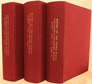
Report on the United States and Mexican Boundary Survey: made under the direction of the Secretary of the Interior
Published by A O P Nicholson, Washington, D C, 1857
Seller: The Book Collector, Inc. ABAA, ILAB, Fort Worth, TX, U.S.A.
Association Member: ABAA ILAB IOBA TXBA
Seller rating 5 out of 5 stars
First Edition
� 2,867.22
Convert currency� 63.10 shipping from U.S.A. to United KingdomQuantity: 1 available
Add to basketHardcover. Condition: Very Good. 1st Edition. 2 volumes in 3. Volume I, parts I and II: xvi+258 pages with frontispiece, 72 maps (1 folding) and illustrations engraved on steel, map and meteorological engraved on copper diagram, 12 engravings on stone, 20 wood cuts and errata; vii+174+[21 plates] with folding map in color, 26 maps and illustrations and errata. Volume 2, part I: 270+[75 plate] pages with index; Volume II, part II: 62+[27 plates] pages with index, 33+[25 plate] pages with index, 35+[41 plate] pages with index, 85+[ii]+[41 plate] pages with index. U S Geological Survey Bulletin 194 map (40" x 26 1/4"). Quarto (11" x 9") bound in red cloth with gilt lettering to spine. House of Representatives, 34th Congress, 1st Session, Senate Ex. Doc 108. (Howes E146; Wagner-Camp 291; Wheat, Transmississippi West III, 822 and pages 242-4.) First edition with this set includes three plates not recorded in Wagner-Camp and not found in all copies: a colorful "Map Illustrating the General Geological Features of the Country West of the Mississippi River" (facing page I:258); "View of Monument Mountain" facing page I:96; and "View Along the Gila (Cereus Giganteus)" facing the last text leaf in the second volume. The folding map in volume one is one of the foundation maps for the western United States and represents the culmination of fifty years of government explorations. Starting with Lewis and Clark, there were numerous official and unofficial surveys and explorations, all adding to the pool of knowledge presented here. While large sections are still labeled "unexplored territory," Emory fitted these fragments together with the information gathered during his surveys into a reasonably correct cartographic picture of the West. This map shows large, transitional territories of Nebraska, Kansas, New Mexico, Utah, Oregon, Washington and Minnesota. It was drawn by Thomas Jekyll under the supervision of Lt. Nathaniel Michler of the Topographical Engineers. Lt. Michler worked with his counterpart representing Mexico, Captain Francisco Jimenez, to survey between Nogales and Yuma including the area south of Arivaca. The U S Geological survey Bulletin 194 was drawn by J.E. Weyss, circa 1860. The map features the survey lines between Texas and New Mexico with good topographical detail. Information includes forts, Raton Pass, the Santa Fe, and Albuquerque trails, numerous explorers' routes, Indian trails, and more. The map is an interesting historical curiosity because it was not published when the survey was finished due to the outbreak of the Civil War. In 1902 the map was belatedly included in a Geological Survey Bulletin by Marcus Baker. Printed by the Norris Peters Co., Photo-Lithograph. It is a large and extremely detailed chart by J.H. Clark, U.S. Commissioner. Report on the United States and Mexican Boundary Survey has been called "one of the masterworks of Western and American history." Published in the years 1857 to 1859, it was the official report of the U.S. Boundary Commission upon completing its work of surveying and mapping the United States-Mexico boundary. The boundary survey was a consequence of the U.S.-Mexican War and the Treaty of Guadalupe Hidalgo, which concluded the war on February 2, 1848. The treaty transferred to the United States nearly half of the territory of Mexico and delimited the boundary. Some of the land was settled by Mexican ranchers and farmers, but much of the territory was unexplored and to Americans, it was an unknown land. Commissions from both the U.S. and Mexico began the survey and demarcation of the line in 1849. In 1853, through negotiation of the Gadsden Treaty, the United States purchased additional territory that now forms the southern parts of Arizona and New Mexico. The boundary survey was completed in 1855, and the U.S. and Mexican commissions finished their maps in 1857, while work on the U.S. final Report continued for another two years. The U.S.-Mexico boundary Report was published in two massive volumes, sometimes in three, and it.
-
Part IV. Illustrations belonging to reports accompanying the message: 34th Congress, 1st Session. [Senate] Ex. Doc. No. 1. Message from the President of the United States to the Two Houses of Congress, at the commencement of the first seesion of the thirty-fourthth Congress.
Published by A. O. P. Nicholson, Printer., Washington, D. C., 1856
First Edition
� 535.21
Convert currency� 51.96 shipping from U.S.A. to United KingdomQuantity: 1 available
Add to basketHardcover. Condition: Good. No Jacket. 1st Edition. 28.5 x 20.5 cm, 2 pp., 35 mostly folding maps and illustrations most of which are cartographic. Maps and Views to accompany Message and Documents 1855-6 [Cover title];34th Congress, 1st Session. [Senate] Ex. Doc. No. 1 message from the President of the united States to the Tw Houses of Congress, at the commencement of the first seesion of the thirtyfourth Congress. ). Partial list of maps by state or territory: Michigan, Wisconsin, Minnesota, Iowa, Arkansas, Louisiana, Florida (6), California, Oregon west of the Cascade Mountains, Territory of Washington, New Mexico, Kansas, Nebraska, 6 maps of parts of New York, General Government Roads in Minnesota and Wisconsin, Red River in the Vicinity of the Raft, different routes of the overland command from Salt Lake City to the Bay of San Francisco, two charts of discoveries of the first and second American Arctic Expeditions. Significantly water damaged, but maps otherwise in unusually good condition, not obviously brittle. Ex library with donation slip. Original blind stamped brown cloth with gilt lettering on front and spine.
-
From Great Salt Lake to the Humboldt Mountains
Published by A. O. P. Nicholson, Washington, D. C., 1861
Seller: Back of Beyond Books, Moab, UT, U.S.A.
Association Member: RMABA
Seller rating 5 out of 5 stars
Map
� 45.88
Convert currency� 33.40 shipping from U.S.A. to United KingdomQuantity: 1 available
Add to basketMap. Condition: Very Good. Map No. 2 From Great Salt Lake to the Humboldt Mountains, an extracted map disbound from the map volume XI of the Explorations and Surveys for a Railroad Route from the Mississippi River to the Pacific Ocean, from 1855 surveys. Light browning and corner fold tears. Detailed mapping of part of the Basin and Range in Nevada east to Salt Lake City, with the Oregon Trail marked as Emigrant Road. Wagner-Camp 266c. ; 21" x 19".
-
St. Paul to Riviere Des Lacs
Published by A. O. P. Nicholson, Washington, D. C., 1861
Seller: Back of Beyond Books, Moab, UT, U.S.A.
Association Member: RMABA
Seller rating 5 out of 5 stars
Map
� 45.88
Convert currency� 33.40 shipping from U.S.A. to United KingdomQuantity: 1 available
Add to basketMap. Condition: Very Good. Map No. 1 St. Paul to Riviere Des Lacs, disbound from the map volume XI of the Explorations and Surveys for a Railroad Route from the Mississippi River to the Pacific Ocean, from 1853-1854 surveys. Light browning, small fold corner tears, and two small archival repairs. Showing the survey routes from the Mississippi to north of the Yellowstone and Missouri Rivers. Wagner-Camp 266c. ; 25" x 37 1/2".
-
Reports of Explorations and Surveys for a Railroad from the Mississippi River to the Pacific Ocean.
Published by A. O. P. Nicholson, Printer, Washington D. C., 1857
� 38.23
Convert currency� 44.54 shipping from U.S.A. to United KingdomQuantity: 1 available
Add to basketHardcover. Condition: Very Good-. 4to, 757 p. Vol. 8. 60 b/w plates (missing #1-16, 29). Ex-lib. Vol. 8 contains General Report upon the Zoology of the Several Pacific Railroad Routes. Some pages are yellowed. Rebound in green cl. Lib rary binding. ; Vol. 8.
-
Map and Profile of the Tejon Pass
Published by A. O. P. Nicholson, Washington, D. C., 1861
Seller: Back of Beyond Books, Moab, UT, U.S.A.
Association Member: RMABA
Seller rating 5 out of 5 stars
Map
� 57.34
Convert currency� 33.40 shipping from U.S.A. to United KingdomQuantity: 1 available
Add to basketMap. Condition: Good. A map disbound from the map volume XI of the Explorations and Surveys for a Railroad Route from the Mississippi River to the Pacific Ocean, from 1853 surveys. Light browning, fold splits, two archival repairs. Wagner-Camp 266c. ; 23" x 33 1/2".
-
Map of Passes in the Sierra Nevada from Walker's Pass to the Coast Range
Published by A. O. P. Nicholson, Washington, D. C., 1861
Seller: Back of Beyond Books, Moab, UT, U.S.A.
Association Member: RMABA
Seller rating 5 out of 5 stars
Map
� 57.34
Convert currency� 33.40 shipping from U.S.A. to United KingdomQuantity: 1 available
Add to basketMap. Condition: Good. A map disbound from the map volume XI of the Explorations and Surveys for a Railroad Route from the Mississippi River to the Pacific Ocean, from 1853 surveys. Light browning, fold corner tears, two archival repairs. Covering the southern Sierra Nevada and showing John C. Fremont's 1844 Expedition route. Walker's Pass at the north end, Fort Tejon, and routes with their Native American names are also noted. Wagner-Camp 266c. ; 31" x 20".
-
From the Pimas Villages to Fort Fillmore
Published by A. O. P. Nicholson, Washington, D. C., 1861
Seller: Back of Beyond Books, Moab, UT, U.S.A.
Association Member: RMABA
Seller rating 5 out of 5 stars
Map
� 57.34
Convert currency� 33.40 shipping from U.S.A. to United KingdomQuantity: 1 available
Add to basketMap. Condition: Good. Map No. 2 From the Pimas Villages to Fort Fillmore, disbound from the map volume XI of the Explorations and Surveys for a Railroad Route from the Mississippi River to the Pacific Ocean, from 1854-5 surveys. Light browning, fold splits, several small archival repairs. Good detail of southern Arizona, with gold placers and "meteororic" iron labeled. Wagner-Camp 266c. ; 24 1/2" x 39".
-
From San Francisco Bay to the Plains of Los Angeles
Published by A. O. P. Nicholson, Washington, D. C., 1861
Seller: Back of Beyond Books, Moab, UT, U.S.A.
Association Member: RMABA
Seller rating 5 out of 5 stars
Map
� 76.46
Convert currency� 33.40 shipping from U.S.A. to United KingdomQuantity: 1 available
Add to basketMap. Condition: Good. Map No. 1, From San Francisco Bay to the Plains of Los Angeles, disbound from the map volume XI of the Explorations and Surveys for a Railroad Route from the Mississippi River to the Pacific Ocean, from 1854-5 surveys. Light browning, fold splits, several small archival repairs. Good detail of the coast ranges of California and original wetlands. Wagner-Camp 266c. ; 29" x 35 1/2".
-
From the Valley of the Mud Lakes to the Pacific Ocean
Published by A. O. P. Nicholson, Washington, D. C., 1861
Seller: Back of Beyond Books, Moab, UT, U.S.A.
Association Member: RMABA
Seller rating 5 out of 5 stars
Map
� 95.57
Convert currency� 33.40 shipping from U.S.A. to United KingdomQuantity: 1 available
Add to basketMap. Condition: Very Good. Map No. 4 From the Valley of the Mud Lakes to the Pacific Ocean, an extracted map disbound from the map volume XI of the Explorations and Surveys for a Railroad Route from the Mississippi River to the Pacific Ocean, from 1855 surveys. Light browning. Covering Northern California with detailed topography of the Sierras and Cascades, from Pyramid Lake over to Mt. Shasta and the Sacramento Valley. Wagner-Camp 266c. ; 21 1/2" x 18 1/2'".
-
From the Valley of Green River to the Great Salt Lake
Published by A. O. P. Nicholson, Washington, D. C., 1861
Seller: Back of Beyond Books, Moab, UT, U.S.A.
Association Member: RMABA
Seller rating 5 out of 5 stars
Map
� 149.10
Convert currency� 33.40 shipping from U.S.A. to United KingdomQuantity: 1 available
Add to basketMap. Condition: Very Good. Map No. 1 From the Valley of Green River to the Great Salt Lake, an extracted map disbound from the map volume XI of the Explorations and Surveys for a Railroad Route from the Mississippi River to the Pacific Ocean, from 1855 surveys. Light browning at edges. With detailed mapping of the Uintah and Wahsatch Mountains. Wagner-Camp 266c. ; 21" x 18 1/2".
-
From the Rio Grande to the Pacific Ocean
Published by A. O. P. Nicholson, Washington, D. C., 1861
Seller: Back of Beyond Books, Moab, UT, U.S.A.
Association Member: RMABA
Seller rating 5 out of 5 stars
Map
� 229.38
Convert currency� 33.40 shipping from U.S.A. to United KingdomQuantity: 1 available
Add to basketMap. Condition: Good. Map No. 2 From the Rio Grande to the Pacific Ocean, disbound from the map volume XI of the Explorations and Surveys for a Railroad Route from the Mississippi River to the Pacific Ocean, from 1853-54 surveys. Browning, fold splits and tears, and small areas of archival repair. Covering a large portion of the Southwest from New Mexico to California near the 35th parallel surveys. Wagner-Camp 266c. ; 23" x 51".
-
33d Congress, 2nd Session, Ex. Doc. No. 1: Message from the President of the United States. Part III [ONLY], Illustrations Belonging to Reports Accompanying The Message [Maps and Views to Accompany Message and Documents, 1854-5]
Published by A. O. P. Nicholson, Printer, Washington, D. C., 1854
Seller: Lloyd Zimmer, Books and Maps, Chanute, KS, U.S.A.
Seller rating 5 out of 5 stars
First Edition
� 382.30
Convert currency� 29.69 shipping from U.S.A. to United KingdomQuantity: 1 available
Add to basketCloth - Hard Cover. Condition: Good. No Jacket. First Edition. Complete with 45, mostly folding, maps, plans, and illustrations. Cloth is torn along lower joint, and shows wear at spine ends. Gilt stamped lettering on top cover remains bright. Blank front free end page shows a few tears on edges. Contents show light scattered edge wear and some misfold and creases to folding maps. Volume remains clean and otherwise intact.

![Seller image for Reports of Explorations and Surveys, to Ascertain the Most Practicable and Economical Route for a Railroad from the Mississippi River to the Pacific Ocean. Made under the Direction of the Secretary of War, in 1853-4, Volume III: Report of Explorations for a Railway Route, Near the Thirty-Fifth Parallel of North Latitude, from the Mississippi River to the Pacific Ocean [1853-4] for sale by Crossroad Books](https://pictures.abebooks.com/inventory/md/md30829377074.jpg)
![Seller image for Reports of Explorations and Surveys, to Ascertain the Most Practicable and Economical Route for a Railroad from the Mississippi River to the Pacific Ocean. Made under the Direction of the Secretary of War, in 1854-5, Volume VI: Report of Lieut. Henry L. Abbot, Corps of Topographical Engineers Upon Explorations for a Railroad Route, from the Sacramento Valley to the Columbia River [1855] for sale by Crossroad Books](https://pictures.abebooks.com/inventory/md/md30828943907.jpg)
![Seller image for Report of Explorations in California for Railroad Routes, to Connect With, the Routes Near the 35th and 32nd Parallels of North Latitude. [House of Representatives, Ex. Doc, No. 91] Route for a Railroad from the Mississippi River to the Pacific Ocean. Made under the Direction of the Secretary of War, in 1853-54, According to Acts of Congress . . Volume V. for sale by G. F. Wilkinson Books, member IOBA](https://pictures.abebooks.com/inventory/md/md31178850904.jpg)

![Seller image for 33d Congress, 2nd Session, Ex. Doc. No. 1: Message from the President of the United States. Part III [ONLY], Illustrations Belonging to Reports Accompanying The Message [Maps and Views to Accompany Message and Documents, 1854-5] for sale by Lloyd Zimmer, Books and Maps](https://pictures.abebooks.com/inventory/md/md18159487023.jpg)