
Order Total (1 Item Items):
Shipping Destination:

9782067210660 - Gard, Herault - Michelin Local Map 339: Map by Michelin (5 results)
Skip to main search results
Search filters
Product Type
- All Product Types
- Books (4)
- Magazines & Periodicals (No further results match this refinement)
- Comics (No further results match this refinement)
- Sheet Music (No further results match this refinement)
- Art, Prints & Posters (No further results match this refinement)
- Photographs (No further results match this refinement)
- Maps (1)
- Manuscripts & Paper Collectibles (No further results match this refinement)
Condition Learn more
- New (3)
- As New, Fine or Near Fine (No further results match this refinement)
- Very Good or Good (1)
- Fair or Poor (1)
- As Described (No further results match this refinement)
Binding
- All Bindings
- Hardcover (No further results match this refinement)
- Softcover (3)
Collectible Attributes
- First Edition (No further results match this refinement)
- Signed (No further results match this refinement)
- Dust Jacket (2)
- Seller-Supplied Images (2)
- Not Print on Demand (5)
Language (1)
Price
- Any Price
- Under � 20
- � 20 to � 35 (No further results match this refinement)
- Over � 35 (No further results match this refinement)
Free Shipping
- Free Shipping to U.S.A. (No further results match this refinement)
Seller Location
Seller Rating
-

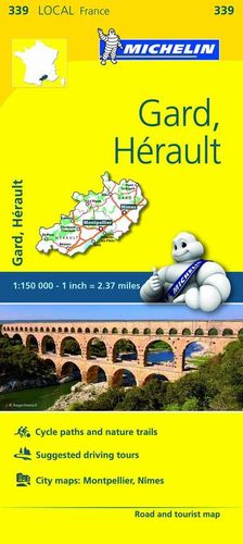
Gard, H�rault Road and Tourist Map (339 Local France)
Language: English
Published by Michelin Travel Publications, 2016
ISBN 10: 2067210661 ISBN 13: 9782067210660
Paperback. Condition: New. Paperback. Publisher overstock, may contain remainder mark on edge.
-
Gard, Herault - Michelin Local Map 339: Map (Michelin Local Maps)
Seller: WorldofBooks, Goring-By-Sea, WS, United Kingdom
Seller rating 5 out of 5 stars

Paperback. Condition: Fair. A readable copy of the book which may include some defects such as highlighting and notes. Cover and pages may be creased and show discolouration.
-
Gard, Herault - Michelin Local Map 339: Map
Seller: WorldofBooks, Goring-By-Sea, WS, United Kingdom
Seller rating 5 out of 5 stars
Paperback. Condition: Very Good. The book has been read, but is in excellent condition. Pages are intact and not marred by notes or highlighting. The spine remains undamaged.
-

Gard, Herault, France Local Map 339 (Maps/Local (Michelin)) : Map
Language: English
Published by Michelin Editions Des Voyages, 2016
ISBN 10: 2067210661 ISBN 13: 9782067210660
Map
Landkarte. Condition: Neu. Neu neuware, importqualit�t, auf lager - (Edition updated in 2017) The MICHELIN Gard, Herault local map, scale 1/150,000 is the ideal companion to fully explore this area in Southern France and provides star-rated Michelin tourist itineraries and attractions, as well as impressive 3D relief mapping. MICHELIN local maps are perfect for cyclists and outdoor enthusiasts with over 20 leisure symbols, extensive coverage of cycling paths and nature trails. With MICHELIN local maps, find more than just your way!MICHELIN LOCAL MAPS provide detailed coverage of France are perfect for fully exploring these countries and are also ideal for cyclists.\* Impressive & realistic 3D relief mapping\* Michelin selected itineraries and must-sees of the area\* A clear and comprehensive key with 20 leisure symbols, as well as cycling paths and nature trails.\* Star rated tourist sights and attractions cross-referenced with the famous MICHELIN Green Guides.\* Plans of main cities and a comprehensive place name index.
-
MAPA LOCAL FRANCRE 339 GARD, H�RAULT
Seller: CENTRAL LIBRERA REAL FERROL, Ferrol. A Coru�a, Spain
Seller rating 5 out of 5 stars
Otros. Condition: Nuevo. Dust Jacket Condition: Nuevo. Los mapas de carreteras de la colecci�n Local se caracterizan por tener cartograf�a fondo sat�lite que, sumada al detalle y precisi�n de su escala, permite descubrir en profundidad Francia e Italia. Incluyen curiosidades y rutas pintorescas. . La edici�n actualizada del mapa Local Gard, H�rault, editado a escala 1/150 000, incorpora la se�alizaci�n de pistas para ciclistas, v�as verdes, sugerencia de itinerarios, as� como los planos de las ciudades de Montpellier y Nimes. . Incluye signos convencionales en ingl�s y franc�s. LIBRO.