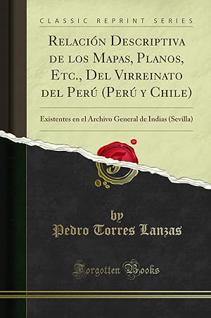
9780483497603 - Relación Descriptiva De Los Mapas, Planos, Etc , Del Virreinato Del Perú Perú Y Chile Classic Reprint : Existentes En El Archivo General De Indias General De Indias... (5 results)
FeedbackSearch filters
Product Type
- All Product Types
- Books (5)
- Magazines & Periodicals (No further results match this refinement)
- Comics (No further results match this refinement)
- Sheet Music (No further results match this refinement)
- Art, Prints & Posters (No further results match this refinement)
- Photographs (No further results match this refinement)
- Maps (No further results match this refinement)
- Manuscripts & Paper Collectibles (No further results match this refinement)
Condition Learn more
- New (5)
- As New, Fine or Near Fine (No further results match this refinement)
- Very Good or Good (No further results match this refinement)
- Fair or Poor (No further results match this refinement)
- As Described (1)
Binding
- All Bindings
- Hardcover (No further results match this refinement)
- Softcover (5)
Collectible Attributes
- First Edition (No further results match this refinement)
- Signed (No further results match this refinement)
- Dust Jacket (No further results match this refinement)
- Seller-Supplied Images (1)
- Not Print on Demand (3)
Language (1)
Free Shipping
Seller Location
Seller Rating
-
Relaci?n Descriptiva de Los Mapas, Planos, Etc., del Virreinato del Per? (Per? Y Chile)
Seller: PBShop.store UK, Fairford, GLOS, United Kingdom
PAP. Condition: New. New Book. Shipped from UK. Established seller since 2000.
-
Relaci?n Descriptiva de Los Mapas, Planos, Etc., del Virreinato del Per? (Per? Y Chile)
Seller: PBShop.store US, Wood Dale, IL, U.S.A.
£ 18.45
Convert currencyFree shipping from U.S.A. to United KingdomQuantity: 15 available
Add to basketPAP. Condition: New. New Book. Shipped from UK. Established seller since 2000.
-
Relación Descriptiva de los Mapas, Planos, Etc., Del Virreinato del Perú (Perú y Chile): Existentes en el Archivo General de Indias (Sevilla) (Classic Reprint)
Seller: Revaluation Books, Exeter, United Kingdom
Paperback. Condition: Brand New. 144 pages. Spanish language. 9.02x5.98x0.31 inches. In Stock.
-
Relacià n Descriptiva de los Mapas, Planos, Etc. (Classic Reprint)
Seller: Forgotten Books, London, United Kingdom
£ 14.77
Convert currencyFree shipping within United KingdomQuantity: Over 20 available
Add to basketPaperback. Condition: New. Print on Demand. This book presents a collection of 150 maps, plans, and other documents produced in the 18th century to aid the governance of Peru and Chile, which at the time formed part of the vast Viceroyalty of Peru. The documents in the book were preserved in the Archive of the Indies in Seville, Spain, and they offer insights into the development, administration, and defense of the region during the colonial era. The maps provide detailed information on settlements, coastal regions, rivers, and natural resources, reflecting the practical concerns of imperial governance, while also shedding light on the impact of European colonialism on the indigenous populations of the region. This book will be of great interest to scholars of Latin American history, cartography, and the history of imperialism. This book is a reproduction of an important historical work, digitally reconstructed using state-of-the-art technology to preserve the original format. In rare cases, an imperfection in the original, such as a blemish or missing page, may be replicated in the book. print-on-demand item.
-
Relación Descriptiva de los Mapas, Planos, Etc., Del Virreinato del Perú (Perú y Chile): Existentes en el Archivo General de Indias (Sevilla) (Classic Reprint)
Seller: Revaluation Books, Exeter, United Kingdom
Paperback. Condition: Brand New. 144 pages. Spanish language. 9.02x5.98x0.31 inches. This item is printed on demand.


