Sider Sandra Mitchell Codding (7 results)
FeedbackSearch filters
Product Type
- All Product Types
- Books (6)
- Magazines & Periodicals (No further results match this refinement)
- Comics (No further results match this refinement)
- Sheet Music (No further results match this refinement)
- Art, Prints & Posters (No further results match this refinement)
- Photographs (No further results match this refinement)
- Maps (1)
- Manuscripts & Paper Collectibles (No further results match this refinement)
Condition Learn more
- New (1)
- As New, Fine or Near Fine (1)
- Very Good or Good (1)
- Fair or Poor (No further results match this refinement)
- As Described (4)
Binding
Collectible Attributes
- First Edition (1)
- Signed (No further results match this refinement)
- Dust Jacket (1)
- Seller-Supplied Images (3)
- Not Print on Demand (7)
Language (4)
Free Shipping
- Free Shipping to U.S.A. (No further results match this refinement)
Seller Location
Seller Rating
-
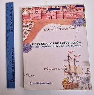
Cinco Seculos de Exploracion: Fondos Cartograficos da Hispanic Society of America
Published by Fundacion Caixa Galicia, A Coruna, 2005
ISBN 10: 8496494322 ISBN 13: 9788496494329
Language: Spanish
Paperback. Green and color-illustrated wraps; green spine with yellow and white lettering; French flaps. 137 pp. 40 color plates. Text in Galician with translations in Castilian and English. VG-. Soiling mainly only on one page (101); remainder of book is clean and tight.
-
Maps, Charts, Globes: Five Centuries of Exploration
Published by Hispanic Society of America, 1992
ISBN 10: 087535145X ISBN 13: 9780875351452
Language: English
Seller: LEA BOOK DISTRIBUTORS, Jamaica, NY, U.S.A.
Hard Cover. Condition: New. 128 pp., 25 illus., 46 col. pl. Photos of maps, with chronological order and index. A New Edition of E. L Stevenson's Portolan Charts and Catalogue of the 1992 Columbus Centennial Exhibition. Language: HISPANIC.
-
Maps, Charts, Gloves: Five Centuries of Exploration
Published by Hispanic Society of America, 1992
Seller: Arader Galleries of Philadelphia, PA, Philadelphia, PA, U.S.A.
Hardcover. Condition: Very Good. This account of global exploration follows the development of the study of cartography. Combining a study of maps, charts, and globes, the authors are able to paint a vivid picture of how humanity's means of tracing the development of the earth develop. This copy is in good condition, with only some small tears at the top.
-
Maps, Charts, Globes: Five Centuries of Exploration. A New Edition of E. L. Stevenson's Portolan Charts and Catalogue of the 1992 Exhibition.
Published by The Hispanic Society of America New York, 1992
Seller: Forest Books, ABA-ILAB, Grantham, LINCS, United Kingdom
Map First Edition
£ 25
Convert currency£ 15 shipping from United Kingdom to U.S.A.Quantity: 1 available
Add to basketFirst Edition, 4to, 73 plates (some coloured), orig. cloth, d.w. Catalogue of the Society's manuscript portolan charts covering material from the fifteenth through the seventeenth century.
-
Cinco séculos de exploración. Fondos cartográficos da Hispanic Society of America. Catálogo Exposición Fundación Caixa Galicia, 2005
Seller: Libros El Trovador, TALAVERA DE LA REINA, TO, Spain
A Coruña, Fundación Caixa Galicia, 2005. 28x21 cm. 137 p. Rústica, solapas. Ilustr. color. Buen estado. Primera edición. (Ref. N. 101-C).
-
Cinco séculos de exploración. Fondos cartográficos da Hispanic Society of America
Published by Fundación Caixa Galicia, Galicia, 2005
ISBN 10: 8496494322 ISBN 13: 9788496494329
Language: Gallegan
Seller: Los libros del Abuelo, Madrid, M, Spain
Encuadernación de tapa blanda. Condition: Muy bien. Unha viaxe a través de cinco séculos dos fondos cartográficos da Hispanic Society of America. Ilustrado en cor. En moi bo estado interno e externo. Medidas: 28x21 cms. Ref.: P-5-6.
-
Idioma publicación: Castellano, Galego, Inglés. 140 páxinas, ilustracións, fotografías en color, 28 x 21 cm. Edit. Fundación Caixa Galicia, 2005 Comprende este catálogo a descrición dunha selección de mapas, atlas e cartas de navegación de entre os séculos XV e XVIII, en pergameo e en papel, procedentes do fondo cartográfico da Hispanic Society of America (Nova York). Este fondo constitúe unha das mellores coleccións do mundo no seu xénero e é moi escasamente coñecido polas propias características das pezas, ao tratarse de documentos únicos.Os mapas aquí descritos son produto dunha época na que poderosos países europeos emprenderon grandes exploracións marítimas e terrestres. Unha das consecuencias que supuxo este afán colonizador foi o avance de ciencias e técnicas como a xeografía e a cartografía. Ao valor histórico e á precisión técnica destes manuscritos súmase ademais o seu notable valor artístico, pois moitos deles están profusamente iluminados.


