
Mitchell Augustus 1790 1868 (14 results)

MITCHELL'S PRIMARY GEOGRAPHY. AN EASY INTRODUCTION TO THE STUDY OF GEOGRAPHY: DESIGNED FOR THE INSTRUCTION OF CHILDREN IN SCHOOLS AND FAMILIES. ILLUSTRATED BY ONE HUNDRED AND TWENTY ENGRAVINGS. AND FOURTEEN MAPS.
Mitchell, S. Augustus [Samuel Augustus Mitchell], 1790-1868.
Published by Philadelphia [PA]: Thomas, Cowperthwait & Co., 1840., 1840
- Hardcover
Seller: David Hallinan, Bookseller, Columbus, MS, U.S.A.David Hallinan, Bookseller
Contact seller5-star seller[2], i-iv, 5-178 pages. Hardcover: H 15.5cm x L 12.75cm. Original binding of green leather spine and paper over boards. Scuffing at spine ends and along rear joint, spine's thin gilt bars have slight losses but otherwise bright; strong toning and soiling to boards with worn corners, lower half of rear board has diagonally-angled… slender small losses to surface paper adversely affecting text. Terrific contemporary bookseller ticket on front pastedown: "Sold by A. Upton, Dealer in Evangelical, School & Miscellaneous Books, at the Union Book-store, 18 Central-street, Lowell. Blank Book Manufactory, Periodical Agency, Circulating Library, &c." Ink and pencil signatures on front free endpaper; faded ink inscription on rear free endpaper; some staining, soiling, and light foxing to leaves which, overall, remain fairly clean. Binding is firm. A good+ copy. Features b/w vignette illustrations and most map illustrations (but not all) enhanced by color.
PLAN OF CINCINNATI AND VICINITY. [S. Augustus Mitchell hand-colored 1860 map of Cincinnati, Ohio and portions of Covington and Newport, Kentucky.]
Mitchell, S. Augustus [Samuel Augustus Mitchell], 1790-1868.
Published by [Philadelphia]: S. Augustus Mitchell, 1860., 1860
Seller: David Hallinan, Bookseller, Columbus, MS, U.S.A.David Hallinan, Bookseller
Contact seller5-star sellerSingle one-sided sheet from Mitchell's atlas with 1860 copyright statement at lower left. Sheet dimensions: H 15 1/4 inches x L 12 9/16 inches. Map dimensions including floral border (image orientated horizontally): approx. H 10 5/8 inches x L 11 1/4 inches. Some foxing and toning and several short tears at margins; small stain…at lower right margin; sheet's removal from atlas caused several shallow chips at gutter/spine edge. Floral border. Map's color in pink, blue, and muted yellow.
NEW HAMPSHIRE AND VERMONT. [S. Augustus Mitchell hand-colored 1862 map.]
Mitchell, S. Augustus, Jr. [Samuel Augustus Mitchell, Jr.], 1790-1868. W.H. Gamble.
Published by [Philadelphia]: S. Augustus Mitchell, 1862., 1862
Seller: David Hallinan, Bookseller, Columbus, MS, U.S.A.David Hallinan, Bookseller
Contact seller5-star sellerSingle sheet removed from atlas. Sheet dimensions approximately H 15 1/2 inches x L 12 9/16 inches. Map with border dimensions: approx. H 13 11/16 inches x L 11 3/8 inches. Several small chips at left margin from removal; light toning at edges with a few small stains. Color remains bright. Ideal for framing. Jpegs emailed upon r…equest.
Published by S. Augustus Mitchell, Philadelphia, 1867
- First Edition
- Map
Seller: T. W. Palmer Books, Eugene, OR, U.S.A.T. W. Palmer Books
Contact seller5-star sellerCondition: Used - Near fine
£ 57.43
£ 3.72 shippingShips within U.S.A.Quantity: 1 available
No Binding. Condition: Near Fine. No Jacket. 1st Edition. 32 x 40 cm, colored counties, numerous well labeled roads and trails, verso blank, grape border, #49, "drawn ad engraved by W. H. Gamble Pholadelphia" top slightly nicked, otherwise fine.
Published by S. Augustus Mitchel, Philadelphia, 1871
- First Edition
- Map
Seller: T. W. Palmer Books, Eugene, OR, U.S.A.T. W. Palmer Books
Contact seller5-star sellerCondition: Used - Very good
£ 61.26
£ 3.72 shippingShips within U.S.A.Quantity: 1 available
No Binding. Condition: Very Good. No Jacket. 1st Edition. 39 x 32 cm, counties lightly colored, grape border,47, topography by hachure, cities, rivers, roads and trails, engraved by W. H. Gamble, verso blank No flaws to map but edges notched and pin holes outside neat line.
 More images
Published by Philadelphia: S. Augustus Mitchell and Grigg & Elliot, 1837., 1837
- Hardcover
- First Edition
Seller: Arader Galleries - AraderNYC, New York, NY, U.S.A.Arader Galleries - AraderNYC
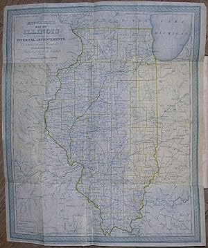
Contact seller5-star sellerHardcover. 1st Edition. rigg & Elliot, 1837. 8vo., (8 7/8 x 5 ½ inches). Publisher's Advertisement (a bit spotted throughout). Fine folding "Map of Illinois" by S. Augustus Mitchell engraved in blue ink and hand-colored in outline (professionally repaired tear along fold). Original brown muslin-cloth backed drab printed paper bo…ards (front board detached, one or two stains, a bit browned). Provenance: Contemporary manuscript ownership inscription of ?S. B. Bradly to recto of front free endpaper, dated Oct. 7, 1843. First edition, second issue with "Animals" spelled correctly on the title page. The map by S. Augustus Mitchell (1790-1868) is crisp and bright. "The publisher is probably the author. It was got up mainly to promote the sale of Illinois Lands then owned by John Grigg of Philadelphia" (Sabin). "No state in the Western Country has attracted more attention and elicited so many inquiries from those who desire to avail themselves of the advantages of a settlement in a new and rising country, as that of Illinois; and none is filling up so rapidly with an industrious and intelligent population, from every part of our extensive country." Howes M689; Graff 2840.
 More images
Published by Philadelphia: Thomas, Cowperthwaite & Co., 1848., 1848
- Hardcover
Seller: Arader Galleries - AraderNYC, New York, NY, U.S.A.Arader Galleries - AraderNYC
Contact seller5-star sellerHardcover. 4to., (12 x 9 ½ inches). 28 engraved maps with original hand-color in full (loosely bound, somewhat toned). Original publisher's pictorial salmon paper-covered boards, with publisher's Advertisement on the rear cover (binding becoming loose, faded to brown, a few stains). Provenance: Contemporary manuscript ownership…inscription to recto of front free endpaper: "Miss Cordelia J. Jaeger / A. Academy Sept. 4th 1849." Second revised edition, first published in 1839. The original edition showed Texas as a republic; this updated version has Texas as a state, with the border along the Rio Grande del Norte. With a very interesting map of Australia, divided into "West Australia" (including a part of present-day Northern Territory), "North Australia" (encompassing present-day Queensland), "South Australia," "New South Wales" (encompassing Victoria), and "Tasmania," bearing the notice "Formerly called New Holland.".
 More images
Published by Philadelphia: Wm. M. Bradley & Bro., 1889, 1889
- Hardcover
Seller: Adrian Harrington Ltd, PBFA, ABA, ILAB, Royal Tunbridge Wells, KENT, United KingdomAdrian Harrington Ltd, PBFA, ABA, ILAB
Contact seller5-star sellerCondition: Used
£ 750.00
£ 30.00 shippingShips from United Kingdom to U.S.A.Quantity: 1 available
[American World Atlas] ORIGINAL COLOURED MAPS. Large quarto (40 x 32cm), with 123 pages of coloured maps, and 46 pages of text at rear. A map of South Africa loosely inserted at rear. Original embossed dark brown cloth over boards, with gilt titles to upper, recently re-backed in brown calf with gilt titles to burgundy morocco l…abel. All edges red. Some gentle spotting to title page, otherwise internally clean. Light general wear to boards, restored to a robust, attractive condition.
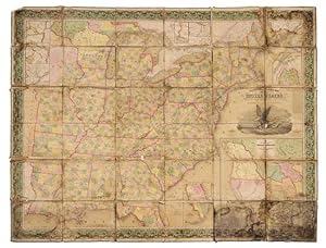
Mitchell's Reference & Distance map of the United States.
MITCHELL, Samuel Augustus (1790-1868) and James H. Young (1817-1866)
Published by Philadelphia: Samuel Augustus Mitchell, 1848 (copyright 1833), 1848
- Softcover
- First Edition
Seller: Arader Galleries - AraderNYC, New York, NY, U.S.A.Arader Galleries - AraderNYC
Contact seller5-star sellerUnbound. 1st Edition. "Engraved folding wall map with large inset map of Texas, Oregon and California in lower right, several smaller inset maps of the Falls of Niagara, Northern Maine, Rochester, Albany, Washington, Charleston, and Florida on the perimeter (overall 56 x 71 in.; 142.5 x 179.6 cm), hand-colored in wash and outlin…e, dissected in 36 sections and mounted on linen, engraving of an eagle on a seashell grasping an olive branch in his left talon and arrows in the right, flanked by the capitol at Washington and Philadelphia (attributed to William Mason), wide ornate vine border, green cloth selvage. BINDING/CONDITION: Marbled paper outer panels. Dampstained with traces of mold chiefly on the linen backing but occasionally affecting portions of the map, some sections separating from backing at corners, margins of several sections creased. (65B2C) FIRST PRINTING OF A LANDMARK MAP OF THE WEST AND THE FIRST TO INCLUDE AN INSET MAP OF TEXAS. This monumental wall map was produced by Mitchell the same year as his pocket size map of Texas, Oregon and California "[It is] an important map [depicting] the western political situation on the eve of the Mexican War. A composite map, it judiciously incorporated the recent work of Nicollet, Wilkes, Frémont, and Emory. Both the Oregon Trail and the 'Caravan route to Santa Fe' are included" (Schwartz & Ehrenberg). Wheat adds: "This map represents a great step forward [utilizing] the recent explorations that had bounded and determined the nature of the Great Basin. The Texas claim to a western boundary up to the Rio Grande is here shown, with the northern panhandle extending all the way to the 42nd parallel, following Emory's map of Texas" (Wheat). PROVENANCE: Evelyn and Eric P. Newman (sale, Leslie Hindman, 12 November 2018, Lot 89) REFERENCES: Rumsey 4308.000; Schwartz & Eherenberg, The Mapping of America, p. 276; Wheat, Mapping of the Transmississippi (1959) II:35, no. 520 (referring to the pocket map's "Accompaniement")".
Published by Philadelphia: S. Augustus Mitchell, 1846., 1846
- Hardcover
- First Edition
Seller: Arader Galleries - AraderNYC, New York, NY, U.S.A.Arader Galleries - AraderNYC
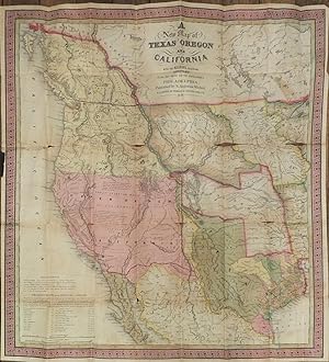
Contact seller5-star sellerHardcover. 1st Edition. Single sheet (20 ¾ x 19 ¼ inches). 46-page "Accompaniment to Mitchell's New Map of Texas, Oregon, and California" (some spotting at beginning and end). Fine folding lithographed map with original hand color in full (separation along folds, some browning). Original publisher's blind stamped morocco gilt, p…reserved in a modern half green morocco slipcase, marbled boards with printed paper spine label (top half of backstrip lacking). Provenance: With contemporary manuscript ownership inscription of Augustus ?Scronsius. From the important cartographical library of Warren Heckrotte, his sale, Rare Cartography, Exploration and Voyages, Part II, December 3, 2015, Lot 192. First edition. Rare first edition of this important map of the West at a time of geographic discovery as well as political upheaval and change. The map is issued with the 46-page text "Accompaniment to Mitchell's New Map of Texas, Oregon, and California, with the Regions Adjoining." As noted in the Accompaniment, Texas has recently been annexed into the United States, and California is in limbo, "Upper California. This part of Mexico was declared independent in 1845. It has of late attracted much attention in the United States; a number of Americans are already settled in it, and many others are preparing to emigrate thither." Regarding Oregon, the Accompaniment declares that "the United States have an indubitable claim to the whole region of Oregon, from N. lat 42º to 54º 40', yet the government has several times proposed, from motives of accommodation, to adopt the 49th parallel of latitude as the dividing line." The proposed boundary line along the 49th parallel is shown on the map, though the coloring of Oregon still reflects joint occupation up to N. lat 54º 40'. "In the Upper California portion, Fremont is carefully followed, while further north Wilkes is followed. The boundary (to be) with Mexico is imperfectly shown but Texas appears with the magnified boundaries, including Santa Fe, of the 1844 Emory. The various claims to Oregon appear. The Accompaniment is of particular interest, containing perhaps the clearest statement of Oregon and California facts that came out of the period just prior to settlement of the former's boundaries and inclusion of the latter in the United States" (Wheat). Cowan p.433. Graff 2841. Howes M685. Wheat Transmississippi 520. Wheat Gold Rush 29. Martin & Martin, Maps of Texas and the Southwest, Plate 36 and p. 57. California 49, map 25. Sabin 49714.
 More images
Published by Philadelphia: S. Augustus Mitchell, 1847., 1847
- Hardcover
Seller: Arader Galleries - AraderNYC, New York, NY, U.S.A.Arader Galleries - AraderNYC
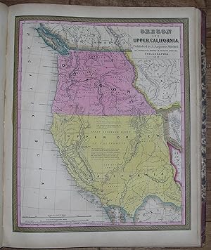
Contact seller5-star sellerHardcover. Folio, (17 3/8 x 14 ½ inches). Vignette title page (toned with one or two spots). Hand-colored lithographed frontispiece "Heights of the Principal Mountains in the World" and "Lengths of the Principal Rivers in the World" (Plate 73), 72 fine lithographed maps with original hand-color in full (lower corner of Plate 14…torn away, occasional spotting and browning). Original publisher's half red roan, marbled boards, lettered in gilt (hinges cracked but holding, overall quite worn with loss). Provenance: Contemporary pen trials to recto of front free endpaper. First published by Mitchell in 1846 after having acquired the rights to Henry Schenk Tanner's "New Universal Atlas" from Carey & Hart who had published editions in 1843 and 1844. However Mitchell changed many of the maps, changed the copperplates to lithography, and then issued the atlas at least once a year until 1850, when he sold the rights to Thomas, Cowperthwait & Company. Thereafter the rights were bought and sold several times, with the atlas being published until at least 1860. "Many maps bear the imprint of S. Augustus Mitchell, and the copyright notice of H. N. Burroughs, or of H. S. Tanner. This atlas is a reissue of Tanner's New Universal Atlas which continued to be published for some years as Mitchell's New Universal Atlas, without reference to Tanner. Includes a map of Oregon and Upper California not called for in the table of contents. [Plate] No. 72, Lengths of the principal rivers in the world [and] Heights of the principal mountains.is bound as [the] frontispiece. The engraved title page has a vignette, 'First landing of Columbus in the New World.'" Phillips Atlases 797. This copy differs from Phillips's in the following issue points: the map of Oregon and Upper California is in fact listed in the Table of Contents as Plate 36; however, the plate itself is unnumbered and the numbering of the subsequent plates is off by one with respect to the Table of Contents. Here, the frontispiece showing the heights of the world's mountains and the lengths of the world's rivers is numbered 73, rather than 72. Title page bears the 1844 copyright notice of Carey & Hart, but most maps bear that of H. N. Burroughs. Catalogued by Megan Scauri.
Published by S. Augustus Mitchell, Philadelphia, 1870
- First Edition
- Map
Seller: T. W. Palmer Books, Eugene, OR, U.S.A.T. W. Palmer Books
Contact seller5-star sellerNo Binding. Condition: Fine. No Jacket. 1st Edition. 32 x 40 cm, colored counties, numerous well labeled roads and trails, verso blank, grape border, #52, "drawn and engraved by W. H. Gamble Pholadelphia" otherwise fine Differs from 1869 (#1919) at least by a larger Nye County and smaller Lincoln County both in Nevada.
Published by S. Augustus Mitchel, Philadelphia, 1876
- First Edition
- Map
Seller: T. W. Palmer Books, Eugene, OR, U.S.A.T. W. Palmer Books
Contact seller5-star sellerNo Binding. Condition: Fine. No Jacket. 1st Edition. 38.5 x 58 cm, colored States, Territories, Provinces, etc., grape border, 12, 13 Engraved by W. Williams, Philadelphia F verso blank States, important cities, railroads, and topography are identified. Oklahoma is still Indian Territory, and Dakota has not been divided. The map… has an inset of Newfoundland.
Published by S. Augustus Mitchell, Philadelphia, 1834
Seller: Arader Galleries - AraderNYC, New York, NY, U.S.A.Arader Galleries - AraderNYC
Contact seller5-star sellerSingle sheet (17 1/2 x 12 1/2 in.; 45.5 x 31.7 cm.). Fine folded engraved map with original hand color in full within an elaborate border of flowers and an attractive vignette on top edge of an eagle and shield; two tables at upper left: "Steam boat routes" and "Principle stage routes, through the states Louisiana, Alabama & Mis…sissippi"; minor early repairs on verso. Original maroon morocco; with minor pale stains (5 1/4 x 3 1/4 in.; 13.3 x 8.3 cm.). PROVENANCE: Contemporary indecipherable ownership inscription on the front pastedown; with the near-contemporary ownership inscription of John Basil Lamar of Bibb County, Georgia, dated 18th March 1835 on the rear pastedown. AN EXCEPTIONALLY BRIGHT AND ATTRACTIVE COPY. First published by Mitchell in his 1831 atlas "A New American Atlas, Designed Principally To Illustrate The Geography Of The United States Of North America; In Which Every Country In Each State And Territory Of The Union Is Accurately Delineated, As Far As At Present Known: The Whole Compiled From The Latest And Most Authentic Information". This map is based on a census of 1830, a number of editions having been published first within "A New American Atlas" and later as individual pocket-maps. The Mitchell Company was one of the first publishing houses to try out the new technique of engraving on steel plates, preceding the majority of the industry by nearly 20 years. During the early years of the company, Mitchell primarily published maps and travel guides. In 1860, Mitchell embarked on an ambitious "New General Atlas" before he retired and turned the business over to his son of the same name Today Mitchell maps are sought after for their fine engraving, sumptuous hand-coloring, and attention to detail. They are some of the finest maps produced during this time period. American Atlases L3584; P11026 and L3585 (Pocket edition). # bci-1-5-30.


