Map World (297 results)
- Softcover
Seller: Prairie Creek Books LLC., Torrington, WY, U.S.A.Prairie Creek Books LLC.
Contact seller5-star sellerCondition: Used - Good
£ 3.09
£ 3.74 shippingShips within U.S.A.Quantity: 1 available
Soft cover. Condition: Good. No Jacket. Revised Edition. G/none, used pb, 166pp. Perfect bound, color illustrated stiff paper wraps with tan colored text on upper and black text on spine; edge wear; no tears; damaged on lower; rubbed. Interior pages clean, unmarked; tail tips wrinkled. Binding is tight. Illustrations, Map (illus…trator).

Published by International Geological Congress., 1964
- Softcover
Seller: Eryops Books, Stephenville, TX, U.S.A.Eryops Books
Contact seller5-star sellerCondition: Used - Very good
£ 3.66
£ 4.49 shippingShips within U.S.A.Quantity: 1 available
Soft cover. Condition: Very Good. Softcovers explanation only; softcovers; staple-bound; in very good condition. Book.
Published by Friends Hereford Cathedral 1979 8th ed, Hereford, UK, 1979
- Softcover
Seller: Ray Boas, Bookseller - Established 1980, Walpole, NH, U.S.A.Ray Boas, Bookseller - Established 1980
Contact seller5-star sellerPB. Condition: very good, wraps (softcover). 40pp. B&W illustrations (illustrator).
Published by Scribner's (base spine ), 1930
- Hardcover
Seller: WONDERFUL BOOKS BY MAIL, CHICO-CA, CA, U.S.A.WONDERFUL BOOKS BY MAIL
Contact seller5-star sellerHardcover. Condition: Fair. HARDCOVER. fair to poor condition.very readable text block. EX LIBRAY COPY.***TITLE PAGE MISSING***."Adapted" by FINLEY, JOHN H. ; Introduction by S.C.B. ADAPTED with helpful APPENDIX for each chapter, short GLOSSARY. .offering for critical perspective & as a example of school use for LITERATURE studi…es. Lite green spine & cover titles on DARK BLUE cloth hard covers.1" floral device to cover. ; 133 pages; Might suggest ideas for deeper study of the book.the adaptation is quite interesting. Illustrated by World Map Endpaper art (illustrator).

Published by World Map Press, 2012
- Softcover
Seller: WorldofBooks, Goring-By-Sea, WS, United KingdomWorldofBooks
Contact seller5-star sellerCondition: Used - Very good
£ 8.50
£ 5.60 shippingShips from United Kingdom to U.S.A.Quantity: 1 available
Paperback. Condition: Very Good. The book has been read, but is in excellent condition. Pages are intact and not marred by notes or highlighting. The spine remains undamaged.

London Review Of Books 1 November 2001
Mary-Kay Wilmers (Editor) / Janes Davidson "Alexander the Great in Fact and Fiction! / Anthony Grafton "The Lost World of Latin Users" / Philip Kitcher "Cab biology be more like Physics?" / Patrick Collinson "The Pilgrimage of Grace and the Politics of the 1530s" / Lorraine Daston "Your map isn't my map" / Andrew saint "The Cambridge Urban History of Britain: Vol.III, 1840-1950
Published by LRB, 2001
- Softcover
- Periodical
Seller: Shore Books, London, United KingdomShore Books
Contact seller5-star sellerCondition: Used - Very good
£ 5.00
£ 11.00 shippingShips from United Kingdom to U.S.A.Quantity: 1 available
Soft cover. Condition: Very Good. 44 pages. Janes Davidson "Alexander the Great in Fact and Fiction! / Anthony Grafton "The Lost World of Latin Users" / Philip Kitcher "Can biology be more like Physics?" / Patrick Collinson "The Pilgrimage of Grace and the Politics of the 1530s" / Lorraine Daston "Your map isn't my map" / Andrew… saint "The Cambridge Urban History of Britain: Vol.III, 1840-1950.

Language: English
Published by Hammond World Atlas Corporation; Langenscheidt Publishing, Union NJ * * * * *, 2002
- Softcover
- Map
Seller: L. Michael, North Hollywood, CA, U.S.A.L. Michael
Contact seller4-star sellerCondition: Used - Fine
£ 14.07
£ 11.43 shippingShips within U.S.A.Quantity: 1 available
Soft cover. Condition: Fine. Map: Fine/, $25.80 0843717955 NEAR & MIDDLE EAST: Regional Maps, REGIONAL MAPS. Digitized Cartography, Comprehensive Index, Distance Indicators. Scale 1: 4,000,000 * Hammond World Atlas Corporation; Langenscheidt Publishing, Staff. Hammond World Atlas Corporation; Langenscheidt Publishing Group. Unio…n NJ * * * * * 2002 UnStated Edition Tall Wide Folding Map S/c Soft Cover Map: Fine/, Slight, Shelf, Edge And Corner Wear. Pages Printed On 0ff~White Paper, Clean And Tight To The Spine, In Fine/ Condition. Appear To Be Viewed. D/j: None. This Item Will Be Sent Wrapped In Plastic, Taped Shut And In A = Padded Mailing Envelope To Prevent Shipping Damage So That It Will Arrive In The Description Described Which Applies To This B00K, Only. = No Odors, No Writing, No Names, No Rippling, Not Stuck Together, No Book Plate, Not X~Library, No Other Marks. = Will Make It, An Excellent Addition To Your Own Personal Library Collection, Or As A Gift, For The Discriminating Reader / Collector. = WORLD WIDE SHIPPING, AVAILABLE *. Map: Fine/, 2002 (illustrator).

Published by Edinburgh: John Bartholomew & Son Ltd., 1977
- Softcover
- First Edition
Seller: MW Books, New York, NY, U.S.A.MW Books
Contact seller5-star sellerCondition: Used
£ 19.37
Free ShippingShips within U.S.A.Quantity: 1 available
First Edition. Near fine folding map. Remains well preserved overall; tight, bright, clean and sharp-cornered. Physical description; 1 folded map : text, col. map ; 25 cm. Subjects; China ; Maps. E0732900 E1344600 N0533300 N0175700. Scale 1:4,500,000. (E 73°29'00"--E 134°46'00"/N 53°33'00"--N 17°57'00"). Genre; Map. 3 Kg.

Imago Mvndi The Journal Of International Society For The History Of Cartography, Volume 37
Catherine Delano Smith, Elizabeth Harris, Waldseemuller World Map, A. V. Postnikov, On Mapping Methods In 18th C. Russia, Douglass Bassett; Others
- Hardcover
Seller: William H. Allen Bookseller, Shillington, PA, U.S.A.William H. Allen Bookseller
Contact seller5-star sellerCondition: Used - Good
£ 27.00
£ 4.12 shippingShips within U.S.A.Quantity: 1 available
Hardcover. Condition: Good. No Jacket. Vol. 37 Only. A Few Scratches On Front Cover. Worn Spot On Outer Edge Of Front Cover.
Published by Ministry of Mines and Energy, Brazil., 1978
- Softcover
Seller: Eryops Books, Stephenville, TX, U.S.A.Eryops Books
Contact seller5-star sellerCondition: Used - Very good
£ 16.93
£ 4.49 shippingShips within U.S.A.Quantity: 1 available
Soft cover. Condition: Very Good. Softcovers explanation and two large folded maps in light cardboard slipcase; ex-corporate library; several small light spots on outside of slipcase; o/w book and maps are in very good condition. Book.
Published by King & Eisele, Buffalo, NY, 1917
- First Edition
Seller: Liberty Book Shop, Avis, PA, U.S.A.Liberty Book Shop
Contact seller4-star sellerCondition: Used - Very good
£ 11.57
£ 4.46 shippingShips within U.S.A.Quantity: 1 available
Condition: Very Good-. Dust Jacket Condition: No Dust Jacket As Issued. 1st US ed. Folds out to 18" x 16". Minor chipping at edges and a couple of chips at inner folds of map. A minor pink stain on rear. This is an interesting WWI promotional for a Wholesale Jeweler and Importer of Diamonds. ; Thin Small 4to 9" - 11" tall; 1 pag…es.
- Softcover
Seller: SZ Global, Toronto, ON, CanadaSZ Global
Contact seller2-star sellerCondition: Used
£ 9.15
£ 24.82 shippingShips from Canada to U.S.A.Quantity: 3 available
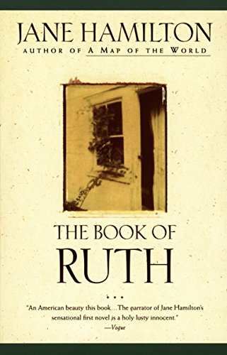
Paperback. Condition: Collectible-Very Good. Ruth, a young woman living in a rural Illinois town, looks back on the people who have shaped her life, including her runaway father, shrewish mother, and crazy husband.

Published by Edinburgh: John Bartholomew & Son Ltd., 1977
- Softcover
- First Edition
Seller: MW Books Ltd., Galway, IrelandMW Books Ltd.
Contact seller5-star sellerCondition: Used
£ 11.43
£ 11.95 shippingShips from Ireland to U.S.A.Quantity: 1 available
First Edition. Near fine folding map. Remains well preserved overall; tight, bright, clean and sharp-cornered. Physical description; 1 folded map : text, col. map ; 25 cm. Subjects; China ; Maps. E0732900 E1344600 N0533300 N0175700. Scale 1:4,500,000. (E 73°29'00"--E 134°46'00"/N 53°33'00"--N 17°57'00"). Genre; Map. 1 Kg.
 More images
Language: English
Published by John Bartholomew & Son Ltd, Edinburgh
Seller: K Books Ltd ABA ILAB, York, YORKS, United KingdomK Books Ltd ABA ILAB
Contact seller5-star sellerCondition: Used - Very good
£ 10.00
£ 19.50 shippingShips from United Kingdom to U.S.A.Quantity: 1 available
No Binding. Condition: Very Good. One folding linen backed colour map, with khaki card covers, scale of 1 : 1,000,000, some pen markings where places have been circled and small tears but o/w good condition, John Bartholomew & Son Ltd, Edinburgh, circa.
 More images
Tectonic Map of South America MC-32, explanatory note of map
Prepared on behalf of the Commission For The Geological Map of the World
Published by Departmento Nacional Da Producao Mineral, Brazil, 1978
Seller: Crossroads Books, Reno, NV, U.S.A.Crossroads Books
Contact seller5-star sellerAssociation member: IOBA
Condition: Used - Very good
£ 16.20
£ 3.78 shippingShips within U.S.A.Quantity: 1 available
Condition: very good. explanatory note of map. cream envelope with brown stripes on sides, text 11.75" x 8.25", 89+ pages, no map.
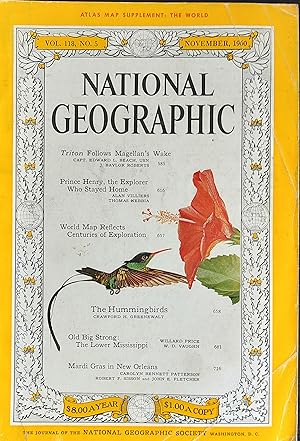
National Geographic Magazine November 1960 / "TRITON FOLLOWS MAGELLAN'S WAKE"- Capt. Edward L. Beach and J. Baylor Roberts / "PRINCE HENRY, THE EXPLORER WHO STAYED AT HOME" Alan Villiers and Thomas Nebbia / WORLD MAP REFLECTS CENTURIES OF EXPLORATION / "THE HUMMINGBIRDS" Crawford H. Greenewalt / "OLD BIG STRONG: THE LOWER MISSISSIPPI" Willard Price and W.D. Vaughn / "MARDI GRAS IN NEW ORLEANS" "Carolyn Bennett Patterson"
Melville Bell Grosvenor (Editor) / "TRITON FOLLOWS MAGELLAN'S WAKE"- Capt. Edward L. Beach and J. Baylor Roberts / "PRINCE HENRY, THE EXPLORER WHO STAYED AT HOME" Alan Villiers and Thomas Nebbia / WORLD MAP REFLECTS CENTURIES OF EXPLORATION / "THE HUMMINGBIRDS" Crawford H. Greenewalt / "OLD BIG STRONG: THE LOWER MISSISSIPPI" Willard Price and W.D. Vaughn / "MARDI GRAS IN NEW ORLEANS" "Carolyn Bennett Patterson"
Published by The National Geographic Society, 1960
- Softcover
- Periodical
Seller: Shore Books, London, United KingdomShore Books
Contact seller5-star sellerCondition: Used - Very good
£ 15.00
£ 11.00 shippingShips from United Kingdom to U.S.A.Quantity: 1 available
Soft cover. Condition: Very Good. "TRITON FOLLOWS MAGELLAN'S WAKE"- Capt. Edward L. Beach and J. Baylor Roberts / "PRINCE HENRY, THE EXPLORER WHO STAYED AT HOME" Alan Villiers and Thomas Nebbia / WORLD MAP REFLECTS CENTURIES OF EXPLORATION / "THE HUMMINGBIRDS" Crawford H. Greenewalt / "OLD BIG STRONG: THE LOWER MISSISSIPPI" Will…ard Price and W.D. Vaughn / "MARDI GRAS IN NEW ORLEANS" "Carolyn Bennett Patterson".

- Softcover
Seller: SZ Global, Toronto, ON, CanadaSZ Global
Contact seller2-star sellerCondition: Used
£ 11.26
£ 27.87 shippingShips from Canada to U.S.A.Quantity: 2 available
Paperback. Condition: Collectible-Very Good. Pen /Hemingway Award-winning novelist Jane Hamilton follows up her first success, 'The Book Of Ruth,' with this spectacularly haunting drama about a rural American family and a disastrous event that forever changes their lives. 'Unforgettably, beat by beat, Hamilton maps the best and…worst of the human heart and all the mysterious, uncharted country in between.' -- 'Kirkus Reviews.'.

- Softcover
Seller: SZ Global, Toronto, ON, CanadaSZ Global
Contact seller2-star sellerCondition: New
£ 12.68
£ 27.87 shippingShips from Canada to U.S.A.Quantity: 3 available
Paperback. Condition: New. From the author of the widely acclaimed The Book of Ruth comes a harrowing, heartbreaking drama about a rural American family and a disastrous event that forever changes their lives.The Goodwins, Howard, Alice, and their little girls, Emma and Claire, live on a dairy farm in Wisconsin. Although suspici…ously regarded by their neighbors as 'that hippie couple' because of their well-educated, urban background, Howard and Alice believe they have found a source of emotional strength in the farm, he tending the barn while Alice works as a nurse in the local elementary school.But their peaceful life is shattered one day when a neighbor's two-year-old daughter drowns in the Goodwins' pond while under Alice's care. Tormented by the accident, Alice descends even further into darkness when she is accused of sexually abusing of a student at the elementary school. Soon, Alice is arrested, incarcerated, and as good as convicted in the eyes of a suspicious community. As a child, Alice designed her own map of the world to find her bearings. Now, as an adult, she must find her way again, through a maze of lies, doubt and ill will. A vivid human drama of guilt and betrayal, A Map of the World chronicles the intricate geographies of the human heart and all its mysterious, uncharted terrain.??The result is a piercing drama about family bonds and a disappearing rural American life.
 More images
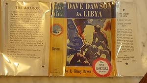
Dave Dawson In Libya, War Adventure Series #3 , in Color Dustjacket showing Dave saving a man from a burning Airplane that crashed. & with Army Tank in Background , Dawson, Young American Pilot of R.A.F. & his Pal, Freddy Farmer . They both are Sensat
R. ( Robert ) Sidney Bowen , Youngest member of Royal Flying corps & R.A.F. in World War 1. FORMER OWNER STAMP back Blank Flyleaf. B/W Illustrated drawing, Blank endpapers Foxed Former Owner Inscription, Modest map of Libya, Egypt, Mediterranean,to Pg 25
Published by Saalfield Publ Akron, OH, 1941
- Hardcover
Seller: Bluff Park Rare Books, LONG BEACH, CA, U.S.A.Bluff Park Rare Books
Contact seller4-star sellerAssociation member: IOBA
Hardcover. Condition: Good. Dust Jacket Condition: Good. HBDJ, 1941, EARLY EDITION, GOOD/GOOD, AS-IS, BurgundyRed Cloth cvr with pilot in Black within round Jagged circle, Tiny chips DJ Extremities, DJ protected Clear Mylar, DJ Spine Light Fade wear Tiny chips Tears Ends, Back DJ light wear fox has Blurb on Author. 252 pgs + AD…IN BACK for Dawson,On Convoy Patrol, Interior nice tight clean , light wear Fox Toning Thruout, CVR LETTERED IN BLACK, ,They both are Sensational R.A.F. Heroes, who are detailed to Duty with The Mediterranean Fleet. Scouting & Thrillin Navy Masnuevers, are only part of their Work.Dave & his co-pilot friend, Freddy Farmer thwart the Nazis' plans & saved the English campaign in Africa.
Published by Hammond World Atlas Corporation, 1998
- Map
Seller: Basement Seller 101, Cincinnati, OH, U.S.A.Basement Seller 101
Contact seller5-star sellerCondition: Used - Very good
£ 19.29
£ 3.74 shippingShips within U.S.A.Quantity: Over 20 available
Map. Condition: Very Good. Please note, this is the version that includes continent and special maps- also indexes and chronology of events since world war II.Listed as very good due to slight discoloration of cover page.
Language: English
Published by American Heritage, New York (Circa 1970?), 1970
- Map
Seller: Arroyo Seco Books, Pasadena, Member IOBA, Pasadena, CA, U.S.A.Arroyo Seco Books, Pasadena, Member IOBA
Contact seller4-star sellerAssociation member: IOBA
Condition: Used - Near fine
£ 28.93
£ 5.99 shippingShips within U.S.A.Quantity: 1 available
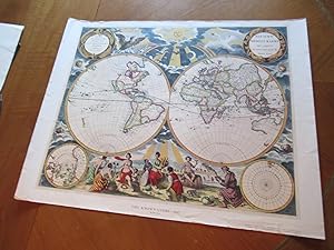
No Binding. Condition: Near Fine. No Jacket. Reprint Published By American Heritage. Size: Image About 20 3/4" X 17" On Heavy Glossy Paper. Double Globe World Map Printed From The Original (illustrator).

- Hardcover
Seller: Aragon Books Canada, OTTAWA, ON, CanadaAragon Books Canada
Contact seller3-star sellerCondition: New
£ 30.09
£ 17.23 shippingShips from Canada to U.S.A.Quantity: 1 available
Condition: New.

- Hardcover
Seller: SZ Global, Toronto, ON, CanadaSZ Global
Contact seller2-star sellerCondition: New
£ 20.45
£ 27.87 shippingShips from Canada to U.S.A.Quantity: 1 available
Hardcover. Condition: New. A standout in the crowd of first novels, Ruth narrates a story that confronts real-life issues of alienation and violence from which Hamilton creates a stunning testament to the human capacity for mercy, compassion, and love. Winner of the 1989 PEN/Hemingway Foundation Award.
WORLD IN HEMISPHERES - PHYSICAL - an Original Coloured Map, Printed C1908
WORLD IN HEMISPHERES - PHYSICAL - an Original Coloured Map, Printed C1908
Language: English
Published by George Philip & Son/The London Geographical Institute, London, 1908
Seller: K Books Ltd ABA ILAB, York, YORKS, United KingdomK Books Ltd ABA ILAB
Contact seller5-star sellerCondition: Used - Very good
£ 20.00
£ 19.50 shippingShips from United Kingdom to U.S.A.Quantity: 1 available
No Binding. Condition: Very Good. An original map, printed in full colour, central fold. Shows the Western and Eastern Hemispheres, the Water Hemisphere and the Land Hemisphere, and sections along various latitudes.
WESTEN HEMISPHERE MAP, ANTIQUE MAP - an Original Antique MAP
WESTERN HEMISPHERE MAP OR THE NEW WORLD , ANIQUE MAP PRINTED IN COLOUR IN 1866
Language: English
Seller: K Books Ltd ABA ILAB, York, YORKS, United KingdomK Books Ltd ABA ILAB
Contact seller5-star sellerCondition: Used - Very good
£ 12.00
£ 19.50 shippingShips from United Kingdom to U.S.A.Quantity: 1 available
No Binding. Condition: Very Good. An original antique coloured map printed in 1866. Mounted (matted) and ready to frame. Very good condition. AN EARLY MAP , IN GOOD CONDITION, MOUNT SIZE 12 X 14 INCHES, 34 X 38 CMS THE MAP SHOWS NORTH AND SOUTH AMERICA , PACIFIC ISLANDS AND NEW ZEALAND .
HYETOGRAPHIC OR RAIN MAP OF THE WORLD - an Original Antique Coloured Map, Published 1849
HYETOGRAPHIC OR RAIN MAP OF THE WORLD - an Original Antique Coloured Map, Published 1849
Language: English
Published by William Blackwood & Sons, Edinburgh, 1849
Seller: K Books Ltd ABA ILAB, York, YORKS, United KingdomK Books Ltd ABA ILAB
Contact seller5-star sellerCondition: Used - Very good
£ 25.00
£ 19.50 shippingShips from United Kingdom to U.S.A.Quantity: 1 available
No Binding. Condition: Very Good. An original antique map, printed in 1849, but showing no date of publication. The map has been extended by Professor Berghaus, engraved by W & A K Johnston. Minimal contemporary colouring. Unmounted - will be posted rolled in a tube. Very good condition. The key at the bottom of the map offers d…etails of the amount of rain the various zones, showing increase and decrease, and details of the significance of the shading of the map. There are also 2 pages of additional information. Engraved By W & A K Johnston (illustrator).
Language: English
Published by Philadelphia, 1830
Seller: K Books Ltd ABA ILAB, York, YORKS, United KingdomK Books Ltd ABA ILAB
Contact seller5-star sellerCondition: Used - Very good
£ 25.00
£ 19.50 shippingShips from United Kingdom to U.S.A.Quantity: 1 available
No Binding. Condition: Very Good. Antique hand-coloured map. Plate size approx. 10 x 8.5 ins, 26 x 22cms. Mounted and ready to frame, mount/matted size approx. 14 x 12 ins, 38 x 32cms, VERY GOOD, Probable printed in Philadelphia in 1830's. Attractive, Decorative and unusual.
Language: English
Published by Stanford, London, 1857
- First Edition
Seller: K Books Ltd ABA ILAB, York, YORKS, United KingdomK Books Ltd ABA ILAB
Contact seller5-star sellerCondition: Used - Very good
£ 25.00
£ 19.50 shippingShips from United Kingdom to U.S.A.Quantity: 1 available
No Binding. Condition: Very Good. First Edition. An antique coloured map- colouring contemporary but expertly and delicately executed - very good condition . Mounted - matted - and ready to frame . . Shows the Northern Hemisphere - very attractive and in excellent condition.
Language: English
Published by Stanford, London, 1857
- First Edition
Seller: K Books Ltd ABA ILAB, York, YORKS, United KingdomK Books Ltd ABA ILAB
Contact seller5-star sellerCondition: Used - Very good
£ 25.00
£ 19.50 shippingShips from United Kingdom to U.S.A.Quantity: 1 available
No Binding. Condition: Very Good. First Edition. An antique coloured map- colouring contemporary but expertly and delicately executed - very good condition . Mounted - matted - and ready to frame . . Shows the Southern Hemisphere - very attractive and in excellent condition.
Published by London; Whittaker & Co. and Simpkin, Marshall, & Co., 1869
- Hardcover
Seller: Sapience Bookstore, Hexham, United KingdomSapience Bookstore
Contact seller3-star sellerCondition: Used - Good
£ 25.20
£ 17.50 shippingShips from United Kingdom to U.S.A.Quantity: 1 available
Hard. Condition: Good-. Good-. Publishers full tan morrocco, worn, spine missing. Hinges cracked. viii and 244pp. Fold-out world map frontispiece and numerous further full-page and fold-out maps. (illustrator).


