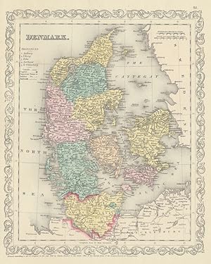
Map Denmark (51 results)

Published by The Battery Press in association with Articles of War, Ltd., Nashville. 1994
- Hardcover
Seller: Sapience Bookstore, Hexham, , United KingdomSapience Bookstore
Contact seller3-star sellerCondition: Used - Fine
£ 18.00
£ 17.50 shippingShips from United Kingdom to U.S.A.Quantity: 1 available
Hard. Condition: Fine. Reprint edition. First printing thus. Fine. Lacking dust jacket, if issued. Illustrated with a map. (illustrator).

Language: English
Published by GEORGE PHILIP & SON 1860
Seller: K Books Ltd ABA ILAB, York, YORKS, United KingdomK Books Ltd ABA ILAB
Contact seller5-star sellerCondition: Used - Very good
£ 25.00
£ 19.50 shippingShips from United Kingdom to U.S.A.Quantity: 1 available
No Binding. Condition: Very Good. A vg copy of an attractive coloured engraving showing the countries of Scandinavia. Colouring contemporary.
Language: English
Seller: K Books Ltd ABA ILAB, York, YORKS, United KingdomK Books Ltd ABA ILAB
Contact seller5-star sellerCondition: Used - Very good
£ 20.00
£ 19.50 shippingShips from United Kingdom to U.S.A.Quantity: 1 available
No Binding. Condition: Very Good. A fine Engraving - printed circa 1870. Mounted and ready to frame. A fine opportunity to purchase an attractive and decorative engraved Map of Denmark.
Language: English
Published by Tallis 1850
Seller: K Books Ltd ABA ILAB, York, YORKS, United KingdomK Books Ltd ABA ILAB
Contact seller5-star sellerCondition: Used - Very good
£ 50.00
£ 19.50 shippingShips from United Kingdom to U.S.A.Quantity: 1 available
No Binding. Condition: Very Good. Antique hand-coloured map. Plate size approx. 13.5 x 10.5 inches, 34 x 26 cms. Mounted and ready to frame. VERY GOOD. *Decorative and unusual. circa 1850.
Denmark and Part of Norway - an Antique Map
Denmark and Part of Norway - an Antique Engraved Map, Circa 1844
Language: English
Seller: K Books Ltd ABA ILAB, York, YORKS, United KingdomK Books Ltd ABA ILAB
Contact seller5-star sellerCondition: Used - Very good
£ 35.00
£ 19.50 shippingShips from United Kingdom to U.S.A.Quantity: 1 available
No Binding. Condition: Very Good. A fine antique map in very good condition - printed in circa 1844. Mounted (matted) and ready to frame. Engraved size approx 16 x 13 Ins, 41 x 33 Cms. Mounted size approx 19 x 16 in, 49 x 41cm. Coloured in outline, hand colouring contemporary. A fine engraved map of Denmark and Part of Norway. E…ngraved By Walker (illustrator).
MAP OF NORWAY, SWEDEN & DENMARK - Original Antique Map, Printed c 1785
MAP OF NORWAY, SWEDEN & DENMARK - Original Antique Map, Printed c 1785
Language: English
Seller: K Books Ltd ABA ILAB, York, YORKS, United KingdomK Books Ltd ABA ILAB
Contact seller5-star sellerCondition: Used - Very good
£ 45.00
£ 19.50 shippingShips from United Kingdom to U.S.A.Quantity: 1 available
No Binding. Condition: Very Good. Original antique map, engraved for Millar's New Complete & Universal System of Geography. Colouring not contemporary, but delicately and expertly done. Mounted (matted) and ready to frame. Cartouche. No date of publication. Includes Finland, the Shetland Isles and Lapland.
Norway, Sweden Denmark & Finland - Antique Hand Coloured Map
NORWAY, SWEDEN, DENMARK & FINLAND - Antique Hand-Coloured Map
Language: English
Seller: K Books Ltd ABA ILAB, York, YORKS, United KingdomK Books Ltd ABA ILAB
Contact seller5-star sellerCondition: Used - Very good
£ 50.00
£ 19.50 shippingShips from United Kingdom to U.S.A.Quantity: 1 available
No Binding. Condition: Very Good. A splendid original antique coloured map . Mounted (matted) and ready to frame . A wonderful opportunity to acquire a vintage map, ca. 1850.
DENMARK, NORWAY & SWEDEN - an Original Antique Engraved Map, Printed 1756, Hand-Coloured
DENMARK, NORWAY & SWEDEN - an Original Antique Engraved Map, Printed 1756, Hand-Coloured
Language: English
Seller: K Books Ltd ABA ILAB, York, YORKS, United KingdomK Books Ltd ABA ILAB
Contact seller5-star sellerCondition: Used - Very good
£ 60.00
£ 19.50 shippingShips from United Kingdom to U.S.A.Quantity: 1 available
No Binding. Condition: Very Good. A splendid original antique engraved map. Hand-coloured, colouring not contemporary but delicately and expertly executed. Mounted - matted - and ready to frame . Very good condition. Printed 1756. A fine map showing the Scandinavian countries of Norway, Sweden and Denmark. NOLIN (illustrator).
 More images
Published by [np, c.1765]. 1765
Seller: William Matthews/The Haunted Bookshop, Sidney, BC, CanadaWilliam Matthews/The Haunted Bookshop
Contact seller5-star sellerCondition: Used
£ 54.91
£ 13.43 shippingShips from Canada to U.S.A.Quantity: 1 available
An engraved map/plan of Husum, boldly coloured. It measures 25.5cm x 17cm, mounted on a larger sheet. Decorative cartouche in the upper left, small inset picture with compass rose beneath, and textual key to the map at the upper right. The key identifies 19 locations, text in Danish. Very clean and attractive, some wrinkling at…corners where attached to backing sheet. Husum was a seaport village, now part of Copenhagen.
Published by Charles Desilver, Philadelphia 1856
- Map
Seller: Main Street Fine Books & Mss, ABAA, Galena, IL, U.S.A.Main Street Fine Books & Mss, ABAA
Contact seller5-star seller[Philadelphia]: Charles Desilver, 1856. 12½" X 14½" (image 9 3/4" X 12"). Hand colored. Near fine. Bright, lovely and large margined example of this fine map, with delicate beautiful hand coloring and handsome ornamental border.

- Map
Seller: New World Cartographic, Chicago, IL, U.S.A.New World Cartographic
Contact seller4-star sellerBy: SDUKDate: 1837 (circa) LondonDimensions: 13 x 15.5 inches (33.02 x 39.4 cm)This handsome map of Copenhagen was published in 1837 by the Society for the Diffusion of Useful Knowledge, also referred to as SDUK.Denmark is almost completely surrounded by water, and Copenhagen itself, the city of 1837, is also surrounded by water…. The map shows the spectacular aquatic defenses of the city which had developed over the centuries since the time the site had been a point of departure for Vikings. From this point had set sail explorers, colonizers and marauders and later merchants. Moats around the city provide additional defense running between the city's double walls which protect its perimeters. All streets are named and buildings labeled. A large castle is denoted, along with fortifications on islands near the city. A panoramic view of the city is presented just below the plan.The SDUK was founded in 1828 by Henry Peter Brougham, an idealistic British nobleman. The aim of the society was to promote self-education and egalitarian sharing of knowledge by providing instruments of learning such as maps and various other publications. Despite being affiliated with London University and various major publishing houses, the Society ultimately failed to achieve its goal as the publications were too costly for the targeted middle to lower class echelons of British society. At the same time, its publications were not grand or fine enough to appeal to the aristocracy.Condition: This map is in B condition. Two short separations enter the bottom edge of the image. Original hand coloring. Inventory #123441200 W. 35th Street #425 Chicago, IL 60609 | P: (312) 496 - 3622.

- Art Print
Seller: Antiquariat Martin Barbian & Grund GbR, Saarbruecken, , GermanyAntiquariat Martin Barbian & Grund GbR
Contact seller5-star sellerCondition: Used
£ 26.67
£ 38.84 shippingShips from Germany to U.S.A.Quantity: 1 available
Kupferstich von Gibson nach Roberts, um 1750, 20x29,5 cm (am oberen Rand außerhalb der Darstellung etwas fleckig).
Emigrationen fra Norden indtil 1. verdenskrig. Rapporter til det nordiske historikermøde i København 1971, 9.-12. august
Nordiske Historikerkongres (15th : 1971 : Copenhagen, Denmark) [ Hvidt, Kristian ; editor: ]
Published by Historisk Institut [1971], København 1971
Seller: Expatriate Bookshop of Denmark, Svendborg, , DenmarkExpatriate Bookshop of Denmark
Contact seller5-star sellerCondition: Used
£ 37.64
£ 111.34 shippingShips from Denmark to U.S.A.Quantity: 1 available
orig.wrappers. Condition: Minor rubbing. VG. 24x15cm, 168 pp. Contains 5 papers concerning Scandinavian emigration before World War I. Includes: Nordisk emigrasjon: en komparativ oversikt; Intern befolkningsomflyttning och emigration; Ekonomiska faktorer som fö rklaringsgrund i emigrationsforskningen; IOnformationsspredning og e…migration med særligt henblik på atlantiske transportsystem; Udvandringen fra Island: En oversigt. Folding map.Textual graphs. (illustrator).
 More images
Published by Oxford University Press, London 1964
Seller: Expatriate Bookshop of Denmark, Svendborg, , DenmarkExpatriate Bookshop of Denmark
Contact seller5-star sellerCondition: Used
£ 45.33
£ 111.34 shippingShips from Denmark to U.S.A.Quantity: 1 available
orig.cloth. 25x18cm, viii,116 pp. Series: Sylloge of Coins of the British Isles, 4, Part I. Full title reads:"Sylloge of Coins of the British Isles : Royal Collection of Coins and Medals ; National Museum, Copenhagen, Part I". Labels taped to head and foot of spine. Some rubbing. Good. 30 photoplates; folding map. (illustrator).

- Map
Seller: Geographicus Rare Antique Maps, Brooklyn, NY, U.S.A.Geographicus Rare Antique Maps
Contact seller4-star sellerVery good. Minor foxing at places. Blank on verso. Size 9.5 x 8 Inches. This is a scarce 1845 Thomas Ewing map of Denmark. It covers all of Denmark inclusive of the Duchies of Schleswig and Holstein. Numerous towns, rivers, roads, mountains and other important topographical features are noted throughout. During the time this map… was made, Denmark was on the brink of the First Schleswig War between Prussia, Germany and the duchies of Holstein and Schleswig against the Kingdom of Denmark. In 1848, when the king of Denmark, Frederick VII, proposed that the Duchies of Schleswig and Holstein be formally recognized as part of the Danish Kingdom, the predominantly German population of the two duchies rebelled for a free constitution, resulting in war. Denmark ultimately won the war and retained control of Schleswig-Holstein. This map was published in 1845 by Oliver and Boyd as part of Ewing's New General Atlas .

- Map
Seller: Geographicus Rare Antique Maps, Brooklyn, NY, U.S.A.Geographicus Rare Antique Maps
Contact seller4-star sellerVery good. Minor toning and spotting at places. Size 10.5 x 8 Inches. This is a scarce 1849 Joseph Meyer map of Denmark. It covers all of Denmark inclusive of the Duchies of Schleswig and Holstein. Numerous towns, rivers, roads, mountains and other important topographical features are noted throughout. An inset in the top left a…nd right quadrants details the cities of Kiev and Copenhagen. Another inset in the bottom right quadrant details the city of Schleswig. The Island of Bornholm is also included in an inset. During the time this map was made, Denmark was in the midst of the First Schleswig War between Prussia, Germany and the duchies of Holstein and Schleswig against the Kingdom of Denmark. In 1848, when the king of Denmark, Frederick VII, proposed that the Duchies of Schleswig and Holstein be formally recognized as part of the Danish Kingdom, the predominantly German population of the two duchies rebelled for a free constitution, resulting in war. Denmark ultimately won the war and retained control of Schleswig-Holstein. This map was issued as plate no. 2 in Meyer's Zeitung Atlas . Although all the maps in this atlas are not individually dated, the title page and maps were often updated while the imprint with the date was not, causing confusion to the exact date for some of the maps. Moreover some maps in the atlas were taped in at a later date as an update to the atlas. We have dated the maps in this collection to the best of our ability.

- Map
Seller: Geographicus Rare Antique Maps, Brooklyn, NY, U.S.A.Geographicus Rare Antique Maps
Contact seller4-star sellerVery good. Blank on verso. Size 12.5 x 10 Inches. This is a fine example of Conrad Malte-Brun's 1843 map of Denmark. It covers all of Denmark inclusive of the Duchy of Holstein and as far east as the island of Bornholm. The Kattegat (Cattegat) is also identified. Two insets in the upper right quadrant depict Iceland and the Faro…e Islands. As this map was being printed, Scandinavia was in the midst of a prolonged period of peace and prosperity that led to a cultural and population boom. Various cities, towns, rivers, islands and other topographical details are marked, with relief shown by hachure. Boundaries are color coded according to regions and territories. This map was issued as plate no. 46 in Conrad Malte-Brun's 1843 Precis de la Geographie Universelle .

- Map
Seller: Geographicus Rare Antique Maps, Brooklyn, NY, U.S.A.Geographicus Rare Antique Maps
Contact seller4-star sellerFine or perfect condition. Margins wide and clean. Blank on verso. Size 8 x 10 Inches. This fascinating 1862 map by Justus Perthes and Stieler depicts Denmark, Schleswig, Holstein, Iceland, and the Faeroe Islands. There are inset maps of Ireland and the Faeroe Islands. In a display of cartographic flair unique to Perthes maps, a… land elevation profile is depicted on the bottom of the Iceland map. Unlike other cartographic publishers of the period, the Justus Perthes firm, did not transition to lithographic printing techniques. Instead, all of his maps are copper plate engravings and hence offer a level of character and depth of detail that was impossible to find in lithography or wax-process engraving. Issued in the 1862 edition of Stieler's Schul-Atlas.

- Map
Seller: Geographicus Rare Antique Maps, Brooklyn, NY, U.S.A.Geographicus Rare Antique Maps
Contact seller4-star sellerVery good. Blank on verso. Original platemark visible. Slight overall toning. Size 10 x 8 Inches. This is an attractive example of the 1828 Malte-Brun map of Denmark. The map covers all of Denmark inclusive of the Duchy of Holstein. The Kattegat (Cattegat) is also identified. At this time in history, Scandinavia was in the midst… of a prolonged period of peace and prosperity that led to a cultural and population boom. Various, important rivers, islands, cities and other topographical details are noted. This map was published by Samuel Walker in 1828 as part of the American edition of Conrad Malte-Brun's System of Geography , Vol. I.

- Map
Seller: Geographicus Rare Antique Maps, Brooklyn, NY, U.S.A.Geographicus Rare Antique Maps
Contact seller4-star sellerVery good. Overall toning. Blank on verso. Size 10 x 12 Inches. A fine example S. A. Mitchell Senior's 1850 map of Denmark. Shows cities, roadways, rail lines, canals, and some topographical features. Color coded according to province, including the Duchy of Holstein. Includes parts of adjacent Sweden and Germany. Dated and copy…righted 1850.

Russia in Europe, Sweden and Norway. Map of Denmark. Map of Holland and Belgium.
1887 Bradley Map of European Russia, Scandinavia, Holland, Belgium and Denmark.
- Map
Seller: Geographicus Rare Antique Maps, Brooklyn, NY, U.S.A.Geographicus Rare Antique Maps
Contact seller4-star sellerVery good. Blank on verso. Size 11.5 x 14.5 Inches. This is a fine example of William M. Bradley's 1887 map of Russia, Norway, Sweden, Holland Belgium and Denmark. Maps of Denmark, Holland and Belgium relegated to insets on the left hand side of the sheet. The larger map covers Scandinavia and the european portion of Russia from… the Arctic Ocean to Turkey, including the european portions of Russia as well as Finland, Ukraine, Latvia, Lithuania and estonia. Denmark is covered in full, from the Skagerrak to the Baltic Sea. Holland and Belgium are covered from the North Sea to France. Russia at this time was under the suzerainty of Tzar Alexander the II. Alexander is best known for his liberal reforms including the emancipation Reform of 1861. The Reform, considered the most important event in 19th century Russian history, liberated Russia's countless serfs. In 1830, the Belgian Revolution led to the secession of Belgium from the United Kingdom of Netherlands into the independent Kingdom of Belgium. Though Belgium had successfully made itself independent, the Netherlands refused to recognize the new country until the 1839 Treaty of London. Meanwhile Scandinavia and Denmark at the time were in the midst of a prolonged period of peace and prosperity that led to a cultural and economic boom. Various towns, cities, rivers and an assortment of additional topographical details are noted. Map is color coded according to regional and political boundaries with elevation rendered by hachure. Copyrighted 1887 by Wm. M. Bradley & Bro., for inssue as plate no. 112 in the 1887 edition of Mitchell's New General Atlas . References: Rumsey 0594.061.

Russia in Europe, Sweden and Norway. / Map of Denmark. / Map of Holland and Belgium.
1864 Mitchell Map of Russia, Scandinavia, Denmark, Holland and Belgium
- Map
Seller: Geographicus Rare Antique Maps, Brooklyn, NY, U.S.A.Geographicus Rare Antique Maps
Contact seller4-star sellerVery good condition. Blank on verso. Size 11 x 13.75 Inches. A beautiful example of S. A. Mitchell Jr.'s 1864 map of Russia, Norway, Sweden, Holland Belgium and Denmark. Maps of Denmark, Holland and Belgium relegated in insets on the left hand side of the map. Denotes both political and geographical details. Extends as far south… and west as the boot of Italy and as far east as the Caspian Sea and the Gulf of Obi. One of the most attractive American atlas maps of this region to appear in the mid 19th century. Features the floral border typical of Mitchell maps from the 1860-65 period. Prepared by S.A. Mitchell for inclusion as plate no. 64 in the 1864 issue of Mitchell's New General Atlas . Dated and copyrighted, 'Entered according to Act of Congress in the Year 1860 by S. Augustus Mitchell in the Clerk's Office of the District Court of the U.S. for the Eastern District of Pennsylvania. References: Rumsey 0565.033 (1860 edition). Phillips (Atlases) 831. New York Public Library, Map Division, 1510828.

- Map
Seller: Geographicus Rare Antique Maps, Brooklyn, NY, U.S.A.Geographicus Rare Antique Maps
Contact seller4-star sellerVery good. Original centerfold. Blank on verso. Size 17 x 12 Inches. This is a fine example of J. Migeon's 1878 map of Denmark, Iceland and the Faroe Islands. It covers all of Denmark inclusive of the Duchy of Holstein. The Kattegat (Cattegat) is also identified. Three inset maps detailing Iceland, the Isle Bornholm and the Faer…oe Islands are included. The upper left quadrant features a beautiful engraving of 'Chateau de Kronborgh' (Kronborg Castle). As this map was being printed Scandinavia was in the midst of a prolonged period of peace and prosperity that led to a cultural and population boom. Migeon identifies various rivers, islands, mountain passes and other topographical features. Migeon's Geographie Universelle , published in Paris, is one of the last great decorative atlases of the 19th century. It contains many stylistic elements of early 19th century cartography such as full hand coloring, numerous decorative vignettes, and high quality paper. This map was issued as plate no. 22 in Migeon's Geographie Universelle .

- Map
Seller: Geographicus Rare Antique Maps, Brooklyn, NY, U.S.A.Geographicus Rare Antique Maps
Contact seller4-star sellerVery good. Blank on verso. Original platemark visible. Original cernterfold exhibits typical wear. Size 11.5 x 13 Inches. This is a fine example of the 1832 Delamarche map of Norway, Sweden and Denmark. Centered on the Kingdom of Sweden, it covers all of Scandinavia, from the Arctic Ocean to Denmark and from Norway to the Gulf o…f Bothnia. Two inset maps in the top left quadrant detail Iceland and the Faroe Islands. At this time in history Scandinavia was in the midst of a prolonged period of peace and prosperity that led to a cultural and population boom. Various cities, towns, rivers, lakes and other topographical details are marked. Issued as part of Delamarche's Atlas de la Geographie .

- Map
Seller: Geographicus Rare Antique Maps, Brooklyn, NY, U.S.A.Geographicus Rare Antique Maps
Contact seller4-star sellerVery good. Minor overall toning. Size 10 x 8 Inches. This is a fine example of Joseph Meyer's 1852 map of Scandinavia, including Norway, Sweden and Denmark. It covers from the Arctic south to Holstein and east as far as Lake Ladoga, the largest lake in Europe. Two insets in the top left quadrant detail Iceland and the Faroe Isla…nds. Throughout, the map identifies various cities, towns, rivers and an assortment of additional topographical details. Of particular interest is the Lofoten Maelstrom in northwestern Norway. This legendary whirlpool was the inspiration for Edgar Allen Poe's classic tale Descent into the Maelstrom . In reality, it is a periodic and powerful current caused by tidal variations in the region. At this time in history, Scandinavia was in the midst of a prolonged period of peace that led to a cultural and population boom, especially in Sweden. The economy however could not keep up with the increase in population and much of Sweden's population immigrated to the United States between 1850 and 1910. This map was issued in Meyer's Zeitung Atlas . Although all the maps in this atlas are not individually dated, the title page and maps were often updated while the imprint with the date was not, causing confusion to the exact date for some of the maps. Moreover some maps in the atlas were taped in at a later date as an update to the atlas. We have dated the maps in this collection to the best of our ability.

Kort over Nordsjaelland. / Karte uber Nordseeland. / Map of North Zealand.
1936 Danske Landmandsbank Pictorial Map of Nordsjaelland, Denmark
- Map
Seller: Geographicus Rare Antique Maps, Brooklyn, NY, U.S.A.Geographicus Rare Antique Maps
Contact seller4-star sellerVery good. Light wear along original fold lines. Size 10 x 7.75 Inches. A highly distinctive and colorful 1936 pictorial map of the Nordsjaelland (North Zealand) region of Denmark, north of Copenhagen, issued by the Danske Landmandsbank (Danish Agricultural Bank). A Closer Look Coverage includes the northern part of the island o…f Zealand, from the northern shore of Denmark on the Kattegat, southwards to Roskilde and Dragør, with Copenhagen appearing near the bottom-right. Cities, towns, roads, railways, and other features are illustrated, along with depictions of automobiles, airplanes, beachgoers, amusement parks, and ships. Tourist attractions are also prominently noted, including the imposing Kronborg Castle, opposite the Swedish city of Helsingborg (which also boasts an impressive castle), the two together historically controlling access to the Baltic Sea. The Frederiksborg Castle is also highlighted; it was built in the 17th century for King Christian IV (r. 1588 - 1648) at the height of the power of the Kingdom of Denmark-Norway. Publication History and Census This map was created for and published by the Danske Landmandsbank in 1936. It accompanied a similar pictorial map of Copenhagen (cf. KobenhavnsCentrum-landmandsbank-1936), and both were part of a tourist guide published by the bank. We note a single cataloged example at the Copenhagen City Archives, though the OCLC notes several examples that appear to be later editions or reprints. References: Københavns Stadsarkiv Kort- og tegningssamlingen A 1936 /1. OCLC 1419029484, 37742982, 740231178, 34687122 (apparent later editions or reprints).

- Map
Seller: Geographicus Rare Antique Maps, Brooklyn, NY, U.S.A.Geographicus Rare Antique Maps
Contact seller4-star sellerVery good. Even overall toning. Blank on verso. Size 12.5 x 10.5 Inches. This is an 1849 Samuel Augustus Mitchell map of Denmark. The map depicts all of Denmark inclusive of the Duchy of Holstein. A list along the upper left border notes Denmark's five Provinces: Aalborg, Viborg, Ribe, Aarhuus, and To Oldenburg. Political and to…pographical features are noted and color coded with elevation rendered by hachure. The whole is engraved and colored in Mitchell's distinctive style with green border work and vivid pastels. Mitchell published this map in his atlas from 1846 to the late 1850s before discontinuing the series and selling his map plates to DeSilver. This map was issued in the 1849 edition of the New Universal Atlas . It was the last edition of that atlas to be published by Mitchell prior to selling the plates and rights to the atlas to Thomas Cowperthwait in 1850. References: Rumsey 0545.057.

Johnson's Prussia Norway, Sweden and Denmark.
1862 Johnson Map of Scandinavia (Norway, Sweden, Denmark) and Prussia
- Map
Seller: Geographicus Rare Antique Maps, Brooklyn, NY, U.S.A.Geographicus Rare Antique Maps
Contact seller4-star sellerVery good. Minor wear along original centerfold. Some foxing and overall toning. Blank on verso. Size 25 x 18 Inches. This is a beautiful example of Johnson and Ward's 1862 map of Scandinavia and Prussia. It depicts all of Sweden, Norway, Finland, Denmark and Prussia, as well as parts of Estonia, Latvia and Lithuania. There are…two decorative city views, Stockholm in the upper left quadrant and Cologne in the lower right. Various towns, cities, railways, rivers and several other topographical features are noted with relief shown by hachure. This map features the strapwork style border common to Johnson's atlas work from 1860 to 1863. Published by Johnson and Ward as plate nos. 77-78 in the scarce 1862 edition of Johnson's Family Atlas. References: Rumsey 2905.044 (1860 edition).

- First Edition
- Map
Seller: Geographicus Rare Antique Maps, Brooklyn, NY, U.S.A.Geographicus Rare Antique Maps
Contact seller4-star seller1st Edition. Very good. Original platemark visible. Minor spotting at places. Blank on verso. Size 10.5 x 8.5 Inches. This is affine example of T. G. Bradford's 1835 map of Sweden, Norway, Denmark and Lapland. Centered on the Gulf of Bothnia, it covers all of Scandinavia, from Finmark to Denmark. Towns, rivers, mountains, lakes,… and various other important topographical details are noted. Elevation throughout is rendered by hachure and political and regional territories are color coded. The legendary and semi-mythical whirlpool known as the Maelstrom (Mahlstrom) in northwestern Norway is noted. This legendary whirlpool was the inspiration for Edgar Allen Poe's classic tale 'Descent into the Maelstrom.' In reality, it is a periodic and powerful current caused by tidal variations in the region. As this map was being printed, all of Scandinavia was in the midst of a prolonged period of peace and prosperity that led to a cultural and population boom. The map was published as plate no. 96 in Thomas G. Bradford's 1835 Comprehensive Atlas Geographical, Historical and Commercial . Bradford's atlas, published in 1835 was an important work on many levels. First, it was one of the first American atlases to follow an encyclopedic format, offering readers extensive geographical and statistical tables to supplement the maps themselves. Second, it was published in Boston and influenced the city's rise as a publishing center later in the 19th century (at the time most publishing in the United States was restricted to New York and Philadelphia). Third, this atlas was the first to contain a separate and specific map showing the Republic of Texas. Fourth and finally, Bradford's atlas in some instances broke the Euro-centric mold regarding atlas production. Among other things, Bradford focused his atlas on the Americas and abandoned the classical decoration common in European atlases in favor of a more informational and inherently American approach. Bradford published this atlas in several editions and with various partners. The first edition was published by William D. Ticktor and did not contain the iconic Republic of Texas map (although we have in fact seen Ticktor examples with a Texas map, suggesting, against conventional wisdom, that there may have been two Ticktor editions). The second official edition, published in the same year by the American Stationers Company, was the first to contain the Republic of Texas map, which is based on Austin's map, with two pages of descriptive text. A third edition was issued in 1836, also by American Stationers (though still dated 1835), and contained an unaltered Republic of Texas map with only a single page of descriptive test. A fourth edition appeared later, possibly 1837, and included an updated and revised map of Texas that replaces the old Mexican land grants with new inchoate counties. The maps from this atlas are an important addition to any collection focusing on early American cartography and Republic of Texas cartography. All maps in this atlas, though not specifically noted as such, were most likely engraved by G. W. Boynton of Boston, who also engraved most of the maps for Bradford's later publication. References: Rumsey 2643.106 (1838 edition).


