
Order Total (1 Item Items):
Shipping Destination:

Ian E Wilson Foreword (1 results)
Skip to main search results
Search filters
Product Type
- All Product Types
- Books (1)
- Magazines & Periodicals (No further results match this refinement)
- Comics (No further results match this refinement)
- Sheet Music (No further results match this refinement)
- Art, Prints & Posters (No further results match this refinement)
- Photographs (No further results match this refinement)
- Maps (No further results match this refinement)
- Manuscripts & Paper Collectibles (No further results match this refinement)
Condition Learn more
- New (No further results match this refinement)
- As New, Fine or Near Fine (No further results match this refinement)
- Very Good or Good (No further results match this refinement)
- Fair or Poor (No further results match this refinement)
- As Described (1)
Binding
- All Bindings
- Hardcover (1)
- Softcover (No further results match this refinement)
Collectible Attributes
- First Edition (1)
- Signed (No further results match this refinement)
- Dust Jacket (1)
- Seller-Supplied Images (1)
- Not Print on Demand (1)
Language (1)
Price
- Any Price
- Under � 20 (No further results match this refinement)
- � 20 to � 40 (No further results match this refinement)
- Over � 40
Free Shipping
- Free Shipping to U.S.A. (No further results match this refinement)
Seller Location
Seller Rating
-
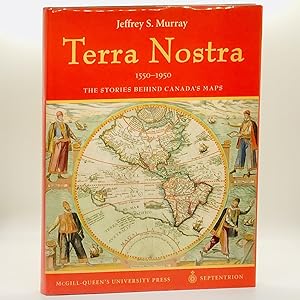
Terra Nostra, 1550-1950: The Stories Behind the Maps ; From the Collection of Library and Archives Canada
Published by Les Editions Du Septentrion | McGill-Queen's University Press, Sillery, Quebec & Georgetown, Ontario, 2006
ISBN 10: 2894484534 ISBN 13: 9782894484531
Seller: Black's Fine Books & Manuscripts, Toronto, ON, Canada
Seller rating 5 out of 5 stars

First Edition
Hardcover. First Edition, First Printing. pp. 189. 4to. Publisher's black boards, blind-stamped title to the front board. Richly illustrated with many black-and-white, and colour photographs, illustrations, facsimiles, et al. Bright, clean, and unmarked with tight, sound binding; near fine and housed in near fine dustjacket. Appears unread; as new. Terra Nostra celebrates the mapping of Canada, in part by telling the stories of the exceptional individuals who helped to create the maps. Drawn from the rich cartographic holdings of Library and Archives Canada, it spans four centuries - from the portolan charts of the early explorers to recent aerial images of east coast ice floes. Canada's maps provide evidence of our nation's technical accomplishments and offer insight into the development of our geographical knowledge. This year marks the 100th anniversary of the official Atlas of Canada; Terra Nostra provides a beautifully illustrated and timely celebration of the country's cartographic history.