
Geographical Map (22 results)
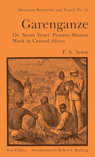
Garenganze or Seven Years Pioneer Mission Work in Central Africa
Frederick Stanley Arnot with New Introduction By Robert I. Rotberg
- Hardcover
Seller: J J Basset Books, bassettbooks, bookfarm.co.uk, Peter Tavy, United KingdomJ J Basset Books, bassettbooks, bookfarm.co.uk
Contact seller4-star sellerCondition: Used - Very good
£ 25.00
£ 20.00 shippingShips from United Kingdom to U.S.A.Quantity: 1 available
Blue Cloth. Condition: VERY GOOD ( AVERAGE). Dust Jacket Condition: VERY GOOD (AVERAGE). New Edition 1969. Frederick Stanley Arnot's stature as a missionary pioneer has not been dimmed by the passage of time. His interest in Africa was stimulated directly by Livingstone, and when he sets out from Scotland in 1881 to take the gos…pel to Africa, he was consciously seeking to emulate the work so nobly begun by his predecessor. He was the first missionary to settle within the modern confines of Zambia and Katanga, thus opening up the interior of Africa to Christian evangelism. By his activities in Britain and South Africa, as well as by his journeyings into the interior, he played a large part in determining the nature and direction of the Christian initiative in Central Africa. Arnott's published writings were compiled directly from diaries and letters, and consequently they contain graphic accounts of the life of a missionary pioneer during the opening up of Central Africa. They provide an unrivaled record of both the trivia and the drama of the daily confrontation between whites and Africans, and as such, they contain much valuable information for the present day Africanist and historian. This volume is the tenth in the Missionary Researches and Travels Series, and includes an introduction by the editor, Professor Robert I. Rotberg of the Massachusetts Institute of Technology. New Edition with a 24 Page New Introduction 276pp including Index.Mission Researches and Travels No. 10.This book will be POSTED AT OUR STANDARD RATES FULLY INSURED (UK) ONLY . Please email for further details Size: 8vo - over 7¾" - 9¾". With 20 Illustrations and an Original Map Prepared By the Royal Geographical Society (illustrator). Not Inscribed or Signed.
Garenganze or Seven Years Pioneer Mission Work in Central Africa
Frederick Stanley Arnot with New Introduction By Robert I. Rotberg
- Hardcover
Seller: J J Basset Books, bassettbooks, bookfarm.co.uk, Peter Tavy, United KingdomJ J Basset Books, bassettbooks, bookfarm.co.uk
Contact seller4-star sellerCondition: Used - As new
£ 35.00
£ 20.00 shippingShips from United Kingdom to U.S.A.Quantity: 1 available
Blue Cloth. Condition: FINE ( AS NEW). Dust Jacket Condition: FINE (AS NEW). New Edition 1969. Frederick Stanley Arnot's stature as a missionary pioneer has not been dimmed by the passage of time. His interest in Africa was stimulated directly by Livingstone, and when he sets out from Scotland in 1881 to take the gospel to Afric…a, he was consciously seeking to emulate the work so nobly begun by his predecessor. He was the first missionary to settle within the modern confines of Zambia and Katanga, thus opening up the interior of Africa to Christian evangelism. By his activities in Britain and South Africa, as well as by his journeyings into the interior, he played a large part in determining the nature and direction of the Christian initiative in Central Africa. Arnott's published writings were compiled directly from diaries and letters, and consequently they contain graphic accounts of the life of a missionary pioneer during the opening up of Central Africa. They provide an unrivaled record of both the trivia and the drama of the daily confrontation between whites and Africans, and as such, they contain much valuable information for the present day Africanist and historian. This volume is the tenth in the Missionary Researches and Travels Series, and includes an introduction by the editor, Professor Robert I. Rotberg of the Massachusetts Institute of Technology. New Edition with a 24 Page New Introduction 276pp including Index.Mission Researches and Travels No. 10.This book will be POSTED AT OUR STANDARD RATES FULLY INSURED (UK) ONLY . Please email for further details Size: 8vo - over 7¾" - 9¾". With 20 Illustrations and an Original Map Prepared By the Royal Geographical Society (illustrator). Not Inscribed or Signed.

The peoples' atlas : the world transformed / literary supplement by Cecil Roberts
Philip, George (1870-1937) [map editor]. London Geographical Institute
Published by London : George Philip and Son 1922
- Hardcover
- First Edition
Seller: MW Books, New York, U.S.A.MW Books
Contact seller5-star sellerFirst Edition. Very good copy in the original title-blocked cloth. Spine bands and panel edges slightly dust-dulled and rubbed as with age, spine somewhat worn. Remains quite well preserved overall; internally tight, bright and clean. Physical description; 136 pages : maps (color), diagrams, illustrations ; 34 cm. Notes; Include…s index. Subjects; Atlases Great Britain. Scales differ. 3 Kg.

The peoples' atlas : the world transformed / literary supplement by Cecil Roberts
Philip, George (1870-1937) [map editor]. London Geographical Institute
Published by London : George Philip and Son 1922
- Hardcover
- First Edition
Seller: MW Books Ltd., Galway, IrelandMW Books Ltd.
Contact seller5-star sellerCondition: Used
£ 75.88
£ 12.09 shippingShips from Ireland to U.S.A.Quantity: 1 available
Add to basketFirst Edition. Very good copy in the original title-blocked cloth. Spine bands and panel edges slightly dust-dulled and rubbed as with age, spine somewhat worn. Remains quite well preserved overall; internally tight, bright and clean. Physical description; 136 pages : maps (color), diagrams, illustrations ; 34 cm. Notes; Include…s index. Subjects; Atlases Great Britain. Scales differ. 1 Kg.

Published by Geographical Map Co Ltd, London (undated)
- Hardcover
Seller: CURIO, Cleethorpes, North East Lincolnshire, United KingdomCURIO
Contact seller5-star sellerCondition: Used - Very good
£ 60.00
£ 30.00 shippingShips from United Kingdom to U.S.A.Quantity: 1 available
Add to basketHardcover. Condition: Very Good. No Jacket. Undated c1950. Hardback copy in dark green cloth boards with gold gilt lettering to front board, no dustjacket as issued. Fold-out colour map mounted in sections on cream linen. Opens to 87cm (h) x 115cm (w). Not library copy, no inscriptions. (1/2).

Jughrafiya-yi jazayir-i Irani-i Khalij-i Fars : ustan-i Hurmuzgan, baksh-i Kish (jazayir-i Kish va Hindurabi)
Iran, National Geographical Organization [ Sazman-i Jughrafiya'i-i Niruha-yi Musallah ]
Published by Sazman-i Jughrafiya'i-i 1383 [2004 AD], Tihran 1383
- Softcover
Seller: Expatriate Bookshop of Denmark, Svendborg, DenmarkExpatriate Bookshop of Denmark
Contact seller5-star sellerCondition: Used
£ 45.20
£ 111.81 shippingShips from Denmark to U.S.A.Quantity: 1 available
Add to basketorig. wrappers. Condition: Minor rubbing. VG. 24x15cm, (20),312 pp. Text entirely in Persian. Geographical study of Kish & Hendurabi islands in the Persian Gulf. Includes 34pp color photoplates + 28pp color map plates. 62p color map & photo plates (illustrator).
Jughrafiya-yi jazayir-i Irani-i Khalij-i Fars : ustan-i Hurmuzgan, jazirah-i Lavan
Iran, National Geographical Organization [ Sazman-i Jughrafiya'i-i Niruha-yi Musallah ]
Published by Sazman-i Jughrafiya'i-i, Tihran 2003
- Softcover
Seller: Expatriate Bookshop of Denmark, Svendborg, DenmarkExpatriate Bookshop of Denmark
Contact seller5-star sellerCondition: Used
£ 45.20
£ 111.81 shippingShips from Denmark to U.S.A.Quantity: 1 available
Add to basketorig. wrappers. Condition: Minor rubbing. VG. 24x15cm, (16),267 pp. Text entirely in Persian. Geographical study of Lavan [Persian Gulf island]. Includes 21pp single-side color photoplates + 21 single-side color maps. 42pp map & photoplates. (illustrator).

[Trelawney Saunders, cartographer and map seller.] First part of long Autograph Letter to Commander James Mangles, RN, discussing his 'Illustrated Geography & Hydrography' and other works, and his desire for a London 'depot' for the sale of maps.
Trelawney William Saunders (1821-1910), FRGS, book and map seller, 6 Charing Cross, London; Geographical Assistant, India Office; cartographer [Captain James Mangles (1786-1867); Edward Stanford]
Published by 6 Charing Cross London. 14 May 1846
- Softcover
- Manuscript
Seller: Richard M. Ford Ltd, London, United KingdomRichard M. Ford Ltd
Contact seller5-star sellerCondition: Used
£ 250.00
£ 4.50 shippingShips from United Kingdom to U.S.A.Quantity: 1 available
Add to basketFour pages, 12mo. Bifolium. In good condition, on aged paper, with small pinholes to both leaves and slight loss at the head of the second. Substantial first part of long letter, and hence lacking the signature. BBTI has Trelawny [for Trelawney] William Saunders at 6 Charing Cross between 1846 and 1853, and Edward Stanford's ent…ry in the Oxford DNB records that he was an apprentice there, returning as partner in 1852 ('The partnership was dissolved by mutual consent in July 1853.'), and that it was Saunders who proposed Stanford for membership of the Royal Geographical Society. A good association and a scarce example of Saunders' handwriting, which has been verified by comparison with a specimen (which will be included with the item) in the Royal Geographical Society archives. Saunders begins by expressing his 'unfeigned respect' for Mangles' 'firm & unconquerable efforts towards the production of so grand & entire a work as "The Illustrated Geography & Hydrography," of which I have received prospectuses from the Geographic[a]l. Society on Wednesday'. (Mangles published a 'Synopsis' with London publisher John Bumpus in 1848, but there is no record that the work itself was ever published.) Saunders hopes he will not be thought 'presumptuous', or acting 'from interested motives', when he states that he has 'read through all your prospectuses with avidity & am now anxious to learn something more of your fine work, and as there is no publication name mentioned, nor any other person referred to for enquiries, I have taken the liberty of addressing you directly'. He hopes Mangles will admit, on reading the enclosed 'short address', that Saunders is also 'employing the humble capacity in which providence has placed me, to promote the study of Geography'. The prospectus of Saunders' unidentified work 'has only been printed a few days', but he has 'already obtained such support, as encourages me to persevere in the plan I have laid down'. He hopes before long that there will be 'a depot in this great centre of geographic enterprise where the maps of & from all countries y be readily obtained. The pursuit of a science which requires an accumulation of materials for its successful development must be dilatory, while the means of supplying & procuring such material is confined to private societies, or scattered amongst innumerable establishments, each having a conflicting interest.' He praises Mangles' 'unique work', which he will promote, in the hope that 'the addition of my name to the splendid "Physical Atlas" [by Alexander Keith Johnston (1804-1871)] of which i enclose a prospectus, will be esteemed as one mark in my favour.' As he does not want to allow 'feelings of restraint' to curb him in communicating with Mangles on the subject, he is glad his 'person is unknown to me, inasmuch as a previous connection in our respecti positions in society would no doubt have imbued me with an idea of distance, the chains of which would now gall me excessively.' Before the letter breaks off, Saunders discusses Mangles' intention 'to divide the whole globe into sections, just like England is divided in the maps of the Ordnance Survey, with the addition of Hydrographic detail along the shores & at sea, & both variations in scale suited to the peculiar exigencies of this undertaking'. He is not sure from the prospectus whether 'you contemplate this happy continuity & oneness of plan, though I doubt not such is your intention'. The letter ends abruptly at the foot of the fourth page, with the incomplete sentence: 'Is it not possible to describe the Hydrographic portion in continuance of the Geographic, so as to avoid '. Note: None of his letters listed on the NRA, but A2A records correspondence [as "Trelawny", confusingly] at the RGS, and has other material illustrating Saunders' importance in the history of map-making and exploration, contributions ranging from "Saunders' official map of the Australian Gold Country" to the map in "Stray leaves from.
 More images
Published by Front cover image for The American Geographical Society's Map of the Americas, 1:5 000 000 : index . The American Geographical Society 1942
- Map
Seller: Sequitur Books, Boonsboro, U.S.A.Sequitur Books
Contact seller5-star sellerMaps. Condition: Good. 85 x 116 cm. Mounted on muslin, wood rods top and bottom. Chipping along top margin close to rod. Note: This is a large, heavy map. Additional postage will apply depending on delivery location.

Survey for Railway from Tabora to the Bend of the Kagera. Made by Order of Dr. H. Schnee Governor of G.E.A. 1913. To Illustrate the paper by C. P. MacCarthy.
1918 Royal Geographical Society Railroad Map of Rwanda and Burundi
- Softcover
- Map
Seller: Geographicus Rare Antique Maps, Brooklyn, U.S.A.Geographicus Rare Antique Maps
Contact seller4-star sellerSoft cover. Very good. Light wear along original fold lines. Size 16 x 12.25 Inches. This is a 1918 Royal Geographical Society map of Rwanda and Burundi highlighting German plans for railroad construction in the region before World War I. Tabora, situated in the lower right corner, hosted a station of the Central Railroad of Ger…man East Africa. Here, dashed a dashed line marks the projected railway from Tabora through Rwanda and Burundi to the Kagera River. This new line would bring railroads to underserved populations and connect to Lake Victoria through the Kagera. Also, since the Kagera River was a likely invasion route - the Belgians had entered Rwanda via the river in 1916 already - a railway between Tabora and the River would be strategically important. Printed names identify regions and mountain peaks, along with villages, the Usuwi military post, rivers, and gulfs and bays in Lake Victoria. Brown lines present the region's topography and are marked with altitudes. An inset on the lower left details the region from north of Lake Victoria to Lake Tanganyika and includes its rivers, lakes, towns and villages. Publication History and Census This map was published by the Royal Geographical Society in the November 1918 edition of The Geographical Journal . One example is cataloged in OCLC and is part of the institutional collection at the University of Oxford. References: OCLC 930772490.

Map Shewing Route of the North Greenland Expedition of 1891-92. R.E.Peary, U.S. Navy.
1893 Royal Geographical Map of North Greenland and the 1891 Peary Expedition
- Softcover
- Map
Seller: Geographicus Rare Antique Maps, Brooklyn, U.S.A.Geographicus Rare Antique Maps
Contact seller4-star sellerSoft cover. Very good. Light wear and toning along original fold lines. Blank on verso. Size 14.25 x 15.75 Inches. This is an 1893 Royal Geographical Society map of northern Greenland depicting the 1891-92 Peary Expedition to confirm the insularity of Greenland. Different patterns are used to trace both Peary's inbound and outbo…und routes between McCormick Bay and Independence Bay. Channels, capes, basins, fjords, and other formations are labeled. Two inset maps are situated in the lower right quadrant, with one detailing Independence Bay and the Academy Glacier that marked the end of Peary's outbound journey, while the other, larger inset details the area immediately surrounding McCormick Bay and Peary's base of operations for the entire expedition. The 1891-92 Peary North Greenland Expedition Peary left New York on June 6, 1891 with the goal of determining whether Greenland was an island or a peninsula of a unknown northern polar continent. His wife, Josephine Diebitsch Peary, accompanied the expedition and stayed at Redcliffe House, a 12x20 foot structure Peary and his men erected for the expedition to survive the winter. During the months between their arrival at McCormick Bay and setting off for Independence Bay, Peary studied the Smith Sound Eskimos and, through his time with them, came to the conclusion that their clothing was much better suited to his needs than anything he had brought with him. Naturally, this meant that Peary ended up fully kitted-out with reindeer-skin jackets, bear-skin boots, and other similar gear. He and his team also spent this time testing different sled designs and woods to have the best material available for their voyage across the ice. The outbound journey took forty-eight days, including several days when weather and other events kept them from moving forward, and covered 650 miles (the last 26 of which was walked overland). The return journey lasted thirty-one days, with only three days of inclement weather. By the time Peary arrived back in the United States September 1892, he had achieved both his goals of studying the local Eskimos and establishing Greenland's insularity. Publication History and Census This map was created and published by the Royal Geographical Society to accompany Cyrus C. Adams' article 'Lieutenant Peary's Arctic Work' in the October 1893 edition of The Geographical Journal . One example is catalogued in the OCLC as being part of the institutional collection at The British Library. References: OCLC 557613098.

Mombasa - Victoria Lake Railway.
1893 Royal Geographical Society Map of the Mombasa-Lake Victoria Railway
- Softcover
- Map
Seller: Geographicus Rare Antique Maps, Brooklyn, U.S.A.Geographicus Rare Antique Maps
Contact seller4-star sellerSoft cover. Very good. Light wear and toning along original fold lines. Closed margin tear professionally repaired on verso. Size 24.5 x 33.75 Inches. This is an 1893 Royal Geographical Society map of the Mombasa-Lake Victoria Railway in modern-day Kenya. The map details the early planning and construction stages of one of the w…orlds more infamous and loved heritage railroads, the famed 'Lunatic Line'. Parts of the railroad still run. Historical Context This map presents the survey work conducted by a team of five men, four of which were royal engineers, between Mombasa on the Indian Ocean and Kisumu on the shores of Lake Victoria. Both the projected and surveyed routes are illustrated here, with solid black lines marking projected routes and dotted lines following surveyed routes. Stations are marked along the projected lines, while the camps used by the surveyors are identified along their route. Rivers, lakes, and other topographical features are noted and numerous printed notations comment on the vegetation, terrain, and indigenous inhabitants. The Uganda Railway Construction began on the Uganda Railway, the only strategic railway constructed in tropical Africa at the time, in 1896. Built during the 'scramble for Africa', the railroad began operation in 1901, after suffering significant human losses due to disease, tribal resistance, and hostile wildlife, including the infamous man-eating Tsavo lions. All these factors, plus the exorbitant cost, earned the railroad the nickname Lunatic Line . Other than the obvious commercial impact, the Uganda Railroad also became an inseparable part of safari expeditions around the turn of the 20th century. Even former U.S. President Theodore Roosevelt rode on the train, reportedly spending most of his time riding on the platform attached to the front of the locomotive. 'Scramble for Africa' The 'scramble for Africa' officially began with the 1884-85 Berlin Conference. The Berlin Conference was a meeting of colonial powers in Berlin during the New Imperialism Period. The resultant 'General Act of the Berlin Conference' is considered to be the formalization of the 'Scramble for Africa', wherein much of Africa was partitioned between major European powers (with little regard to the claims and priorities of the indigenous peoples). To claim territory, the delegates needed to prove 'effective occupation.' This means they needed to establish the existence of treaties with local powers, show that their flags were being flown (hence the identification of various flags on this map), or have active forts in the region. The conference marked a major change in the European approach to Africa. Initially European powers treated African peoples much like Native Americans, establishing trading relationships and alliances with indigenous kingdoms. After the Berlin Conference, heightened colonial activity and the need to prove effective occupation lead to the subjugation of most indigenous control. Publication History and Census This map was created and published by the Royal Geographical Society for publication in the August 1893 edition of The Geographical Journal from a map issued by the Intelligence Division of the War Office. Two examples are catalogued in the OCLC as being part of the collections at the University of Chicago and the University of Oxford. References: OCLC 53894348.
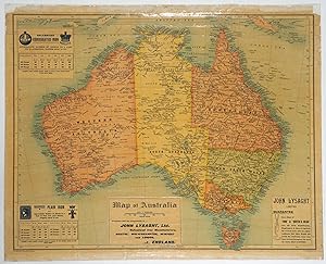
Published by John Bartholomew and Co, Edinburgh 1901
Seller: Antipodean Books, Maps & Prints, ABAA, Garrison, U.S.A.Antipodean Books, Maps & Prints, ABAA
Contact seller3-star sellerCondition: Used - Very good
£ 547.77
£ 7.44 shippingShips within U.S.A.Quantity: 1 available
Add to basketMaps. Condition: Very good condition. A rolling wall map advertising a British steel firm with connections to Australia. Printed "With Compliments John Lysaght Ltd." of Bristol, England and features three insets advertising their products. In the 1880s, Lysaght's produce 40,000 tons of rolled iron sheet each year, much of which…was exported to Australia. John Lysaght himself traveled to Australia in 1879, and formed a subsidiary company there, Lysaght (Australia), the Victoria Galvanised Iron and Wire Co. Published around 1901 after the discovery of Kalgoorlie; while the Northern Territory was still a South Australian protectorate (it was made a state in 1911). The map was most likely published to commemorate Federation. 18x24", originally published as a rolling map on small metal rollers, which are not present. The map has its original lamination and has been deacidified and flattened with the borders restored by Green Dragon Bindery.

Published by Geographical publishing company,, Chicago, 1936
Seller: Antiquariaat FORUM BV, Houten, NetherlandsAntiquariaat FORUM BV
Contact seller5-star sellerCondition: Used
£ 1,339.09
£ 21.67 shippingShips from Netherlands to U.S.A.Quantity: 1 available
Add to basketMap of the Arabian Peninsula and parts of the USSR, Turkey, Iran and the British, French and Italian colonies in Africa, possibly coming from an edition of the Commercial atlas of the world. Printed in yellow are oil fields and pipelines, including the legendary Kirkuk-Haifa/Tripoli oil pipeline. Detailed maps of Iran and of Bri…tish controlled Palestine are printed on the other side.With a few small holes near the inner margin. Colour printed map, 54 x 40 cm.

Arabia and near bordering countries. Includes: Palestine, Iran (Persia) and surrounding territories.
Published by Chicago, Geographical publishing company, ca. 1936-1941. 1941
Seller: Antiquariat INLIBRIS Gilhofer Nfg. GmbH, Vienna, AustriaAntiquariat INLIBRIS Gilhofer Nfg. GmbH
Contact seller5-star sellerCondition: Used
£ 1,339.09
£ 26.00 shippingShips from Austria to U.S.A.Quantity: 1 available
Add to basketColour printed map, 540 x 400 mm. Map of the Arabian Peninsula and parts of the USSR, Turkey, Iran and the British, French and Italian colonies in Africa, possibly coming form an edition of the "Commercial atlas of the world". Printed in yellow are oil fields and pipelines, including the legendary Kirkuk-Haifa/Tripoli oil pipeli…ne. Detailed maps of Iran and of British controlled Palestine are printed on the other side. - With a few small holes near the inner margin.

Map of the Queen Maud Mountains Between Longitudes 175deg and 135deg W. From the Surveys of The Byrd Antarctic Expedition.
1931 American Geographical Map of the Queen Maud Mountains, Antarctica
- Map
Seller: Geographicus Rare Antique Maps, Brooklyn, U.S.A.Geographicus Rare Antique Maps
Contact seller4-star sellerGood. Backed on archival tissue for stability. Closed tears extending two-and-one-half (2.5) and one-and-one-quarter inches from top margin professionally repaired. Bears Nazi library stamp. Size 20 x 28.5 Inches. This is a 1931 American Geographical Society map of the Queen Maud Mountains, Antarctica. Named by Roald Amundsen af…ter the Norwegian queen Maud of Wales, the Queen Maud Mountains are a group of mountains, ranges, and subordinate features of the Transantarctic Mountains. They are situated between the Beardmore and Reedy Glaciers and run from the Ross Ice Shelf to the Antarctic Plateau. A Closer Look Compiled using information contributed by the Byrd Expedition and the American Geographical Society, the map traces the three expeditions undertaken by the Byrd party (November - December 1929) as well as the route of Amundsen's South Pole Expedition. Numerous positions along the Byrd route were determined astronomically, allowing for a degree of precision. Mountain peaks, glaciers, and other features are noted. Richard Byrd's First Antarctic Expedition Byrd's first Antarctic expedition took place between 1928 and 1930. The team erected a base camp which they named 'Little America' on the Ross Ice Shelf and conducted scientific expeditions by snowmobile, dog sled, snowshoe, and airplane. The team completed geological surveys and photographic expeditions and remained in constant radio contact with the rest of the world. It was during this expedition that Byrd, along with three others, flew to the South Pole and back. Following the flight, Congress promoted Byrd to the rank of rear admiral, one of only three people to be promoted to that rank in the U.S. Navy without having first held the rank of captain. The expedition survived two Antarctic winters and returned to North America on June 18, 1930. A Disturbing Library Stamp A library stamp from the Geographishes Institut der Universitat Berlin appears just to the left of the title in the legend above the scale. While library stamps are unremarkable (libraries regularly deaccession materials), the present stamp bears the insignia of the Nazi Party, suggesting it was added to the University collection under the Nazi regime. Publication History and Census This map was created and published by the American Geographical Society to accompany an article written by Laurence M. Gould (who accompanied Byrd on the expedition) that was published in the April 1931 edition of The Geographical Review . This map is well represented in institutional collections; the present example bears a Nazi-era stamp for the Geographisches Institut der Universitat Berlin . References: OCLC 6135564.

- Map
Seller: Geographicus Rare Antique Maps, Brooklyn, U.S.A.Geographicus Rare Antique Maps
Contact seller4-star sellerGood. Even overall toning. Photographs and text on verso. Size 34.5 x 27 Inches. This is a 1929 Geographical Publishing Company pictorial resource map of North America. The map depicts the continent from the Pacific Ocean to the Atlantic Ocean and from the Yukon and Northwest Territories in Canada to Panama and northern Colombia…. Myriad symbols populate the map, illustrating the variety of resources, both natural and manufactured, that were available throughout North America. Cities and towns throughout Canada, the United States, Mexico, Central America, Cuba, and Hispaniola are labeled, each of which is associated with certain resources. A legend situated in the upper right corner shows the principal symbols used throughout, although several symbols not included in the legend are employed throughout the map. These symbols are labeled in at least one place, and more often than not several of the same symbol are labeled somewhere. Agriculture, textiles, train stops, foundries, and printing are some of the 'principal symbols' used, while ship building, fertilizer, butter, and other symbols indicate other resources. Each state is labeled, along with each province and each country in Central America. Two inset maps, in the lower left corner, illustrate Chicago and its environs (Geographical Publishing was based in Chicago) and Alaska. This map was designed and published in 1929 by The Geographical Publishing Company. This particular example was printed by the Southern Agriculturist .

Horoscopium Geographicum Sciatericum.
1671 Kircher / Burgundus North Polar Projection World Map, Geographical Sundial
- Map
Seller: Geographicus Rare Antique Maps, Brooklyn, U.S.A.Geographicus Rare Antique Maps
Contact seller4-star sellerExcellent. Size 9.75 x 15.25 Inches. This is an absorbing 1671 Athanasius Kircher map and representation of his concept of a 'sciatericum,' a sundial-like device that could be used for both geographic and astrological purposes. The work is characteristic of the thought of Kircher, one of the most original and prolific philosophe…rs of his day, in that it draws on a range of traditions and influences, including mysticism, numerology, and what today would be called astrology. A Closer Look Most of the printed portion of the sheet is taken up by a map of the world with a North Polar projection, which is interesting in itself for reflecting the uncertain state of geographic knowledge of the Arctic at the time. (Kircher is non-committal on the possibility of a Northwest Passage.) The map also features additional curious elements, such as the extremely long Niger and Ganges Rivers, as well as the labeling of Virginia, Florida, and California. A dashed line tracks across the northern part of the Americas, marked with zodiac symbols. This work contrasts well with Kircher's stunning maps of the interior of the world, covering volcanoes and water systems (previously sold by us). Below the map are two circular representations of what Kircher would call a 'sciathericon' or 'sciatericum,' referring to the use of shadows cast by the sun in determining not only the time of day but additional meaning as well. It is related to his broader fascination with light, shadow, and circular motion, as laid out in the book Ars Magna Lucis et Umbrae (discussed below), in which this sheet appeared. Figure 2, at the bottom right, is a projection of the map above, viewed two-dimensionally from a side oblique angle, allowing the shadows it would cast to be seen. Figure 3, at the bottom left, is a chronological chart with countries and cities recorded along with their relative times ante or post meridian. Notably, it begins in Mexico (New Granada) and Syria. Text below and on the verso further explains Kircher's notion of a 'horoscopium geographicum sciatericum.' Ars Magna Lucis et Umbrae This sheet appeared in Kircher's work Ars Magna Lucis et Umbrae ('The Great Art of Light and Shadow'), which was an important milestone in the history of science, being the first published work in Europe on illumination and the projection of images. The book also included the first published illustration of Saturn and one of the first published descriptions of a microscope, of Kircher's own design, which he called a 'smicroscopus.' Otherwise, there were hundreds of pages of text, diagrams, illustrations, and maps dealing with all facets of light, color, vision, and optics. Soon before Ars Magna , Kircher published a book on magnetism ( Magnes sive de Arte Magnetica ), and the titles of the two books made a playful duo. They also fit into Kircher's broader philosophical framework, in which magnetism played a central role. (His first book, Ars Magnesia , published in 1631, was on the topic.) The name of this book was also influenced by the 13th century Majorcan thinker Ramon Llull (c. 1232 - 1316), whose philosophical system dubbed 'Ars,' set out in a book titled Ars Magna , heavily influenced Kircher and others, particularly alchemists, in the early modern period. Llull's system, rooted in combinatorics and numerology, was itself strongly influenced by Arabic astronomy and combinations of the Hebrew alphabet from Kabbalah traditions. Kircher was also clearly impacted by Llull's fascination with 'volvelles,' concentric discs with concepts written on them that could be rotated into different alignments to divine meaning. Kircher was so taken with the phrase 'Ars Magna' that he used it in the titles of two of his other works, Musurgia Universalis sive Ars Magna Consoni et Dissoni (1650) and Ars Magna Sciendi Sive Combinatoria (1669), the latter being in many ways the culmination of his life's thought. Taken as a whole, the work is indicative of the state of European intellec.

Administrativ-und General-Karte des Konigreiches Ungarn. [Administrative and General Map of the Kingdom of Hungary.]
1858 Royal Military Geographical Institute 17-Sheet Wall Map of the Kingdom of Hungary
- Map
Seller: Geographicus Rare Antique Maps, Brooklyn, U.S.A.Geographicus Rare Antique Maps
Contact seller4-star sellerVery good. 17 sheets unjoined. All 17 sheets dissected and mounted on linen. All 17 sheets contained in slipcase. The sheets average 17x23 inches. Nearly every sheet trimmed to border. Size 68 x 116 Inches. This is an impressive 17-sheet 1858 Royal Military Geographical Institute map of Hungary. Beautifully engraved, this was th…e most important and detailed map of Hungary to date, a product of the Franziszeische Landesaufnahme, the Second Military Mapping Survey of the Austrian Empire. A Closer Look Coverage embraces Hungary from Bruck to Poschorita and from Grybów to Esseg. Rivers, lakes, roads, and canals are illustrated with topography defined by hachure. A key to the illustrations, symbols, and other notations is included on Sheet IV. A table on Sheet VIII 1/2 details the judicial and financial division of the Crown Land of Hungary. A further table on Sheet XIII provides the political classification and statistical overview of the Crown Land of Hungary. The Franziszeische Landesaufnahme The Franziszeische Landesaufname (Second Military Mapping Survey) was a military land survey of the Austro-Hungarian Empire that took place between 1806 and 1869. It was named after Emperor Francis I (r. 1804 - 1835). The Franziszeische Landesaufnahme was a military mapping project that replaced the Josephinische Landesaufnahme (First Military Mapping Survey). It was the first survey of the Austrian Empire that used triangulation and was conducted on the same scale as the Josephinische Survey. The maps were published for public distribution as 'special maps' at a scale of 1:144,000 and 'general maps' at a scale of 1:288,000. Kingdom of Hungary The Kingdom of Hungary existed from 1526 until 1867. It was part of the lands of the Habsburg monarchy and was a state outside the Holy Roman Empire. It became part of the Austrian Empire after it was established in 1804. Hungary revolted against Habsburg rule in April 1848, part of the Springtime Revolutions. It implemented democratic parliamentary elections with the goal of transforming the old feudal system into a democratic representative parliament. This movement turned into an armed revolution against Habsburg rule. The Hungarians dealt the Austrians a series of defeats and appeared to be close to winning independence. Then, Austrian Emperor Franz Joseph appealed to the Russians for help. In response, Russian Tsar Nicholas 1 sent 200,000 soldiers and helped the Austrians defeat the Hungarians. The Habsburgs retained control over Hungary and quickly implemented martial law. Following the Hungarian Revolution of 1848, Austrian Emperor Franz Joseph took absolute control of Hungary and revoked its constitution. The first cracks in Habsburg rule appeared after France and Sardinia-Piedmont defeated Austria at the Battle of Solferino in 1859. This defeat prompted Franz Joseph to grant concessions to the Hungarians and demonstrated that ruling by decree was no longer entirely viable. Then, the Prussians defeated the Austrians in the Austro-Prussian War in 1866. This defeat rendered the weaknesses of the Habsburgs apparent to all of Europe and brought the monarchy to the negotiating table. This led to the Compromise of 1867 and the creation of the Dual Monarchy of Austria-Hungary, better known as the Austro-Hungarian Empire. Publication History and Census This map was created and published by the Imperial and Royal Geographical Institute (K. K. Militärisch Geographische Institut) in 1858. We note 3 examples cataloged in OCLC: two are in Germany, and one is in Switzerland. References: OCLC 1398953975.

- Map
Seller: Geographicus Rare Antique Maps, Brooklyn, U.S.A.Geographicus Rare Antique Maps
Contact seller4-star sellerVery good. Some dampstaining; abrasion at lower right, small puncture to upper right, reinforced separation in margin corners. Light creasing and cracking typical of this kind. Size 33.25 x 48.75 Inches. A rare 1929 American Geographical Society wall map of Antarctica issued to celebrate the 1928-29 Wilkins-Hearst Expedition (19…28 - 29), wherein George Hubert Wilkins (1888 - 1958) accomplished the first Antarctic flight, revealing some 1000 miles of uncharted territory. A Monumental Achievement. The map was described in a pamphlet published at the same time by the Society: This generation is the last that will have the opportunity of witnessing the exploration of a continent. We are again in the midst of a period of intensive exploring in the Antarctic. True to the spirit of the time this work is being done by the high-powered airplane; the results are being made known to the whole civilized world almost immediately by radio. It is to supply a means of following these expeditions in what they have already done and what they are going to do that the accompanying map has been prepared by the American Geographical Society of New York. A Closer Look The wall map is presented in three parts. The primary map is centered on Antarctica and places the Antarctic in relation to the southern continents, thus incorporating the southern limits of South Africa, South America, Australia, and New Zealand. The coastline includes both confirmed land as well as conjectural shores. For example, 'Wilkes Land' is illustrated BOTH under the assumption that Charles Wilkes' 1838 discoveries indicated the presence of a large continent; and also in the more restricted form proposed by Sir Douglas Mawson, who questioned many of Wilkes's reported landfalls. The map is richly detailed and benefits from modern navigation, hydrography, and land surveys. Depth soundings are derived from state-of-the-art sonic measurements considered superior to the contemporaneous soundings then used for most nautical charts. Variations in the icy terrain are specified. Specific features are noted with the years of their discovery. Wilkins' Flight A detail map focuses on the Antarctic region of Graham Land. It details the track (red) and discoveries of Wilkins' 1928-1929 aerial expedition, the first airplane flight over Antarctica. It also presents in glaring detail the efforts that Wilkins was willing to make in order to acknowledge and flatter his patrons. Chief among these is the decision to dub the mainland at the base of the Antarctic Archipelago 'Hearst Land,' after Wilkins' primary patron and financier William Randolph Hearst. Many of other the placenames honor fellows of the American Geographical Society, which also supported the expedition. Standouts include 'Lockheed Mountains' (named after the manufacturer of Wilkins' Lockheed Vega aircraft) and 'Mobiloil Bay' (whose fuel and lubricants that aircraft no doubt depended on). A note on the map indicates that the positions of the coastline and other features were based not on astronomical observation but were sketched in-flight and checked by dead reckoning. Wilkins acknowledged that this could result in latitudinal errors of 5-10 miles and that longitudinal errors could be even greater. The Photographs Much of Wilkins' fame, going back to his exploits in World War I (1914 - 1918), was tied to photography. His exploration also produced a significant photographic record. The third part of the map is dedicated to ten of Wilkins' aerial photographs of the Antarctic. These include views of the expedition's base on Deception Island, and dramatic views of islands and mountains spotted on the journey (highlighting, for instance, the 'Detroit Aviation Society Plateau,' another one of the adventurer's patron societies). Publication History and Census This map was published in 1929 by the American Geographical Society in a single edition. We see approximately 30 examples listed in OCLC. Scarce to the market. References: OCLC 7120.

- Map
Seller: Geographicus Rare Antique Maps, Brooklyn, U.S.A.Geographicus Rare Antique Maps
Contact seller4-star sellerVery good. Small area reinforced on verso. Soiling to top margin. Size 32.5 x 41.25 Inches. This is a 1972 American Geographical Society map of Antarctica depicting submarine and subglacial topography. Compiled by geologist Bruce Heezen and glaciologist Charles Bentley, this revolutionary map reveals the bizarrely shaped contine…nt hidden under miles of Antarctic ice. A Closer Look Centered over Antarctica, the map employs a Polar Stereographic Conformal Projection. It includes South America as far north as Bolivia and Rio de Janeiro, the southernmost portion of Africa, nearly all of Madagascar, most of Australia, and all of New Zealand. Colors illustrate subglacial topography: some glaciers sit atop mountains over 3,000 meters high, while others, such as the Ross Ice Shelf, extend thousands of meters below sea level. Color details the sea floor surrounding Antarctica in all directions, reaching depths of over 7,000 meters. Islands in the Atlantic, Pacific, and Indian oceans are labeled, along with reefs, plateaus, trenches, and other formations. Both the Mid-Atlantic Ridge and the Mid-Indian Ocean Ridge are illustrated as well. Publication History and Census This map was compiled by the American Geographical Society with submarine topography by Bruce C. Heezen and subglacial topography by Charles R. Bentley. We note 4 examples cataloged in OCLC: Columbia University, the Library of Congress, the Osher Map Library at the University of Southern Maine, and the University of California San Diego. References: OCLC 799918835.

- Map
Seller: Geographicus Rare Antique Maps, Brooklyn, U.S.A.Geographicus Rare Antique Maps
Contact seller4-star sellerGood. Exhibits some toning and soiling. Closed tear extending one half inch into printed area from bottom margin professionally repaired on verso. Verso repairs to fold separations. Blank on verso. Size 12.875 x 8 Inches. This is a 1944 Allied Geographical Section mimeograph map of the Philippines. Created for the planning and p…reparation of the Philippine Campaign, the map is dated twice: once for its publication by the Allied Geographical Section (30 July 44) and a second time when it was reproduced by Battalion Landing Team (BLT) 184-2 (28 Sept. '44), less than a month before the amphibious invasion of the island of Leyte on October 20, 1944. The landings on Leyte marked the beginning of the Philippine Campaign, which lasted until the war ended on September 2, 1945. Each of the islands is labeled, as are a few cities, including Manila on Luzon and Davao on Mindanao, but very little other detail is present. Battalion Landing Team 184-2 in World War II Battalion Landing Team (BLT) 184-2 was part of the 7th Infantry Division and fought in the Pacific Theater during World War II. Although the 7th Infantry Division first saw combat in the Aleutian Campaign, the traceable history of BLT 184-2 begins in the Marshall Islands with the January 30, 1944 landing on Kwajalein Atoll. After securing Kwajalein and Eniwetok in the Marshalls, the 7th Infantry Division next saw combat during the amphibious invasion of Leyte Island, the Philippines. BLT 184-2 was held in reserve for the first few days of the Battle of Leyte before being moved up to front line combat and played a critical role during the rest of the battle helping to secure Leyte. After Leyte, the 7th Infantry Division and likely BLT 184-2 took part in the invasion of Okinawa. After the war, the 184th Infantry Regiment, of which BLT 184-2 was a part, was reassigned to the California National Guard. This Map and BLT 184-2 Since this map was originally produced by the Allied Geographical Section, it can be surmised that it was meant to be part of the planning process for the Leyte operation. The present example, which was 'reproduced' by a staff sergeant in BLT 184-2, on September 28, 1944 must have helped in preparing the men of this unit for the assault on Leyte. It is of note that this map is a mimeograph, a short-run printing technique used widely for field reproductions of important document during wartime. Publication History This map was originally created by the Allied Geographical Section on July 30, 1944 and then was reproduced for use by BLT 184-2 on September 28, 1944. This is the only known example. References: Heinl Jr., Robert D. and John A. Crown, The Marshalls: Increasing the Tempo (Nashville: The Battery Press) 1991. Operation Report 7th Infantry Division King II.


