Edited Mahesh Gaur Pandey Goyal (1 results)
Search filters
Product Type
- All Product Types
- Books (1)
- Magazines & Periodicals (No further results match this refinement)
- Comics (No further results match this refinement)
- Sheet Music (No further results match this refinement)
- Art, Prints & Posters (No further results match this refinement)
- Photographs (No further results match this refinement)
- Maps (No further results match this refinement)
- Manuscripts & Paper Collectibles (No further results match this refinement)
Condition Learn more
- New (1)
- As New, Fine or Near Fine (No further results match this refinement)
- Very Good or Good (No further results match this refinement)
- Fair or Poor (No further results match this refinement)
- As Described (No further results match this refinement)
Binding
- All Bindings
- Hardcover (1)
- Softcover (No further results match this refinement)
Collectible Attributes
- First Edition (1)
- Signed (No further results match this refinement)
- Dust Jacket (No further results match this refinement)
- Seller-Supplied Images (No further results match this refinement)
- Not Print on Demand (1)
Language (1)
Price
- Any Price
- Under £ 20 (No further results match this refinement)
- £ 20 to £ 40 (No further results match this refinement)
- Over £ 40
Free Shipping
- Free Shipping to U.S.A. (No further results match this refinement)
Seller Location
Seller Rating
-
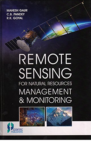
Remote Sensing for Natural Resources Management and Monitoring
Published by Scientific Publisher, 2016
ISBN 10: 9386102722 ISBN 13: 9789386102720
Language: English
Seller: Vedams eBooks (P) Ltd, New Delhi, India
First Edition
Hardcover. Condition: New. 1st Edition. Contents: 1. Remote sensing and geographic information system for natural resources management/Mahesh Gaur and R.K. Goyal. 2. Remote sensing and GIS concepts/Suparn Pathak. 3. Recent trends in natural resources inventory, mapping and monitoring/Mahesh Gaur. 4. Geospatial technologies for sustainable development of the natural resources/Jyotsana Chuchra Raheja and Mahesh Gaur. 5. Land evaluation for sustainable land use management/Mahesh Gaur, Pradeep Pagaria, R.K. Goyal and J.S. Chouhan. 6. Remote sensing and GIS techniques for mapping of soil resources/Mahesh Gaur and Pradeep Pagaria. 7. Land capability assessment using remote sensing and GIS techniques/Sanjay Dhakad, R.K. Goyal, Mahesh Gaur and Devi Dayal. 8. Integration of geospatial analysis techniques for natural resources management/Peeyush Gupta and Swati Goyal. 9. Appraisal of rainfed agriculture in arid Western Rajasthan using remote sensing and GIS/Balak Ram, Mahesh Gaur and J.S. Chouhan. 10. Water resources and surface water bodies in hot arid zone/R.K. Goyal and Mahesh Gaur. 11. Recent approaches in watershed delineation and integrated management/A. K. Bera, Sagar S. Salukhe and Niteenkumar Bankar. 12. Role of geomatics in morphometric analysis of a watershed - a case study of the Bata River at Lower Shivalik Hills/Nitin Chauhan and Vipin Kumar. 13. Spatial Trend of Evapotranspiration in Western Rajasthan under Climate Change/R.K. Goyal and Mahesh Gaur. 14. Vegetation ecology of hot arid and semi arid grazing lands of India/Manish Mathur and C.B. Pandey. 15. Spatial and temporal variations in cropped area in the Thar Desert/Ila Agnihotri and J.R. Sharma. 16. Land degradation mapping using geospatial technologies/S. Rama Subramoniam, A.K. Bera and Uday Raj. 17. Spatial pattern of agricultural drought using NOAA-AVHRR derived vegetation indices/Arnab Kundu, D. M. Denis, N. R. Patel and Dipanwita Dutta. 18. Landslide hazards zonation and its management using remote sensing and GIS/Ravinder Singh Bora. 19. Multi-temporal satellite data for wastelands monitoring /Mahesh Gaur and J. S. Chouhan. 20. Efficacy of close range photogrammetric techniques for 3D modeling of buildings using DSLR cameras/Chilka Sharma and Nitin Chauhan. 21. Urban footprints on environment: a geo-informatics approach/Amit Kumar. 22. Green city modeling to bring up forestry and horticulture under urban morphology: a case study of Jaipur/Himani Singh and Vinay Sinha. 23. Re-Survey of cadastral maps using high-resolution satellite imagery/S. Srinivasa Rao, J. R. Sharma, S. S. Rajasekhar, D. S. Prakasa Rao, Abhishek Arepalli, Virat Arora, Kuldeep, Ravi Prakash Singh and Madhubabu Kanaparthi. 24. Site suitability modeling for future urban development using MCDM- Analytic Hierarchy Process/Amit Kumar, Anish Kumar Rai and A.C. Pandey. 25. Temporal trend analysis of LST, NDVI and soil moisture over Indian summer monsoon season/P. Thanabalan, R. Vidhya and V. Kumar. 26. Identification of groundwater potential zone in Girudhumal River sub- basin using the Remote Sensing and GIS/M. Dhanasekarapandian, S. Chandran, K. Mutheeswaran and V. Kumar. 27. India's space program for natural resources management/A.T. Jeyaseelan. The book attempts to match user need to the level of technology required for management, planning and monitoring of natural resources. It provides clear guidance on the reliability, accuracy and cost of applications. Editors believe that this endeavour shall provide a valuable scientific basis to students and researchers to address the future challenges in natural resources monitoring and management. Accurate inventory, assessment and periodic monitoring of resources will enable the policy makers to keep an eye on optimal utilization of resources and development process to take timely interventions. We further hope this book will be a valuable reference and provide practical guidance for all who work towards the goal of the sustainable and judicious use of resources.


