Order Total (1 Item Items):
Shipping Destination:

Davies Br (56 results)
Author:
davies br
Refine with Advanced Search
Skip to main search results
Search filters
Product Type
- All Product Types
- Books (26)
- Magazines & Periodicals (No further results match this refinement)
- Comics (No further results match this refinement)
- Sheet Music (No further results match this refinement)
- Art, Prints & Posters (11)
- Photographs (No further results match this refinement)
- Maps (19)
- Manuscripts & Paper Collectibles (No further results match this refinement)
Condition Learn more
Binding
Collectible Attributes
- First Edition (4)
- Signed (No further results match this refinement)
- Dust Jacket (No further results match this refinement)
- Seller-Supplied Images (41)
- Not Print on Demand (56)
Language (2)
Free Shipping
Seller Location
Seller Rating
-

GLIMMER TRAIN Issue 5, Winter 1993
Published by Glimmer Train Press, Inc., 1993
Seller: marvin granlund, Emeryville, CA, U.S.A.
Association Member: IOBA
Seller rating 5 out of 5 stars

First Edition
Softcover. Condition: Near Fine. First Edition. Near Fine unread paperback first edition with bookmark & subscription envelope. 160 pages, unmarked ; ECR V4V-3; 8vo 8" - 9" tall; 160 pages.
-

Loose Leaf. Condition: New. Reproduction. Original title: Mount Blanc German: Mont Blanc French: Mont Blanc Spanish: Monte Blanc High-quality fine-art reproduction based on an original work from the Ycba. Creation period: 19th century (ca. 1828). Professionally printed on premium fine-art paper (Photo Matt Fibre) in size A5. The motif is printed with a white border (museum-style presentation). No.
-

Loose Leaf. Condition: New. Reproduction. Original title: Mount Blanc German: Mont Blanc French: Mont Blanc Spanish: Monte Blanc High-quality fine-art reproduction based on an original work from the Ycba. Creation period: 19th century (1828). Professionally printed on premium fine-art paper (Photo Matt Fibre) in size A5. The motif is printed with a white border (museum-style presentation). No.
-
Condition: Good. This is an ex-library book and may have the usual library/used-book markings inside.This book has hardback covers. In good all round condition. Library sticker on front cover. Please note the Image in this listing is a stock photo and may not match the covers of the actual item,1300grams, ISBN:9780471960621.
-
MAP OF HERTFORDSHIRE -1865
Language: English
Published by CASSELL. PETTER & GALPIN, London, 1865
Seller: K Books Ltd ABA ILAB, York, YORKS, United Kingdom
Association Member: ABA ILAB PBFA
Seller rating 5 out of 5 stars
No Binding. Condition: Very Good. B R DAVIES (illustrator). A very detailed original antique map drawn by B R Davies, showing roads, railways, hills etc. no date of publication but with a lot of information about Hertfordshire and its population based on the 1861 census and with crime statistics dated 1862, coloured in outline - impressive and reasonably priced.
-
MAP OF BUCKINGHAMSHIRE -1865
Language: English
Published by CASSELL. PETTER & GALPIN, London, 1865
Seller: K Books Ltd ABA ILAB, York, YORKS, United Kingdom
Association Member: ABA ILAB PBFA
Seller rating 5 out of 5 stars
No Binding. Condition: Very Good. B R DAVIES (illustrator). A very detailed original antique map drawn by B R Davies, showing roads, railways, hills etc. no date of publication but with a lot of information about Buckinghamshire and its population based on the 1861 census and with crime statistics dated 1862, coloured in outline - impressive and reasonably priced.
-
MAP OF OXFORDSHIRE -1865
Language: English
Published by CASSELL. PETTER & GALPIN, London, 1865
Seller: K Books Ltd ABA ILAB, York, YORKS, United Kingdom
Association Member: ABA ILAB PBFA
Seller rating 5 out of 5 stars
No Binding. Condition: Very Good. B R DAVIES (illustrator). A very detailed original antique map drawn by B R Davies, showing roads, railways, hills etc. no date of publication but with a lot of information about Oxfordshire and its population based on the 1861 census and with crime statistics dated 1862, coloured in outline, slight foxing at edges - impressive and reasonably priced.
-
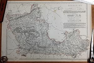
MAP OF BERKSHIRE -1865
Language: English
Published by CASSELL. PETTER & GALPIN, London, 1865
Seller: K Books Ltd ABA ILAB, York, YORKS, United Kingdom
Association Member: ABA ILAB PBFA
Seller rating 5 out of 5 stars
No Binding. Condition: Very Good. B R DAVIES (illustrator). A very detailed original antique map drawn by B R Davies, showing roads, railways, hills etc. no date of publication but with a lot of information about Berkshire and its population based on the 1861 census and with crime statistics dated 1862, coloured in outline, slight foxing at edges - impressive and reasonably priced.
-

The Biology and Conservation of South Africa's Vanishing Waters
Language: English
Published by Centre for Extra-Mural Studies, University of Cape Town, 1986
ISBN 10: 0799210218 ISBN 13: 9780799210217
Soft cover. Condition: Very Good. The wraps are rubbed and marked.Light tanning.Well bound.Very good copy.[R.K]. Our orders are shipped using tracked courier delivery services.
-

The Biology and Conservation of South Africa's Vanishing Waters
Language: English
Published by Centre for Extra-Mural Studies, University of Cape Town, 1986
ISBN 10: 0799210218 ISBN 13: 9780799210217
Soft cover. Condition: Very Good. The wraps are rubbed and marked.Internally clean.Tightly bound.[R.K]. Our orders are shipped using tracked courier delivery services.
-
No Binding. Condition: Very Good. Dispatch Atlas map of Berkshire, image size approx 470mm by 315mm; plate mark; minor hand colour. Three to four spots. Please refer to pictures. Many other maps and engravings available, please contact.
-
MAP - COUNTY OF KENT
Published by Day & Son, London, 1860
Seller: Luis Porretta Fine Arts, Nanaimo RPO Country Club, BC, Canada
Seller rating 3 out of 5 stars

Hardcover. Condition: Very Good. Dust Jacket Condition: No Dust Jacket. This wonderful and very detailed map of the County Of Kent was published in 1860 and is in very good condition, full borders as published, original outline color, measures 19" x 14", a beautiful map. Images available. ; 19" x 14".
-

Softcover. Condition: Very Good. 1863. A very presentable print, with, a few minor spots and handling marks at the edges and corners, but clean and clear across the image surface, neatly trimmed to prevent wear. Why on Amazon do most sellers not describe their actual book? Buy with confidence and support a genuine Independent Bricks & Mortar Real Bookshop. We are Maynard & Bradley CAMBO & PBFA(now lapsed) members here in Leicester City Centrebu Size: 445 x 320 mm. 1. Item Type: Book. Quantity Available: 1. Shipped Weight: Under 500 grams. Category: Travel & Places; Britain/UK; 19th century; Inventory No: 47327.
-
An antique map of Essex, England, engraved by B. R. Davies, from the Ordnance Survey, taken from a copy of the Supplement to The Weekly Dispatch of Sunday, September 12th 1858
Language: English
Published by Weekly Dispatch Atlas, printed by Day & Son, 1858
Seller: GN Books and Prints, Inverness, United Kingdom
Seller rating 4 out of 5 stars

Map
No Binding. Condition: As Described. No Jacket. B. R. Davies (illustrator). An antique map of Essex, England, engraved by B R Davies, from the Ordnance Survey, taken from a copy of the Supplement to The Weekly Dispatch of Sunday, September 12th 1858, published by Weekly Dispatch Atlas, 139 Fleet Street, printed by Day & Son, Lithographers to The Queen Contains Scale of English Miles Measures around 19 1/2" x 13 3/4" (495mm x 350mm) Hand-colouring to county borders and coast The map contains a central vertical fold Some edge-wear and some edge and corner creasing Coloured stamp to corner containing publication details A little marking and slight toning around edges but quite clean for age See pictures for further information 1 pp. n.
-
An antique map of Hertfordshire, England, engraved by B. R. Davies, from the Ordnance Survey, taken from a copy of the Supplement to The Weekly Dispatch of Sunday, April 8th, 1860
Language: English
Published by Weekly Dispatch Atlas, printed by Day & Son, 1860
Seller: GN Books and Prints, Inverness, United Kingdom
Seller rating 4 out of 5 stars
Map
No Binding. Condition: As Described. No Jacket. B. R. Davies (illustrator). An antique map of Hertfordshire, England, engraved by B R Davies, from the Ordnance Survey, taken from a copy of the Supplement to The Weekly Dispatch of Sunday, April 8th, 1860, published by Weekly Dispatch Atlas, 139 Fleet Street, printed by Day & Son, Lithographers to The Queen Contains Scale of English Miles Measures around 19 1/2" x 13 3/4" (495mm x 350mm) Hand-colouring to county borders The map contains a central vertical fold Some edge-wear and some edge and corner creasing Coloured stamp to corner containing publication details A little marking and slight toning around edges but quite clean for age See pictures for further information 1 pp. n.
-
An antique map of Oxfordshire, England, engraved by B. R. Davies, from the Ordnance Survey, taken from a copy of the Supplement to The Weekly Dispatch of Sunday, November 7th, 1858
Language: English
Published by Weekly Dispatch Atlas, printed by Day & Son, 1858
Seller: GN Books and Prints, Inverness, United Kingdom
Seller rating 4 out of 5 stars
Map
No Binding. Condition: As Described. No Jacket. B. R. Davies (illustrator). An antique map of Oxfordshire, England, engraved by B R Davies, from the Ordnance Survey, taken from a copy of the Supplement to The Weekly Dispatch of Sunday, November 7th, 1858, published by Weekly Dispatch Atlas, 139 Fleet Street, printed by Day & Son, Lithographers to The Queen Contains Scale of English Miles Measures around 13 3/4" x 19 1/2" (350mm x 495mm) Hand-colouring to county borders The map contains a central horizontal fold Some edge-wear and some edge and corner creasing Coloured stamp to corner containing publication details A little marking and slight toning around edges but quite clean for age Clear tape repair on rear to edge of fold See pictures for further information 1 pp. n.
-

Huntingdonshire.
Published by LondonThe Weekly Dispatch. Feby 20th 1863, 1859
Seller: Robert Frew Ltd. ABA ILAB, London, United Kingdom
Association Member: ABA ILAB PBFA
Seller rating 5 out of 5 stars
Map
30.6 x 42.2 cm. Original outline colour. Lithograph map. Publisher's date stamp to upper left corner. Very good condition.
-

A Synthesis of the Ecological Functioning, Conservation and Management of South African River Ecosystems (Prepared for the Water Research Commission June, 1993 (WRC Report No. TT 62/63))
Published by Water Research Commission, Pretoria, 1993
First Edition
Softcover. Condition: Good. No Jacket. First Edition. 232 pages (complete). An amiably owned copy. The covers are benign, placid with handling and shelving wear about the edges and corners and seams. They are secure and sure. Within, the contents page has light pencilled annotations. The pages are clean, clear, diligent, competent, confident. fk. Our orders are shipped using tracked courier delivery services.
-
A Synthesis of the Ecological Functioning, Conservation and Management of South African River Ecosystems.
Published by Pretoria, Water Research Commission, 1993, 1993
Seller: Treasure House Books, Franschhoek, WCAPE, South Africa
Seller rating 5 out of 5 stars
First Edition
First Edition. In pictorial wraps.Very good condition, clean and tight. Africana. Paperback. No dj.
-

A Companion to Latin American Women Writers (Monografi?as A) (Monograf?as A)
Seller: Kennys Bookshop and Art Galleries Ltd., Galway, GY, Ireland
Seller rating 5 out of 5 stars
First Edition
Condition: New. 2012. 1st Edition. Hardcover. This volume offers a critical study of a representative selection of Latin American women writers who have made major contributions to all literary genres and represent a wide range of literary perspectives and styles. Editor(s): Pastor, Brigida M.; Davies, Lloyd Hughes. Series: Coleccion Tamesis: Serie A, Monografias. Num Pages: 260 pages. BIC Classification: 2ADSL; DSB; JFSJ1. Category: (P) Professional & Vocational. Dimension: 240 x 166 x 27. Weight in Grams: 594. Series: Coleccion Tamesis: Serie A, Monografias. 260 pages. Editor(s): Pastor, Brigida M.; Davies, Lloyd Hughes. This volume offers a critical study of a representative selection of Latin American women writers who have made major contributions to all literary genres and represent a wide range of literary perspectives and styles. Cateogry: (P) Professional & Vocational. BIC Classification: 2ADSL; DSB; JFSJ1. Dimension: 240 x 166 x 27. Weight: 594. . . . . .
-

The Ecology of River Systems
Published by Dr. W. Junk, The Hague, 1986
Seller: Attic Books (ABAC, ILAB), London, ON, Canada
Seller rating 5 out of 5 stars
Cloth. Condition: Good. Monogaphiae Biologicae Vol. 60. xviii, 793 p. 25 cm. Over 200 b&w photos, figures, and tables. Cloth hardcover. Corners bumped. Small mark on lower front corner. Rear hinge torn towards top. Spine cloth creased. Clean and bright. Topics include river systems as ecological units and the following river systems: Niger, Orange-Vaal, Volta, Zaïre, Zambezi, Amazon, Colorado, Mackenzie, Paraná, Uruguay, Murray-Darling, Mekong. Fish, plants, reservoirs, environmental features, development, zoobenthos described. Indices of organisms and floodplain, lake, reservoir, river and swamp systems, as well as subject index.
-
Condition: Acceptable. No Jacket. Octavo. Green cloth covered boards with gilt stamped lettering to front board; Blind stamped decoration to both boards. Yellow front endpapers with black text. Fold out map backed on cloth with hand-tinting placed loosely between boards. Mild dampstains to cloth backing. Map is generally clean.
-
Perspectives in southern hemisphere Limnology. Proceedings of a symposium, Wilderness, South Africa. xiv, 263 p., num. figs, 4to, hardbound (Dev. Hydrob
Seller: Backhuys Biological Books, Kerkwerve, Netherlands
Seller rating 5 out of 5 stars
Hardcover. 28) 0.0.
-

British Isles Map, Original Antique Engraving c.1865
Published by Cassell, Petter & Galpin, UK, 1812
Softcover. Condition: Very Good. c.1812. A well-presented and lightly-handcoloured map, with some minor nicks around the outer page edges but largely clean across the entire image surface and free from any signs of wear beyond a few minor scattered spots. Why on Amazon do most sellers not describe their actual book? Buy with confidence and support a genuine Independent Bricks & Mortar Real Bookshop. We are Maynard & Bradley CAMBO & PBFA(now lapsed) members here in Leicester City Centre. Size: 490 x 700 mm. 1 pages. Item Type: Book. Quantity Available: 1. Shipped Weight: Under 1 kilo. Category: Geography & Maps; Britain/UK; 19th century; Inventory No: 31971.
-

'ESSEX'. Map drawn and engraved by B. R. Davies.
Published by Weekly Dispatch Atlas, ca 1861, 1861
Map
Lithograph with original colour, 30 x 43 cm.
-

'SUSSEX'. Drawn and engraved by B.R.Davies, with additional notes refering to births, marriages & deaths, education, parlimentary representation etc.
Published by Weekly Dispatch Atlas, ca 1861, 1861
Map
Lithograph with original outline colour, 43 x 30 cm.
-

Condition: Buono (Good). litografia a colori inciso cm. 57,5 x 38,3 - foglio cm. 60,6 x 41,1 Buono (Good) Buon es. Book.
-
Railway map of the British Isles and part of France. Drawn & engraved by B.R. Davies.
Published by London: B. R. Davies and Edward Stanford, 1866
Map
Soft cover. Condition: Very Good. Folding linen-backed dissected colour map. 899 x 730 mm. Scale 1:1,267,200. Some spotting to linen backing and to sea area at left of the British Isles, else a very good, fresh copy in fine green boards with gilt device of Letts Son & Co 'Agents by appointment to Her Majesty's Board of Ordnance'.
-
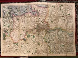
Davies' Map of the Environs of London
Published by Edward Stanford ca. 1870, London, 1870
Seller: Foster Books - Stephen Foster - ABA, ILAB, & PBFA, London, United Kingdom
Association Member: ABA ILAB PBFA
Seller rating 5 out of 5 stars
Cloth. Condition: Very Good. 112 cm x 80 cm when folded out. 14.5 cm x 21 cm when folded up. Pocket style linen folding map of London and its immediate area, including Surrey, Essex, Buckingham, Kent, Hertfordshire, etc. with beautiful original colouring. Cover is original green blind-stamped cloth with gilt lettering on boards. Spine of the cover is worn with some tearing to joint, but the map itself is clean and in very good condition. From Stanford's Series of New Library Maps. 8vo. Folding Map.
-
Antwerp; (Antwerpen.) (Anvers.)
Published by George Cox, London, 1855
Seller: Argosy Book Store, ABAA, ILAB, New York, NY, U.S.A.
Seller rating 5 out of 5 stars
unbound. W.B. Clarke; B.R. Davies (illustrator). Map. Original engraving with hand coloring. Page measures 12 1/4" x 15 1/2" Beautifully detailed town plan of Antwerp, Belgium. Features a impressive aerial view of the city's grid plan, showing buildings, canals, and military fortifications. Streets, plazas, and major landmarks are labeled, with parks, waterways, and rail lines accented by hand coloring. An inset along the left margin depicts a Plan of the Scheldt & the Forts from Antwerp to Lillo, with major roads and villages labeled and forts colored in red. Along the bottom is a "Comparison of the Principal Buildings in Antwerp", with eleven buildings illustrated. William Barnard Clarke (1806-1865) was an English architect, cartographer, archeological writer and art collector. He was the founding president of the Architectural Society of London. The "Society for the Diffusion of Useful Knowledge" (SDUK), founded in 1826 at the initiative of British lord Henry Peter Brougham, aimed to distribute affordable, high-quality educational materials to the working and middle classes. Despite ties to prestigious publishers like Baldwin and Cradock, Chapman and Hall, and Charles Knight, SDUK closed in 1848 due to financial challenges. It achieved renown for its exceptional atlases, notably a comprehensive series of maps initially issued individually and later consolidated into a groundbreaking world atlas under Chapman and Hall. SDUK maps are celebrated for their accuracy, detail, and accessibility, representing a pinnacle of 19th-century English mass-market cartography.