
Order Total (1 Item Items):
Shipping Destination:

Comiso Josefino (24 results)
Skip to main search results
Search filters
Product Type
- All Product Types
- Books (24)
- Magazines & Periodicals (No further results match this refinement)
- Comics (No further results match this refinement)
- Sheet Music (No further results match this refinement)
- Art, Prints & Posters (No further results match this refinement)
- Photographs (No further results match this refinement)
- Maps (No further results match this refinement)
- Manuscripts & Paper Collectibles (No further results match this refinement)
Condition Learn more
- New (12)
- As New, Fine or Near Fine (5)
- Very Good or Good (3)
- Fair or Poor (No further results match this refinement)
- As Described (4)
Binding
Collectible Attributes
- First Edition (6)
- Signed (2)
- Dust Jacket (No further results match this refinement)
- Seller-Supplied Images (9)
- Not Print on Demand (16)
Language (2)
Free Shipping
Seller Location
Seller Rating
-

Arctic and Antarctic Sea Ice 1978 - 1987 Satellite Passive-Microwave Observations and Analysis
Published by NASA, Washington D. C., 1992
Hardcover. Condition: Near Fine with no dust jacket. 290 pages. NASA SP - 511/ shipping will be extra for this large and heavy book, please inquire.; 12 1/4 x 12 1/4".
-

Polar Oceans from Space (Atmospheric and Oceanographic Sciences Library)
First Edition Signed
Hardcover. Condition: As New. Dust Jacket Condition: No DJ. First Edition. This is a fine, as new, hardcover first edition copy, no DJ, blue spine. Inscribed by the author on the half title page. Inscribed by Author(s).
-
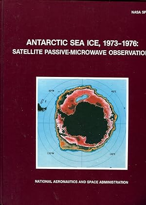
Antarctic sea ice, 1973-1976 : satellite passive-microwave observations
Published by DC - 1983, 1983
NASA, Washington, DC - 1983, 23,50x29,50 cm, cartonn�, XIV + 206 pages Tr�s bon �tat - Pour les envois hors de France, la tafication �livre & brochure� pour les frais de port a disparue.Les frais de port annonc�s correspondent � une moyenne. Ils seront calcul�s au plus juste en fonction du poids de votre article.
-
Pictorial Cover. Condition: Near Fine. NASA SP-459. Size: 4to - over 9�" - 12" tall. Book.
-
SSM/I Sea Ice Concentrations Using the Bootstrap Algorithm
Published by NASA, Greenbelt, Maryland, U.S.A, 1995
First Edition
Paperback. Condition: Good +. Paperback Edition. 280 x 220mm. pp. 49. English text. Original NASA publication entitled 'SSM/I Sea Ice Concentrations Using the Bootstrap Algorithm' issued in December 1995. NASA reference publication 1380. Black and white illustrations. Bound in original light brown card covers. Library marks to front cover and some bumping to corners and edges. Binding strong. No underlining. Ex-Library.
-
NASA SP-489: ARCTIC SEA ICE, 1973-1976: Satellite Passive-Microwave Observations.
Published by Washington, DC: NASA, 1987., 1987
Seller: OLD WORKING BOOKS & Bindery (Est. 1994), West Brookfield, MA, U.S.A.
Association Member: SNEAB
Seller rating 5 out of 5 stars

First Edition
Illustrated by Color and b/w photos of, and line-drawn maps. First edition. Gloss pictorial boards. 4to. pp. xvi, 296. Index. Near Fine/No jacket, as issued/Ex-Lib. Technical markings: bookplate, rear envelope, white spine label. Atlas of Satellite photos of freezing and thawing of sea ice, implications on weather and Geology and Space Technology (Same format as NASA SP-459 ANTARCTIC Sea Ice, 1983).
-
NASA SP-459: ANTARCTIC SEA ICE, 1973-1976: Satellite Passive-Microwave Observations.
Published by Washington, DC: NASA, 1983., 1983
Seller: OLD WORKING BOOKS & Bindery (Est. 1994), West Brookfield, MA, U.S.A.
Association Member: SNEAB
Seller rating 5 out of 5 stars
First Edition
Illustrated by Color and b/w. First edition. Gloss pictorial boards. 4to. pp. xii, 206. Index. Near Fine/No jacket, as issued/Ex-Lib. Technical marking: remnant of rear envelope, white spine label. Atlas of Satellite photos of freezing and thawing of sea ice, implications on weather and Geology and Space Technology (Same format as NASA SP-489, Arctic Sea Ice, 1987).
-
hardcover. Condition: Very Good. Connecting readers with great books since 1972! Used books may not include companion materials, and may have some shelf wear or limited writing. We ship orders daily and Customer Service is our top priority!
-

-

-
Condition: Sehr gut. Zustand: Sehr gut | Sprache: Englisch | Produktart: B�cher.
-
Condition: New. PP. x + 430.
-

Polar Oceans from Space
Published by Springer New York, Springer New York, 2016
ISBN 10: 1493938878 ISBN 13: 9781493938872
Language: English
Taschenbuch. Condition: Neu. Druck auf Anfrage Neuware - Printed after ordering - Only a few centuries ago, we knew very little about our planet Earth. The Earth was considered flat by many although it was postulated by a few like Aristotle that it is spherical based on observations that included the study of lunar eclipses. Much later, Christopher Columbus successfully sailed to the West to discover the New World and Ferdinand Magellan's ship circumnavigated the globe to prove once and for all that the Earth is indeed a sphere. Worldwide navigation and explorations that followed made it clear that the Earth is huge and rather impossible to study solely by foot or by water. The advent of air travel made it a lot easier to do exploratory studies and enabled the mapping of the boundaries of continents and the oceans. But aircraft coverage was limited and it was not until the satellite era that full c- erage of the Earth's surface became available. Many of the early satellites were research satellites and that meant in part the development of engineering measurement systems with no definite applications in mind. The Nimbus-5 Electrically Scanning Microwave Radiometer (ESMR) was a classic case in point. The sensor was built with the idea that it may be useful for meteorological research and especially rainfall studies over the oceans, but success in this area of study was very limited.
-
Arctic Sea Ice, 1973-1976: Satellite Passive-Microwave Observations. NASA SP-489
Published by NASA, Washington, DC, 1987
Seller: Ground Zero Books, Ltd., Silver Spring, MD, U.S.A.
Seller rating 4 out of 5 stars

First Edition
Condition: very good. First Edition. 30 cm, 296, illus., maps (some color), bibliography, index. Study of climate changes observed in Arctic region by monitoring sea ice from near-Earth orbit. Sea ice plays a key role in the climate of the earth; this work summarizes Arctic observations made by the electrically scanning radiometer aboard the Nimbus 5 satellite.
-

Polar Oceans from Space (Lecture Notes in Computer Science)
Published by Springer, 2011
ISBN 10: 0387563938 ISBN 13: 9780387563930
Paperback. Condition: Like New. Like New. book.
-
Cloth. Condition: Near Fine. No Jacket. First Edition. Inscribed on Half-Title page: "To Robin, With Compliments of Josefino Comiso.". Inscribed from Author.
-
Leather Bound. Condition: New. Language: English. Presenting an Exquisite Leather-Bound Edition, expertly crafted with Original Natural Leather that gracefully adorns the spine and corners. The allure continues with Golden Leaf Printing that adds a touch of elegance, while Hand Embossing on the rounded spine lends an artistic flair. This masterpiece has been meticulously reprinted in 2025, utilizing the invaluable guidance of the original edition published many years ago in 1989. The contents of this book are presented in classic black and white. Its durability is ensured through a meticulous sewing binding technique, enhancing its longevity. Imprinted on top-tier quality paper. A team of professionals has expertly processed each page, delicately preserving its content without alteration. Due to the vintage nature of these books, every page has been manually restored for legibility. However, in certain instances, occasional blurriness, missing segments, or faint black spots might persist. We sincerely hope for your understanding of the challenges we faced with these books. Recognizing their significance for readers seeking insight into our historical treasure, we've diligently restored and reissued them. Our intention is to offer this valuable resource once again. We eagerly await your feedback, hoping that you'll find it appealing and will generously share your thoughts and recommendations. Lang: - English, Pages:- 98, Print on Demand. If it is a multi-volume set, then it is only a single volume. We are specialised in Customisation of books, if you wish to opt different color leather binding, you may contact us. This service is chargeable. Product Disclaimer: Kindly be informed that, owing to the inherent nature of leather as a natural material, minor discolorations or textural variations may be perceptible. Explore the FOLIO EDITION (12x19 Inches): Available Upon Request. 98.
-
Impact Studies of a 2 C Global Warming on the Arctic Sea Ice Cover
Seller: THE SAINT BOOKSTORE, Southport, United Kingdom
Seller rating 5 out of 5 stars
Paperback / softback. Condition: New. This item is printed on demand. New copy - Usually dispatched within 5-9 working days 94.
-

Polar Oceans from Space
Published by Springer New York Aug 2016, 2016
ISBN 10: 1493938878 ISBN 13: 9781493938872
Language: English
Seller: BuchWeltWeit Ludwig Meier e.K., Bergisch Gladbach, Germany
Seller rating 5 out of 5 stars
Taschenbuch. Condition: Neu. This item is printed on demand - it takes 3-4 days longer - Neuware -Only a few centuries ago, we knew very little about our planet Earth. The Earth was considered flat by many although it was postulated by a few like Aristotle that it is spherical based on observations that included the study of lunar eclipses. Much later, Christopher Columbus successfully sailed to the West to discover the New World and Ferdinand Magellan's ship circumnavigated the globe to prove once and for all that the Earth is indeed a sphere. Worldwide navigation and explorations that followed made it clear that the Earth is huge and rather impossible to study solely by foot or by water. The advent of air travel made it a lot easier to do exploratory studies and enabled the mapping of the boundaries of continents and the oceans. But aircraft coverage was limited and it was not until the satellite era that full c- erage of the Earth's surface became available. Many of the early satellites were research satellites and that meant in part the development of engineering measurement systems with no definite applications in mind. The Nimbus-5 Electrically Scanning Microwave Radiometer (ESMR) was a classic case in point. The sensor was built with the idea that it may be useful for meteorological research and especially rainfall studies over the oceans, but success in this area of study was very limited. 524 pp. Englisch.
-

Condition: New. Dieser Artikel ist ein Print on Demand Artikel und wird nach Ihrer Bestellung fuer Sie gedruckt. Presents unique information on polar oceans derived from satellite data for predictive purposesDiscusses the changes of ice-covered oceans over the last 25 years and how these changes may be related to observed environmental changesJose.
-

Taschenbuch. Condition: Neu. Polar Oceans from Space | Josefino Comiso | Taschenbuch | xiv | Englisch | 2016 | Humana | EAN 9781493938872 | Verantwortliche Person f�r die EU: Springer Verlag GmbH, Tiergartenstr. 17, 69121 Heidelberg, juergen[dot]hartmann[at]springer[dot]com | Anbieter: preigu Print on Demand.
-

Polar Oceans from Space
Published by Springer New York, Springer New York Aug 2016, 2016
ISBN 10: 1493938878 ISBN 13: 9781493938872
Language: English
Seller: buchversandmimpf2000, Emtmannsberg, BAYE, Germany
Seller rating 5 out of 5 stars
Taschenbuch. Condition: Neu. This item is printed on demand - Print on Demand Titel. Neuware -Only a few centuries ago, we knew very little about our planet Earth. The Earth was considered flat by many although it was postulated by a few like Aristotle that it is spherical based on observations that included the study of lunar eclipses. Much later, Christopher Columbus successfully sailed to the West to discover the New World and Ferdinand Magellan�s ship circumnavigated the globe to prove once and for all that the Earth is indeed a sphere. Worldwide navigation and explorations that followed made it clear that the Earth is huge and rather impossible to study solely by foot or by water. The advent of air travel made it a lot easier to do exploratory studies and enabled the mapping of the boundaries of continents and the oceans. But aircraft coverage was limited and it was not until the satellite era that full c- erage of the Earth�s surface became available. Many of the early satellites were research satellites and that meant in part the development of engineering measurement systems with no definite applications in mind. The Nimbus-5 Electrically Scanning Microwave Radiometer (ESMR) was a classic case in point. The sensor was built with the idea that it may be useful for meteorological research and especially rainfall studies over the oceans, but success in this area of study was very limited.Springer Verlag GmbH, Tiergartenstr. 17, 69121 Heidelberg 524 pp. Englisch.
-
Condition: New. Print on Demand PP. x + 430 267 Illus. (Col.).
-
Condition: New. PRINT ON DEMAND PP. x + 430.


![Seller image for Polar microwave brightness temperatures from Nimbus-7 SMMR : time series of daily and monthly maps from 1978 to 1987 / Josefino C. Comiso and H. Jay Zwally. 1989 [Leather Bound] for sale by Gyan Books Pvt. Ltd.](https://pictures.abebooks.com/inventory/md/md31223606334.jpg)