
Order Total (1 Item Items):
Shipping Destination:

Cartographer (597 results)
Skip to main search results
Search filters
Product Type
- All Product Types
- Books (398)
- Magazines & Periodicals (No further results match this refinement)
- Comics (No further results match this refinement)
- Sheet Music (No further results match this refinement)
- Art, Prints & Posters (56)
- Photographs (No further results match this refinement)
- Maps (62)
- Manuscripts & Paper Collectibles (81)
Condition Learn more
Collectible Attributes
Language (9)
Free Shipping
Seller Location
Seller Rating
-

Rite of Spring by Andrew M. Greeley; Heidi Hornaday; H. Roberts
Language: English
Published by Grand Central Publishing, 1988
ISBN 10: 0446343412 ISBN 13: 9780446343411
Mass Market Paperback. Condition: Very Good. 000-006: Thick Paperback with 422 pages. Light spine reading creases and light edge wear. A beautiful, square, tight copy with clean, unmarked pages. An International Espionage Novel filled with Suspense, Adventure, and Passion. 10 9 8 7 6 5 4 3 2 1 First Paperback Edition, First Printing November 1988. Published by Warner Books.
-

1996 Indonesia Malaysia & Singapore Handbook Fourth Edition
Language: English
Published by Passport Books, A Division of NTC Publishing Company, Lincolnwood (Chicago), Illinois, 1995
ISBN 10: 0844288861 ISBN 13: 9780844288864
First Edition
Hard Cover. Condition: Very Good. Sebastian Ballard (Cartographer) (illustrator). First Edition. 1,344 pgs. Colorful book is near perfect, almost unmarked and unread with sharp corners. Slight fading to spine, stain on the bottom of the page edges. No interior markings or po names, Not Ex-Library. No DJ as issued. Size: 12mo - over 6�" - 7�" tall.
-

Rite of Spring
Language: English
Published by Grand Central Publishing, 1988
ISBN 10: 0446343412 ISBN 13: 9780446343411
First Edition
Mass Market Paperback. Condition: Good. First Edition. First edition paperback with full number line. Book in good condition. Light age spotting on the fore edges.
-
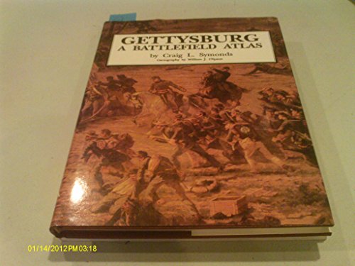
Gettysburg: A Battlefield Atlas
Language: English
Published by Nautical & Aviation Pub Co of Amer, 1992
ISBN 10: 187785316X ISBN 13: 9781877853166
Seller: Sequitur Books, Boonsboro, MD, U.S.A.
Association Member: IOBA
Seller rating 5 out of 5 stars

Hardcover. Condition: Very Good. 6th. Hardcover and dust jacket. Good binding and cover. Shelf wear. Clean, unmarked pages.
-

The World ( Map ) Produced by the Cartographic Division of the National Geographic Society December 1981
Published by National Geographic Society, 1981
paperback. Condition: Fine.
-
The World ( Map ) Produced by the Cartographic Division of the National Geographic Society December 1981
Published by National Geographic Society, 1981
paperback. Condition: New.
-
The World ( Map ) Produced by the Cartographic Division of the National Geographic Society December 1981
Published by National Geographic Society, 1981
paperback. Condition: Very Good. Large folded map; mark on one corner.
-
Gale River Section 1936 White Mountain National Forest
Language: English
Published by Wmnf, Unknown, 1936
Seller: White Mountains, NH Books and Maps, Lincoln, NH, U.S.A.
Seller rating 4 out of 5 stars

Soft cover. Condition: Near Fine. A.A.T. (Unknown Cartographer) (illustrator). White Mountain National Forest, 1936. A. A. T. Cartographer On This Previously Unknown/Unrecorded Map. I Have Looked In All Of My Resources And Not Found An Example Of It Anywhere. Printed On A Light Green Paper With Black Ink. It Shows In The North From Agassiz Mt To The Zealand River And In The South From Approximately Garfield Shelter/Bickford Mt. Over To The Zeacliff Shelter And Zealand Amc Hut/Notch. I Know Of No Other Map Concerning Specifically This Small Selection. It Measures 8" X 10.5". Copies Are Available For The Asking, This Original Will Be Archived. Note: If You Order This You Will Receive A Copy Of The Original, Not The Original. If You Are The Curator Of A White Mountains Museum Or Official Collection Please Contact Me And We Will Discuss Ownership. Thanks, Mat.
-
Land of the Maya A Traveler's Map
Published by National Geographic Society, Washington, D.C., 1989
Seller: Hastings of Coral Springs, Altamonte Springs, FL, U.S.A.
Seller rating 5 out of 5 stars
Unbound. Condition: Fine. No Jacket. John B. Garver, Jr. -Chief Cartographer (illustrator). Edition Not Stated. Few signs of use.
-
Canada Before Confederation; A Study in Historical Geography
Published by Oxford University Press, New York, 1974
First Edition
Cloth. Condition: Fine. No Jacket. Miklos Pinther (Cartographer) (illustrator). 1st Edition. First Edition. Hard cover 8vo - over 7�" - 9�" tall in glossy green cloth w/gold spine titles. Fine/No DJ. x, 338pp inc. Bibliography, Index; well-illustrated in maps, photos and reproductions, tables. Book.
-
Atlas of the Pacific Northwest Resources and Development
Published by Oregon State Univ Pr, Corvallis, OR, 1962
Hardcover. Condition: Very Good. Dust Jacket Condition: Very Good. Large red book w/light rubs to bottom edges, map end papers, many maps, illus. Unclipped dj in protective film.
-
![Seller image for Grant Takes Command [Hardcover] by Bruce Catton; Cartographer Samuel H. for sale by Cheryl's Books](https://pictures.abebooks.com/inventory/md/md32183859127.jpg)
Grant Takes Command [Hardcover] by Bruce Catton; Cartographer Samuel H.
Language: English
Published by BOOK-OF-THE-MONTH CLUB, 1969
ISBN 10: 1299342957 ISBN 13: 9781299342958
Hardcover. Condition: Very Good. Book in excellent condition, but missing dustjacket. Non-smoking home. 1969 hardback.
-

Fodor's 93: Santa Fe, Taos, Albuquerque
Language: English
Published by Fodor's Travel Publications, Inc., New York, 1993
ISBN 10: 0679023372 ISBN 13: 9780679023371
Soft Cover. Condition: Good. David Lindroth (Cartographer); Karl Tanner (Illustrator); Scott Lynn Bailey (Cover Photo) (illustrator). 231 pp. Solidly bound copy with moderate use. Moderate foxing on page edges.
-

A map of Tudor London : England's greatest city in 1520 / by Caroline Barron, Vanessa Harding and Nick Holder ; cartography by Giles Darkes
Language: English
Published by [Oxford] : British Historic Towns Atlas, 2018
ISBN 10: 0993469833 ISBN 13: 9780993469831
Edition Unstated. Fine map, slightly edge-bumped. Remains well-preserved overall. Physical description; 1 map : color ; 87 x 128 cm, folded to 24 x 14 cm. Notes; Scale approximately 1:2500. Based on a map first researched and produced by Col Henry Johns, 1989. Subjects; London (England). History. 16th century. Maps. London (England). Historical geography. Maps. City of London (England). Maps. Early maps. Facsimiles. 1 Kg.
-

Skye - Portree & Bracadale / Ordnance Survey
Language: English
Published by Southampton, United Kingdom : Ordnance Survey, 2007
ISBN 10: 0319239470 ISBN 13: 9780319239476
Revised Edition. Fine folding map. Remains well preserved overall; tight, bright, clean and sharp-cornered. Series; OS explorer map ; 410. Physical description; 1 map : colour ; 84 x 124 cm, folded to 24 x 14 cm. Notes; Previous edition: 2002. Geographic coverage Europe, Great Britain, Scotland, Inverness-shire, Skye - Portree & Bracadale. Text in English with notes in French and German. Subjects; Skye, Island of (Scotland) ; Maps. Portree (Scotland) ; Maps. Bracadale (Scotland : Parish) ; Maps. 1:25,000. Genres; cartographic image. Map. 1 Kg.
-
![Stock image for Ocmulgee River User's Guide (Georgia River Network Guidebooks) [Paperback] Cook, Joe and Carroll, Andy for sale by Mercantile Books](https://pictures.abebooks.com/isbn/9780820358901-uk-300.jpg)
Ocmulgee River User's Guide (Georgia River Network Guidebooks) [Paperback] Cook, Joe and Carroll, Andy
Language: English
Published by Wormsloe Foundation Nature Books, 2021
ISBN 10: 0820358908 ISBN 13: 9780820358901
paperback. Condition: New.
-
Historical Assessment of Hazardous Waste Management in Madison and St. Clair Counties llinois 1890-1980
Language: English
Published by ILLINOIS STATE MUSEUM, 1988
First Edition
Paperback. Condition: As New. Ted B. Samuel (Cartographer) (illustrator). 1st Edition. RARE COPY. This copy is LIKE NEW; the text is clear, bright, and unmarked; binding is tight, but slight shelf wear on edges. First edition, unstated but earliest appearance of book. The covers are Very Good: absolutely intact, including perfect color and design, but spine has sunned. We have a five star rating because of our fulfilment success and because our descriptions are accurate.
-

Encyclopedia of New Jersey
Language: English
Published by Rutgers University Press, 2004
ISBN 10: 0813533252 ISBN 13: 9780813533254
Seller: Sequitur Books, Boonsboro, MD, U.S.A.
Association Member: IOBA
Seller rating 5 out of 5 stars
hardcover. Condition: As New. Hardcover and dust jacket. Good binding and cover. Clean, unmarked pages. This is an oversized or heavy book, which requires additional postage for international delivery outside the US.
-
Atlas of Russian History
Language: English
Published by Dorset Press, Dorset, UK, 1985
Seller: Books by White/Walnut Valley Books, Winfield, KS, U.S.A.
Seller rating 5 out of 5 stars
Hardcover. Condition: Fine. Dust Jacket Condition: Near Fine. Arthur Banks, Cartographer (illustrator). Reprint Edition. Dorset Press, Dorset, UK. 1985. Hardcover. Reprint edition. Book is tight, square, and unmarked. Book Condition: Fine. DJ: Near Fine; light sunfading to spine; light rubbing to panels. Red paper over boards with black cloth overlay on the spine with bright gilt lettering on the spine. 146 pp tall 8vo. Surveying more than 2,000 years of Russian history, this atlas presents more than 200 maps on an extraordinary range of topics, including examinations of rebellion and exile, famine, the anarchists of Russia, the growth of revolutionary activity before 1917, the Revolution itself, Lenin's return to Russia, the early years of Communism, the Cuban missile crisis, relations with China, trade, and military strength. This Third Edition features new maps charting the collapse of Communism in Eastern Europe, the changing names of Russian cities, the emerging Asian republics, and individuals and institutions of the new Russia. A clean very presentable copy.
-
Andesite Conference Guidebook Bulletin 62 (International Upper Mantle Project Scientific Report 16-S)
Published by State of Oregon, Dept. of Geology and Mineral Industries, 1968
Seller: Book Happy Booksellers, Portland, OR, U.S.A.
Association Member: CBA
Seller rating 5 out of 5 stars
Soft cover. Condition: Very Good. 8-1/2 x 11 Softcover; 107pp; Previous owner's name to title page, light age-toning to covers, small stain on a few pages, binding is tight, VG- condition. Articles from the Andesite Conference, July 1 to 6, 1968 at Eugene and Bend, Oregon. International Upper Mantle Project Scientific Report 16-S. Bulletin 62. Illustrated with photos & maps.
-
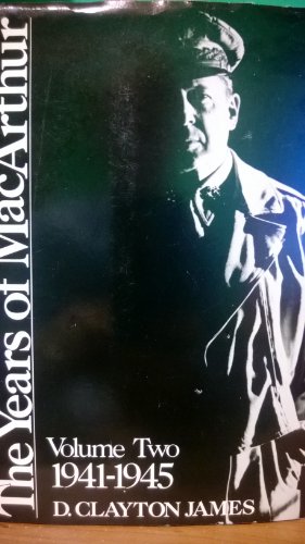
The Years of MacArthur, Volume II: 1941-1945
Language: English
Published by Houghton Mifflin Company, 1975
ISBN 10: 0395204461 ISBN 13: 9780395204467
Seller: Strand Book Store, ABAA, New York, NY, U.S.A.
Seller rating 4 out of 5 stars
Hardcover. Condition: Good.
-
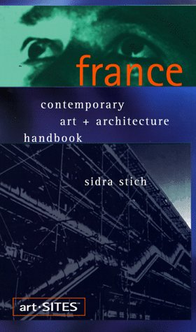
France: Contempory Art + Architecture Handbook ***AUTOGRAPHED COPY!!!***
Language: English
Published by Art Sites, San Francisco, CA, 1999
ISBN 10: 0966771737 ISBN 13: 9780966771732
First Edition Signed
Trade Paperback. Condition: Very Good. Lisa Schultz/Elysium (Designer); Tracey Croom (Cartographer) (illustrator). 1st Edition. 284 pp. SIGNED BY AUTHOR!!! Solidly bound copy with moderate external wear, crisp pages and clean text. ***AUTOGRAPHED COPY!!!***.
-
The Atlas of North American Exploration : from the Norse Voyages to the Race to the Pole / William Goetzmann and Glyndwr Williams ; [cartographic director, Malcolm Swanston ; maps created by Isabelle Lewis and Jacqueline Land].
Language: English
Published by University of Oklahoma Press, 1998
ISBN 10: 080613058X ISBN 13: 9780806130583
Seller: Shasta Library Foundation, Redding, CA, U.S.A.
Seller rating 4 out of 5 stars
First Edition
Soft cover. Condition: As New. No Jacket. 1st Edition. Colored illustrated glossy wraps, with blue lettering on front cover and white lettering on spine. Binding is tight. Spine is straight. No crease. Content is clean, No markings. Corners are sharp. No shelf wear. Includes: Coontents, Bibliography, Index B/W Photographs, Illustrations, Maps. 224 pp.
-

Atlas of the Pacific Northwest
Language: English
Published by Oregon State University Press, US, 1962
ISBN 10: 1111752702 ISBN 13: 9781111752705
First Edition
Hardcover. Condition: Very Good+. First Edition NAP. Oregon State University Press 1962 First Edition NAP Very Good+/ NO DUST JACKET. Slight wear to orange cloth gold spine lettering. 2-color map end papers. Previous owner's stamps blotted out inside cover. Tight bright photo, map, graph and table illustrated pages. 168 pages with index. OVERSIZE HEAVY ITEM 2.34 Pounds. Size: 12 1/4 x 9 1/8 x 3/4 inches. No Exp.
-

Hardcover. Condition: Near Fine. Dust Jacket Condition: Fine. Opatowski, Michel (cartographer) (illustrator). First Edition. Book would be fine or as new except for a slight lean and the previous owner's information penned on FFE. DJ is fine, now under protective covering. Illustrated in color with numerous photographs, drawings, and maps. Size: 4to - over 9�" - 12" tall.
-
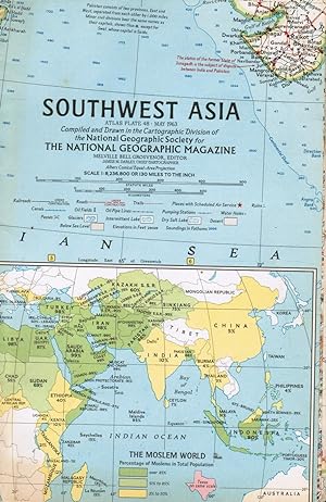
Map. Condition: G. Clean outer wraps with mild edge wear, fold creases. Shows India, Iran, Bay of Bengal, Saudi Arabia, Afghanistan, Ceylon, China, etc. Inset map of The Moslem World, with Percentage of Moslems in Total Population. Also includes an inset of Karachi.
-
No Binding. Condition: Fine. Fine condition. (Folded map.) Ships from NC. All maps are sealed in recycled plastic, packaged securely, and shipped promptly.
-
Condition: Very Good. Map of Central America on reverse side. Clean copy with no splits in folds.
-

Paperback. Condition: Brand New. fol map edition. 1 pages. 8.25x6.00x0.20 inches. In Stock.
-

Paperback. Condition: Brand New. fol map edition. 1 pages. 8.25x6.00x0.20 inches. In Stock.


![Seller image for The Atlas of North American Exploration : from the Norse Voyages to the Race to the Pole / William Goetzmann and Glyndwr Williams ; [cartographic director, Malcolm Swanston ; maps created by Isabelle Lewis and Jacqueline Land]. for sale by Shasta Library Foundation](https://pictures.abebooks.com/inventory/md/md32332372601.jpg)