Gomarasca, Mario a (33 results)
Search filters
Product Type
- All Product Types
- Books (33)
- Magazines & Periodicals (No further results match this refinement)
- Comics (No further results match this refinement)
- Sheet Music (No further results match this refinement)
- Art, Prints & Posters (No further results match this refinement)
- Photographs (No further results match this refinement)
- Maps (No further results match this refinement)
- Manuscripts & Paper Collectibles (No further results match this refinement)
Condition Learn more
- New (24)
- As New, Fine or Near Fine (5)
- Very Good or Good (4)
- Fair or Poor (No further results match this refinement)
- As Described (No further results match this refinement)
Binding
Collectible Attributes
- First Edition (2)
- Signed (No further results match this refinement)
- Dust Jacket (No further results match this refinement)
- Seller-Supplied Images (17)
- Not Print on Demand (23)
Language (1)
Free Shipping
Seller Location
Seller Rating
-
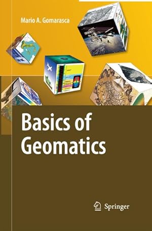
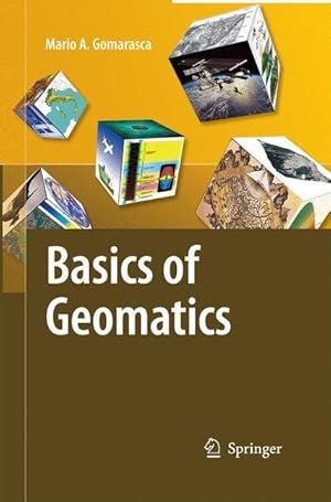
Basics of Geomatics
Published by Springer-Verlag Publishing, 2009
ISBN 10: 1402090137 ISBN 13: 9781402090134
Language: English
Seller: Salish Sea Books, Bellingham, WA, U.S.A.
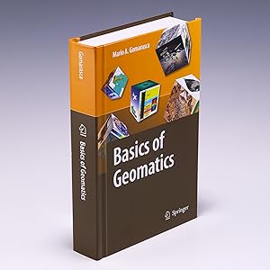
Condition: Very Good. Very Good++; Hardcover; Close to new condition; Covers are still glossy with "straight" edge-corners; Unblemished textblock edges; The endpapers and all text pages are bright and unmarked; Binding is tight with a straight spine; This book will be shipped in a sturdy cardboard box with foam padding; Medium Format (8.5" - 9.75" tall); Tan and brown covers with title in white lettering; 2009, Springer-Verlag Publishing; 697 pages; "Basics of Geomatics," by Mario A. Gomarasca.
-
Hardcover. Condition: Near Fine. No Jacket. 1st Edition. 697 pages, 6.0 x 9.3 inches.
-
Basics of Geomatics
Published by Springer Netherlands, 2009
ISBN 10: 1402090137 ISBN 13: 9781402090134
Language: English
Seller: Better World Books Ltd, Dunfermline, United Kingdom
First Edition
Condition: Very Good. 1st Edition. Ships from the UK. Former library book; may include library markings. Used book that is in excellent condition. May show signs of wear or have minor defects.
-
Basics of Geomatics
Published by Springer-Verlag Publishing, 2009
ISBN 10: 1402090137 ISBN 13: 9781402090134
Language: English
Seller: Salish Sea Books, Bellingham, WA, U.S.A.
Condition: Very Good. Very Good++; Hardcover; Close to new condition; Covers are still glossy with "straight" edge-corners; Unblemished textblock edges; The endpapers and all text pages are bright and unmarked; Binding is tight with a straight spine; This book will be shipped in a sturdy cardboard box with foam padding; Medium Format (8.5" - 9.75" tall); Tan and brown covers with title in white lettering; 2009, Springer-Verlag Publishing; 697 pages; "Basics of Geomatics," by Mario A. Gomarasca.
-
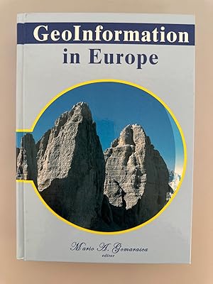
GeoInformation in Europe (Proceedings.Bolzano, 2007).
Published by Millpress, Rotterdam, 2008
ISBN 10: 9059660617 ISBN 13: 9789059660618
Language: English
Seller: Wissenschaftl. Antiquariat Th. Haker e.K, Klettgau, Germany
hardcover. Condition: Sehr gut. 681 p. Very good. Includes CD_ROM. ISBN: 9059660617 Sprache: Englisch Gewicht in Gramm: 1223.
-
Condition: New.
-
Condition: New.
-
Condition: New.
-
Condition: Good. Your purchase helps support Sri Lankan Children's Charity 'The Rainbow Centre'. Ex-library, so some stamps and wear, but in good overall condition. Our donations to The Rainbow Centre have helped provide an education and a safe haven to hundreds of children who live in appalling conditions.
-
Condition: New. In.
-
Condition: New.
-
Condition: New. In.
-
Condition: As New. Unread book in perfect condition.
-
Condition: New.
-
Condition: As New. Unread book in perfect condition.
-
Taschenbuch. Condition: Neu. Basics of Geomatics | Mario A. Gomarasca | Taschenbuch | xli | Englisch | 2014 | Springer Netherland | EAN 9789400789517 | Verantwortliche Person für die EU: Springer Verlag GmbH, Tiergartenstr. 17, 69121 Heidelberg, juergen[dot]hartmann[at]springer[dot]com | Anbieter: preigu.
-
Condition: New. pp. 656.
-
Basics of Geomatics
Published by Springer Netherlands, Springer Netherlands Okt 2009, 2009
ISBN 10: 1402090137 ISBN 13: 9781402090134
Language: English
Seller: buchversandmimpf2000, Emtmannsberg, BAYE, Germany
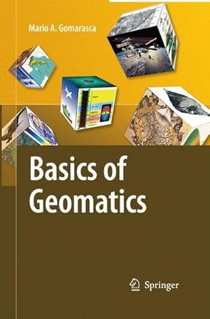
Buch. Condition: Neu. Neuware -Geomatics is a neologism, the use of which is becoming increasingly widespread, even if it is not still universally accepted. It includes several disciplines and te- niques for the study of the Earth¿s surface and its environments, and computer science plays a decisive role. A more meaningful and appropriate expression is G- spatial Information or GeoInformation. Geo-spatial Information embeds topography in its more modern forms (measurements with electronic instrumentation, sophisticated techniques of data analysis and network compensation, global satellite positioning techniques, laser scanning, etc.), analytical and digital photogrammetry, satellite and airborne remote sensing, numerical cartography, geographical information systems, decision support systems, WebGIS, etc. These specialized elds are intimately interrelated in terms of both the basic science and the results pursued: rigid separation does not allow us to discover several common aspects and the fundamental importance assumed in a search for solutions in the complex survey context. The objective pursued by Mario A. Gomarasca, one that is only apparently modest, is to publish an integrated text on the surveying theme, containing simple and comprehensible concepts relevant to experts in Geo-spatial Information and/or speci cally in one of the disciplines that compose it. At the same time, the book is rigorous and synthetic, describing with precision the main instruments and methods connected to the multiple techniques available today.Springer Verlag GmbH, Tiergartenstr. 17, 69121 Heidelberg 700 pp. Englisch.
-
Basics of Geomatics
Published by Springer Netherlands, Springer Netherlands, 2014
ISBN 10: 9400789513 ISBN 13: 9789400789517
Language: English
Seller: AHA-BUCH GmbH, Einbeck, Germany
Taschenbuch. Condition: Neu. Druck auf Anfrage Neuware - Printed after ordering - Geomatics is a neologism, the use of which is becoming increasingly widespread, even if it is not still universally accepted. It includes several disciplines and te- niques for the study of the Earth's surface and its environments, and computer science plays a decisive role. A more meaningful and appropriate expression is G- spatial Information or GeoInformation. Geo-spatial Information embeds topography in its more modern forms (measurements with electronic instrumentation, sophisticated techniques of data analysis and network compensation, global satellite positioning techniques, laser scanning, etc.), analytical and digital photogrammetry, satellite and airborne remote sensing, numerical cartography, geographical information systems, decision support systems, WebGIS, etc. These specialized elds are intimately interrelated in terms of both the basic science and the results pursued: rigid separation does not allow us to discover several common aspects and the fundamental importance assumed in a search for solutions in the complex survey context. The objective pursued by Mario A. Gomarasca, one that is only apparently modest, is to publish an integrated text on the surveying theme, containing simple and comprehensible concepts relevant to experts in Geo-spatial Information and/or speci cally in one of the disciplines that compose it. At the same time, the book is rigorous and synthetic, describing with precision the main instruments and methods connected to the multiple techniques available today.
-
Basics of Geomatics
Published by Springer Netherlands, Springer, 2009
ISBN 10: 1402090137 ISBN 13: 9781402090134
Language: English
Seller: AHA-BUCH GmbH, Einbeck, Germany
Buch. Condition: Neu. Druck auf Anfrage Neuware - Printed after ordering - Geomatics is a neologism, the use of which is becoming increasingly widespread, even if it is not still universally accepted. It includes several disciplines and te- niques for the study of the Earth's surface and its environments, and computer science plays a decisive role. A more meaningful and appropriate expression is G- spatial Information or GeoInformation. Geo-spatial Information embeds topography in its more modern forms (measurements with electronic instrumentation, sophisticated techniques of data analysis and network compensation, global satellite positioning techniques, laser scanning, etc.), analytical and digital photogrammetry, satellite and airborne remote sensing, numerical cartography, geographical information systems, decision support systems, WebGIS, etc. These specialized elds are intimately interrelated in terms of both the basic science and the results pursued: rigid separation does not allow us to discover several common aspects and the fundamental importance assumed in a search for solutions in the complex survey context. The objective pursued by Mario A. Gomarasca, one that is only apparently modest, is to publish an integrated text on the surveying theme, containing simple and comprehensible concepts relevant to experts in Geo-spatial Information and/or speci cally in one of the disciplines that compose it. At the same time, the book is rigorous and synthetic, describing with precision the main instruments and methods connected to the multiple techniques available today.
-
Condition: New. pp. 700.
-
Basics Of Geomatics
Published by Springer-Verlag New York Inc., 2009
ISBN 10: 1402090137 ISBN 13: 9781402090134
Language: English
Seller: Revaluation Books, Exeter, United Kingdom
Hardcover. Condition: Brand New. 1st edition. 656 pages. 9.45x6.54x1.81 inches. In Stock.
-
Paperback. Condition: Like New. Like New. book.
-
Basics of Geomatics
Published by Springer Netherlands Nov 2014, 2014
ISBN 10: 9400789513 ISBN 13: 9789400789517
Language: English
Seller: BuchWeltWeit Ludwig Meier e.K., Bergisch Gladbach, Germany
Taschenbuch. Condition: Neu. This item is printed on demand - it takes 3-4 days longer - Neuware -Geomatics is a neologism, the use of which is becoming increasingly widespread, even if it is not still universally accepted. It includes several disciplines and te- niques for the study of the Earth's surface and its environments, and computer science plays a decisive role. A more meaningful and appropriate expression is G- spatial Information or GeoInformation. Geo-spatial Information embeds topography in its more modern forms (measurements with electronic instrumentation, sophisticated techniques of data analysis and network compensation, global satellite positioning techniques, laser scanning, etc.), analytical and digital photogrammetry, satellite and airborne remote sensing, numerical cartography, geographical information systems, decision support systems, WebGIS, etc. These specialized elds are intimately interrelated in terms of both the basic science and the results pursued: rigid separation does not allow us to discover several common aspects and the fundamental importance assumed in a search for solutions in the complex survey context. The objective pursued by Mario A. Gomarasca, one that is only apparently modest, is to publish an integrated text on the surveying theme, containing simple and comprehensible concepts relevant to experts in Geo-spatial Information and/or speci cally in one of the disciplines that compose it. At the same time, the book is rigorous and synthetic, describing with precision the main instruments and methods connected to the multiple techniques available today. 700 pp. Englisch.
-
Basics of Geomatics
Published by Springer Netherlands, 2014
ISBN 10: 9400789513 ISBN 13: 9789400789517
Language: English
Seller: moluna, Greven, Germany
Condition: New. Dieser Artikel ist ein Print on Demand Artikel und wird nach Ihrer Bestellung fuer Sie gedruckt. Presents a comprehensive and complete treatment Covers in an easy accessible manner the complex topics and techniques covered under geomatics Abundantly illustrated Defined as the Bible of Geomatics in ItalyGeomatics is a n.
-
Basics of Geomatics
Published by Springer Netherlands, 2009
ISBN 10: 1402090137 ISBN 13: 9781402090134
Language: English
Seller: moluna, Greven, Germany
Gebunden. Condition: New. Dieser Artikel ist ein Print on Demand Artikel und wird nach Ihrer Bestellung fuer Sie gedruckt. Presents a comprehensive and complete treatment Covers in an easy accessible manner the complex topics and techniques covered under geomatics Abundantly illustrated Defined as the Bible of Geomatics in ItalyGeomatics is a n.
-
Basics of Geomatics
Published by Springer Netherlands Okt 2009, 2009
ISBN 10: 1402090137 ISBN 13: 9781402090134
Language: English
Seller: BuchWeltWeit Ludwig Meier e.K., Bergisch Gladbach, Germany
Buch. Condition: Neu. This item is printed on demand - it takes 3-4 days longer - Neuware -Geomatics is a neologism, the use of which is becoming increasingly widespread, even if it is not still universally accepted. It includes several disciplines and te- niques for the study of the Earth's surface and its environments, and computer science plays a decisive role. A more meaningful and appropriate expression is G- spatial Information or GeoInformation. Geo-spatial Information embeds topography in its more modern forms (measurements with electronic instrumentation, sophisticated techniques of data analysis and network compensation, global satellite positioning techniques, laser scanning, etc.), analytical and digital photogrammetry, satellite and airborne remote sensing, numerical cartography, geographical information systems, decision support systems, WebGIS, etc. These specialized elds are intimately interrelated in terms of both the basic science and the results pursued: rigid separation does not allow us to discover several common aspects and the fundamental importance assumed in a search for solutions in the complex survey context. The objective pursued by Mario A. Gomarasca, one that is only apparently modest, is to publish an integrated text on the surveying theme, containing simple and comprehensible concepts relevant to experts in Geo-spatial Information and/or speci cally in one of the disciplines that compose it. At the same time, the book is rigorous and synthetic, describing with precision the main instruments and methods connected to the multiple techniques available today. 700 pp. Englisch.
-
Basics of Geomatics
Seller: preigu, Osnabrück, Germany
Buch. Condition: Neu. Basics of Geomatics | Mario A. Gomarasca | Buch | xli | Englisch | 2009 | Springer | EAN 9781402090134 | Verantwortliche Person für die EU: Springer Verlag GmbH, Tiergartenstr. 17, 69121 Heidelberg, juergen[dot]hartmann[at]springer[dot]com | Anbieter: preigu Print on Demand.
-
Basics of Geomatics
Seller: Majestic Books, Hounslow, United Kingdom
Condition: New. Print on Demand pp. 656.
-
Basics of Geomatics
Published by Springer Netherlands, Springer Netherlands Nov 2014, 2014
ISBN 10: 9400789513 ISBN 13: 9789400789517
Language: English
Seller: buchversandmimpf2000, Emtmannsberg, BAYE, Germany
Taschenbuch. Condition: Neu. This item is printed on demand - Print on Demand Titel. Neuware -Geomatics is a neologism, the use of which is becoming increasingly widespread, even if it is not still universally accepted. It includes several disciplines and te- niques for the study of the Earth¿s surface and its environments, and computer science plays a decisive role. A more meaningful and appropriate expression is G- spatial Information or GeoInformation. Geo-spatial Information embeds topography in its more modern forms (measurements with electronic instrumentation, sophisticated techniques of data analysis and network compensation, global satellite positioning techniques, laser scanning, etc.), analytical and digital photogrammetry, satellite and airborne remote sensing, numerical cartography, geographical information systems, decision support systems, WebGIS, etc. These specialized elds are intimately interrelated in terms of both the basic science and the results pursued: rigid separation does not allow us to discover several common aspects and the fundamental importance assumed in a search for solutions in the complex survey context. The objective pursued by Mario A. Gomarasca, one that is only apparently modest, is to publish an integrated text on the surveying theme, containing simple and comprehensible concepts relevant to experts in Geo-spatial Information and/or speci cally in one of the disciplines that compose it. At the same time, the book is rigorous and synthetic, describing with precision the main instruments and methods connected to the multiple techniques available today.Springer Verlag GmbH, Tiergartenstr. 17, 69121 Heidelberg 700 pp. Englisch.


