Order Total (1 Item Items):
Shipping Destination:

Kendall Morgan (26 results)
Skip to main search results
Search filters
Product Type
- All Product Types
- Books (24)
- Magazines & Periodicals (No further results match this refinement)
- Comics (No further results match this refinement)
- Sheet Music (No further results match this refinement)
- Art, Prints & Posters (No further results match this refinement)
- Photographs (2)
- Maps (No further results match this refinement)
- Manuscripts & Paper Collectibles (No further results match this refinement)
Condition Learn more
Binding
Collectible Attributes
- First Edition (1)
- Signed (1)
- Dust Jacket (No further results match this refinement)
- Seller-Supplied Images (9)
- Not Print on Demand (26)
Language (2)
Free Shipping
Seller Location
Seller Rating
-

Secrets: The Best in Women's Erotic Romance, Vol. 4
Seller: Wonder Book, Frederick, MD, U.S.A.
Seller rating 5 out of 5 stars

Condition: Very Good. Very Good condition. Volume 4. A copy that may have a few cosmetic defects. May also contain light spine creasing or a few markings such as an owner's name, short gifter's inscription or light stamp.
-
Condition: Very Good. Very Good Condition. Five star seller - Buy with confidence!
-
Paperback. Condition: Good. No Jacket. Pages can have notes/highlighting. Spine may show signs of wear. ~ ThriftBooks: Read More, Spend Less.
-
Paperback. Condition: Good. A used book with light to moderate shelf wear and imperfections. Thank you for supporting Last Word Books and independent bookstores.
-

The Agency in Suite 309
Signed
Hardcover. Condition: Very Good. Presentation Inscription by author on first front end page. A nice copy with a tight and square binding. Front and back cover are very good. Text is clean and bright. Dust jacket is very good (clean, no creasing, no edge wear). Careful packaging and fast shipping. We recommend EXPEDITED MAIL for even faster delivery. Signed.
-

Good Gravy; A Pure Tonic of Wit and Humor
Language: English
Published by Geffert & Crummel, Cleveland, Ohio, 1901
Soft cover. Condition: Very Good. W.J.Morgan & Co. (illustrator). 96pp. Softcover with a little wear and 1/2" chip to lower spine and rear cover, minor soiling, contents age-toned but clean and tight. Amusing humor from the turn of the last century. Profusely and humorously illustrated with many in-text sketches.
-

Good Gravy a Pure Tonic of Wit and Humor
Published by GEPFERT & CRUMMEL, CLEVELAND, O., 1901
Seller: Princeton Antiques Bookshop / Ruffolo Enterprises, Atlantic City, NJ, U.S.A.
Seller rating 5 out of 5 stars
PAPER BACK TAN. Condition: POOR. W. J. MORGAN (illustrator). covers loose, spine ripped, princeton antiques book plate on inside of front cover, black and white illustrations DATE PUBLISHED: 1901 EDITION: 96.
-
Condition: New.
-
GOOD GRAVY A Pure Tonic of Wit and Humor Served Up By Ezra Kendall
Published by The Cleveland News Co, 1901
First Edition
Softcover. Condition: Fair. W. J. Morgan & Co. (illustrator). 1st Edition. 5 1/8" X 7 3/4" Self-published. 96 pps. with line illustration spots throughout. Text tight and unmarked and toned with some light staining Bottom right-hand corner has been bumped on the reverse. Soft cover with period type treatments and graphics printed in black shows wear -especially along spine - but is intact with no paper loss. A "pure tonic of wit and humor" from the turn of 19th century via Cleveland, Ohio.
-
Condition: Very good.
-
Condition: New.
-

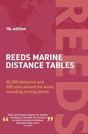
Reeds Marine Distance Tables 18th edition
Language: English
Published by Bloomsbury Publishing PLC, GB, 2024
ISBN 10: 1399412418 ISBN 13: 9781399412414
Paperback. Condition: New. Reeds Marine Distance Tables are the perfect ready-reckoner for captains, navigators and owners of merchant and cruise ships large and small wanting a quick and accurate distance reference between all the regularly used commercial ports around the world. They are also of increasing value to the superyacht fleet.The book is divided into key 'market areas', and includes a pull-out map for area identification and easy see-at-a-glance port reference. Traffic Separation Schemes are calculated into the tables whilst the distance to any port not included can easily be determined by making an approximation from the next closest port. Useful tables of major 'turning points' around the world (such as Cape Finisterre, Cape Horn and the Dover Straits), Transatlantic distances, world time zones, and time and speed conversion tables are also included.As well as incorporating general updates and improvements, this edition has been expanded to include more Indian Ocean ports, routes reflecting the increasing role of China in international shipping, as well as inter-distance tables for the Adriatic and Aegean. Freighter movements, cargo tonnage and cruise ship destinations have all been factored into considering details on the top ten busiest ports worldwide.Reeds Marine Distance Tables are an invaluable reference for ship owners, operators, brokers, navigators and superyacht skippers. Using this one reference, anyone can calculate the shortest or most economical distances between all the major ports in the world.
-

Condition: As New. Unread book in perfect condition.
-

Reeds Marine Distance Tables 18th edition
Language: English
Published by Bloomsbury Publishing PLC, GB, 2024
ISBN 10: 1399412418 ISBN 13: 9781399412414
Seller: Rarewaves.com USA, London, LONDO, United Kingdom
Seller rating 5 out of 5 stars
Paperback. Condition: New. Reeds Marine Distance Tables are the perfect ready-reckoner for captains, navigators and owners of merchant and cruise ships large and small wanting a quick and accurate distance reference between all the regularly used commercial ports around the world. They are also of increasing value to the superyacht fleet.The book is divided into key 'market areas', and includes a pull-out map for area identification and easy see-at-a-glance port reference. Traffic Separation Schemes are calculated into the tables whilst the distance to any port not included can easily be determined by making an approximation from the next closest port. Useful tables of major 'turning points' around the world (such as Cape Finisterre, Cape Horn and the Dover Straits), Transatlantic distances, world time zones, and time and speed conversion tables are also included.As well as incorporating general updates and improvements, this edition has been expanded to include more Indian Ocean ports, routes reflecting the increasing role of China in international shipping, as well as inter-distance tables for the Adriatic and Aegean. Freighter movements, cargo tonnage and cruise ship destinations have all been factored into considering details on the top ten busiest ports worldwide.Reeds Marine Distance Tables are an invaluable reference for ship owners, operators, brokers, navigators and superyacht skippers. Using this one reference, anyone can calculate the shortest or most economical distances between all the major ports in the world.
-
Condition: New.
-
Paperback. Condition: New.
-
Reeds Marine Distance Tables 18th Edition
Seller: GreatBookPricesUK, Woodford Green, United Kingdom
Seller rating 5 out of 5 stars
Condition: New.
-
Reeds Marine Distance Tables 18th edition
Seller: Ria Christie Collections, Uxbridge, United Kingdom
Seller rating 5 out of 5 stars
Condition: New. In.
-
Paperback. Condition: Brand New. 240 pages. 8.50x5.51x1.00 inches. In Stock.
-
Reeds Marine Distance Tables 18th Edition
Seller: GreatBookPricesUK, Woodford Green, United Kingdom
Seller rating 5 out of 5 stars
Condition: As New. Unread book in perfect condition.
-
Condition: New.
-
Condition: New.
-

Reeds Marine Distance Tables 18th edition
Language: English
Published by Bloomsbury Publishing PLC, GB, 2024
ISBN 10: 1399412418 ISBN 13: 9781399412414
Paperback. Condition: New. Reeds Marine Distance Tables are the perfect ready-reckoner for captains, navigators and owners of merchant and cruise ships large and small wanting a quick and accurate distance reference between all the regularly used commercial ports around the world. They are also of increasing value to the superyacht fleet.The book is divided into key 'market areas', and includes a pull-out map for area identification and easy see-at-a-glance port reference. Traffic Separation Schemes are calculated into the tables whilst the distance to any port not included can easily be determined by making an approximation from the next closest port. Useful tables of major 'turning points' around the world (such as Cape Finisterre, Cape Horn and the Dover Straits), Transatlantic distances, world time zones, and time and speed conversion tables are also included.As well as incorporating general updates and improvements, this edition has been expanded to include more Indian Ocean ports, routes reflecting the increasing role of China in international shipping, as well as inter-distance tables for the Adriatic and Aegean. Freighter movements, cargo tonnage and cruise ship destinations have all been factored into considering details on the top ten busiest ports worldwide.Reeds Marine Distance Tables are an invaluable reference for ship owners, operators, brokers, navigators and superyacht skippers. Using this one reference, anyone can calculate the shortest or most economical distances between all the major ports in the world.
-
The Penthouse [La nuit des alligators] (Two original oversize photographs of actress Suzy Kendall from the French release of the 1967 film)
Published by Paramount British Pictures, Buckinghamshire, 1967
Seller: Royal Books, Inc., ABAA, Baltimore, MD, U.S.A.
Seller rating 5 out of 5 stars
Photograph
Two vintage oversize matte-finish borderless double weight reference photographs from the French release of the 1967 film, both showing actress Suzy Kendall. Loosely based on the 1967 play "The Meter Man" by Scott Forbes. A pair of oafish thugs break into a wealthy London penthouse apartment, planning to terrorize the couple they find within-only to discover the couple ready and willing to explore a number of bizarre sexual fetishes. Set in London. 11.75 x 9.5 inches. Very Good, moderately edgeworn, one with pinholes at the corners.
-
The Penthouse (Two original photographs from the 1967 British film)
Published by N.p., N.p., 1967
Seller: Royal Books, Inc., ABAA, Baltimore, MD, U.S.A.
Seller rating 5 out of 5 stars
Photograph
Two vintage borderless reference photographs of Suzy Kendall, Terence Morgan, and Norman Rodway from the 1967 British film. Loosely based on the 1967 play "The Meter Man" by Scott Forbes. A pair of oafish thugs break into a wealthy London penthouse apartment, planning to terrorize the couple they find within-only to discover the couple ready and willing to explore a number of bizarre sexual fetishes. Set in London. 7.25 x 7.25 inches. Near Fine.

![Seller image for The Penthouse [La nuit des alligators] (Two original oversize photographs of actress Suzy Kendall from the French release of the 1967 film) for sale by Royal Books, Inc., ABAA](https://pictures.abebooks.com/inventory/md/md31786037738.jpg)