Stoke-on-Trent and Macclesfield Area (Sheet 118) (OS Landranger Map)
Ordnance Survey
ISBN 10: 0319221180 ISBN 13: 9780319221181
Published by Ordnance Survey
Used
From
WeBuyBooks, Rossendale, LANCS, United Kingdom
Seller rating 5 out of 5 stars
![]()
AbeBooks Seller since 14 November 2005
This specific item is no longer available.
About this Item
Description:
Most items will be dispatched the same or the next working day. A copy that has been read, but is in excellent condition. Pages are intact and not marred by notes or highlighting. The spine remains undamaged. Seller Inventory # wbs8137760581
Synopsis:
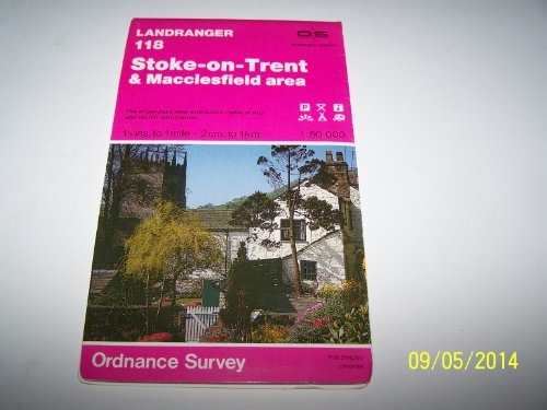
This map is part of the Landranger (Pink) series and is designed for people who really want to get to know an area. It includes the following information: tourist information, camping and caravan sites, picnic areas and viewpoints, selected places of interest and rights of way information for England and Wales. Each map in the series covers an area of 40 km by 40 km (25 miles by 25 miles) and like other Ordnance Survey maps, National Grid squares are provided so that any feature can be given a unique reference number. Perfect for planning ahead and local excursions, these maps are full of useful information that will help you really get to know an area.
About the Author: Ordnance Survey is Britain's national mapping agency, responsible for the official, definitive mapping of the whole country. They produce and market a wide range of maps for educational and leisure purposes, as well as producing computer data products for government, business and administrative use.
"About this title" may belong to another edition of this title.
Bibliographic Details
Title: Stoke-on-Trent and Macclesfield Area (Sheet ...
Publisher: Ordnance Survey
Condition: Very Good
Top Search Results from the AbeBooks Marketplace

Seller Image
Stoke-on-Trent and Macclesfield Area (Sheet 118) (OS Landranger Map)
Seller: WeBuyBooks, Rossendale, LANCS, United Kingdom
Seller rating 5 out of 5 stars
![]()
Condition: Good. Most items will be dispatched the same or the next working day. A copy that has been read but remains in clean condition. All of the pages are intact and the cover is intact and the spine may show signs of wear. The book may have minor markings which are not specifically mentioned. Seller Inventory # wbs2893274712
Quantity: 1 available
Stock Image
Landranger Maps: Stoke-on-Trent and Macclesfield Area Sheet 118 (OS Landranger Map)
Seller: Bahamut Media, Reading, United Kingdom
Seller rating 5 out of 5 stars
![]()
Map. Condition: Very Good. This book is in very good condition and will be shipped within 24 hours of ordering. The cover may have some limited signs of wear but the pages are clean, intact and the spine remains undamaged. This book has clearly been well maintained and looked after thus far. Money back guarantee if you are not satisfied. See all our books here, order more than 1 book and get discounted shipping. Seller Inventory # 6545-9780319221181
Quantity: 1 available
Stock Image
Landranger Maps: Stoke-on-Trent and Macclesfield Area Sheet 118 (OS Landranger Map)
Seller: AwesomeBooks, Wallingford, United Kingdom
Seller rating 5 out of 5 stars
![]()
Map. Condition: Very Good. Landranger Maps: Stoke-on-Trent and Macclesfield Area Sheet 118 (OS Landranger Map) This book is in very good condition and will be shipped within 24 hours of ordering. The cover may have some limited signs of wear but the pages are clean, intact and the spine remains undamaged. This book has clearly been well maintained and looked after thus far. Money back guarantee if you are not satisfied. See all our books here, order more than 1 book and get discounted shipping. Seller Inventory # 7719-9780319221181
Quantity: 1 available
Stock Image
Stoke-on-Trent and Macclesfield Area (Sheet 118) (OS Landranger Map)
Published by
Ordnance Survey, United Kingdom, Hants, 1990
ISBN 10: 0319221180
ISBN 13: 9780319221181
Used
Paperback
Seller: WorldofBooks, Goring-By-Sea, WS, United Kingdom
Seller rating 5 out of 5 stars
![]()
Paperback. Condition: Very Good. This map is part of the Landranger (Pink) series and is designed for people who really want to get to know an area. It includes the following information: tourist information, camping and caravan sites, picnic areas and viewpoints, selected places of interest and rights of way information for England and Wales. Each map in the series covers an area of 40 km by 40 km (25 miles by 25 miles) and like other Ordnance Survey maps, National Grid squares are provided so that any feature can be given a unique reference number. Perfect for planning ahead and local excursions, these maps are full of useful information that will help you really get to know an area. The book has been read, but is in excellent condition. Pages are intact and not marred by notes or highlighting. The spine remains undamaged. Seller Inventory # GOR001699890
Quantity: 4 available
Stock Image
Landranger Maps: Stoke-on-Trent and Macclesfield Area Sheet 118 (OS Landranger Map)
Seller: Brit Books, Milton Keynes, United Kingdom
Seller rating 4 out of 5 stars
![]()
Map. Condition: Used; Very Good. ***Simply Brit*** Welcome to our online used book store, where affordability meets great quality. Dive into a world of captivating reads without breaking the bank. We take pride in offering a wide selection of used books, from classics to hidden gems, ensuring there is something for every literary palate. All orders are shipped within 24 hours and our lightning fast-delivery within 48 hours coupled with our prompt customer service ensures a smooth journey from ordering to delivery. Discover the joy of reading with us, your trusted source for affordable books that do not compromise on quality. Seller Inventory # 2389896
Quantity: 1 available
Landranger 118 Stoke-on-Trent & Macclesfield area
Seller: Book Souk, Porstoy, United Kingdom
Seller rating 5 out of 5 stars
![]()
Soft cover. Condition: Very Good. 100 grams. Scale 1:50,000 1.25 inch to 1 mile - 2 cm to 1 km. Seller Inventory # 004166
Quantity: 1 available
Stock Image
Landranger Maps: Stoke-on-Trent and Macclesfield Area Sheet 118 (OS Landranger Map)
Seller: Better World Books, Mishawaka, IN, U.S.A.
Seller rating 5 out of 5 stars
![]()
Condition: Good. Former library book; may include library markings. Used book that is in clean, average condition without any missing pages. Seller Inventory # 18995084-20
Quantity: 1 available