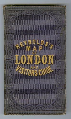
Reynolds's Map of Modern London. Divided into Quarter Mile Sections
REYNOLDS, James; JARMAN, Richard
From
Attic Books (ABAC, ILAB), London, ON, Canada
Seller rating 5 out of 5 stars
![]()
AbeBooks Seller since 15 December 2006
About this Item
Description:
Linen-backed hand-coloured folding map opens to 50 x 73.5 cm (19 3/4 x 29 in). Closed dimensions 18 x 10 cm (7 x 4 in). In purple cloth with blind-stamped borders on both covers.The front cover reads, in gilt: Reynolds's Map of London and Visitors Guide. Moderate wear.Light foxing on the backside of the linen.Ink name and date (1866) on the cartouche. Scale: 3.5 inches to the mile. Drawn and engraved by R. Jarman.This is a map only, with no accompanying Visitor's Guide.Map area extends from Highbury in the north to Camberwell in the south and from Notting Hill in the west to Limehouse in the east.Some of the railways show proposed extensions. The Thames River has, inside the north bank, lines showing Proposed Line of Embankment and Proposed Roadway between Westminster Bridge (Houses of Parliament) to Blackfriars Bridge, a distance of something over a mile. This would have narrowed the river considerably on that curve if the project had been undertaken.Boyle 224. Seller Inventory # 107144
Bibliographic Details
Title: Reynolds's Map of Modern London. Divided ...
Publisher: James Reynolds, London
Publication Date: 1862
Binding: Cloth
Condition: Very good
Top Search Results from the AbeBooks Marketplace
[cover] Reynolds' colored Distance Map of London and Vistors Guide; Guide to the sights and amusements of London; list of Bankers and Public Offices; Street Directory; Distances in all Directions; 3000 cab fares; Postal Districts; 1/ [and] 6; [map] Reynolds's Map of Modern London divided into quarter-mile sections for measuring distances
Seller: Avenue Victor Hugo Books, Newmarket, NH, U.S.A.
Hardcover. Condition: Good +. First thus. No date given. 24mo, book size, 5 3/4" x 3 3/4", 32 directory pages with ads, plus fold-out map approx 30 x 20, red paper title plate tipped on front cover, brown cloth binding. (please note--this is NOT the edition with map on linen backing. This map is paper only) In good condition overall, much of the interior very good, text pages slightly loosened from the sewn binding fold, but secure, map clean, paper moderately yellowed with foxing visible on back side of map, little soiling overall BUT the paper has begun to split, primarily at the first horizontal fold and the margins of other folds, the panel attached to rear boards has come loose; exterior cloth cover boards moderately worn with no fraying to spine cloth. Seller Inventory # 31567
Quantity: 1 available
Reynolds's Map of Modern London. Divided into Quarter Mile Sections
Seller: George Jeffery Books, HERTFORDSHIRE, United Kingdom
Condition: Near Very Good. No printed date, circa 1862.Linen backed, coloured map. Map measures 50x73.cm, in 24 sections. Map showing wear on folds, some minor stain marking. Map folding into publishers cloth case. Without the printed index. A nice copy. F. Seller Inventory # 013834
Quantity: 1 available


