About this Item
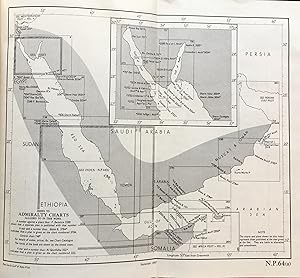
xv, 599 pp., [1], 82 plates, 2 folding maps, tables, contemporary cloth, lightly faded, title printed on spine & upper cover, biblio, glossary, appendices, index, copy clean & in very good condition - This work comprises direction for navigation through the Red Sea, Strait of Bab el Mandeb, and Gulf of Aden. It also contains descriptions of the African and Arabian shores of the Red Sea and Gulf of Aden, including Sokotra and adjacent islands, and the southeast coast of Arabia as far as Ras Al Hadd. The information contained herein is taken mainly from the Hydrographic Department of the British Admiralty, revised and brought up to date. This important information includes remarks and full details and a survey from Ras Muhammed to Jeddah, and from Jeddah to Kamaran Bay, and the Strait of Bab el Mandeb. The survey includes also the African coast, from Bab el Mandeb to Ras al Hamer and the Somali coast. #24750.
Seller Inventory # 014070
Contact seller
Report this item

