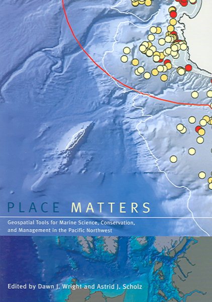
Place Matters : Geospatial Tools For Marine Science, Conservation, And Management in the Pacific Northwest
Wright, Dawn J. (EDT); Scholz, Astrid J. (EDT); Earle, Sylvia A. (EDT)
ISBN 10: 0870710575 ISBN 13: 9780870710575
Published by Oregon State University Press, 2005
New
Soft cover
From
GreatBookPrices, Columbia, MD, U.S.A.
Seller rating 5 out of 5 stars
![]()
AbeBooks Seller since 6 April 2009
This specific item is no longer available.
About this Item
Description:
Seller Inventory # 3375356-n
Synopsis:
Although the ocean provides living space for about 97 percent of life on Earth, less than 5 percent of the ocean below the surface has actually been seen, let alone explored. Now, using the geogrpahic information system (GIS), marine scientists are gaining new insights into a once-mysterious world. A technologically sophisticated database, information-management, and display system, GIS holds tremendous potential for mapping, interpreting, and managing ocean environments--"from the seafloor to the seafloor to the shoreline. "Place Matters explores how marine GIS is contributing to the understanding, management, and conservation of the shores and ocean of the Pacific Northwest, which is becoming a hotbed of marine GIS development and applications as scientists expand the use of this cutting-edge technology to a variety of ocean science, policy, and management issues. Using these geospatial databases and tools, scientists, resource managers, and conservationists--"often in collaboration--"are making advances in the way that data are collected, documented, used, shared, and saved. The contributors to "Place Matters show how together they are using GIS to hadle and exploit present and future data streams from observatories, experiments, numerical models, simulations, and other sources, yielding fresh insights into oceanographic, ecological, and socioeconomic conditions of the marine environment. The book begins with a conceptual framework, laying out selected methods and models for conservation-based marine GIS. Chapters in the second section describe working examples of marine GIS tools and large-scale implementations. The final section focuses onthe use of GIS by environmntal advocacy andlocal citizens' organizations. A companion Web site includes GIS maps and databases, as well as extensive Web-based resources. with its unique focus on the use of GIS to solve marine conservation problems, "Place Matters offers an important new resources for all who study and work to protect the world's oceans.
About the Author:
Esri Chief Scientist Dawn J. Wright is a professor of geography and oceanography at Oregon State University. In 2007, the Carnegie Foundation for the Advancement of Teaching and the Council for the Advancement and Support of Education named her US Professor of the Year for the State of Oregon. She is also a fellow of the American Association for the Advancement of Science and a new fellow of Stanford University's Aldo Leopold Leadership Program in science communication. Her research interests include geographic information science; ocean informatics and cyberinfrastructure; benthic terrain and habitat characterization; and the processing and interpretation of high-resolution bathymetry, video, and underwater photographic images. Wright received a PhD in physical geography and marine geology from the University of California, Santa Barbara; an MS in oceanography from Texas A&M University; and a BS with honors from Wheaton College in Illinois. She is also certified by the GIS Certification Institute as a GIS professional (GISP). She coauthored the book Arc Marine: GIS for a Blue Planet, published by Esri Press in 2007.
Astrid J. Scholz is Ecological Economist and Director of knowledge Systems for Ecotrust, a Portland, Oregon, based conservation organiozation dedicated to strengthening economics and the environment from Alaska to California. She serves on the faculty of the OSU College of Oceanic and Atmospheric Science, and oversees several research projects to integrate socioeconomic information into natural resource management.
Sylvia A. Earle is an explore-in-residence at the National Geographic Society.
"About this title" may belong to another edition of this title.
Bibliographic Details
Title: Place Matters : Geospatial Tools For Marine ...
Publisher: Oregon State University Press
Publication Date: 2005
Binding: Soft cover
Condition: New
Top Search Results from the AbeBooks Marketplace

Stock Image
Place Matters: Geospatial Tools for Marine Science, Conservation, and Management in the Pacific Northwest
Published by
Oregon State University Press, 2005
ISBN 10: 0870710575
ISBN 13: 9780870710575
Used
Paperback
Seller: ThriftBooks-Atlanta, AUSTELL, GA, U.S.A.
Seller rating 5 out of 5 stars
![]()
Paperback. Condition: Very Good. No Jacket. Former library book; May have limited writing in cover pages. Pages are unmarked. ~ ThriftBooks: Read More, Spend Less. Seller Inventory # G0870710575I4N10
Stock Image
Place Matters Format: Paperback
Published by
University of Chicago press, 2005
ISBN 10: 0870710575
ISBN 13: 9780870710575
New
Softcover
Seller: INDOO, Avenel, NJ, U.S.A.
Seller rating 5 out of 5 stars
![]()
Condition: New. Brand New. Seller Inventory # 9780870710575