About this Item
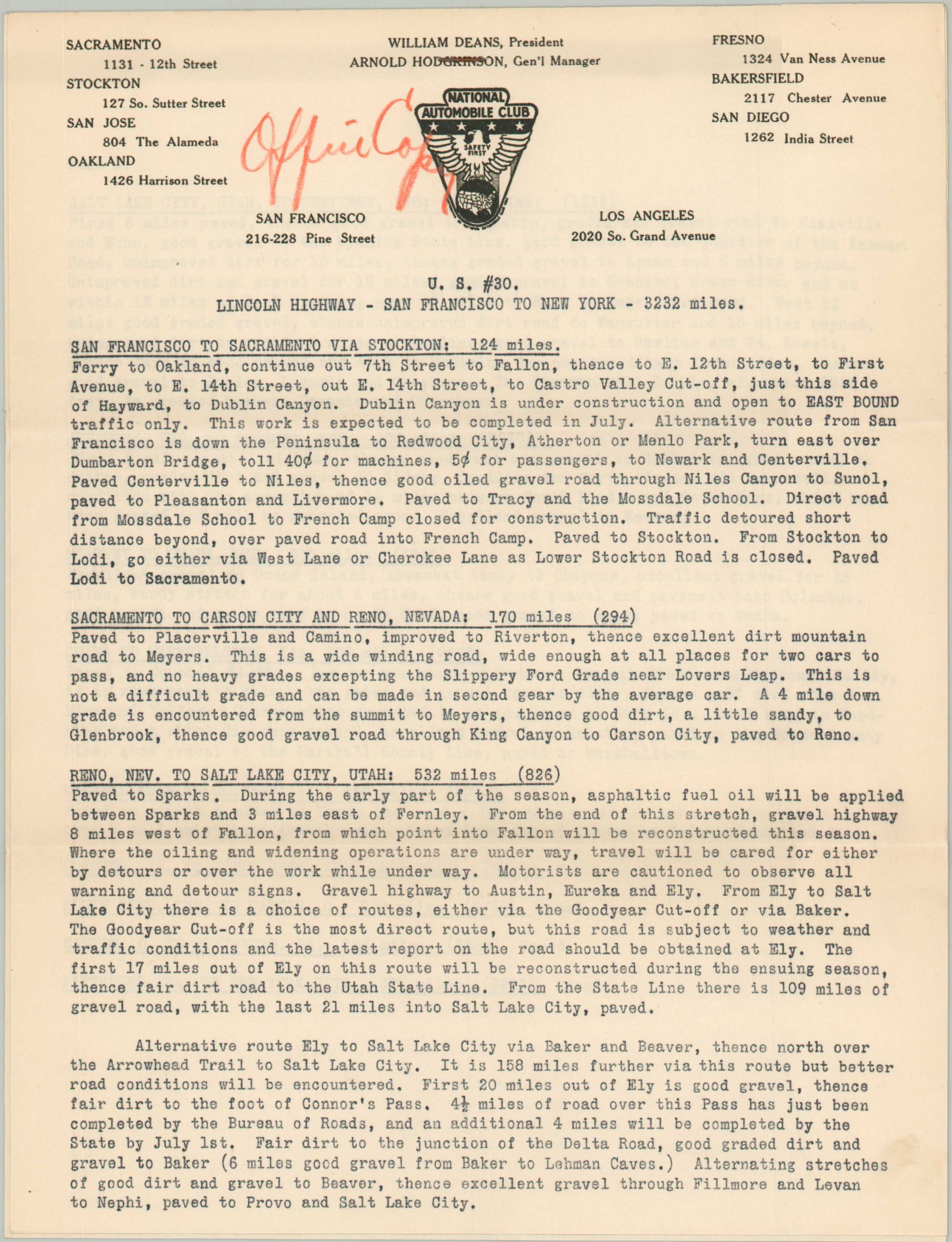
"This incredible and scarce map of America's rapidly expanding motor transportation network was first issued by the National Automobile Association (San Francisco) in 1927. Transcontinental travel is clearly emphasized, with thick solid red lines indicating 'hard surface' roads, dotted lines are improved (generally gravel, macadam, etc.), and thin red lines remain dirt surfaced. Several of the country's most popular highways are numbered throughout the image and identified in the lower left. Even in the late 1920s, large portions of iconic routes like the Pacific Coast Highway, Yellowstone Trail, and Lincoln Highway had yet to be paved! With such uncertainty in the road conditions and available amenities, planning long-distance automobile travel in the 1920s was a challenging adventure. Organizations like the National Automobile Association (NAA), and its better-known competitor the Automobile Association of America, were established to assist motorists with relevant information (including maps), improve road signage, and encourage beneficial legislation. This map is accompanied by a typewritten NAA letter (dated 6/28/1928) and eight pages of printed route details. The letter was sent in response to an inquiry from a resident of Mohawk, New York, who was looking for advice on the best roads to California. An excerpt reads, "The best route to this State is that via the Lincoln Highway to Salt Lake City, Utah, then over the Victory Highway. Multigraphed copies of detailed routings over both routes are enclosed [sic], and these will give you information on conditions of roads and type of country. Obtain local information on best roads to reach the Lincoln Highway." In addition to turn-by-turn directions, the accompanying 'routings' provide fascinating contemporary insight into the local road conditions, including surface material, elevation grades, alternative routes, major landmarks, etc. A list of state laws regarding registration, speed limits, firearm possession, etc. is also included with this rare collection. The map has been identified in the 1927 Congressional Catalog of Copyright Entries, but no examples are listed in OCLC or other online repositories." Sheet Width (in) 32.5 Sheet Height (in) 20.5 Condition Description "Single-sided map shows moderate wear and creasing along old fold lines. A 2" separation in the center has been repaired on the verso with archival tape with very minimal image loss. A hand-drawn route line in blue pencil can be seen running haphazardly from approximately Pittsburgh to San Francisco. Includes original cover letter (heavily worn) and three groups of printed directions and trip information. A rare collection in very good condition.".
Seller Inventory # 5334
Contact seller
Report this item


