
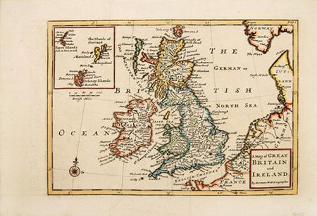

A Map of GREAT BRITAIN and IRELAND
MOLL, Herman.
Published by Magna Britannia Et Hibernia Antiqua & Nova. 1720
Used
From
Peter Harrington. ABA/ ILAB., London, United Kingdom
Seller rating 5 out of 5 stars

Heritage Bookseller
AbeBooks member since 1996
This specific copy is no longer available. Here are our closest matches for A Map of GREAT BRITAIN and IRELAND by MOLL, Herman..
About this Item
Description:
Attractive map of the British Isles with an inset at top left of the Orkney, Shetland and Faroe Islands. Compass rose at sea. The map was published in the 1720 edition of The Magna Britannia, added to the county maps of Robert Morden. Smith: Antique Maps of the British Isles, 81. Copper engraving. Very good condition, with wide margins. Some light offsetting Later colour. Size: 25 x 17 cm. (10 x 6½ inches). Seller Inventory # 54458
Bibliographic Details
Title: A Map of GREAT BRITAIN and IRELAND
Publisher: Magna Britannia Et Hibernia Antiqua & Nova. 1720