About this Item
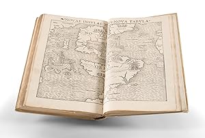
Munster / 1545 / Geographia Universalis, Vetus et Nova, Complectens Claudii Ptolemaei Alexandrini Enarrationis Libras VIII. (Safe 1, 96321) Quarto. Later stiff vellum. Title labels seemingly applied over earlier labels and somewhat scraped and coming up. a-[c6], [*6], A-[N6], 54 woodcut maps, Aa-[Cc6]. Complete. (Some of the maps, particularly the ones appearing earlier in the collation, are misbound, but all are present. Small wormholes scattered throughout, largely confined to the gutters. Some minor toning. Title page repaired at the edges and tipped in, likewise with the final printed leaf. Endpapers renewed.) Early Edition of this Foundational 16th-Century Work on Geography. Geographia Universalis, compiled by Sebastian Munster and published in Basel by Henri Petri in 1545, is a remarkable piece of cartographic history. This is the fourth edition, following the Basel Latin editions of 1540, 1541, and 1542, which stands out for its inclusion of many maps not seen in the earlier editions of the Geographia. Munster's Geographia established a new standard for world atlases by including specific continental maps of the Americas, Europe, Africa, and Asia, setting a convention that would be followed in future atlases. Additionally, the Geographia was the first printed work to render latitude and longitude in their now-standard degree-minute-second form. The influence of global exploration, such as Magellan's circumnavigation in 1522, is also evident in the atlas, reflecting a growing interest in worldwide geography during the Renaissance period. M nster's Geographia was instrumental in ushering in a series of "modern"-style world atlases, culminating in the 1570 Theatrum Orbis Terrarum by Abraham Ortelius. Sebastian M nster's efforts in creating the Geographia Universalis marked a critical juncture in the history of cartography. His work not only served as a snapshot of geographical understanding during the Renaissance but also acted as a catalyst for the development of modern atlases. By thoughtfully curating maps and adhering to emerging geographical principles, M nster's Geographia became a valuable and fascinating document, reflecting the evolving perception of the world in the 16th century. Comparison with the Previous Edition Compared with the 1542 edition, this book adds the following maps: Nova Graecia, Helvetia I Rheni, Secunda Rheni, Brabant III Rheni, Slesia, Septentr. Regiones, Transsylvania, Sclavonia, Bohemia, Valesia I, Valesia II, and Nigra Silva. The first seven of these appeared in the 1544 first edition Cosmographia, the others are wholly-new in this book. Six maps that appeared in the first three editions have been removed in this edition: Helvetia I Rheni, Alsatia II Rheni, Tertia Rheni, Quarta Rheni, Brabantia V Rheni, and Schonlandia. Thus, in total the number of maps in the 1545 edition has grown from 48 to 54. The Sources of M nster's Geographia First compiled by Greek polymath Claudius Ptolemaeus in the 2nd-century, the Geographia was a gazetteer of the geographical and cartographical knowledge of the Roman Empire. It passed in manuscript form, almost entirely lost to history, until, in the 13th century it was rediscovered and the maps for it were redrawn by the Byzantine Greek monk Maximus Planudes. M nster's text has its origins in the Latin-translation of Ptolemy by Willibald Pirckheimer, who in turn relied on the notes of Johannes Regiomontanus. Pirckheimer's translation was first printed in the 1525 "Fries" Ptolemy. The text for the Fries Ptolemy was substantially corrected by Michael Villanovan. Seller Inventory # 96321
Contact seller
Report this item


