
Items related to GIS Assisted Multicriteria Analysis of Malaria Spatial...
GIS Assisted Multicriteria Analysis of Malaria Spatial Distribution: Malaria Spatial Distribution and Risk Mapping: The Case of Jabi Tehinan District, Amhara Region - Softcover
Synopsis
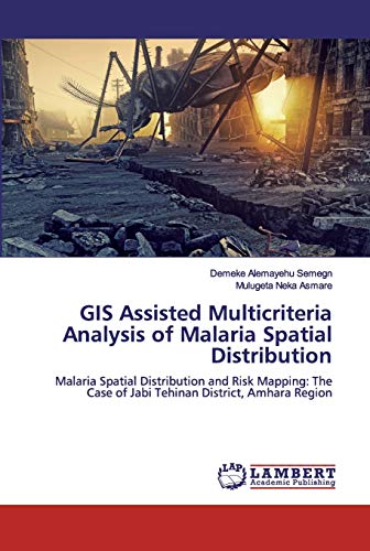
Malaria is still among the top killing disease in Ethiopia, in general, and the study area in particular. This study was initiated with the central aim of mapping out malaria hazard and risk area within the district. So GIS is the best tool to map out by considering different parameters together.To produce a malaria hazard map; altitude, rainfall, temperature, river proximity, slope, and soil type were used while the distance from health service, land use type, and population density are the four parameters used to produce risk mapping. Meteorological data were collected from 13 meteorological stations.The last five-year malaria patients report showed that there is a dramatic increase of malaria patients in the study area which is different from the national annual report.
"synopsis" may belong to another edition of this title.
Search results for GIS Assisted Multicriteria Analysis of Malaria Spatial...

Seller Image
GIS Assisted Multicriteria Analysis of Malaria Spatial Distribution
Published by
LAP LAMBERT Academic Publishing Dez 2019, 2019
ISBN 10: 6200498563
ISBN 13: 9786200498564
New
Taschenbuch
Seller: BuchWeltWeit Ludwig Meier e.K., Bergisch Gladbach, Germany
Seller rating 5 out of 5 stars

Taschenbuch. Condition: Neu. This item is printed on demand - it takes 3-4 days longer - Neuware -Malaria is still among the top killing disease in Ethiopia, in general, and the study area in particular. This study was initiated with the central aim of mapping out malaria hazard and risk area within the district. So GIS is the best tool to map out by considering different parameters together.To produce a malaria hazard map; altitude, rainfall, temperature, river proximity, slope, and soil type were used while the distance from health service, land use type, and population density are the four parameters used to produce risk mapping. Meteorological data were collected from 13 meteorological stations.The last five-year malaria patients report showed that there is a dramatic increase of malaria patients in the study area which is different from the national annual report. 104 pp. Englisch. Seller Inventory # 9786200498564
Stock Image
GIS Assisted Multicriteria Analysis of Malaria Spatial Distribution: Malaria Spatial Distribution and Risk Mapping: The Case of Jabi Tehinan District, Amhara Region
Published by
LAP LAMBERT Academic Publishing, 2019
ISBN 10: 6200498563
ISBN 13: 9786200498564
New
Softcover
Seller: Books Puddle, Woodside, NY, U.S.A.
Seller rating 4 out of 5 stars

Condition: New. Seller Inventory # 26387014600
Seller Image
GIS Assisted Multicriteria Analysis of Malaria Spatial Distribution
Published by
LAP LAMBERT Academic Publishing, 2019
ISBN 10: 6200498563
ISBN 13: 9786200498564
New
Softcover
Seller: moluna, Greven, Germany
Seller rating 5 out of 5 stars
Condition: New. Dieser Artikel ist ein Print on Demand Artikel und wird nach Ihrer Bestellung fuer Sie gedruckt. Autor/Autorin: Semegn Demeke AlemayehuDemeke Alemayehu Semegn is living in Addis Ababa. He graduated from Addis Ababa University in Geography and Environmental Studies in 2006. He also holds his MSc in Geographic Information Science (GIS) at Bahird. Seller Inventory # 385892394
Buy New
£ 39.20
£ 41.03 shipping
Ships from Germany to U.S.A.
Ships from Germany to U.S.A.
Quantity: Over 20 available
Stock Image
GIS Assisted Multicriteria Analysis of Malaria Spatial Distribution: Malaria Spatial Distribution and Risk Mapping: The Case of Jabi Tehinan District, Amhara Region
Published by
LAP LAMBERT Academic Publishing, 2019
ISBN 10: 6200498563
ISBN 13: 9786200498564
New
Softcover
Seller: Majestic Books, Hounslow, United Kingdom
Seller rating 4 out of 5 stars
Condition: New. Print on Demand. Seller Inventory # 392618007
Buy New
£ 76.15
£ 6.50 shipping
Ships from United Kingdom to U.S.A.
Ships from United Kingdom to U.S.A.
Quantity: 4 available
Seller Image
GIS Assisted Multicriteria Analysis of Malaria Spatial Distribution : Malaria Spatial Distribution and Risk Mapping: The Case of Jabi Tehinan District, Amhara Region
Published by
LAP LAMBERT Academic Publishing, 2019
ISBN 10: 6200498563
ISBN 13: 9786200498564
New
Taschenbuch
Seller: AHA-BUCH GmbH, Einbeck, Germany
Seller rating 5 out of 5 stars
Taschenbuch. Condition: Neu. nach der Bestellung gedruckt Neuware - Printed after ordering - Malaria is still among the top killing disease in Ethiopia, in general, and the study area in particular. This study was initiated with the central aim of mapping out malaria hazard and risk area within the district. So GIS is the best tool to map out by considering different parameters together.To produce a malaria hazard map; altitude, rainfall, temperature, river proximity, slope, and soil type were used while the distance from health service, land use type, and population density are the four parameters used to produce risk mapping. Meteorological data were collected from 13 meteorological stations.The last five-year malaria patients report showed that there is a dramatic increase of malaria patients in the study area which is different from the national annual report. Seller Inventory # 9786200498564
Stock Image
GIS Assisted Multicriteria Analysis of Malaria Spatial Distribution: Malaria Spatial Distribution and Risk Mapping: The Case of Jabi Tehinan District, Amhara Region
Published by
LAP LAMBERT Academic Publishing, 2019
ISBN 10: 6200498563
ISBN 13: 9786200498564
New
Softcover
Seller: Biblios, Frankfurt am main, HESSE, Germany
Seller rating 4 out of 5 stars
Condition: New. PRINT ON DEMAND. Seller Inventory # 18387014594
Seller Image
GIS Assisted Multicriteria Analysis of Malaria Spatial Distribution
Published by
LAP LAMBERT Academic Publishing Dez 2019, 2019
ISBN 10: 6200498563
ISBN 13: 9786200498564
New
Taschenbuch
Seller: buchversandmimpf2000, Emtmannsberg, BAYE, Germany
Seller rating 5 out of 5 stars
Taschenbuch. Condition: Neu. This item is printed on demand - Print on Demand Titel. Neuware -Malaria is still among the top killing disease in Ethiopia, in general, and the study area in particular. This study was initiated with the central aim of mapping out malaria hazard and risk area within the district. So GIS is the best tool to map out by considering different parameters together.To produce a malaria hazard map; altitude, rainfall, temperature, river proximity, slope, and soil type were used while the distance from health service, land use type, and population density are the four parameters used to produce risk mapping. Meteorological data were collected from 13 meteorological stations.The last five-year malaria patients report showed that there is a dramatic increase of malaria patients in the study area which is different from the national annual report.VDM Verlag, Dudweiler Landstraße 99, 66123 Saarbrücken 104 pp. Englisch. Seller Inventory # 9786200498564
Seller Image
GIS Assisted Multicriteria Analysis of Malaria Spatial Distribution | Malaria Spatial Distribution and Risk Mapping: The Case of Jabi Tehinan District, Amhara Region
Published by
LAP LAMBERT Academic Publishing, 2020
ISBN 10: 6200498563
ISBN 13: 9786200498564
New
Taschenbuch
Seller: preigu, Osnabrück, Germany
Seller rating 5 out of 5 stars
Taschenbuch. Condition: Neu. GIS Assisted Multicriteria Analysis of Malaria Spatial Distribution | Malaria Spatial Distribution and Risk Mapping: The Case of Jabi Tehinan District, Amhara Region | Demeke Alemayehu Semegn (u. a.) | Taschenbuch | 104 S. | Englisch | 2020 | LAP LAMBERT Academic Publishing | EAN 9786200498564 | Verantwortliche Person für die EU: preigu GmbH & Co. KG, Lengericher Landstr. 19, 49078 Osnabrück, mail[at]preigu[dot]de | Anbieter: preigu. Seller Inventory # 117948651