
Items related to Mediterranean Land-surface Processes Assessed from...
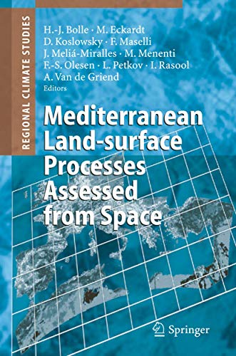
Synopsis
This is a detailed description of the steps leading from raw signals measured in space, to calibrated comparable long term data sets, to its final form: useful information for user communities. Examples of applications and data validations result from different investigations in the Mediteranean area. An appendix summarizes useful formulas of the evaluation of satellite data.
"synopsis" may belong to another edition of this title.
From the Back Cover
1. 1 Space View and Ground Observations 1 1. 2 Mediterranean Climatic Environment 2 1. 3 Processes at Surfaces 10 1. 3. 1 Deforestation and Land-use Changes 10 1. 3. 2 Water Related Problems 16 1. 3. 3 Fire, Grazing, and Land Degradation 19 1. 3. 4 Drought, Floods, Frost, and Desertification 21 1. 3. 5 Coupling Between Surface and Atmosphere: The Role of the Atmospheric Boundary Layer 25 1. 4 Role and Capabilities of Measurements Made From Space 30 1. 4. 1 Research Programmes 30 1. 4. 2 Expected Information 32 1. 4. 3 Research Strategy 33 1. 4. 4 Observation of Changes in Heterogeneous Landscapes: Spatial and Temporal Scales 35 1. 4. 5 Land-surface Change Indicators Observable from Space 36 Spectral Characteristics of Vegetation and Soils (36); Responses of Remote Sensing Signals to Changes of Land-surface Properties (40) 1. 5 About this Book 48 Chapter 2 Processing and Archiving of Satellite and Ancillary Data 51 2. 1 Introduction 51 2. 2 The Remote Sensing Data Base 55 2. 2. 1 Satellite Instruments 55 The NOAA Observing System (55); Meteosat (57); Nimbus-7 (59); Landsat (59); SPOT (61); DMSP (62); ERS-1 and ERS-2 (62); TRMM (63); Terra (64); Envisat (65); Aqua (66) 2. 2. 2 Aircraft Instruments 66 The Use of Aircraft for Land-surface Process Studies (66); AVIRIS (67); TMS (68); AIRSAR (68); DIAL (69) 2. 3 Reception, Acquisition and Availability of Satellite Data 70 2. 3.
"About this title" may belong to another edition of this title.
Search results for Mediterranean Land-surface Processes Assessed from...

Stock Image
Mediterranean Land-surface Processes Assessed
Seller: Basi6 International, Irving, TX, U.S.A.
Seller rating 5 out of 5 stars

Condition: Brand New. New. US edition. Expediting shipping for all USA and Europe orders excluding PO Box. Excellent Customer Service. Seller Inventory # ABEJAN27-226921
Stock Image
MEDITERRANEAN LAND-SURFACE PROCESSES ASSESSED FROM SPACE (REGIONAL CLIMATE STUDIES)
Seller: Basi6 International, Irving, TX, U.S.A.
Seller rating 5 out of 5 stars
Condition: Brand New. New. US edition. Expediting shipping for all USA and Europe orders excluding PO Box. Excellent Customer Service. Seller Inventory # ABEJAN27-226922
Stock Image
Mediterranean Land-surface Processes Assessed
Seller: Romtrade Corp., STERLING HEIGHTS, MI, U.S.A.
Seller rating 5 out of 5 stars
Condition: New. This is a Brand-new US Edition. This Item may be shipped from US or any other country as we have multiple locations worldwide. Seller Inventory # ABBB-166062
Stock Image
Mediterranean Land-Surface Processes Assessed from Space
Seller: Books Puddle, Woodside, NY, U.S.A.
Seller rating 4 out of 5 stars

Condition: Used. pp. xxviii + 760 1st Edition. Seller Inventory # 26302636
Stock Image
Mediterranean Land-Surface Processes Assessed from Space
Print on DemandSeller: Majestic Books, Hounslow, United Kingdom
Seller rating 4 out of 5 stars
Condition: Used. pp. xxviii + 760 442 Illus. This item is printed on demand. Seller Inventory # 7545331
Buy Used
£ 173.59
£ 6.50 shipping
Ships from United Kingdom to U.S.A.
Ships from United Kingdom to U.S.A.
Quantity: 1 available
Stock Image
Mediterranean Land-Surface Processes Assessed from Space
Seller: Biblios, Frankfurt am main, HESSE, Germany
Seller rating 4 out of 5 stars
Condition: Used. pp. xxviii + 760. Seller Inventory # 18302630
Seller Image
Mediterranean Land-surface Processes Assessed from Space
Published by
Springer Berlin Heidelberg, 2006
ISBN 10: 3540401512
ISBN 13: 9783540401513
New
Hardcover
Seller: moluna, Greven, Germany
Seller rating 5 out of 5 stars
Gebunden. Condition: New. Dieser Artikel ist ein Print on Demand Artikel und wird nach Ihrer Bestellung fuer Sie gedruckt. Present achievements and limitations of remote sensing techniques to land-surface studiesGive explanations of the interactions between climate variability, land use, and land-surface processesThis is a detailed description of the st. Seller Inventory # 448924921
Buy New
£ 155.46
£ 41.06 shipping
Ships from Germany to U.S.A.
Ships from Germany to U.S.A.
Quantity: Over 20 available
Stock Image
Mediterranean Land-surface Processes Assessed from Space
Print on DemandSeller: Chiron Media, Wallingford, United Kingdom
Seller rating 5 out of 5 stars
Condition: New. This item is printed on demand. Brand new book, sourced directly from publisher. Dispatch time is 6-7 days from our warehouse. Book will be sent in robust, secure packaging to ensure it reaches you securely. Seller Inventory # 6666-IUK-9783540401513
Buy New
£ 189.35
£ 9.99 shipping
Ships from United Kingdom to U.S.A.
Ships from United Kingdom to U.S.A.
Quantity: 20 available
Seller Image
Mediterranean Land-surface Processes Assessed from Space
Published by
Springer Berlin Heidelberg Okt 2006, 2006
ISBN 10: 3540401512
ISBN 13: 9783540401513
New
Hardcover
Seller: BuchWeltWeit Ludwig Meier e.K., Bergisch Gladbach, Germany
Seller rating 5 out of 5 stars
Buch. Condition: Neu. This item is printed on demand - it takes 3-4 days longer - Neuware -This is a detailed description of the steps leading from raw signals measured in space, to calibrated comparable long term data sets, to its final form: useful information for user communities. Examples of applications and data validations result from different investigations in the Mediteranean area. An appendix summarizes useful formulas of the evaluation of satellite data. 792 pp. Englisch. Seller Inventory # 9783540401513
Seller Image
Mediterranean Land-surface Processes Assessed from Space
Published by
Springer Berlin Heidelberg, 2006
ISBN 10: 3540401512
ISBN 13: 9783540401513
New
Hardcover
Seller: preigu, Osnabrück, Germany
Seller rating 5 out of 5 stars
Buch. Condition: Neu. Mediterranean Land-surface Processes Assessed from Space | Hans-Jürgen Bolle (u. a.) | Buch | Regional Climate Studies | xxvii | Englisch | 2006 | Springer Berlin Heidelberg | EAN 9783540401513 | Verantwortliche Person für die EU: Springer Verlag GmbH, Tiergartenstr. 17, 69121 Heidelberg, juergen[dot]hartmann[at]springer[dot]com | Anbieter: preigu Print on Demand. Seller Inventory # 112012233