
Items related to Uncle Josh's Outline Map Collection CD-ROM
Synopsis
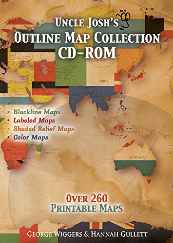
Outline maps are a foundational part of teaching geography and history. Here are 260+ maps to use year after year, regardless of topic or time studied. Print from the convenience of your home computer with this CD-Rom. <P> From drawing explorer's routes to tracking hurricanes to depicting the rise and fall of empires, it's here! Includes continents, ancient historical regions, important war arenas, each of the fifty states, and more! Rivers are lightly shaded and surrounding borders are visible for reference points to aid students in their labeling ignments. <P> This CD-Rom has the same great maps in Uncle Josh's Outline Map Book plus 21 additional maps including shaded relief maps of the world and each continent and also maps of each Canadian Province and Territory. <P> ADDED to this NEW edition are 50 Color Labeled USA State Maps with Shaded Relief and a hurricane tracking map! New color shaded relief and labeled continent maps. NEW 6' x 9' Driveway Map Template. <P> Mac and PC compatible. Pdf files, uses Acrobat Reader.
"synopsis" may belong to another edition of this title.
Search results for Uncle Josh's Outline Map Collection CD-ROM

Stock Image
Uncle Josh's Outline Map Book CD
Published by
Geography Matters (edition 2008 Revised Edition ©2013), 2008
ISBN 10: 1931397104
ISBN 13: 9781931397100
Used
Seller: BooksRun, Philadelphia, PA, U.S.A.
Seller rating 5 out of 5 stars

CD-ROM. Condition: Very Good. 2008 Revised Edition ©2013. It's a well-cared-for item that has seen limited use. The item may show minor signs of wear. All the text is legible, with all pages included. It may have slight markings and/or highlighting. Seller Inventory # 1931397104-11-1
Seller Image
Uncle Josh's Outline Map Book CD
Seller: Dream Books Co., Denver, CO, U.S.A.
Seller rating 5 out of 5 stars
Condition: good. Gently used with minimal wear on the corners and cover. A few pages may contain light highlighting or writing, but the text remains fully legible. Dust jacket may be missing, and supplemental materials like CDs or codes may not be included. May be ex-library with library markings. Ships promptly! Seller Inventory # DBV.1931397104.G
Stock Image
Uncle Josh's Outline Map Collection CD-ROM
Seller: World of Books (was SecondSale), Montgomery, IL, U.S.A.
Seller rating 5 out of 5 stars
Hardback. Condition: Good. Outline maps are a foundational part of teaching geography and history. Here are 100+ maps to use year after year, regardless of topic or time studied. From drawing explorer s routes to tracking hurricanes to depicting the rise and fall of empires, it s here Includes continents, ancient historical regions, important war arenas, each of the fifty states, and more Rivers are lightly shaded and surrounding borders are visible . You ve got the whole world covered in this one-of-a-kind book Reproducible pages. Conveniently print from your own home computer Mac and PC compatible. Pdf files, uses Acrobat Reader. Seller Inventory # 00107076496
Stock Image
Uncle Josh's Outline Map Collection CD-ROM
Seller: World of Books (was SecondSale), Montgomery, IL, U.S.A.
Seller rating 5 out of 5 stars
Hardback. Condition: Fair. Outline maps are a foundational part of teaching geography and history. Here are 100+ maps to use year after year, regardless of topic or time studied. From drawing explorer s routes to tracking hurricanes to depicting the rise and fall of empires, it s here Includes continents, ancient historical regions, important war arenas, each of the fifty states, and more Rivers are lightly shaded and surrounding borders are visible . You ve got the whole world covered in this one-of-a-kind book Reproducible pages. Conveniently print from your own home computer Mac and PC compatible. Pdf files, uses Acrobat Reader. Seller Inventory # 00098328636
Stock Image
Uncle Josh's Outline Map Collection CD-ROM
Seller: World of Books Inc, Montgomery, IL, U.S.A.
Seller rating 4 out of 5 stars

Hardback. Condition: Good. Outline maps are a foundational part of teaching geography and history. Here are 100+ maps to use year after year, regardless of topic or time studied. From drawing explorer s routes to tracking hurricanes to depicting the rise and fall of empires, it s here Includes continents, ancient historical regions, important war arenas, each of the fifty states, and more Rivers are lightly shaded and surrounding borders are visible . You ve got the whole world covered in this one-of-a-kind book Reproducible pages. Conveniently print from your own home computer Mac and PC compatible. Pdf files, uses Acrobat Reader. Seller Inventory # CIN1931397104G
Stock Image
Uncle Josh's Outline Map Collection CD-ROM
Seller: World of Books Inc, Montgomery, IL, U.S.A.
Seller rating 4 out of 5 stars
Hardback. Condition: Fair. Outline maps are a foundational part of teaching geography and history. Here are 100+ maps to use year after year, regardless of topic or time studied. From drawing explorer s routes to tracking hurricanes to depicting the rise and fall of empires, it s here Includes continents, ancient historical regions, important war arenas, each of the fifty states, and more Rivers are lightly shaded and surrounding borders are visible . You ve got the whole world covered in this one-of-a-kind book Reproducible pages. Conveniently print from your own home computer Mac and PC compatible. Pdf files, uses Acrobat Reader. Seller Inventory # CIN1931397104A