Synopsis
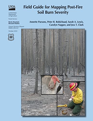
Following wildfires in the United States, the U.S. Department of Agriculture and U.S. Department of the Interior mobilize Burned Area Emergency Response (BAER) teams to assess immediate post-fire watershed conditions. BAER teams must determine threats from flooding, soil erosion, and instability. Developing a postfire soil burn severity map is an important first step in the rapid assessment process. It enables BAER teams to prioritize field reviews and locate burned areas that may pose a risk to critical values within or downstream of the burned area. By helping to identify indicators of soil conditions that differentiate soil burn severity classes, this field guide will help BAER teams to consistently interpret, field validate, and map soil burn severity.
"synopsis" may belong to another edition of this title.
Other Popular Editions of the Same Title

Search results for Field Guide for Mapping Post-Fire Soil Burn Severity

Seller Image
Field Guide for Mapping Post-fire Soil Burn Severity
Published by
CreateSpace Independent Publishing Platform, 2015
ISBN 10: 1505877458
ISBN 13: 9781505877458
Used
Softcover
Seller: GreatBookPrices, Columbia, MD, U.S.A.
Seller rating 5 out of 5 stars
![]()
Condition: As New. Unread book in perfect condition. Seller Inventory # 23239321
Stock Image
Field Guide for Mapping Post-Fire Soil Burn Severity
Published by
Createspace Independent Publishing Platform, 2015
ISBN 10: 1505877458
ISBN 13: 9781505877458
New
Paperback / softback
Seller: THE SAINT BOOKSTORE, Southport, United Kingdom
Seller rating 5 out of 5 stars
![]()
Paperback / softback. Condition: New. This item is printed on demand. New copy - Usually dispatched within 5-9 working days. Seller Inventory # C9781505877458
Buy New
� 18.30
� 12.25 shipping
Ships from United Kingdom to U.S.A.
Ships from United Kingdom to U.S.A.
Quantity: Over 20 available
Seller Image
Field Guide for Mapping Post-fire Soil Burn Severity
Published by
CreateSpace Independent Publishing Platform, 2015
ISBN 10: 1505877458
ISBN 13: 9781505877458
New
Softcover
Seller: GreatBookPrices, Columbia, MD, U.S.A.
Seller rating 5 out of 5 stars
![]()
Condition: New. Seller Inventory # 23239321-n
Seller Image
Field Guide for Mapping Post-fire Soil Burn Severity
Published by
CreateSpace Independent Publishing Platform, 2015
ISBN 10: 1505877458
ISBN 13: 9781505877458
Used
Softcover
Seller: GreatBookPricesUK, Woodford Green, United Kingdom
Seller rating 5 out of 5 stars
![]()
Condition: As New. Unread book in perfect condition. Seller Inventory # 23239321
Buy Used
� 17.77
� 15 shipping
Ships from United Kingdom to U.S.A.
Ships from United Kingdom to U.S.A.
Quantity: Over 20 available
Seller Image
Field Guide for Mapping Post-fire Soil Burn Severity
Published by
CreateSpace Independent Publishing Platform, 2015
ISBN 10: 1505877458
ISBN 13: 9781505877458
New
Softcover
Seller: GreatBookPricesUK, Woodford Green, United Kingdom
Seller rating 5 out of 5 stars
![]()
Condition: New. Seller Inventory # 23239321-n
Buy New
� 18.29
� 15 shipping
Ships from United Kingdom to U.S.A.
Ships from United Kingdom to U.S.A.
Quantity: Over 20 available
Stock Image
Field Guide for Mapping Post-Fire Soil Burn Severity (Paperback)
Published by
Createspace Independent Publishing Platform, 2015
ISBN 10: 1505877458
ISBN 13: 9781505877458
New
Paperback
Seller: CitiRetail, Stevenage, United Kingdom
Seller rating 5 out of 5 stars
![]()
Paperback. Condition: new. Paperback. Following wildfires in the United States, the U.S. Department of Agriculture and U.S. Department of the Interior mobilize Burned Area Emergency Response (BAER) teams to assess immediate post-fire watershed conditions. BAER teams must determine threats from flooding, soil erosion, and instability. Developing a postfire soil burn severity map is an important first step in the rapid assessment process. It enables BAER teams to prioritize field reviews and locate burned areas that may pose a risk to critical values within or downstream of the burned area. By helping to identify indicators of soil conditions that differentiate soil burn severity classes, this field guide will help BAER teams to consistently interpret, field validate, and map soil burn severity. This item is printed on demand. Shipping may be from our UK warehouse or from our Australian or US warehouses, depending on stock availability. Seller Inventory # 9781505877458
Buy New
� 20.99
� 37 shipping
Ships from United Kingdom to U.S.A.
Ships from United Kingdom to U.S.A.
Quantity: 1 available