Synopsis
Taking into account the key events of the French and Indian War, this book shows the American Revolution s progress in 60 glorious contemporary maps and accompanying essays relating them to the events of the time. The authors tell the stories of the maps and cartographers whose talents have made these some of the most valuable artifacts in our nation s history. When warfare between Britain and her colonists erupted in 1775, maps provided the pictorial news about military matters. A number of the best examples of those maps, including some from the personal collection of King George III, the Duke of Northumberland, and the Marquis de Lafayette, are beautifully reproduced here. Others from institutional and private collections are being published for the first time."
"synopsis" may belong to another edition of this title.
About the Authors
Richard H. Brown is a collector of maps and views of the French and Indian War and American Revolution. He is vice chairman of the Norman B. Leventhal Map Center at the Boston Public Library and serves as a councilor of the American Antiquarian Society. He is also a member of the Madison Council of the Library of Congress and the Library Committee of the New-York Historical Society.
Paul E. Cohen is the coauthor of Manhattan in Maps (New York: Rizzoli, 1997; Mineola, NY: Dover, 2014), which received the New York City Book Award in 1997. He is also the author of Mapping the West (New York: Rizzoli, 2002), and the co-editor of American Cities (New York: Assouline, 2005). He is a partner in Cohen & Taliaferro LLC, New York City, dealers in rare books and antique maps.
"About this title" may belong to another edition of this title.
Search results for Revolution - Mapping the Road to American Independence,...

Seller Image
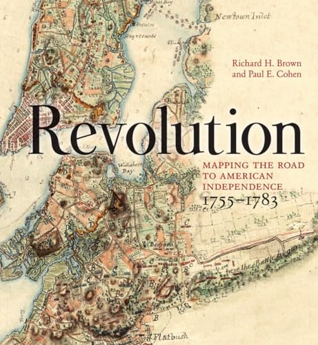
Revolution: Mapping the Road to American Independence, 1755�"1783
Seller: Dream Books Co., Denver, CO, U.S.A.
Seller rating 5 out of 5 stars
![]()
Condition: good. Gently used with minimal wear on the corners and cover. A few pages may contain light highlighting or writing, but the text remains fully legible. Dust jacket may be missing, and supplemental materials like CDs or codes may not be included. May be ex-library with library markings. Ships promptly! Seller Inventory # 4EKQOV00321Y_ns
Stock Image
Revolution: Mapping the Road to American Independence, 1755-1783
Seller: HPB Inc., Dallas, TX, U.S.A.
Seller rating 5 out of 5 stars
![]()
Hardcover. Condition: Very Good. Connecting readers with great books since 1972! Used books may not include companion materials, and may have some shelf wear or limited writing. We ship orders daily and Customer Service is our top priority! Seller Inventory # S_445122528
Stock Image
Revolution : Mapping the Road to American Independence, 1755-1783
Published by
Norton & Company, Incorporated, W. W., 2015
ISBN 10: 0393060322
ISBN 13: 9780393060324
Used
Hardcover
Seller: Better World Books, Mishawaka, IN, U.S.A.
Seller rating 5 out of 5 stars
![]()
Condition: Good. Used book that is in clean, average condition without any missing pages. Seller Inventory # 13142757-6
Stock Image
Revolution : Mapping the Road to American Independence, 1755-1783
Published by
Norton & Company, Incorporated, W. W., 2015
ISBN 10: 0393060322
ISBN 13: 9780393060324
Used
Hardcover
Seller: Better World Books, Mishawaka, IN, U.S.A.
Seller rating 5 out of 5 stars
![]()
Condition: Good. Former library book; may include library markings. Used book that is in clean, average condition without any missing pages. Seller Inventory # 8717511-75
Stock Image
Revolution : Mapping the Road to American Independence, 1755-1783
Published by
Norton & Company, Incorporated, W. W., 2015
ISBN 10: 0393060322
ISBN 13: 9780393060324
Used
Hardcover
Seller: Better World Books, Mishawaka, IN, U.S.A.
Seller rating 5 out of 5 stars
![]()
Condition: Very Good. Used book that is in excellent condition. May show signs of wear or have minor defects. Seller Inventory # 13142758-6
Stock Image
Revolution: Mapping the Road to American Independence, 17551783
Seller: Friends of Johnson County Library, Lenexa, KS, U.S.A.
Seller rating 5 out of 5 stars
![]()
Condition: Good. Ex-library hardcover with stickers and labels but otherwise appears only lightly used. The dust jacket, with its labels, is covered with mylar that cannot be removed. All items ship Monday - Saturday - Fast Shipping in a secure package. Your purchase will help support the programs and collections of the Johnson County (Kansas) Library. Seller Inventory # 53DTTR000WYH
Stock Image
Revolution: Mapping the Road to American Independence, 1755-1783
Seller: St Vincent de Paul of Lane County, Eugene, OR, U.S.A.
Seller rating 5 out of 5 stars
![]()
Condition: Very Good. PLEASE NOTE: FORMER LIBRARY COPY. MAY HAVE IDENTIFYING MARKS, STAMPS AND/OR STICKERS, ETC. Former Library book. hardcover 100% of proceeds go to charity! May have signs of use, wear and minor cosmetic defects. Seller Inventory # OVERSIZED-02-0269
Stock Image
Revolution: Mapping the Road to American Independence, 1755-1783
Seller: HPB-Diamond, Dallas, TX, U.S.A.
Seller rating 5 out of 5 stars
![]()
Hardcover. Condition: Very Good. Connecting readers with great books since 1972! Used books may not include companion materials, and may have some shelf wear or limited writing. We ship orders daily and Customer Service is our top priority! Seller Inventory # S_450693161
Stock Image
Revolution: Mapping the Road to American Independence, 1755-1783
Published by
W. W. Norton & Company, New York And London, 2015
ISBN 10: 0393060322
ISBN 13: 9780393060324
Used
Hardcover
First Edition
Signed
Seller: First Landing Books & Arts, Virginia Beach, VA, U.S.A.
Seller rating 5 out of 5 stars
![]()
Hardcover. Condition: Near Fine. Dust Jacket Condition: Near Fine. 1st Edition. Near Fine Hardcover In A Near Fine Dust Jacket. Inscribed To Head Of Williamsburg Library And Signed By Both Authors. Page After Page Of Beautiful Colored Maps And The Text Of The Battles From The French And Indian War.The Spectacular Legacy And Importance Of Early American Cartographers. Historians Of The Revolutionary War In America Have Been Fortunate In Their Resources: Few Wars In History Have Such A Rich Literary And Cartographic Heritage. The High Skills Of The Surveyors, Artists, And Engravers Who Delineated The Topography And Fields Of Battle Allow Us To Observe The Unfolding Of Events That Ultimately Defined The United States. When Warfare Erupted Between Britain And Her Colonists In 1775, Maps Provided Graphic News About Military Matters. A Number Of The Best Examples Are Reproduced Here, Including Some From The Personal Collections Of King George Iii, The Duke Of Northumberland, And The Marquis De Lafayette. Other Maps From Institutional And Private Collections Are Being Published For The First Time. In All, Sixty Significant And Beautiful Cartographic Works From 1755 To 1783 Illustrate This Intriguing Era. Size: Folio - over 12 - 15" tall. Inscribed and Signed By Authors. Book. Seller Inventory # 059895
Seller Image
Revolution: Mapping the Road to American Independence, 1755-1783
Published by
W. W. Norton & Company, 2015
ISBN 10: 0393060322
ISBN 13: 9780393060324
Used
Hardcover
First Edition
Seller: Nightshade Booksellers, IOBA member, Atlanta, GA, U.S.A.
Seller rating 5 out of 5 stars
![]()
Hardcover. Condition: Fine. Dust Jacket Condition: Fine. 1st Edition. First Edition, first printing stated. A fine copy in a fine mylar protected DJ. A gorgeous book with superb reproductions. See my photos of the book you will receive, not stock photos. All books are wrapped in bubble wrap and shipped in a cardboard box. USPS tracking provided. Additional postage will be required for international orders. #AD1. Seller Inventory # 011887