Items related to Mapping The First World War: The Great War Through...
Synopsis
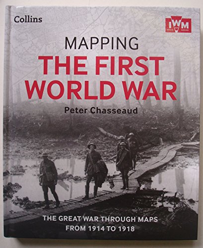
Follow the conflict of the World War 1 from 1914-1918 through a unique collection of historical maps, expert commentary and photographs. Published in association and including mapping from the archives of the Imperial War Museum. Over 150 maps demonstrating how the Great War was fought around the world. Types of maps featured: ? Small scale maps showing country boundaries and occupied territories ? Large-scale maps covering the key battles and offensives on all fronts of the war ? Trench maps showing detailed positions of the front line ? Maps from newspapers, battle planning and propaganda A fascinating collection of maps for anyone with an interest in aspects of WW1. This hardback book has 304 pages and measures: 27 x 23 x 2.5cm.
"synopsis" may belong to another edition of this title.
Review
"A visual feast for the eyes" All About History
"This book should be high on the list of any serious reader with a general interest in the First World War. For those interested in the history of military mapping, it is essential." Military History Monthly
“the appeal of this richly illustrated work lies in the maps – barrage maps, diagrams of "battlefield geometry" for artillery, diagrams showing the elevation of craters made by exploding mines, and pioneering aerial photography.” Richard Norton-Taylor, The Guardian
“A fascinating collection... All those who love studying maps will thoroughly enjoy tracing the conflict as it unfolded.” This is England Magazine
“Of the many publications appearing to mark the centenary of the outbreak of World War I, this book must stand above the crowd, offering a fascinating new angle on the subject.” Your Family Tree
Book Description
The Great war through maps from 1914 to 1918
"About this title" may belong to another edition of this title.
Other Popular Editions of the Same Title

Search results for Mapping The First World War: The Great War Through...

Stock Image
Mapping The First World War: The Great War Through Maps From 1914 - 1918
Seller: WorldofBooks, Goring-By-Sea, WS, United Kingdom
Seller rating 5 out of 5 stars
![]()
Paperback. Condition: Very Good. The book has been read, but is in excellent condition. Pages are intact and not marred by notes or highlighting. The spine remains undamaged. Seller Inventory # GOR007517235
Buy Used
� 2.90
� 5.60 shipping
Ships from United Kingdom to U.S.A.
Ships from United Kingdom to U.S.A.
Quantity: 14 available
Seller Image
Mapping The First World War: The Great War Through Maps From 1914 - 1918
Seller: MusicMagpie, Stockport, United Kingdom
Seller rating 5 out of 5 stars
![]()
Condition: Very Good. 1779262051. 5/20/2026 7:27:31 AM. Seller Inventory # U9780007941971
Buy Used
� 4.76
� 5.49 shipping
Ships from United Kingdom to U.S.A.
Ships from United Kingdom to U.S.A.
Quantity: 1 available
Seller Image
Mapping The First World War: The Great War Through Maps From 1914 - 1918
Seller: WeBuyBooks, Rossendale, LANCS, United Kingdom
Seller rating 5 out of 5 stars
![]()
Condition: Good. Most items will be dispatched the same or the next working day. A copy that has been read but remains in clean condition. All of the pages are intact and the cover is intact and the spine may show signs of wear. The book may have minor markings which are not specifically mentioned. Seller Inventory # rev3007166786
Buy Used
� 1.95
� 8.32 shipping
Ships from United Kingdom to U.S.A.
Ships from United Kingdom to U.S.A.
Quantity: 1 available
Stock Image
Mapping The First World War: The Great War Through Maps From 1914-1918
Seller: Better World Books Ltd, Dunfermline, United Kingdom
Seller rating 5 out of 5 stars
![]()
Condition: Very Good. Former library copy. Pages intact with possible writing/highlighting. Binding strong with minor wear. Dust jackets/supplements may not be included. Includes library markings. Stock photo provided. Product includes identifying sticker. Better World Books: Buy Books. Do Good. Seller Inventory # GRP102439603
Buy Used
� 5.62
� 5 shipping
Ships from United Kingdom to U.S.A.
Ships from United Kingdom to U.S.A.
Quantity: 2 available
Stock Image
Mapping The First World War: The Great War Through Maps From 1914 - 1918
Published by
Harpercollins 09/04/2014, 2014
ISBN 10: 0007941978
ISBN 13: 9780007941971
Used
Hardcover
Seller: AwesomeBooks, Wallingford, United Kingdom
Seller rating 5 out of 5 stars
![]()
Condition: Very Good. This book is in very good condition and will be shipped within 24 hours of ordering. The cover may have some limited signs of wear but the pages are clean, intact and the spine remains undamaged. This book has clearly been well maintained and looked after thus far. Money back guarantee if you are not satisfied. See all our books here, order more than 1 book and get discounted shipping. . Seller Inventory # 7719-9780007941971
Buy Used
� 9.98
� 4.12 shipping
Ships from United Kingdom to U.S.A.
Ships from United Kingdom to U.S.A.
Quantity: 2 available
Stock Image
Mapping The First World War: The Great War Through Maps From 1914 - 1918
Published by
Harpercollins 09/04/2014, 2014
ISBN 10: 0007941978
ISBN 13: 9780007941971
Used
Hardcover
Seller: Bahamut Media, Reading, United Kingdom
Seller rating 5 out of 5 stars
![]()
Condition: Very Good. Shipped within 24 hours from our UK warehouse. Clean, undamaged book with no damage to pages and minimal wear to the cover. Spine still tight, in very good condition. Remember if you are not happy, you are covered by our 100% money back guarantee. Seller Inventory # 6545-9780007941971
Buy Used
� 9.98
� 6.98 shipping
Ships from United Kingdom to U.S.A.
Ships from United Kingdom to U.S.A.
Quantity: 2 available
Stock Image
Xthe Works Mapping the First World War H
Seller: Brit Books, Milton Keynes, United Kingdom
Seller rating 4 out of 5 stars
![]()
Unknown Binding. Condition: Used; Very Good. ***Simply Brit*** Welcome to our online used book store, where affordability meets great quality. Dive into a world of captivating reads without breaking the bank. We take pride in offering a wide selection of used books, from classics to hidden gems, ensuring there is something for every literary palate. All orders are shipped within 24 hours and our lightning fast-delivery within 48 hours coupled with our prompt customer service ensures a smooth journey from ordering to delivery. Discover the joy of reading with us, your trusted source for affordable books that do not compromise on quality. Seller Inventory # 2414158
Buy Used
� 3.59
� 15.99 shipping
Ships from United Kingdom to U.S.A.
Ships from United Kingdom to U.S.A.
Quantity: 1 available
Seller Image
Mapping the First World War
Published by
Glasgow: Collins in association with Imperial War Museums, 2013
ISBN 10: 0007941978
ISBN 13: 9780007941971
Used
Hardcover
First Edition
Seller: BookLovers of Bath, Peasedown St. John, BATH, United Kingdom
Seller rating 5 out of 5 stars
![]()
Hardback in Dust Wrapper. Condition: Very Good. Dust Jacket Condition: Very Good. First edition (first printing). Hardback. Dust wrapper over matching pictorial boards; Measures 10�" x 9" (1.9 kg); pp 304; Index; Includes: Further reading list; Black & white photographs; Maps (some colour); Maps to the lining papers; Glossary; || The book is on the shelf, ready to be appropriately packed, and posted from the pastoral paradise of Peasedown St. John, Bath, by a real bookseller in a real book shop - with my personal guarantee and beady eye on the Consumer Contracts Regulations. REMEMBER! Buying my copy means the book shop Jack Russells get their supper! My Book #190502 ||. Seller Inventory # 190502
Buy Used
� 22.99
� 15 shipping
Ships from United Kingdom to U.S.A.
Ships from United Kingdom to U.S.A.
Quantity: 1 available
Stock Image
Mapping The First World War
Seller: Strawberry Hill Books, Rotherfield, East Sussex, United Kingdom
Seller rating 5 out of 5 stars
![]()
Hardcover. Condition: As New. Dust Jacket Condition: As New. 1st Edition. 1st printing. An unread book in an as new condition dust jacket. Seller Inventory # 042063
Buy Used
� 28.50
� 10 shipping
Ships from United Kingdom to U.S.A.
Ships from United Kingdom to U.S.A.
Quantity: 1 available