History of the World in Maps: The rise and fall of Empires, Countries and Cities - Hardcover
Book 1 of 5: History in Maps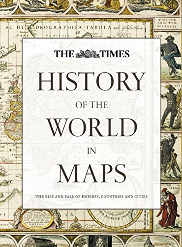
Synopsis
From Babylonian tablets to Google Maps, the world has evolved rapidly, along with the ways in which we see it. In this time, cartography has not only kept pace with these changes, but has often driven them. In this beautiful book, over 70 maps give a visual representation of the history of the world.
Every map tells a story and this book tells the incredible history of our world through maps, and includes many famous examples of cartography, along with some that deserve to be better known. See countries and cities come and go, empires rise and fall, significant geographical discoveries, and key historical events unfold.
Key maps shown include:
• Babylonian clay tablets, c.2300 BC and c.600 BC – some of the world’s oldest surviving maps.
• Waldseem�ller World Map, 1507 – the first map to use the name ‘America’ for the New World.
• Waghenaer chart, 1584 – a forerunner to modern nautical charts.
• Abel Buell map of North America, 1782 – the first map of the newly independent United States that was produced in America by an American.
• The Scramble for Africa, 1852/1898 – maps of new colonies being created.
• Ypres, 1918 – map of the aftermath of the First World War.
• Cuban Missile Crisis, 1962 – map used by President John F. Kennedy during the crisis.
"synopsis" may belong to another edition of this title.
About the Author
A historian and Sunday Times bestselling author with The Northman’s Fury, who studied at Cambridge and Johns Hopkins University.
He has written widely on the worlds of late antiquity and the early Middle Ages and his unique panoramic history of the nation was published by Collins: History of Britain in Maps.
He lives in London.
"About this title" may belong to another edition of this title.
Other Popular Editions of the Same Title

Search results for History of the World in Maps: The rise and fall of...

Seller Image
History of the World in Maps: The Rise and Fall of Empires, Countries and Cities
Published by
HarperCollins Publishers Ltd, 2014
ISBN 10: 0007588240
ISBN 13: 9780007588244
Used
Hardcover
Seller: MusicMagpie, Stockport, United Kingdom
Seller rating 5 out of 5 stars
![]()
Condition: Very Good. 1779780092. 5/26/2026 7:21:32 AM. Seller Inventory # U9780007588244
Buy Used
� 8.47
� 5.49 shipping
Ships from United Kingdom to U.S.A.
Ships from United Kingdom to U.S.A.
Quantity: 1 available
Stock Image
History of the World in Maps: The rise and fall of Empires, Countries and Cities
Published by
HarperCollins Publishers Ltd, 2014
ISBN 10: 0007588240
ISBN 13: 9780007588244
Used
Paperback
Seller: WorldofBooks, Goring-By-Sea, WS, United Kingdom
Seller rating 5 out of 5 stars
![]()
Paperback. Condition: Very Good. The book has been read, but is in excellent condition. Pages are intact and not marred by notes or highlighting. The spine remains undamaged. Seller Inventory # GOR006864008
Buy Used
� 9.98
� 5.60 shipping
Ships from United Kingdom to U.S.A.
Ships from United Kingdom to U.S.A.
Quantity: 4 available
Seller Image
History of the World in Maps: The rise and fall of Empires, Countries and Cities
Seller: WeBuyBooks, Rossendale, LANCS, United Kingdom
Seller rating 5 out of 5 stars
![]()
Condition: Like New. Most items will be dispatched the same or the next working day. An apparently unread copy in perfect condition. Dust cover is intact with no nicks or tears. Spine has no signs of creasing. Pages are clean and not marred by notes or folds of any kind. Seller Inventory # rev8772588799
Buy Used
� 6.23
� 10 shipping
Ships from United Kingdom to U.S.A.
Ships from United Kingdom to U.S.A.
Quantity: 1 available
Seller Image
History of the World in Maps: The Rise and Fall of Empires, Countries and Cities
Seller: Klondyke, Almere, Netherlands
Seller rating 5 out of 5 stars
![]()
Condition: Good. Original pictorial boards, dust jacket, map on endpapers, illustrated with numerous (double page) maps in colour, folio. Seller Inventory # 400085-MB13
Buy Used
� 19.56
� 17.27 shipping
Ships from Netherlands to U.S.A.
Ships from Netherlands to U.S.A.
Quantity: 1 available
Stock Image
The Times History of the World in Maps
Seller: Russell Books, Victoria, BC, Canada
Seller rating 5 out of 5 stars
![]()
Condition: Acceptable. Dust Jacket Condition: Fair. Seller Inventory # FORT933741
Stock Image
History of the World in Maps: The Rise and Fall of Empires, Countries and Cities
Published by
HarperCollins Publishers Ltd, 2014
ISBN 10: 0007588240
ISBN 13: 9780007588244
Used
Hardcover
Seller: Optimon Books, Gravesend, KENT, United Kingdom
Seller rating 5 out of 5 stars
![]()
Hardcover. Condition: Good. Book itself good; dustjacket badly torn at the back. Seller Inventory # 402956
Buy Used
� 54.99
� 15 shipping
Ships from United Kingdom to U.S.A.
Ships from United Kingdom to U.S.A.
Quantity: 1 available
Seller Image
History of the World in Maps: The Rise and Fall of Empires, Countries and Cities
Published by
Times Books, 2014
ISBN 10: 0007588240
ISBN 13: 9780007588244
Used
Hardcover
First Edition
Seller: The Berwyn Bookshop, BUCKLEY, FLINT, United Kingdom
Seller rating 4 out of 5 stars
![]()
Hardcover. Condition: Fine. 1st Edition. Fine condition. A beautifully illustrated guide. 2014 1st edition. Bright, tight and clean. Unclipped dust jacket with slight signs of being shelved at the edges. No inscriptions. 256pp. *This book is large and rather heavy. Additional postage will be applicable - please contact us to query if you wish*. Seller Inventory # 1508
Stock Image
The Times History of the World in Maps The Rise and Fall of Empires, Countries and Cities
Published by
HarperCollins Publishers Limited, 2014
ISBN 10: 0007588240
ISBN 13: 9780007588244
Used
Hardcover
Seller: Mooney's bookstore, Den Helder, Netherlands
Seller rating 4 out of 5 stars
![]()
Condition: Very good. Seller Inventory # E-9780007588244-2-2
Buy Used
� 65.11
� 12.91 shipping
Ships from Netherlands to U.S.A.
Ships from Netherlands to U.S.A.
Quantity: 1 available