
Order Total (1 Item Items):
Shipping Destination:

trailblazer publications hindhead surrey (128 results)
Skip to main search results
Product Type
- All Product Types
- Books (128)
- Magazines & Periodicals
- Comics
- Sheet Music
- Art, Prints & Posters
- Photographs
- Maps
-
Manuscripts &
Paper Collectibles
Condition
Binding
Collectible Attributes
- First Edition (4)
- Signed
- Dust Jacket
- Seller-Supplied Images (76)
- Not Printed On Demand
Free Shipping
Seller Location
Seller Rating
-

Trans-Canada Rail Guide
Published by Trailblazer Publications, United Kingdom, Hindhead, Surrey, 2003
ISBN 10: 1873756690ISBN 13: 9781873756690
Book
Paperback. Condition: Very Good. The book has been read, but is in excellent condition. Pages are intact and not marred by notes or highlighting. The spine remains undamaged.
-

Pembrokeshire Coast Path (British Walking Guides)
Published by Trailblazer Publications, United Kingdom, Hindhead, Surrey, 2004
ISBN 10: 1873756569ISBN 13: 9781873756560
Book
Paperback. Condition: Very Good. The book has been read, but is in excellent condition. Pages are intact and not marred by notes or highlighting. The spine remains undamaged.
-

Kilimanjaro - A Trekking Guide to Africa's Highest Mountain; Includes City Guides to Arusha, Moshi, Marangu, Nairobi and Dar Es Salaam
Published by Trailblazer Publications, United Kingdom, Hindhead, Surrey, 2003
ISBN 10: 1873756658ISBN 13: 9781873756652
Book
Paperback. Condition: Very Good. The book has been read, but is in excellent condition. Pages are intact and not marred by notes or highlighting. The spine remains undamaged.
-

Trans-Canada Rail Guide
Published by Trailblazer Publications, United Kingdom, Hindhead, Surrey, 1996
ISBN 10: 1873756054ISBN 13: 9781873756058
Book
Paperback. Condition: Very Good. A guide to Canada's trans-continental railroad. The journey through the Rocky Mountains ranks as one of the most scenic rail rides in the world. Covers the entire route from coast to coast. What to see and where to stay in the cities along the line, with information for all budgets. The book has been read, but is in excellent condition. Pages are intact and not marred by notes or highlighting. The spine remains undamaged.
-

Trans-Siberian Handbook
Published by Trailblazer Publications, United Kingdom, Hindhead, Surrey, 1991
ISBN 10: 1873756003ISBN 13: 9781873756003
Book
Paperback. Condition: Good. The book has been read but remains in clean condition. All pages are intact and the cover is intact. Some minor wear to the spine.
-
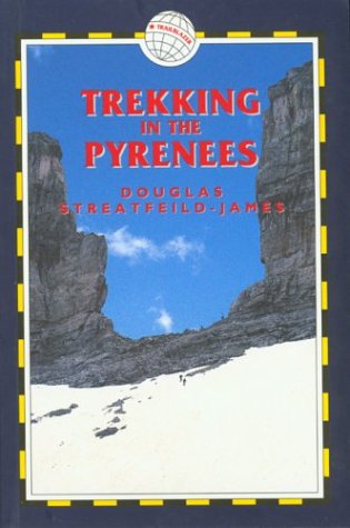
Trekking in the Pyrenees
Published by Trailblazer Publications, United Kingdom, Hindhead, Surrey, 2005
ISBN 10: 1873756828ISBN 13: 9781873756829
Book
Paperback. Condition: Very Good. The book has been read, but is in excellent condition. Pages are intact and not marred by notes or highlighting. The spine remains undamaged.
-
Pennine Way
Published by Trailblazer Publications, United Kingdom, Hindhead, Surrey, 2008
ISBN 10: 1905864027ISBN 13: 9781905864027
Book
Paperback. Condition: Very Good. Hiking route guide to the 256 mile Pennine Way, Britain's best known National Trail. The book has been read, but is in excellent condition. Pages are intact and not marred by notes or highlighting. The spine remains undamaged.
-
Hadrian's Wall Path: Wallsend to Bowness-on-Solway - Planning, Places to Stay, Places to Eat (British Walking Guides): Edition en anglais (Trailblazer)
Published by Trailblazer Publications, United Kingdom, Hindhead, Surrey, 2014
ISBN 10: 1905864582ISBN 13: 9781905864584
Book
Paperback. Condition: Very Good. All-in-one guide to walking Hadrian's Wall Path National Trail. The walking guide includes: 59 large-scale walking maps, 8 town plans, 8 stage maps and 2 overview maps; reviews of places to stay - pubs, hotels, B&Bs, hostels, bunkhouses, campsites, and places to eat, attractions along the way, history, and detailed public transport information showing access points on the path; GPS Waypoints. Ideal for walking the complete path, and for weekend and day walks. New edition also includes 32 pages colour and extra colour mapping for each stage of the walk. The information is written onto the maps, so walking directions, trlicky junctions, places to stay and eat, points of interest and waking times are all written onto the maps themselves in the places to which they apply. These are not general purpose maps but fully-edited maps drawn by walkers for walkers. This week-long walk is regarded as one of the least challenging National Trails. Also includes 30pp of colour photos and a 4pp colour flower guide. The book has been read, but is in excellent condition. Pages are intact and not marred by notes or highlighting. The spine remains undamaged.
-
Scottish Highlands (Hillwalking Guide S.)
Published by Trailblazer Publications, United Kingdom, Hindhead, Surrey, 2005
ISBN 10: 1873756844ISBN 13: 9781873756843
Book
Paperback. Condition: Very Good. This guide covers 81 hills and mountains in the Scottish Highlands. Detailed walking maps in the Trailblazer style including tricky trail junctions, walking times and points of interest written onto the maps themselves. It also details places to eat, local sights and a full-colour flora identification section. The book has been read, but is in excellent condition. Pages are intact and not marred by notes or highlighting. The spine remains undamaged.
-
Trekking in the Pyrenees
Published by Trailblazer Publications, United Kingdom, Hindhead, Surrey, 2001
ISBN 10: 187375650XISBN 13: 9781873756508
Book
Paperback. Condition: Very Good. The book has been read, but is in excellent condition. Pages are intact and not marred by notes or highlighting. The spine remains undamaged.
-
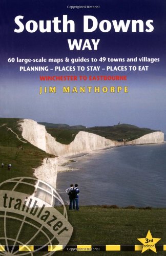
South Downs Way: Winchester to Eastbourne (Trailblazer British Walking Guides)
Published by Trailblazer Publications, United Kingdom, Hindhead, Surrey, 2009
ISBN 10: 1905864183ISBN 13: 9781905864188
Book
Paperback. Condition: Very Good. The complete walking guide to the 100-mile footpath from Winchester to Eastbourne. Includes 60 large-scale walking maps plus GPS waypoints and 11 town plans, itineraries for all walkers, practical information for all budgets and public transport information for day walks. The book has been read, but is in excellent condition. Pages are intact and not marred by notes or highlighting. The spine remains undamaged.
-

The Railway Anthology
Published by Trailblazer Publications, United Kingdom, Hindhead, Surrey, 2015
ISBN 10: 1905864620ISBN 13: 9781905864621
Book
Paperback. Condition: Very Good. Anthology of short excerpts from the writings of more than 50 famous literary and historical figures on the subject of railways and rail journeys around the world - Bill Bryson, Agatha Christie, William Dalrymple, Peter Fleming, Kenneth Grahame, Rudyard Kipling, Eric Newby, Christopher Portway, Paul Theroux, Colin Thubron and Mark Tully among many others. Brief biographies of all the writers quoted are included. Will appeal to rail travellers and armchair travellers alike. This hardback anthology is a perfect gift book. The book has been read, but is in excellent condition. Pages are intact and not marred by notes or highlighting. The spine remains undamaged.
-
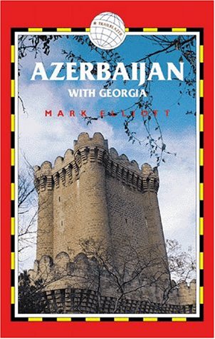
Azerbaijan with Georgia
Published by Trailblazer Publications, United Kingdom, Hindhead, Surrey, 1999
ISBN 10: 187375633XISBN 13: 9781873756331
Book
Paperback. Condition: Very Good. The book has been read, but is in excellent condition. Pages are intact and not marred by notes or highlighting. The spine remains undamaged.
-
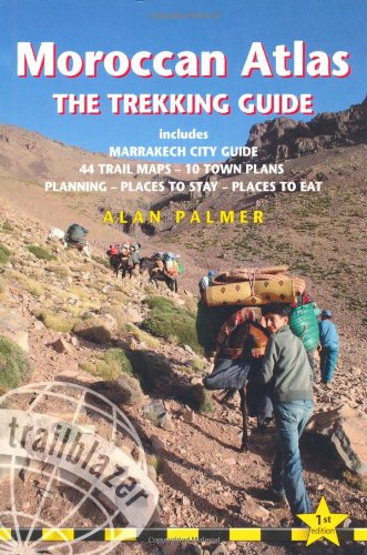
Moroccan Atlas - The Trekking Guide
Published by Trailblazer Publications, United Kingdom, Hindhead, Surrey, 2010
ISBN 10: 1873756771ISBN 13: 9781873756775
Book
Paperback. Condition: Very Good. A comprehensive and practical guidebook to trekking in the Moroccan Atlas mountains ideal for both experienced and novice trekkers. The guide contains: 50 detailed trekking maps showing route times, places to stay and points of interest; the best treks in Toubkal, Sirwa, Sahro, M'goun; practical information - planning your trip and getting to Morocco; historical and cultural background; Marrakech, Imlil, Taliouine, Ouarzazate, N'Kob, Boumalne du Dades, Azilal and Tabant - detailed street plans, where to stay, where to eat, what to see and getting to the start of your trek; green hiking and safety; language sections in Arabic, Berber and French; Moroccan flora and fauna - four page colour guide to the flowers of the High Atlas, plus an illustrated bird identification section. The book has been read, but is in excellent condition. Pages are intact and not marred by notes or highlighting. The spine remains undamaged.
-
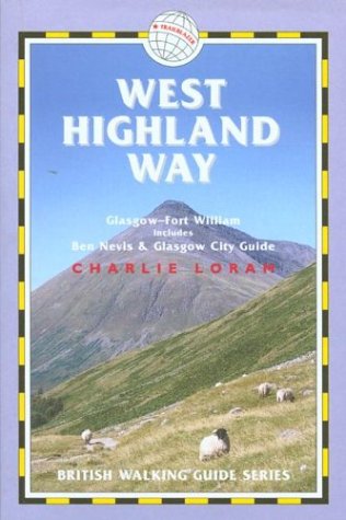
West Highland Way (British Walking Guide: Planning, Places to)
Published by Trailblazer Publications, United Kingdom, Hindhead, Surrey, 2003
ISBN 10: 1873756542ISBN 13: 9781873756546
Book
Paperback. Condition: Good. The book has been read but remains in clean condition. All pages are intact and the cover is intact. Some minor wear to the spine.
-

West Highland Way: (Trailblazer British Walking Guide) 53 Large-Scale Walking Maps & Guides to 26 Towns & Villages - Planning, Places to Stay, Places . Planning - Places to Stay - Places to Eat
Published by Trailblazer Publications, United Kingdom, Hindhead, Surrey, 2019
ISBN 10: 1912716011ISBN 13: 9781912716012
Book
Paperback. Condition: Very Good. Fully revised 7th edition. The West Highland Way passes through some of the most spectacular scenery in all of Britain. From the outskirts of Glasgow it winds for 96 miles (154.5km) along the wooded banks of Loch Lomond, across the wilderness of Rannoch Moor, over the mountains above Glencoe to a dramatic finish passing Ben Nevis - Britain's highest mountain - into the centre of Fort William. *4 large-scale town plans, 8 overview maps and 53 large-scale walking maps - at just under 1:20,000 - showing route times, places to stay, places to eat, points of interest and much more. These are not general-purpose maps but fully-edited maps drawn by walkers for walkers. *Itineraries for all walkers - whether walking the route in its entirety over a week to 10 days or sampling the highlights on day walks and short breaks *Practical information for all budgets - camping, bunkhouses, hostels, B&Bs, pubs and hotels; Glasgow through to Fort William - where to stay, where to eat, what to see, plus detailed street plans *Comprehensive public transport information - for all access points on the West Highland Way *Climb Ben Nevis - route descriptions to the top of Britain's highest mountain and other peaks *Flora and fauna - four page full colour flower guide, plus an illustrated section on local wildlife *Green hiking - understanding the local environment and minimizing our impact on it *Includes GPS waypoints. These are also downloadable from the Trailblazer website* *Plus extra colour sections: 16pp colour introduction and 10pp of colour mapping for stage sections (one stage per page) with trail profiles. The book has been read, but is in excellent condition. Pages are intact and not marred by notes or highlighting. The spine remains undamaged.
-
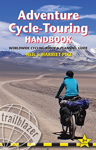
Adventure Cycle-Touring Handbook: Worldwide Cycling Route & Planning Guide (Trailblazer): Worldwide Route & Planning Guide
Published by Trailblazer Publications, United Kingdom, Hindhead, Surrey, 2015
ISBN 10: 190586468XISBN 13: 9781905864683
Book
Paperback. Condition: Very Good. '.the definitive guide to how, where, why and what to do on a cycle expedition.' Adventure Travel Magazine (UK) Every cyclist dreams of making the Big Trip, the Grand Cycle Tour abroad. Whether that's a two-week trip or a year-long journey, the Adventure Cycle-Touring Handbook is the comprehensive manual that will make that dream a reality. Riding across Asia, cycling in Africa or pedaling from Patagonia to Alaska, whether you're planning your own Big Trip or just enjoy reading about other people's adventures, the Handbook is guaranteed to illuminate, entertain and above all, inspire. This fully revised 3rd edition includes: PART 1 - Practical information *How to prepare for a long-distance trip*What to look for in a new bike with reviews of some of the world's best touring- and trekking-bikes*Adapting a standard bike for the Big Ride*Choosing components, equipment for the road and reviews of camping gear*Health precautions, inoculations, visas, money and safety PART 2 - Worldwide route outlines Across Europe, Asia, Australasia, North and South America and Africa; recommended routes within countries and overland. Everything from popular routes eg India's Leh-Manali Highway to lesser-known cycle-touring areas such as Mongolia. PART 3 - Tales from the Saddle Ten first-hand accounts of spoke-bending biking adventures worldwide. Introduction Why are so many people going bike touring these days? A minority pastime during the heyday of the car, cycling has once again become a popular choice for travellingespecially for long overseas trips. The first cycle-touring craze began in the 1870s. Then, as now, the bicycle offered a revolutionary way of touring: you go exactly where you want, when you want, and all under your own steam. This was before the age of the car and walking or riding a horse were the only other options until the bicycle. In 1885 the Rover Safety Bicycle came along, and for all the innovation since then, most modern touring bicycles would be recognizable to a Victorian, as would their derailleur gears. Bike touring is undergoing a boom at the moment but it is really one of many periodic rediscoveries. Bicycle design, components and gear are evolving to suit the changing needs and tastes of people. It's a combination of experimentation and using tried and tested designs, such as the 'diamond' frame of the Rover Safety Bicycle. The Adventure Cycle-Touring Handbook is all about looking at what people are choosing and using: what kind of bikes, what gear and what destinations are being chosen by today's bike tourers. There are many reasons for taking a bike on your next long trip. My own guess as to why bike touring is back in fashion is that many travellers get burned out by backpacking, which really amounts to travelling by bus and train for most of the time. Buses are certainly fast but they go from one noisy town to another, leaving little possibility of exploring the spaces in between, the places where the bus doesn't stop. Others use bikes to go even further off the beaten track: they want to go where buses don't go at all and perhaps where other vehicles cannot get to either. Paul Woloshansky built his own racks to carry extra gear after being told all too often: 'There's a prettier way to go but there's nothing out there at all.' Other adventurers, such as Sweden's Janne Corax (see p122), have said the same thing: there were times when there was no other way of getting to where they wanted to go. You couldn't get there on foot and you couldn't get there in a truck. It was possible only on a bicycle. Half the adventure, though, is in the riding itself. Being out in the fresh air and seeing much more than is possible from a bus or train window is always a good feeling, whether you are wandering around France or riding across India. A lot of today's cycle tourists are interested in the riding but not that interested in bikes. It's a means of transport and a way to carry bags comfortably, while sitting down and enjoying the view. Not everyone is drawn to the high passes of the Andes or the Himalaya but they are all enjoying that same sense of freedom and all that comes with itunexpected discoveries, off-route detours or an impromptu day off when you find a great place to stay. Trips like these are not as arduous as some expeditions but they are every bit as satisfyingand they are still adventures, for they allow for spontaneity. And if you are carrying a tent and camping gear, you're prepared for just about any eventuality because you've always got a place to spend the night. This book looks at the possibilities out there, the different styles of travelling and the basic gear and know-how that you need. We also look at some of the more exciting cycling destinations around the world, complete with suggestions as to which routes to take and what you need to plan a trip in that region. The Adventure Cycle-Touring Handbook does not set out to tell you exactly where to go: it's your adventure, after all. But it's good to have a general idea of a destination and what you're likely to find when you're there and this is what this book aims to do. In the final part of this book we include stories from all around the world, not just about the biking but also about the adventures cyclists had on their journeys. It's the old idea that a bike ride isn't just about the riding but also about the places you were able to get to and the people you got to meetand all because you decided to travel by bicycle. The book has been read, but is in excellent condition. Pages are intact and not marred by notes or highlighting. The spine remains undamaged.
More buying choices from other sellers on AbeBooks
New offers from � 15.99
Used offers from � 7.98
Also find Softcover
-
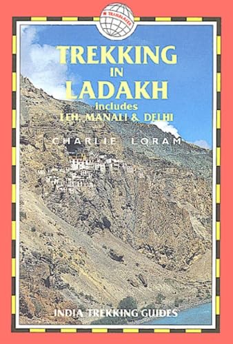
Trekking in Ladakh: includes Leh, Manali and Delhi (India Trekking Guide S.)
Published by Trailblazer Publications, United Kingdom, Hindhead, Surrey, 1999
ISBN 10: 1873756305ISBN 13: 9781873756300
Book
Paperback. Condition: Very Good. Fully revised and extended 2nd edition of Charlie Loram's guide originally published as LEH AND TREKKING IN LADAKH. Includes 70 detailed walking maps plus information on getting to Ladakh. The book has been read, but is in excellent condition. Pages are intact and not marred by notes or highlighting. The spine remains undamaged.
-
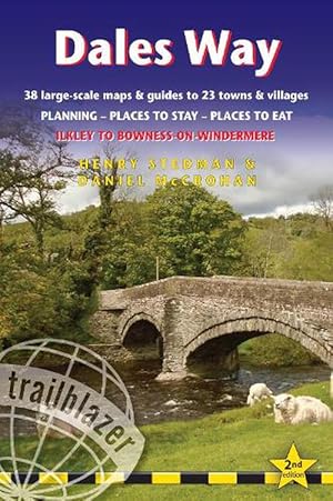
Dales Way Trailblazer Walking Guide (Paperback)
Published by Trailblazer Publications, Hindhead, Surrey, 2022
ISBN 10: 1912716305ISBN 13: 9781912716302
Book
Paperback. Condition: new. Paperback. All the information you need to enjoy your hiking adventure along the Dales Way in this fully revised and updated 2nd edition. Enjoy the Dales Way with this all-in-one guide to walking the long distance footpath from Ilkley, West Yorkshire, through the Yorkshire Dales National Park, for 84 miles (135km) to end in the Lake District, in Bowness-on-Windermere.New edition re-researched and rewritten, with maps redrawn in new two-colour styleIncludes 38 detailed walking maps, the largest-scale maps available - At just under 1:20,000 (8cm or 3 1/8 inches to 1 mile) these are bigger than even the most detailed walking maps currently available in the shopsUnique mapping features - walking times, directions, tricky junctions, places to stay, places to eat, points of interest. These are not general-purpose maps but fully edited maps drawn by walkers for walkersItineraries for all walkers - whether hiking the entire route or sampling highlights on day walks or short breaksDetailed public transport information - for all access pointsPractical information for all budgets. What to see, where to eat (cafes, pubs and restaurants); where to stay (B&Bs, hotels, bunkhouses, hostels & campsites) All-in-one guide to walking the Dales Way long distance footpath from Ilkley, West Yorkshire, through the Yorkshire Dales National Park, for 84 miles (135km) to end in the Lake District, in Bowness-on-Windermere. Shipping may be from multiple locations in the US or from the UK, depending on stock availability.
More buying choices from other sellers on AbeBooks
New offers from � 13.53
-
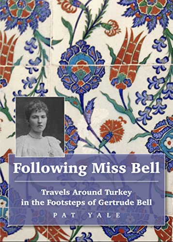
Following Miss Bell (Paperback)
Published by Trailblazer Publications, Hindhead, Surrey, 2023
ISBN 10: 1912716356ISBN 13: 9781912716357
Book
Paperback. Condition: new. Paperback. Travel around Turkey in the footsteps of the great British archaelogist Gertrude Bell.In 1889 Gertrude Bell, the great British archaeologist, writer and explorer, arrived in Constantinople (Istanbul) on the first of many visits to what is now Turkey. Over the next twenty-five years, she would travel the length and breadth of the country, climbing mountains Hasan and Cudi, crossing the Dicle (Tigris) on a raft of inflated goatskins and taking the earliest photographs of remote corners of the country.Veteran guidebook writer Pat Yale set out to retrace Bells Turkish adventures as one British traveller following another. Her journey took her to the site on the Syrian border where she met Lawrence of Arabia, to forgotten monasteries with solitary occupants and to villages where the conversation of trilingual inhabitants recalled a more multicultural past. Along the way, she rubbed shoulders with adherents of faiths that barely survive in modern Turkey, with young men manning barricades in the troubled southeast and refugees struggling to make new lives, with settled nomads making a living from modern tourism and a myriad taxi drivers whose stories exemplify the Turkish dream. Interwoven with each other, the tales of these two womens travels evoke a Turkey of then and now that is so much more complex than its modern tourist image suggests. The author of the Lonely Planet guide to Turkey interweaves her travels in modern Turkey with those of explorer Gertrude Bell 100 years ago, in an entertaining travelogue. Shipping may be from multiple locations in the US or from the UK, depending on stock availability.
More buying choices from other sellers on AbeBooks
New offers from � 14.49
-

North Downs Way (Trailblazer British Walking Guides) (Paperback)
Published by Trailblazer Publications, Hindhead, Surrey, 2018
ISBN 10: 1905864906ISBN 13: 9781905864904
Book
Paperback. Condition: new. Paperback. Practical guide to walking the North Downs Way National Trail that runs from Farnham in Surrey to Dover in Kent, partly following the old Pilgrims Way to the shrine of St Thomas a Becket at Canterbury. It winds its way through the protected landscape of the Surrey Hills and the Kent Downs, passing medieval churches, castles, Neolithic burial sites, vineyards and numerous WWII defences. There are literary associations with Swift, Cobbett, Dickens and Jane Austen. The guide includes: * 80 large-scale walking maps - at just under 1:20,000 - showing route times, places to stay, points of interest and much more, and 15 town plans. * 14 stage maps showing hills and descents, and 2 overview maps. * Itineraries for all walkers - whether walking the route in its entirety or sampling highlights on day walks and short breaks. * 15 town plans. * Places to stay with reviews - campsites, bunkhouses, hostels, B&Bs, pubs and hotels. * Places to eat with reviews - cafes, teashops, pubs, takeaways, restaurants. * What to see - historical, cultural, geographical background information. * Comprehensive public transport information - for all access points on the Path.* Flora and fauna - four page full colour flower guide, plus an illustrated section on local wildlife. * Green hiking - understanding the local environment and minimizing our impact on it. * GPS waypoints - also downloadable from the Trailblazer website. All-in-one, practical guide to walking the North Downs Way National Trail that runs from Farnham in Surrey to Dover in Kent, via Canterbury. Shipping may be from multiple locations in the US or from the UK, depending on stock availability.
More buying choices from other sellers on AbeBooks
New offers from � 14.72
-
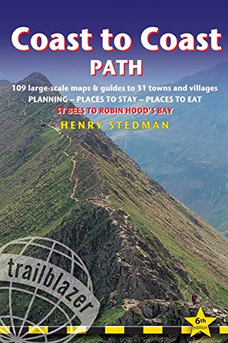
Coast to Coast Path: St Bees to Robin Hood's Bay : Planning, Places to Stay, Places to Eat (Trailblazer Guide): British Walking Guide: Planning, . to Eat; Includes (British Walking Guides)
Published by Trailblazer Publications, United Kingdom, Hindhead, Surrey, 2014
ISBN 10: 1905864574ISBN 13: 9781905864577
Book
Paperback. Condition: Very Good. Practical Trailblazer guide to walking the complete Coast-to-Coast Path from St Bees on the Irish Sea for almost 200 miles (320km) across the width of northern England to the North Sea at Robin's Hood Bay. This spectacular two-week walk crosses three National Parks - the Lake District, the Yorkshire Dales and the North York Moors. The guide covers the complete walking experience including: * 109 detailed walking maps: the largest-scale maps available. At just under 1:20,000 (8cm or 3 inches to 1 mile) these maps are bigger than even the most detailed walking maps currently available in the shops. * Unique mapping features - walking times, directions, tricky junctions, places to stay, places to eat, points of interest are all written onto the maps themselves in the places to which they apply. These are not general-purpose maps but fully-edited maps drawn by walkers for walkers. * Downloadable GPS waypoints. * An all-in-one guide: Trailblazer guides include practical information not usually found in walking guides to the UK: reviews of places to stay, places to eat, attractions along the way and detailed public transport information showing all access points on the path, for weekend and day walkers. Itineraries for all walkers: whether hiking the entire route or sampling highlights on day walks or short breaks. * Detailed public transport information for all access points. * Practical information for all budgets: what to see, where to eat (cafes, pubs and restaurants); where to stay (B&Bs, hotels, bunkhouses, hostels and campsites). The book has been read, but is in excellent condition. Pages are intact and not marred by notes or highlighting. The spine remains undamaged.
-
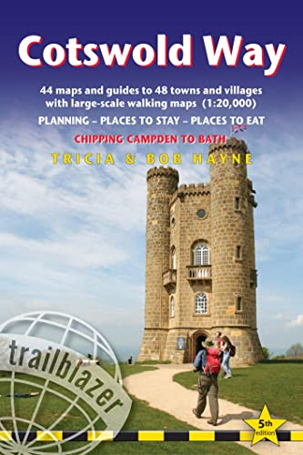
Cotswold Way Trailblazer Walking Guide 5e (Paperback)
Published by Trailblazer Publications, Hindhead, Surrey, 2024
ISBN 10: 1912716410ISBN 13: 9781912716418
Book
Paperback. Condition: new. Paperback. All the information you need to walk the Cotswold Way. Trailblazer Cotswold Way guide is an all-in-one hiking route guide with the most detailed maps for the Cotswold Way, a 102-mile National Trail that runs from Chipping Campden to Bath, following the beautiful Cotswold escarpment for most of its course.This is the fully revised and updated 5th edition. The trail leads through quintessentially English countryside with little villages of honey-coloured stone to the well-known town of Bath. The guideIncludes:44 large-scale maps at just under 1:20,000 (3 1/8 inches to 1 mile) - showing route times, places to stay, points of interest and much more and trail profiles8 town plans - Chipping Campden, Broadway, Winchcombe, Cheltenham, Painswick, Dursley, Wotton-under-Edge, and the city of Bath and 8 overview mapsFull details of all accommodations and campsites, restaurants and pubsItineraries for all walkers - whether walking the route in its entirety over seven to eight days or sampling the highlights on day walks and short breaksPractical information for all budgets: where to eat, what to seeComprehensive public transport information - for all access points on the Cotswold WayFlora and fauna - four page full colour flower guide, plus an illustrated section on local wildlifeGreen hiking - understanding the local environment and minimizing our impact on itBath city guideIncludes downloadable gps waypoints Practical guide to walking the 102-mile Cotswold Way from Chipping Campden to Bath, including 44 large-scale walking maps (1:20,000), places to stay, places to eat and public transport information. Shipping may be from multiple locations in the US or from the UK, depending on stock availability.
More buying choices from other sellers on AbeBooks
New offers from � 16.55
-

Offa's Dyke Path (Trailblazer British Walking Guides) (Paperback)
Published by Trailblazer Publications, Hindhead, Surrey, 2019
ISBN 10: 1912716038ISBN 13: 9781912716036
Book
Paperback. Condition: new. Paperback. The Offa's Dyke Path is a magnificent National Trail that runs from the North Wales coast to the Severn Estuary following the line of Offa's Dyke, an impressive 8th century earthwork along the English/Welsh border. The ever-changing landscape - the Wye Valley, the Black Mountains, the Shropshire Hills and the Clwydian Hills - is steeped in history and legend providing 177 miles of fascinating walking. This is the 5th edition. * New Two-Way edition, with directions both south to north and north to south * 98 walking maps - 1:20,000 (3-1/8 inches to 1 mile) - the largest-scale maps available. *Unique mapping features - walking times, directions, tricky junctions, places to stay, places to eat, points of interest. * Itineraries for all walkers - whether walking the route in its entirety or sampling the highlights on day walks and short breaks. * Practical information for all budgets - what to see, where to stay, where to eat: pubs, B&Bs, hotels, campsites, hostels. * Guides to 52 towns and villages - along the way * Public transport information - all access points on the path. * GPS waypoints. These are also downloadable from the Trailblazer website. * Includes extra colour sections: 16pp color introduction and 16pp of colour mapping for stage sections (one stage per page) with trail profiles. All-in-one, hiking route guide to 177-mile path following Offa's Dyke, the 8th century earthwork along the Wales/England border, with Two-Way directions, Chepstow to Prestatyn and Prestatyn to Chepstow. 98 large-scale maps; full details of all accommodations with reviews, and restaurants, pubs, teashops with reviews, public transport information. Shipping may be from multiple locations in the US or from the UK, depending on stock availability.
More buying choices from other sellers on AbeBooks
New offers from � 16.89
-
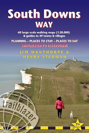
South Downs Way (Trailblazer British Walking Guides) (Paperback)
Published by Trailblazer Publications, Hindhead, Surrey, 2022
ISBN 10: 1912716232ISBN 13: 9781912716234
Book
Paperback. Condition: new. Paperback. Practical, complete guide to walking the South Downs Way, a 100-mile National Trail footpath which follows the line of chalk hills stretching from Winchester to Eastbourne in southern England. Includes * 82 Maps: 60 large-scale walking maps - 1:20,000 (3-1/8 inches to 1 mile), 11 town plans, 10 stage maps with trail profiles showing hills and descents, and 2 overview maps. * Detailed accommodation with reviews: B&Bs, campsites, pubs, hotels, bunkhouses. * Where to eat with reviews: cafes, teashops, pubs, takeaways and restaurants. * Comprehensive public transport information with frequency of services for all access points on the Path. * Downloadable GPS waypoints. * Itineraries for all walkers, whether hiking the entire route or sampling highlights on day walks, weekends or short breaks. * Unique mapping features - walking times, directions, tricky junctions, places to stay, places to eat, points of interest written onto the maps. * Flora and fauna - four page full colour flower guide, plus an illustrated section on local wildlife * Green hiking - understanding the local environment and minimizing our impact on it. Practical, all-in-one guidebook to walking the South Downs Way National Trail with 60 large-scale walking maps (1:20,000), places to stay, places to eat, what to see and public transport information. Shipping may be from multiple locations in the US or from the UK, depending on stock availability.
More buying choices from other sellers on AbeBooks
New offers from � 16.89
-

Thames Path (Trailblazer British Walking Guides) (Paperback)
Published by Trailblazer Publications, Hindhead, Surrey, 2022
ISBN 10: 1912716275ISBN 13: 9781912716272
Book
Paperback. Condition: new. Paperback. Barrier in London. Officially 184 miles (294km) in length (although the actual distance you walk will depend on a number of decisions you make en route), the path meanders, accompanied by its watery muse, through pristine and tranquil countryside, past historic sites and buildings, via pub, lock, weir, and the occasional scattering of waterfowl, to a city, once the fulcrum of an empire, and now the heart of modern day England. The river, responsible for the metropolis' very being, tells tales, inspires artists, accommodates swans, geese, and water voles, reflects the silhouettes of red kites and kingfishers, provides employment, entices adventure, and allows time for carefree pilgrims to procrastinate and think. Following its banks is a grand way to go for a ramble. The path begins, as the river does, in a meadow in the Cotswolds; its upper reaches lonely and wild, the meadows and banks the domain of waterfowl and willows; a collage of wild flowers, otters, fishermen and farmers. As the waters deepen and spread the settlements along its banks gradually begin to grow in both size and grandeur, and reaching Oxford, the solitude of the river slowly subsides and the trail becomes as much about historic towns, churches, abbeys and castles as it does the river. Lechlade, Abingdon, Wallingford, Henley . they all owe their location to the Thames, and different eras, when the river was a life source, a place of conflict, a boundary, a mode of transport and the provider of leisure, which, thankfully--for us, at least--it remains to this day. Squeezing through the ancient Goring Gap, loomed over by the Chiltern Hills, you pass Runnymede--the site of the signing of Magna Carta--and Windsor Castle; where the aeroplanes overhead hint at the ominous size of the city to come. Walking in London is not as blighted by sound, fury and concrete as many may imagine, as the river--and especially the route along the south bank in London--remains relatively countrified, at least as far as Putney, from which the approaching sights of Westminster and Tower Bridge offer comparably fine vistas to anywhere along the Thames' green and scenic upper reaches. Leaving central London, the regenerated dockland areas of East London (ideas of what constitutes 'wild' in the modern world are of course open to debate) lure you to your journey's end and the conclusion of a most enjoyable and magnificently-varied riparian ramble, quite like no other in Britain. Yet the Thames Path is more than just a trek, more than a long walk, more than just a national trail; the river acts as a postgraduate course in the history of a nation, a counselor to the modern world, a reminder of the importance of protecting the natural habitats which gave us what we have. But most importantly--at least, for those wishing to spend some time in the river's company, and indeed planning on doing so with the help of this book--the Thames Path is a fluvial escapade of the finest kind. -Includes 90 walking maps--the largest-scale maps available. At a scale of just under 1:20,000 (8cm or 3-1/8 inches to one mile) these are bigger than the most detailed walking maps currently available in the shops. -Unique mapping features--walking times, directions, tricky junctions, places to stay and eat, points of interest. These are not general-purpose maps but fully-edited maps drawn by walkers for walkers. -Itineraries for all walkers--whether hiking the 184-mile route in its entirety or sampling the highlights on day walks or short breaks. -Includes detailed public transport information for all access points. -Practical information for all budgets--what to see, where to stay, where to eat: pubs, hotels, B&B, camping, bunkhouses, hostels. -GPS waypoints. These are also downloadable from the Trailblazer website. -Plus--extra color sections: 16pp color introduction and 16pp of color mapping for stag Shipping may be from multiple locations in the US or from the UK, depending on stock availability.
More buying choices from other sellers on AbeBooks
New offers from � 16.89
-
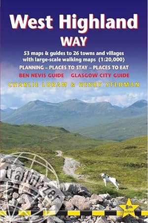
West Highland Way (Paperback)
Published by Trailblazer Publications, Hindhead, Surrey, 2022
ISBN 10: 1912716291ISBN 13: 9781912716296
Book
Paperback. Condition: new. Paperback. All the information you need to enjoy your hiking adventure along the West Highland Way in this fully revised 8th edition.The West Highland Way passes through some of the most spectacular scenery in all of Britain. From the outskirts of Glasgow it winds for 96 miles (154.5km) along the wooded banks of Loch Lomond, across the wilderness of Rannoch Moor, over the mountains above Glencoe to a dramatic finish passing Ben Nevis - Britain's highest mountain - into the centre of Fort William.4 large-scale town plans, 8 overview maps and 53 large-scale walking maps - at just under 1:20,000 - showing route times, places to stay, places to eat, points of interest and much more. These are not general-purpose maps but fully-edited maps drawn by walkers for walkers.Itineraries for all walkers - whether walking the route in its entirety over a week to 10 days or sampling the highlights on day walks and short break.Practical information for all budgets - camping, bunkhouses, hostels, B&Bs, pubs and hotels; Glasgow through to Fort William - where to stay, where to eat, what to see, plus detailed street plans.Comprehensive public transport information - for all access points on the West Highland Way.Climb Ben Nevis - route descriptions to the top of Britain's highest mountain and other peaks.Flora and fauna - four page full colour flower guide, plus an illustrated section on local wildlife.Green hiking - understanding the local environment and minimizing our impact on it.Includes GPS waypoints. - also downloadable from the Trailblazer website.Plus extra colour sections: 16pp colour introduction and 10pp of colour mapping for stage sections (one stage per page) with trail profiles. All the information you need to enjoy your hiking adventure along the West Highland Way in this fully revised 8th edition. Shipping may be from multiple locations in the US or from the UK, depending on stock availability.
More buying choices from other sellers on AbeBooks
New offers from � 16.89
-
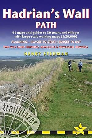
Hadrian's Wall Path Trailblazer walking guide (Paperback)
Published by Trailblazer Publications, Hindhead, Surrey, 2023
ISBN 10: 1912716372ISBN 13: 9781912716371
Book
Paperback. Condition: new. Paperback. All the information you need to enjoy your hiking adventure along Hadrian's Wall Path in this fully revised 7th edition.Hadrian's Wall Path, 84 miles from end to end, follows the course of northern Europe's largest surviving Roman monument, a 2nd-century fortification built - in the border country between England and Scotland - on the orders of the Emperor Hadrian in AD122. Opened in 2003, the path crosses the beautiful border country between England and Scotland. It is the first National Trail to follow the course of a UNESCO World Heritage Site. This week-long walk is regarded as one of the least challenging National Trails.This 7th edition has been re-walked and fully updated.8 town plans and 59 large-scale walking maps - at just under 1:20,000 - showing route times, places to stay, points of interest and much morePlus 8 stage maps and 2 overview mapsItineraries for all walkers - whether walking the route in its entirety over seven to eight days or sampling the highlights on day walks and short breaksPractical information for all budgetsWhere to stay with reviews - camping, bunkhouses, hostels, B&Bs, pubs and hotelsWhere to eat with reviews - cafes, pubs, tea-shops, restaurants, takeaways and shops/supermarketsWhat to see - historical, cultural, geographical informationDetailed street plansComprehensive public transport information - for all access points on the Hadrian's Wall PathFlora and fauna - four page full colour flower guide, plus an illustrated section on local wildlifeGreen hiking - understanding the local environment and minimizing our impact on itNewcastle city guideGPS waypoints. These are also downloadable from the Trailblazer websiteIncludes extra colour sections: 16pp colour introduction and 16pp of colour mapping for stage sections (one stage per page) with trail profiles. All the information you need to enjoy your hiking adventure along Hadrian's Wall Path in this fully revised 7th edition. Shipping may be from multiple locations in the US or from the UK, depending on stock availability.
More buying choices from other sellers on AbeBooks
New offers from � 16.89
-
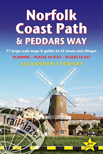
Norfolk Coast Path and Peddars Way (Paperback)
Published by Trailblazer Publications, Hindhead, Surrey, 2023
ISBN 10: 1912716399ISBN 13: 9781912716395
Book
Paperback. Condition: new. Paperback. All the information you need to enjoy your hiking adventure along the Norfolk Coast Path and Peddars Way.The Norfolk Coast Path & Peddars Way cover 130-miles of walking trails. The Peddars Way runs through East Anglia from Knettishall Heath on the Norfolk/Suffolk border and follows a Roman road to Holme-next-the-Sea. From here it becomes the Norfolk Coast Path, hugging the beautiful Norfolk coastline through Holkham, Wells, Blakeney and Cley to Cromer before it rounds the shoulder of the county and continues along the superb beaches and crumbling cliffs to Mundesley, Sea Palling and Great Yarmouth, finishing just before the Suffolk border.Includes:77 large-scale walking maps - at just under 1: 20,000 (8cm or 3 and one eighth inches to 1 mile) our maps are bigger than even the most detailed walking maps currently available, with walking directions, tricky junctions, places to stay and eat, points of interest and walking times written onto the mapsText and maps in clear TWO-COLOUR styleAll standards of accommodation with reviews: campsites, B&Bs, hostels, hotels, bunkhousesWhere to eat with reviews: cafes, teashops, pubs, takeaways and restaurantsDetailed public transport information for all villages and towns along the pathsItineraries for all walkers including one day Peddars Way and Norfolk Coast Path walks, car parks near the trail for weekend and day walkersIncludes 40 mile extension of the National Trail from Cromer to Hopton-on-SeaDownloadable GPS waypoints with what3words refsColour pictures including a 6 page colour bird and flower guideHistorical, cultural and geographical background information All-in-one hiking route guide, route maps and accommodation for this 130-mile route in Norfolk. Includes 77 large-scale maps (1:20,000); 8 town plans, 10 stage maps with profiles and 2 overview maps. Full details of all accommodation and campsites, restaurants and pubs; plus full public transport information. Includes day-walks. Shipping may be from multiple locations in the US or from the UK, depending on stock availability.
More buying choices from other sellers on AbeBooks
New offers from � 16.89
-
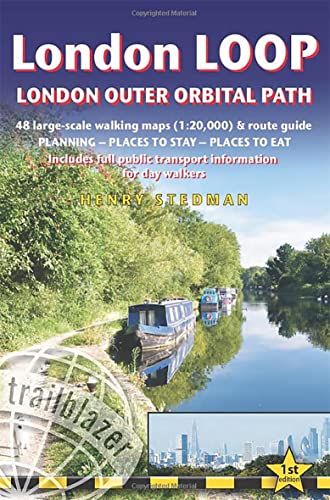
London LOOP - London Outer Orbital Path (Trailblazer British Walking Guides) (Paperback)
Published by Trailblazer Publications, Hindhead, Surrey, 2021
ISBN 10: 1912716216ISBN 13: 9781912716210
Book
Paperback. Condition: new. Paperback. The London LOOP - London Outer Orbital Path - is a 1503/4 -mile (242.6km) circuit of the country's capital. It was largely the brainchild of an organisation called the London Walking Forum, which was formed in the early 1990s to encourage people to visit and take advantage of the many green spaces in the capital. They created a walk that followed, roughly, the outskirts of Greater London - and the LOOP was born. The official start is at Erith and the end at Purfleet-on-Thames. Although it does stray into some of the home counties, the trail does, however, stay within the M25 and by-and-large sticks to the 'Metropolitan Green Belt' - that buffer zone of green, largely undeveloped land that encircles the city. New title - covers the complete circuit but also ideal for London-based day walks New style trail maps and text colour All-in-one guide - Trailblazer guides include practical information not usually found in walking guides to the UK: reviews of places to stay, places to eat, attractions along the way and detailed public transport information showing all access points on the path, for day walkers. The largest scale walking maps available - At just under 1:20,000 (8cm or 3-1/8 inches to 1 mile) our maps (fully-edited and drawn by walkers for walkers) are bigger than even the most detailed walking maps currently available in shops or online. All-in-one guide to walking the complete London LOOP - London Outer Orbital Path, including trail maps, places to stay, where to eat and what to see, public transport information. Shipping may be from multiple locations in the US or from the UK, depending on stock availability.
More buying choices from other sellers on AbeBooks
New offers from � 16.89