Items related to Offa's Dyke Path (Trailblazer British Walking Guides):...
Offa's Dyke Path (Trailblazer British Walking Guides): Chepstow to Prestatyn & Prestatyn to Chepstow, Planning, Places to Stay, Places to Eat: ... to Eat; Includes 98 Large-Scale Walking Maps - Softcover
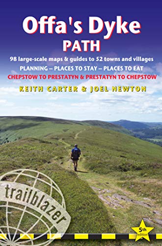

The Offa's Dyke Path is a magnificent National Trail that runs from the North Wales coast to the Severn Estuary following the line of Offa's Dyke an impressive 8th century earthwork along the English/Welsh border. The ever-changing landscape - the Wye Valley the Black Mountains the Shropshire Hills and the Clwydian Hills - is steeped in history and legend providing 177 miles of fascinating walking.
"synopsis" may belong to another edition of this title.
Review:
For the previous edition: 'The Trailblazer series stands head, shoulders, waist and ankles above the rest. They are particularly strong on mapping...' The Sunday Times (UK). 'Keith Carter's Offa's Dyke Path is good, with amusing hand-drawn maps' The Daily Telegraph (UK). 'Fully updated and includes downloadable GPS waypoints'._- Strider Magazine (UK) 'All the info you need'_- Wanderlust Magazine (UK). 'Recommended'._- Country Walking (UK. --Wanderlust
About the Author:
Keith Carter has over 40 years' experience of hiking Britain's long-distance paths with numerous magazine articles published on the subject. He is also co-author of Trailblazer's Pennine Way (British Walking Guide). Joel Newton has updated this 5th edition. He is a keen outdoorsman, having completed most of Britains long-distance paths. He is the co-author with Henry Stedman of British Walking Guides from Trailblazer: Exmoor & North Devon Coast Path, Cornwall Coast Path and Dorset & South Devon Coast Path, and author of Thames Path.
"About this title" may belong to another edition of this title.
- PublisherTrailblazer Publications
- Publication date2019
- ISBN 10 1912716038
- ISBN 13 9781912716036
- BindingPaperback
- Edition number5
- Number of pages268
Buy New
Learn more about this copy
� 14.64
Shipping:
� 2.11
Within U.S.A.
Top Search Results from the AbeBooks Marketplace
Seller Image
British Walking Guides Offa's Dyke Path : 98 Large-scale Maps & Guides to 52 Towns and Villages; Planning-places to Stay-places to Eat
Published by
Trailblazer Publications
(2019)
ISBN 10: 1912716038
ISBN 13: 9781912716036
New
Softcover
Quantity: 5
Seller:
Rating
Book Description Condition: New. Seller Inventory # 33806434-n
Buy New
� 14.64
Convert currency
Seller Image
Offa's Dyke Path (Trailblazer British Walking Guides) (Paperback)
Published by
Trailblazer Publications, Hindhead, Surrey
(2019)
ISBN 10: 1912716038
ISBN 13: 9781912716036
New
Paperback
Quantity: 1
Seller:
Rating
Book Description Paperback. Condition: new. Paperback. The Offa's Dyke Path is a magnificent National Trail that runs from the North Wales coast to the Severn Estuary following the line of Offa's Dyke, an impressive 8th century earthwork along the English/Welsh border. The ever-changing landscape - the Wye Valley, the Black Mountains, the Shropshire Hills and the Clwydian Hills - is steeped in history and legend providing 177 miles of fascinating walking. This is the 5th edition. * New Two-Way edition, with directions both south to north and north to south * 98 walking maps - 1:20,000 (3-1/8 inches to 1 mile) - the largest-scale maps available. *Unique mapping features - walking times, directions, tricky junctions, places to stay, places to eat, points of interest. * Itineraries for all walkers - whether walking the route in its entirety or sampling the highlights on day walks and short breaks. * Practical information for all budgets - what to see, where to stay, where to eat: pubs, B&Bs, hotels, campsites, hostels. * Guides to 52 towns and villages - along the way * Public transport information - all access points on the path. * GPS waypoints. These are also downloadable from the Trailblazer website. * Includes extra colour sections: 16pp color introduction and 16pp of colour mapping for stage sections (one stage per page) with trail profiles. All-in-one, hiking route guide to 177-mile path following Offa's Dyke, the 8th century earthwork along the Wales/England border, with Two-Way directions, Chepstow to Prestatyn and Prestatyn to Chepstow. 98 large-scale maps; full details of all accommodations with reviews, and restaurants, pubs, teashops with reviews, public transport information. Shipping may be from multiple locations in the US or from the UK, depending on stock availability. Seller Inventory # 9781912716036
Buy New
� 16.82
Convert currency
Stock Image
Offa's Dyke Path: British Walking Guide: planning, places to stay, places to eat; includes 98 large-scale walking maps (British Walking Guides)
Published by
Trailblazer Publications
(2019)
ISBN 10: 1912716038
ISBN 13: 9781912716036
New
Paperback
Quantity: 1
Seller:
Rating
Book Description Paperback. Condition: new. New. Fast Shipping and good customer service. Seller Inventory # Holz_New_1912716038
Buy New
� 29.64
Convert currency
Stock Image
Offa's Dyke Path: British Walking Guide: planning, places to stay, places to eat; includes 98 large-scale walking maps (British Walking Guides)
Published by
Trailblazer Publications
(2019)
ISBN 10: 1912716038
ISBN 13: 9781912716036
New
Softcover
Quantity: 1
Seller:
Rating
Book Description Condition: New. Book is in NEW condition. 0.57. Seller Inventory # 1912716038-2-1
Buy New
� 32.90
Convert currency
Stock Image
Offa's Dyke Path: British Walking Guide: planning, places to stay, places to eat; includes 98 large-scale walking maps (British Walking Guides)
Published by
Trailblazer Publications
(2019)
ISBN 10: 1912716038
ISBN 13: 9781912716036
New
Softcover
Quantity: 1
Seller:
Rating
Book Description Condition: New. New! This book is in the same immaculate condition as when it was published 0.57. Seller Inventory # 353-1912716038-new
Buy New
� 32.91
Convert currency
Stock Image
Offa's Dyke Path: British Walking Guide: planning, places to stay, places to eat; includes 98 large-scale walking maps (British Walking Guides)
Published by
Trailblazer Publications
(2019)
ISBN 10: 1912716038
ISBN 13: 9781912716036
New
Softcover
Quantity: 1
Seller:
Rating
Book Description Condition: new. Seller Inventory # FrontCover1912716038
Buy New
� 30.52
Convert currency
Seller Image
British Walking Guides Offa's Dyke Path : 98 Large-scale Maps & Guides to 52 Towns and Villages; Planning-places to Stay-places to Eat
Published by
Trailblazer Publications
(2019)
ISBN 10: 1912716038
ISBN 13: 9781912716036
New
Softcover
Quantity: 5
Seller:
Rating
Book Description Condition: New. Seller Inventory # 33806434-n
Buy New
� 19.24
Convert currency
Stock Image
British Walking Guides Offa's Dyke Path: 98 Large-scale Maps & Guides to 52 Towns and Villages; Planning-places to Stay-places to Eat
Published by
Trail Blazer Pubns
(2019)
ISBN 10: 1912716038
ISBN 13: 9781912716036
New
Paperback
Quantity: 1
Seller:
Rating
Book Description Paperback. Condition: Brand New. 5th edition. 256 pages. 7.00x4.75x0.75 inches. In Stock. Seller Inventory # 1912716038
Buy New
� 31.49
Convert currency
Seller Image
Offa's Dyke Path (Trailblazer British Walking Guides) (Paperback)
Published by
Trailblazer Publications, Hindhead, Surrey
(2019)
ISBN 10: 1912716038
ISBN 13: 9781912716036
New
Paperback
Quantity: 1
Seller:
Rating
Book Description Paperback. Condition: new. Paperback. The Offa's Dyke Path is a magnificent National Trail that runs from the North Wales coast to the Severn Estuary following the line of Offa's Dyke, an impressive 8th century earthwork along the English/Welsh border. The ever-changing landscape - the Wye Valley, the Black Mountains, the Shropshire Hills and the Clwydian Hills - is steeped in history and legend providing 177 miles of fascinating walking. This is the 5th edition. * New Two-Way edition, with directions both south to north and north to south * 98 walking maps - 1:20,000 (3-1/8 inches to 1 mile) - the largest-scale maps available. *Unique mapping features - walking times, directions, tricky junctions, places to stay, places to eat, points of interest. * Itineraries for all walkers - whether walking the route in its entirety or sampling the highlights on day walks and short breaks. * Practical information for all budgets - what to see, where to stay, where to eat: pubs, B&Bs, hotels, campsites, hostels. * Guides to 52 towns and villages - along the way * Public transport information - all access points on the path. * GPS waypoints. These are also downloadable from the Trailblazer website. * Includes extra colour sections: 16pp color introduction and 16pp of colour mapping for stage sections (one stage per page) with trail profiles. All-in-one, hiking route guide to 177-mile path following Offa's Dyke, the 8th century earthwork along the Wales/England border, with Two-Way directions, Chepstow to Prestatyn and Prestatyn to Chepstow. 98 large-scale maps; full details of all accommodations with reviews, and restaurants, pubs, teashops with reviews, public transport information. Shipping may be from our Sydney, NSW warehouse or from our UK or US warehouse, depending on stock availability. Seller Inventory # 9781912716036
Buy New
� 21.01
Convert currency
Seller Image
Offa's Dyke Path (Trailblazer British Walking Guides) (Paperback)
Published by
Trailblazer Publications, Hindhead, Surrey
(2019)
ISBN 10: 1912716038
ISBN 13: 9781912716036
New
Paperback
Quantity: 1
Seller:
Rating
Book Description Paperback. Condition: new. Paperback. The Offa's Dyke Path is a magnificent National Trail that runs from the North Wales coast to the Severn Estuary following the line of Offa's Dyke, an impressive 8th century earthwork along the English/Welsh border. The ever-changing landscape - the Wye Valley, the Black Mountains, the Shropshire Hills and the Clwydian Hills - is steeped in history and legend providing 177 miles of fascinating walking. This is the 5th edition. * New Two-Way edition, with directions both south to north and north to south * 98 walking maps - 1:20,000 (3-1/8 inches to 1 mile) - the largest-scale maps available. *Unique mapping features - walking times, directions, tricky junctions, places to stay, places to eat, points of interest. * Itineraries for all walkers - whether walking the route in its entirety or sampling the highlights on day walks and short breaks. * Practical information for all budgets - what to see, where to stay, where to eat: pubs, B&Bs, hotels, campsites, hostels. * Guides to 52 towns and villages - along the way * Public transport information - all access points on the path. * GPS waypoints. These are also downloadable from the Trailblazer website. * Includes extra colour sections: 16pp color introduction and 16pp of colour mapping for stage sections (one stage per page) with trail profiles. All-in-one, hiking route guide to 177-mile path following Offa's Dyke, the 8th century earthwork along the Wales/England border, with Two-Way directions, Chepstow to Prestatyn and Prestatyn to Chepstow. 98 large-scale maps; full details of all accommodations with reviews, and restaurants, pubs, teashops with reviews, public transport information. Shipping may be from our UK warehouse or from our Australian or US warehouses, depending on stock availability. Seller Inventory # 9781912716036
Buy New
� 19.25
Convert currency