
Order Total (1 Item Items):
Shipping Destination:

ordnance survey hants (Over 2,400 results)
Skip to main search results
Product Type
- All Product Types
- Books (2,493)
- Magazines & Periodicals
- Comics
- Sheet Music
- Art, Prints & Posters
- Photographs
- Maps (1)
-
Manuscripts &
Paper Collectibles
Condition
Binding
- All Bindings
- Hardcover
- Softcover (766)
Collectible Attributes
- First Edition
- Signed
- Dust Jacket (7)
- Seller-Supplied Images (1,166)
- Not Printed On Demand
Free Shipping
Seller Location
Seller Rating
-

South West England: 05 (Out & about walking guides to Great Britain)
Published by Ordnance Survey, United Kingdom, Hants, 1995
ISBN 10: 0319005771ISBN 13: 9780319005774
Book
Paperback. Condition: Very Good. The book has been read, but is in excellent condition. Pages are intact and not marred by notes or highlighting. The spine remains undamaged.
-
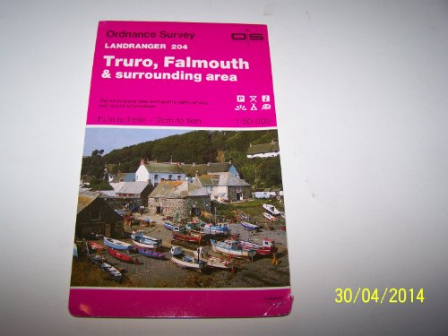
Truro, Falmouth and Surrounding Area (Sheet 204) (OS Landranger Map)
Published by Ordnance Survey, United Kingdom, Hants, 1992
ISBN 10: 0319222047ISBN 13: 9780319222041
Book
Paperback. Condition: Very Good. This map is part of the Landranger (Pink) series and is designed for people who really want to get to know an area. It includes the following information: tourist information, camping and caravan sites, picnic areas and viewpoints, selected places of interest and rights of way information for England and Wales. Each map in the series covers an area of 40 km by 40 km (25 miles by 25 miles) and like other Ordnance Survey maps, National Grid squares are provided so that any feature can be given a unique reference number. Perfect for planning ahead and local excursions, these maps are full of useful information that will help you really get to know an area. The book has been read, but is in excellent condition. Pages are intact and not marred by notes or highlighting. The spine remains undamaged.
-
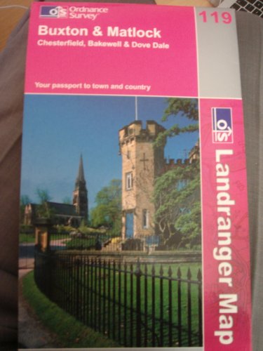
Buxton and Matlock: Chesterfield, Bakewell and Dove Dale: Sheet 119 (Landranger Maps)
Published by Ordnance Survey, United Kingdom, Hants, 2002
ISBN 10: 0319227197ISBN 13: 9780319227190
Book
Paperback. Condition: Very Good. This map is part of the Landranger (Pink) series and is designed for people who really want to get to know an area. It includes the following information: tourist information, camping and caravan sites, picnic areas and viewpoints, selected places of interest and rights of way information for England and Wales. Each map in the series covers an area of 40 km by 40 km (25 miles by 25 miles) and like other Ordnance Survey maps, National Grid squares are provided so that any feature can be given a unique reference number. Perfect for planning ahead and local excursions, these maps are full of useful information that will help you really get to know an area. The book has been read, but is in excellent condition. Pages are intact and not marred by notes or highlighting. The spine remains undamaged.
-
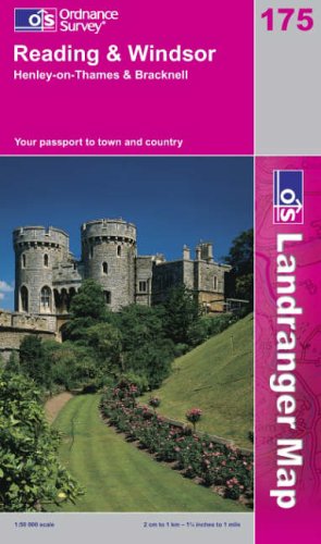
Reading and Windsor, Henley-on-Thames and Bracknell: Sheet 175 (Landranger Maps)
Published by Ordnance Survey, United Kingdom, Hants, 2002
ISBN 10: 0319227758ISBN 13: 9780319227756
Book
Paperback. Condition: Very Good. This map is part of the Landranger (Pink) series and is designed for people who really want to get to know an area. It includes the following information: tourist information, camping and caravan sites, picnic areas and viewpoints, selected places of interest and rights of way information for England and Wales. Each map in the series covers an area of 40 km by 40 km (25 miles by 25 miles) and like other Ordnance Survey maps, National Grid squares are provided so that any feature can be given a unique reference number. Perfect for planning ahead and local excursions, these maps are full of useful information that will help you really get to know an area. The book has been read, but is in excellent condition. Pages are intact and not marred by notes or highlighting. The spine remains undamaged.
-
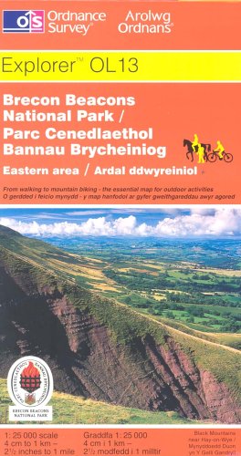
Brecon Beacons National Park: Western and Central Areas: Sheet 12 (Explorer Maps)
Published by Ordnance Survey, United Kingdom, Hants, 2002
ISBN 10: 0319234487ISBN 13: 9780319234488
Book
Paperback. Condition: Very Good. This map is part of the Ordnance Survey's Explorer series designed to replace the old Pathfinder map series. At 1:25,000 scale this detailed map shows a host of attractions including gardens which are open to the public, nature reserves and country parks as well as all official footpaths, bridleways, roads and lanes. Other facilities covered include: camping and caravan sites, picnic areas and viewpoints, selected places of interest, rights of way information for England and Wales, National Trail and Recreational Path routes, and selected tourist information. The main advantages of this map are the geographical design of the sheetlines to capture the best local coverage, and the coverage of a larger area for value for money. The series is aimed mainly at the experienced map user but can be used by tourists and locals alike. The book has been read, but is in excellent condition. Pages are intact and not marred by notes or highlighting. The spine remains undamaged.
-
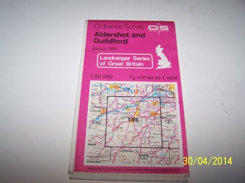
Aldershot, Guildford and Surrounding Area (Sheet 186) (OS Landranger Map)
Published by Ordnance Survey, United Kingdom, Hants, 1990
ISBN 10: 0319221865ISBN 13: 9780319221860
Book
Paperback. Condition: Very Good. This map is part of the Landranger (Pink) series and is designed for people who really want to get to know an area. It includes the following information: tourist information, camping and caravan sites, picnic areas and viewpoints, selected places of interest and rights of way information for England and Wales. Each map in the series covers an area of 40 km by 40 km (25 miles by 25 miles) and like other Ordnance Survey maps, National Grid squares are provided so that any feature can be given a unique reference number. Perfect for planning ahead and local excursions, these maps are full of useful information that will help you really get to know an area. The book has been read, but is in excellent condition. Pages are intact and not marred by notes or highlighting. The spine remains undamaged.
-
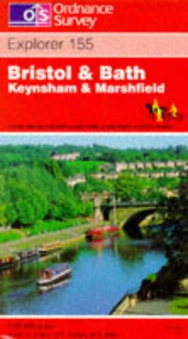
Bristol and Bath: Sheet 155 (Explorer Maps)
Published by Ordnance Survey, United Kingdom, Hants, 1783
ISBN 10: 0319217647ISBN 13: 9780319217641
Book
Paperback. Condition: Fair. This map is part of the Ordnance Survey's Explorer series designed to replace the old Pathfinder map series. At 1:25,000 scale this detailed map shows a host of attractions including gardens which are open to the public, nature reserves and country parks as well as all official footpaths, bridleways, roads and lanes. Other facilities covered include: camping and caravan sites, picnic areas and viewpoints, selected places of interest, rights of way information for England and Wales, National Trail and Recreational Path routes, and selected tourist information. The main advantages of this map are the geographical design of the sheetlines to capture the best local coverage, and the coverage of a larger area for value for money. The series is aimed mainly at the experienced map user but can be used by tourists and locals alike. A readable copy of the book which may include some defects such as highlighting and notes. Cover and pages may be creased and show discolouration.
-
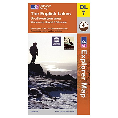
The English Lakes: South Eastern Area: Sheet 7 (Outdoor Leisure Maps)
Published by Ordnance Survey, United Kingdom, Hants, 1998
ISBN 10: 0319260828ISBN 13: 9780319260821
Book
Paperback. Condition: Very Good. The highly detailed Outdoor Leisure series covers Britain's popular holiday destinations and areas of outstanding natural beauty. They are ideal for people wanting to walk, ramble and explore Britain's National Parks. They show official rights of way in England and Wales and include the layout of fences and field walls, water activities and popular fishing areas as well as campsites, viewpoints and other places of interest. Each map offers up to 1200 KM2 coverage on a double-sided map and is a must for all walkers and people who enjoy walking in areas of outstanding natural beauty. The book has been read, but is in excellent condition. Pages are intact and not marred by notes or highlighting. The spine remains undamaged.
-
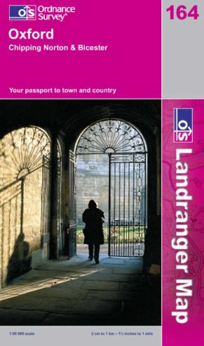
Oxford, Chipping Norton and Bicester: Sheet 164 (Landranger Maps)
Published by Ordnance Survey, United Kingdom, Hants, 2002
ISBN 10: 0319227642ISBN 13: 9780319227640
Book
Paperback. Condition: Very Good. This map is part of the Landranger (Pink) series and is designed for people who really want to get to know an area. It includes the following information: tourist information, camping and caravan sites, picnic areas and viewpoints, selected places of interest and rights of way information for England and Wales. Each map in the series covers an area of 40 km by 40 km (25 miles by 25 miles) and like other Ordnance Survey maps, National Grid squares are provided so that any feature can be given a unique reference number. Perfect for planning ahead and local excursions, these maps are full of useful information that will help you really get to know an area. The book has been read, but is in excellent condition. Pages are intact and not marred by notes or highlighting. The spine remains undamaged.
-
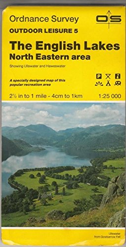
The English Lakes - North Eastern Area - Ordnance Survey Outdoor Leisure Maps 5: Sheet 5
Published by Ordnance Survey, United Kingdom, Hants, 1989
ISBN 10: 0319260054ISBN 13: 9780319260050
Book
Paperback. Condition: Very Good. The book has been read, but is in excellent condition. Pages are intact and not marred by notes or highlighting. The spine remains undamaged.
-
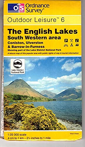
The English Lakes: South Western Area (Outdoor Leisure Maps)
Published by Ordnance Survey, United Kingdom, Hants, 1998
ISBN 10: 031926081XISBN 13: 9780319260814
Book
Paperback. Condition: Good. The highly detailed Outdoor Leisure series covers Britain's popular holiday destinations and areas of outstanding natural beauty. They are ideal for people wanting to walk, ramble and explore Britain's National Parks. They show official rights of way in England and Wales and include the layout of fences and field walls, water activities and popular fishing areas as well as campsites, viewpoints and other places of interest. Each map offers up to 1200 KM2 coverage on a double-sided map and is a must for all walkers and people who enjoy walking in areas of outstanding natural beauty. The book has been read but remains in clean condition. All pages are intact and the cover is intact. Some minor wear to the spine.
-
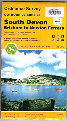
South Devon (Outdoor Leisure Maps)
Published by Ordnance Survey, United Kingdom, Hants, 1995
ISBN 10: 0319260534ISBN 13: 9780319260531
Book
Paperback. Condition: Very Good. The highly detailed Outdoor Leisure series covers Britain's popular holiday destinations and areas of outstanding natural beauty. They are ideal for people wanting to walk, ramble and explore Britain's National Parks. They show official rights of way in England and Wales and include the layout of fences and field walls, water activities and popular fishing areas as well as campsites, viewpoints and other places of interest. Each map offers up to 1200 KM2 coverage on a double-sided map and is a must for all walkers and people who enjoy walking in areas of outstanding natural beauty. The book has been read, but is in excellent condition. Pages are intact and not marred by notes or highlighting. The spine remains undamaged.
-

Loch Lomond and Inveraray Area (Sheet 56) (OS Landranger Map)
Published by Ordnance Survey, United Kingdom, Hants, 1992
ISBN 10: 0319220567ISBN 13: 9780319220566
Book
Paperback. Condition: Very Good. This map is part of the Landranger (Pink) series and is designed for people who really want to get to know an area. It includes the following information: tourist information, camping and caravan sites, picnic areas and viewpoints, selected places of interest and rights of way information for England and Wales. Each map in the series covers an area of 40 km by 40 km (25 miles by 25 miles) and like other Ordnance Survey maps, National Grid squares are provided so that any feature can be given a unique reference number. Perfect for planning ahead and local excursions, these maps are full of useful information that will help you really get to know an area. The book has been read, but is in excellent condition. Pages are intact and not marred by notes or highlighting. The spine remains undamaged.
-
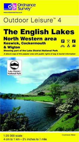
The English Lakes: North Western Area: Sheet 4 (Outdoor Leisure Maps)
Published by Ordnance Survey, United Kingdom, Hants, 1998
ISBN 10: 0319260798ISBN 13: 9780319260791
Book
Paperback. Condition: Fair. The highly detailed Outdoor Leisure series covers Britain's popular holiday destinations and areas of outstanding natural beauty. They are ideal for people wanting to walk, ramble and explore Britain's National Parks. They show official rights of way in England and Wales and include the layout of fences and field walls, water activities and popular fishing areas as well as campsites, viewpoints and other places of interest. Each map offers up to 1200 KM2 coverage on a double-sided map and is a must for all walkers and people who enjoy walking in areas of outstanding natural beauty. A readable copy of the book which may include some defects such as highlighting and notes. Cover and pages may be creased and show discolouration.
-

Hexham, Haltwhistle and Surrounding Area (Sheet 87) (OS Landranger Map)
Published by Ordnance Survey, United Kingdom, Hants
ISBN 10: 0319220877ISBN 13: 9780319220870
Book
Paperback. Condition: Very Good. This map is part of the Landranger (Pink) series and is designed for people who really want to get to know an area. It includes the following information: tourist information, camping and caravan sites, picnic areas and viewpoints, selected places of interest and rights of way information for England and Wales. Each map in the series covers an area of 40 km by 40 km (25 miles by 25 miles) and like other Ordnance Survey maps, National Grid squares are provided so that any feature can be given a unique reference number. Perfect for planning ahead and local excursions, these maps are full of useful information that will help you really get to know an area. The book has been read, but is in excellent condition. Pages are intact and not marred by notes or highlighting. The spine remains undamaged.
-

Landranger Map 96 Barrow-in-Furness and South Lakeland Area: Sheet 96
Published by Ordnance Survey, United Kingdom, Hants
ISBN 10: 0319220966ISBN 13: 9780319220962
Book
Paperback. Condition: Very Good. This map is part of the Landranger (Pink) series and is designed for people who really want to get to know an area. It includes the following information: tourist information, camping and caravan sites, picnic areas and viewpoints, selected places of interest and rights of way information for England and Wales. Each map in the series covers an area of 40 km by 40 km (25 miles by 25 miles) and like other Ordnance Survey maps, National Grid squares are provided so that any feature can be given a unique reference number. Perfect for planning ahead and local excursions, these maps are full of useful information that will help you really get to know an area. The book has been read, but is in excellent condition. Pages are intact and not marred by notes or highlighting. The spine remains undamaged.
-
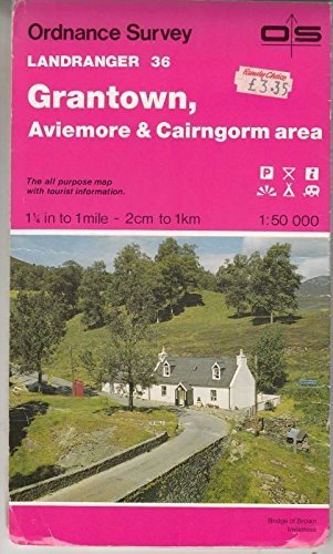
Grantown, Aviemore and Cairngorm Area: Sheet 36 (Landranger Maps)
Published by Ordnance Survey, United Kingdom, Hants, 1992
ISBN 10: 0319220362ISBN 13: 9780319220368
Book
Paperback. Condition: Very Good. This map is part of the Landranger (Pink) series and is designed for people who really want to get to know an area. It includes the following information: tourist information, camping and caravan sites, picnic areas and viewpoints, selected places of interest and rights of way information for England and Wales. Each map in the series covers an area of 40 km by 40 km (25 miles by 25 miles) and like other Ordnance Survey maps, National Grid squares are provided so that any feature can be given a unique reference number. Perfect for planning ahead and local excursions, these maps are full of useful information that will help you really get to know an area. The book has been read, but is in excellent condition. Pages are intact and not marred by notes or highlighting. The spine remains undamaged.
-

Bury St.Edmunds and Sudbury Area (Sheet 155) (OS Landranger Map)
Published by Ordnance Survey, United Kingdom, Hants, 1991
ISBN 10: 0319221555ISBN 13: 9780319221556
Book
Paperback. Condition: Very Good. This map is part of the Landranger (Pink) series and is designed for people who really want to get to know an area. It includes the following information: tourist information, camping and caravan sites, picnic areas and viewpoints, selected places of interest and rights of way information for England and Wales. Each map in the series covers an area of 40 km by 40 km (25 miles by 25 miles) and like other Ordnance Survey maps, National Grid squares are provided so that any feature can be given a unique reference number. Perfect for planning ahead and local excursions, these maps are full of useful information that will help you really get to know an area. The book has been read, but is in excellent condition. Pages are intact and not marred by notes or highlighting. The spine remains undamaged.
-

Cardiff, Newport and Surrounding Area (Sheet 171) (OS Landranger Map)
Published by Ordnance Survey, United Kingdom, Hants
ISBN 10: 0319221717ISBN 13: 9780319221716
Book
Paperback. Condition: Very Good. This map is part of the Landranger (Pink) series and is designed for people who really want to get to know an area. It includes the following information: tourist information, camping and caravan sites, picnic areas and viewpoints, selected places of interest and rights of way information for England and Wales. Each map in the series covers an area of 40 km by 40 km (25 miles by 25 miles) and like other Ordnance Survey maps, National Grid squares are provided so that any feature can be given a unique reference number. Perfect for planning ahead and local excursions, these maps are full of useful information that will help you really get to know an area. The book has been read, but is in excellent condition. Pages are intact and not marred by notes or highlighting. The spine remains undamaged.
-

Sheffield, Doncaster, Rotherham, Barnsley and Thorne (OS Landranger Map Series): Sheet 111
Published by Ordnance Survey, United Kingdom, Hants, 2006
ISBN 10: 0319229351ISBN 13: 9780319229354
Book
Paperback. Condition: Very Good. Perfect for day trips and short breaks, the OS Landranger Map series covers Great Britain with 204 detailed maps. Each map provides all the information you need to get to know your local area and includes places of interest, tourist information, picnic areas and camp sites, plus Rights of Way information for England and Wales. The book has been read, but is in excellent condition. Pages are intact and not marred by notes or highlighting. The spine remains undamaged.
-
Yorkshire Dales (Touring Maps & Guides)
Published by Ordnance Survey, United Kingdom, Hants
ISBN 10: 0319250261ISBN 13: 9780319250266
Book
Paperback. Condition: Fair. The Touring map series is a must for anyone visiting Britain's most popular holiday destinations. These reformatted maps are simple to use and packed with essential tourist information - from the best beaches to rural pubs, designed specifically with Tourists in mind. All county boundaries are clearly marked and as well as showing motorways and main roads, the maps also pinpoint many minor roads, cycle routes and even rural toilets. No holiday is complete without one. A readable copy of the book which may include some defects such as highlighting and notes. Cover and pages may be creased and show discolouration.
-

Abingdon (Sheet 1136 (SU49/59)) (Pathfinder maps)
Published by Ordnance Survey, United Kingdom, Hants, 1992
ISBN 10: 0319211363ISBN 13: 9780319211366
Book
Paperback. Condition: Fair. Although they are to be replaced by the award winning Explorer series, Pathfinder maps are particularly suitable for the countryside lover wanting to discover areas of Scotland not yet covered by an Explorer. The Pathfinder series is planned to be completely withdrawn in spring 2003. A readable copy of the book which may include some defects such as highlighting and notes. Cover and pages may be creased and show discolouration.
-
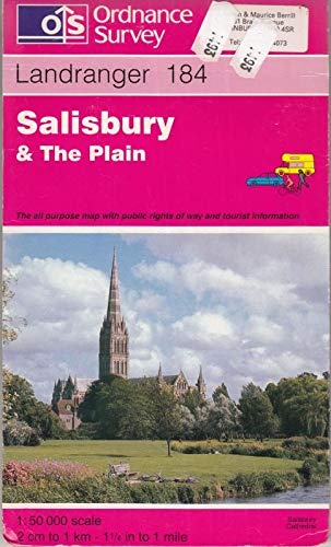
Salisbury and the Plain: Sheet 184 (Landranger Maps)
Published by Ordnance Survey, United Kingdom, Hants, 1994
ISBN 10: 0319222195ISBN 13: 9780319222195
Book
Paperback. Condition: Very Good. This map is part of the Landranger (Pink) series and is designed for people who really want to get to know an area. It includes the following information: tourist information, camping and caravan sites, picnic areas and viewpoints, selected places of interest and rights of way information for England and Wales. Each map in the series covers an area of 40 km by 40 km (25 miles by 25 miles) and like other Ordnance Survey maps, National Grid squares are provided so that any feature can be given a unique reference number. Perfect for planning ahead and local excursions, these maps are full of useful information that will help you really get to know an area. The book has been read, but is in excellent condition. Pages are intact and not marred by notes or highlighting. The spine remains undamaged.
-

Nidderdale: Sheet 26 (Explorer Maps)
Published by Ordnance Survey, United Kingdom, Hants
ISBN 10: 0319217280ISBN 13: 9780319217283
Book
Paperback. Condition: Very Good. This map is part of the Ordnance Survey's Explorer series designed to replace the old Pathfinder map series. At 1:25,000 scale this detailed map shows a host of attractions including gardens which are open to the public, nature reserves and country parks as well as all official footpaths, bridleways, roads and lanes. Other facilities covered include: camping and caravan sites, picnic areas and viewpoints, selected places of interest, rights of way information for England and Wales, National Trail and Recreational Path routes, and selected tourist information. The main advantages of this map are the geographical design of the sheetlines to capture the best local coverage, and the coverage of a larger area for value for money. The series is aimed mainly at the experienced map user but can be used by tourists and locals alike. The book has been read, but is in excellent condition. Pages are intact and not marred by notes or highlighting. The spine remains undamaged.
-
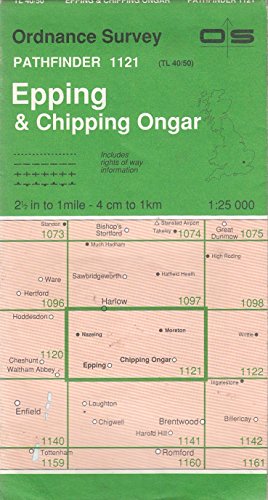
Epping and Chipping Ongar (Sheet 1121 (TL40/50)) (Pathfinder maps)
Published by Ordnance Survey, United Kingdom, Hants, 1991
ISBN 10: 0319211215ISBN 13: 9780319211212
Book
Paperback. Condition: Good. Although they are to be replaced by the award winning Explorer series, Pathfinder maps are particularly suitable for the countryside lover wanting to discover areas of Scotland not yet covered by an Explorer. The Pathfinder series is planned to be completely withdrawn in spring 2003. The book has been read but remains in clean condition. All pages are intact and the cover is intact. Some minor wear to the spine.
-
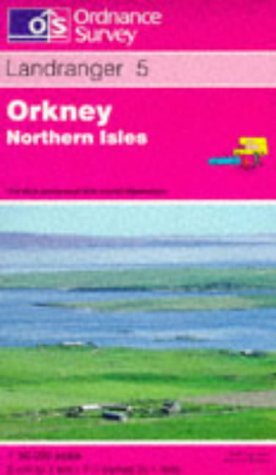
Orkney - Northern Isles: Sheet 5 (Landranger Maps)
Published by Ordnance Survey, United Kingdom, Hants
ISBN 10: 0319223620ISBN 13: 9780319223628
Book
Paperback. Condition: Very Good. This map is part of the Landranger (Pink) series and is designed for people who really want to get to know an area. It includes the following information: tourist information, camping and caravan sites, picnic areas and viewpoints, selected places of interest and rights of way information for England and Wales. Each map in the series covers an area of 40 km by 40 km (25 miles by 25 miles) and like other Ordnance Survey maps, National Grid squares are provided so that any feature can be given a unique reference number. Perfect for planning ahead and local excursions, these maps are full of useful information that will help you really get to know an area. The book has been read, but is in excellent condition. Pages are intact and not marred by notes or highlighting. The spine remains undamaged.
More buying choices from other sellers on AbeBooks
Used offers from £ 2.40
-

Snowdonia - Harlech and Bala Areas (Sheet 18) (Outdoor Leisure Maps)
Published by Ordnance Survey, United Kingdom, Hants, 1990
ISBN 10: 0319260186ISBN 13: 9780319260180
Book
Paperback. Condition: Very Good. The book has been read, but is in excellent condition. Pages are intact and not marred by notes or highlighting. The spine remains undamaged.
-
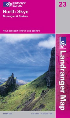
North Skye, Dunvegan and Portree: Sheet 23 (Landranger Maps)
Published by Ordnance Survey, United Kingdom, Hants, 2002
ISBN 10: 0319226239ISBN 13: 9780319226230
Book
Paperback. Condition: Very Good. This map is part of the Landranger (Pink) series and is designed for people who really want to get to know an area. It includes the following information: tourist information, camping and caravan sites, picnic areas and viewpoints, selected places of interest and rights of way information for England and Wales. Each map in the series covers an area of 40 km by 40 km (25 miles by 25 miles) and like other Ordnance Survey maps, National Grid squares are provided so that any feature can be given a unique reference number. Perfect for planning ahead and local excursions, these maps are full of useful information that will help you really get to know an area. The book has been read, but is in excellent condition. Pages are intact and not marred by notes or highlighting. The spine remains undamaged.
More buying choices from other sellers on AbeBooks
Used offers from £ 2.46
-
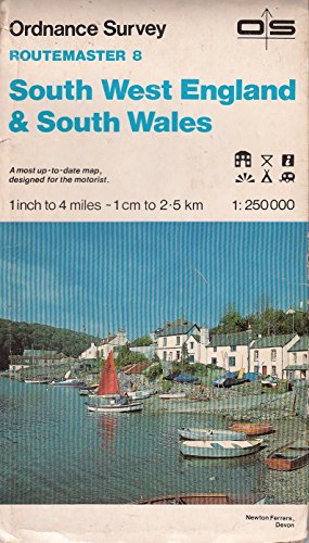
Routemaster 8: South West England and South Wales
Published by Ordnance Survey, United Kingdom, Hants, 1984
ISBN 10: 0319230082ISBN 13: 9780319230084
Book
Paperback. Condition: Fair. A readable copy of the book which may include some defects such as highlighting and notes. Cover and pages may be creased and show discolouration.
-
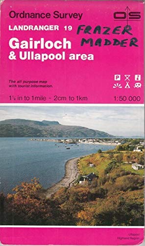
Gairloch and Ullapool Area (Sheet 19) (OS Landranger Map)
Published by Ordnance Survey, United Kingdom, Hants, 1988
ISBN 10: 0319220192ISBN 13: 9780319220191
Book
Paperback. Condition: Very Good. This map is part of the Landranger (Pink) series and is designed for people who really want to get to know an area. It includes the following information: tourist information, camping and caravan sites, picnic areas and viewpoints, selected places of interest and rights of way information for England and Wales. Each map in the series covers an area of 40 km by 40 km (25 miles by 25 miles) and like other Ordnance Survey maps, National Grid squares are provided so that any feature can be given a unique reference number. Perfect for planning ahead and local excursions, these maps are full of useful information that will help you really get to know an area. The book has been read, but is in excellent condition. Pages are intact and not marred by notes or highlighting. The spine remains undamaged.
