Items related to Allendale and Hexhamshire 1866 (Old Ordnance Survey...
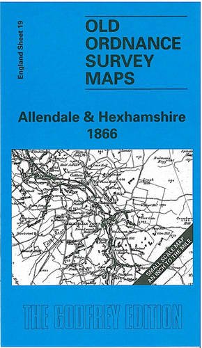

Here is information about Sheet 19: One Inch Sheet 19 Allendale & Hexhamshire 1866 - published 1998; intro by Robert Forsythe. ISBN.978-0-85054-976-8 This early One Inch Ordnance Survey map covers a rural part of south Northumberland, with Allendale running through it. This includes the railway from Hexham to Allendale Town. On the reverse is a detailed map of the village of Blanchland, which stands in the lower right corner of the one inch map. It is not possible to list the many hamlets, farmsteads and other topographical features shown on these maps. However, you may find it useful if we list the towns and principal villages or church parishes that are included on this map. Links are given for those for which detailed large-scale maps are also available. Northumberland: Acomb, Allendale Town, Bardon Mill, Blanchland, Catton, Haltwhistle, Haydon Bridge, Hexham, Hunstanworth, Melridge, Sandhoe, Slaley, St John Lee, Warden.
"synopsis" may belong to another edition of this title.
- PublisherAlan Godfrey Maps
- Publication date1998
- ISBN 10 0850549760
- ISBN 13 9780850549768
- BindingMap
Buy New
Learn more about this copy
� 2.75
Shipping:
� 30.45
From United Kingdom to U.S.A.
Top Search Results from the AbeBooks Marketplace
Stock Image
Allendale and Hexhamshire 1866 (Old Ordnance Survey Maps - Inch to the Mile)
Seller:
Rating
Book Description No Binding. Condition: New. No Jacket. Here is information about Sheet 19: One Inch Sheet 19 Allendale & Hexhamshire 1866 - published 1998; intro by Robert Forsythe. ISBN.978-0-85054-976-8 This early One Inch Ordnance Survey map covers a rural part of south Northumberland, with Allendale running through it. This includes the railway from Hexham to Allendale Town. On the reverse is a detailed map of the village of Blanchland, which stands in the lower right corner of the one inch map. It is not possible to list the many hamlets, farmsteads and other topographical features shown on these maps. However, you may find it useful if we list the towns and principal villages or church parishes that are included on this map. Links are given for those for which detailed large-scale maps are also available. Northumberland: Acomb, Allendale Town, Bardon Mill, Blanchland, Catton, Haltwhistle, Haydon Bridge, Hexham, Hunstanworth, Melridge, Sandhoe, Slaley, St John Lee, Warden. Seller Inventory # 007947
Buy New
� 2.75
Convert currency