
Order Total (1 Item Items):
Shipping Destination:

Allendale Hexhamshire 1866 by Forsythe Robert (2 results)
Product Type
- All Product Types
- Books
- Magazines & Periodicals
- Comics
- Sheet Music
- Art, Prints & Posters
- Photographs
- Maps (2)
- Manuscripts & Paper Collectibles
Condition
Binding
- All Bindings
- Hardcover
- Softcover
Collectible Attributes
- First Edition
- Signed
- Dust Jacket
- Seller-Supplied Images
- Not Print on Demand (2)
Free Shipping
- Free US Shipping
Seller Location
Seller Rating
-
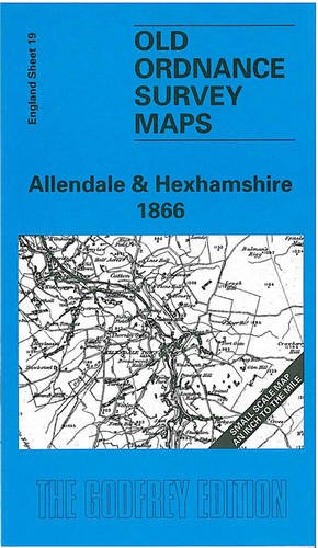
Allendale and Hexhamshire 1866 (Old Ordnance Survey Maps - Inch to the Mile)
Published by Alan Godfrey Maps, 1998
ISBN 10: 0850549760ISBN 13: 9780850549768
Map
No Binding. Condition: As New. One Inch Sheet 19 Allendale & Hexhamshire 1866 - published 1998; intro by Robert Forsythe.
-
Allendale and Hexhamshire 1866 (Old Ordnance Survey Maps - Inch to the Mile)
Published by Alan Godfrey Maps, 1998
ISBN 10: 0850549760ISBN 13: 9780850549768
Map
No Binding. Condition: New. No Jacket. Here is information about Sheet 19: One Inch Sheet 19 Allendale & Hexhamshire 1866 - published 1998; intro by Robert Forsythe. ISBN.978-0-85054-976-8 This early One Inch Ordnance Survey map covers a rural part of south Northumberland, with Allendale running through it. This includes the railway from Hexham to Allendale Town. On the reverse is a detailed map of the village of Blanchland, which stands in the lower right corner of the one inch map. It is not possible to list the many hamlets, farmsteads and other topographical features shown on these maps. However, you may find it useful if we list the towns and principal villages or church parishes that are included on this map. Links are given for those for which detailed large-scale maps are also available. Northumberland: Acomb, Allendale Town, Bardon Mill, Blanchland, Catton, Haltwhistle, Haydon Bridge, Hexham, Hunstanworth, Melridge, Sandhoe, Slaley, St John Lee, Warden.