Items related to Oban and East Mull: Sheet 49 (Landranger Maps)
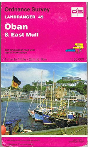

This map is part of the Landranger (Pink) series and is designed for people who really want to get to know an area. It includes the following information: tourist information, camping and caravan sites, picnic areas and viewpoints, selected places of interest and rights of way information for England and Wales. Each map in the series covers an area of 40 km by 40 km (25 miles by 25 miles) and like other Ordnance Survey maps, National Grid squares are provided so that any feature can be given a unique reference number. Perfect for planning ahead and local excursions, these maps are full of useful information that will help you really get to know an area.
"synopsis" may belong to another edition of this title.
About the Author:
Ordnance Survey is Britain's national mapping agency, responsible for the official, definitive mapping of the whole country. They produce and market a wide range of maps for educational and leisure purposes, as well as producing computer data products for government, business and administrative use.
"About this title" may belong to another edition of this title.
- PublisherOrdnance Survey
- Publication date1992
- ISBN 10 0319220494
- ISBN 13 9780319220498
- BindingMap
Top Search Results from the AbeBooks Marketplace

Stock Image
Oban and East Mull: Sheet 49 (Landranger Maps)
Published by
Ordnance Survey, United Kingdom, Hants, 1992
ISBN 10: 0319220494
ISBN 13: 9780319220498
Used
Paperback
Quantity: 3 available
Seller: WorldofBooks, Goring-By-Sea, WS, United Kingdom
Paperback. Condition: Good. This map is part of the Landranger (Pink) series and is designed for people who really want to get to know an area. It includes the following information: tourist information, camping and caravan sites, picnic areas and viewpoints, selected places of interest and rights of way information for England and Wales. Each map in the series covers an area of 40 km by 40 km (25 miles by 25 miles) and like other Ordnance Survey maps, National Grid squares are provided so that any feature can be given a unique reference number. Perfect for planning ahead and local excursions, these maps are full of useful information that will help you really get to know an area. The book has been read but remains in clean condition. All pages are intact and the cover is intact. Some minor wear to the spine. Seller Inventory # GOR001694684
Stock Image
Oban and East Mull: Sheet 49 (Landranger Maps)
Published by
Ordnance Survey, United Kingdom, Hants, 1992
ISBN 10: 0319220494
ISBN 13: 9780319220498
Used
Paperback
Quantity: 4 available
Seller: WorldofBooks, Goring-By-Sea, WS, United Kingdom
Paperback. Condition: Very Good. This map is part of the Landranger (Pink) series and is designed for people who really want to get to know an area. It includes the following information: tourist information, camping and caravan sites, picnic areas and viewpoints, selected places of interest and rights of way information for England and Wales. Each map in the series covers an area of 40 km by 40 km (25 miles by 25 miles) and like other Ordnance Survey maps, National Grid squares are provided so that any feature can be given a unique reference number. Perfect for planning ahead and local excursions, these maps are full of useful information that will help you really get to know an area. The book has been read, but is in excellent condition. Pages are intact and not marred by notes or highlighting. The spine remains undamaged. Seller Inventory # GOR001747432
Stock Image
Landranger Map 0049 : Oban and East Mull
Published by
Ordnance Survey, 1996
ISBN 10: 0319220494
ISBN 13: 9780319220498
Used
Quantity: 1 available
Seller: Better World Books Ltd, Dunfermline, United Kingdom
Condition: Good. Ships from the UK. Used book that is in clean, average condition without any missing pages. Seller Inventory # 10935301-6
Stock Image
Oban and East Mull (Landranger Maps)
Published by
Ordnance Survey, 1992
ISBN 10: 0319220494
ISBN 13: 9780319220498
Used
Quantity: 1 available
Seller: Greener Books, London, United Kingdom
Map. Condition: Used; Very Good. **SHIPPED FROM UK** We believe you will be completely satisfied with our quick and reliable service. All orders are dispatched as swiftly as possible! Buy with confidence! Greener Books. Seller Inventory # 4685804
Seller Image
Landranger 49 Oban & East Mull
Published by
Ordnance Survey, 1985
ISBN 10: 0319220494
ISBN 13: 9780319220498
Used
Soft cover
Quantity: 1 available
Seller: Book Souk, Porstoy, United Kingdom
Soft cover. Condition: Very Good. 100 grams. Scale 1:50,000 1.25 inch to 1 mile - 2 cm to 1 km. Seller Inventory # 004121