
Order Total (1 Item Items):
Shipping Destination:

Oban East Mull Sheet by Ordnance Survey (6 results)
Feedback
Skip to main search results
Search filters
Product Type
- All Product Types
- Books (6)
- Magazines & Periodicals (No further results match this refinement)
- Comics (No further results match this refinement)
- Sheet Music (No further results match this refinement)
- Art, Prints & Posters (No further results match this refinement)
- Photographs (No further results match this refinement)
- Maps (No further results match this refinement)
- Manuscripts & Paper Collectibles (No further results match this refinement)
Condition
- All Conditions
- New (No further results match this refinement)
- Used (6)
Binding
- All Bindings
- Hardcover (No further results match this refinement)
- Softcover (5)
Collectible Attributes
- First Edition (No further results match this refinement)
- Signed (No further results match this refinement)
- Dust Jacket (No further results match this refinement)
- Seller-Supplied Images (1)
- Not Print on Demand (6)
Free Shipping
- Free Shipping to United Kingdom (No further results match this refinement)
Seller Rating
-

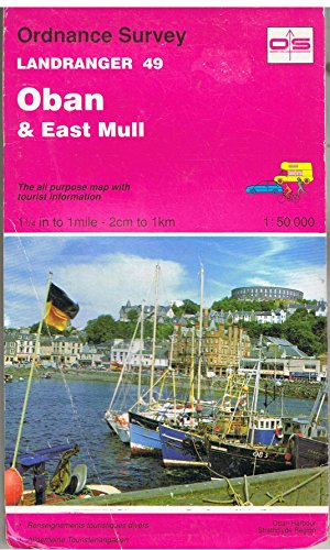
Oban and East Mull: Sheet 49 (Landranger Maps)
Published by Ordnance Survey, 1849
ISBN 10: 0319226492 ISBN 13: 9780319226490
Paperback. Condition: Very Good. The book has been read, but is in excellent condition. Pages are intact and not marred by notes or highlighting. The spine remains undamaged.
-
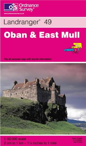
Oban and East Mull: Sheet 49 (Landranger Maps)
Published by Ordnance Survey, United Kingdom, Hants, 1992
ISBN 10: 0319220494 ISBN 13: 9780319220498
Paperback. Condition: Good. This map is part of the Landranger (Pink) series and is designed for people who really want to get to know an area. It includes the following information: tourist information, camping and caravan sites, picnic areas and viewpoints, selected places of interest and rights of way information for England and Wales. Each map in the series covers an area of 40 km by 40 km (25 miles by 25 miles) and like other Ordnance Survey maps, National Grid squares are provided so that any feature can be given a unique reference number. Perfect for planning ahead and local excursions, these maps are full of useful information that will help you really get to know an area. The book has been read but remains in clean condition. All pages are intact and the cover is intact. Some minor wear to the spine.
-
Oban and East Mull: Sheet 49 (Landranger Maps)
Published by Ordnance Survey, United Kingdom, Hants, 1992
ISBN 10: 0319220494 ISBN 13: 9780319220498
Paperback. Condition: Very Good. This map is part of the Landranger (Pink) series and is designed for people who really want to get to know an area. It includes the following information: tourist information, camping and caravan sites, picnic areas and viewpoints, selected places of interest and rights of way information for England and Wales. Each map in the series covers an area of 40 km by 40 km (25 miles by 25 miles) and like other Ordnance Survey maps, National Grid squares are provided so that any feature can be given a unique reference number. Perfect for planning ahead and local excursions, these maps are full of useful information that will help you really get to know an area. The book has been read, but is in excellent condition. Pages are intact and not marred by notes or highlighting. The spine remains undamaged.
-
Oban and East Mull: Sheet 49 (Landranger Maps)
Published by Ordnance Survey, United Kingdom, Hants, 2001
ISBN 10: 0319224899 ISBN 13: 9780319224892
Paperback. Condition: Very Good. The book has been read, but is in excellent condition. Pages are intact and not marred by notes or highlighting. The spine remains undamaged.
-
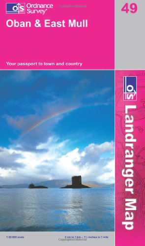
Oban and East Mull (OS Landranger Map Series): Sheet 49
Published by Ordnance Survey, United Kingdom, Hants, 2007
ISBN 10: 0319229777 ISBN 13: 9780319229774
Paperback. Condition: Very Good. Perfect for day trips and short breaks, the OS Landranger Map series covers Great Britain with 204 detailed maps. Each map provides all the information you need to get to know your local area and includes places of interest, tourist information, picnic areas and camp sites, plus Rights of Way information for England and Wales. The book has been read, but is in excellent condition. Pages are intact and not marred by notes or highlighting. The spine remains undamaged.
-

Oban and East Mull: Sheet 49 (Landranger Maps)
Published by Ordnance Survey, 1849
ISBN 10: 0319226492 ISBN 13: 9780319226490
Condition: Good. Most items will be dispatched the same or the next working day.