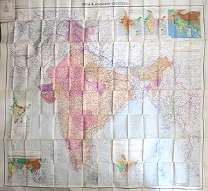
India and Adjacent Countries
SURVEY OF INDIA
From
Bow Windows Bookshop (ABA, ILAB), Lewes, United Kingdom
Seller rating 5 out of 5 stars
![]()
AbeBooks Seller since 22 September 1998
About this Item
Description:
Second edition. Map dimensions 150 x 164 cm, overall 165 x 181 cm. A magnificent large folding map of the country in the very early years after independence, with printed colour to differentiate the states, three inset maps to the upper right corner illustrating the isothermal lines, average rainfall and orographical features plus another three inset maps to the lower left illustrating densities of population, principal industries and the country's geographical situation in south Asia, another large inset to the centre of the lower edge features a map of the country's geology and its mineral deposits. Folds between original printed card covers. Covers slightly soiled with a little edge creasing, one repair on the verso of the map along a fold, else a remarkably well preserved map considering its size and it not being backed onto linen. The first edition was published the previous year. Seller Inventory # 36272
Bibliographic Details
Title: India and Adjacent Countries
Publisher: [N.p.]: Survey of India
Publication Date: 1952
Top Search Results from the AbeBooks Marketplace
India and Adjacent Countries Sheet No.43 Srinagar [map]
Seller: Keoghs Books, Skipton, United Kingdom
, linen backed colour map of India subtitled Kashmir and Jammu, N.W. Frontier Provinces, Punjab and Punjab States, scale 1:1000000, reprint of the 1927 third edition Third edition , covers rubbed and scuffed at corners and edges, spine missing, map in good condition , quarter cloth and marbled boards with folded linen backed map , 15.5 x 13.5 cm (folded), 58 x 49 cm (open) map ISBN: Seller Inventory # 71569
Quantity: 1 available
India and Adjacent Countries - India during The Emergency.
Seller: Curtis Wright Maps, Berwyn, IL, U.S.A.
Condition: Fine. This is the third edition of India's national survey, published in 1976 by the Survey of India, then under the direction of Major-General Kishori Lal Khosla. The image, issued at a scale of 1:12,000,000 on a Lambert Conical Projection, provides a detailed political overview of the nation just a few years after the creation of Bangladesh. Text in the lower margin references national boundaries that have yet to be verified. An inset in the lower right provides a diagrammatic route map of Indian Airlines, which had just introduced the Boeing 737 and Airbus A300 to its fleet. Sheet Width (in) 20.5 Sheet Height (in) 18 Condition Description Pocket map folded into 8 segments and affixed to original pink wraps. A slight misfold along the center and some faint wear to the covers. Very good to near fine condition overall. Seller Inventory # 6375
Quantity: 1 available
INDIA AND ADJACENT COUNTRIES SHEET NO. 34 - AFGHANISTAN BALUCHISTAN AND SIND - QUETTA - FIRST EDITION - PUBLISHED UNDER THE DIRECTION OF COLONEL S G BURRARD SURVEYOR GENERAL OF INDIA 1917
Seller: Hornseys, Ripon, United Kingdom
No Binding. Condition: Very Good. 1st Edition. Size: 46.5cm x 57.8cm. Sheet No. 34.† A detailed map of the region on a good scale of 1 inch to 16 miles at an important time in the history of Quetta. Covers very slightly dusty and marked. Original fold lines. Railway line from Sibi to Ghazni and Kabul marked in pencil to the right hand margin. Minor wear to the fold intersections with a small amount of loss. Reverse is blank with very minor age toning and marks. In very good, original and unrestored condition. Very scarce. Seller Inventory # 002508
Quantity: 1 available
INDIA AND ADJACENT COUNTRIES MILLION SHEET NO. 38 - KABUL - FIRST EDITION - PUBLISHED UNDER THE DIRECTION OF COLONEL S G BURRARD SURVEYOR GENERAL OF INDIA 1917
Seller: Hornseys, Ripon, United Kingdom
No Binding. Condition: Very Good. 1st Edition. Size: 44.8cm x 56.6cm. Sheet No. 38.†Stamp of the Headquarters of the Mobile Brigade. A detailed map of the region on a good scale of 1 inch to 16 miles at an important time in the history of Kabul and 'the great game'. Covers very slightly dusty and marked. Original fold lines. Minor wear to the fold intersections with a small amount of loss. Reverse is blank with very minor age toning and marks. In very good, original and un-restored condition. Very scarce. Seller Inventory # 002509
Quantity: 1 available
India & Adjacent Countries. Scale 40 Miles to 1 Inch. Fifth Edition.
Seller: Robert Frew Ltd. ABA ILAB, London, United Kingdom
Extremely large colour-printed folding map of India and the adjacent countries (82 x 173 cm) mounted onto linen with seven inset maps showing Density of Population, Principal Industries, Geology and Principal Minerals, Orographical Features, Average Rainfall, Isothermal Lines, and a small version of India and Surrounding Countries. Remnants of original paper wrappers printed in red still present to verso. Light spotting to verso only, generally a very good copy of this large-scale map. First published in 1951. Seller Inventory # 59553
Quantity: 1 available
[Sir Sidney Gerald Burrard (1860-1943), Surveyor General of India.] Large printed coloured map of 'Tibet and Adjacent Countries', during the First World War.
Seller: Richard M. Ford Ltd, London, United Kingdom
The original item. On one side of a piece of a piece of paper roughly 70 x 100 cm, folded into a 10.5 x 15.5 cm packet of fifty panels. An attractive item, but in need of some attention: on brittle and discoloured paper, with several closed tears. The map was the work of Col. H. B. Hudson. A significant map, still cited in the Sino-Indian border dispute. For the background see 'Two Important Maps from the Survey of India', Geographical Journa, October 1915. First published in 1914, but the only copy of this 1917 version located in the National Library of Australia. Seller Inventory # 25705
Quantity: 1 available


