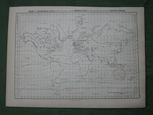
Chart of Isothermal Lines, Shewing the Mean Annual Temperature of the Different Parts of the Earth's Surface
Black, A & C
From Crouch Rare Books, Godalming, United Kingdom
Seller rating 5 out of 5 stars
AbeBooks Seller since 12 September 2016
From Crouch Rare Books, Godalming, United Kingdom
Seller rating 5 out of 5 stars
AbeBooks Seller since 12 September 2016
About this Item
black and white engraved chart/map with a some isothermal lines depicted in colour, 273 x 390 mm, showing 'the Northern Limit of Perpetually Frozen Ground in the Antarctic Regions', Antarctic coast partially drawn, for example, partially according to the American Expedition also Enderby's Land discovered only in 1831 by John Biscoe, from A & C Blacks General Atlas, a small chart/map suitable for mounting or framing, fine. This is an original antique map. We do not sell reproductions or facsimiles. Seller Inventory # 7790
Bibliographic Details
Title: Chart of Isothermal Lines, Shewing the Mean ...
Publisher: A & C Black, Edinburgh
Publication Date: 1857
Store Description
Payment Methods
accepted by seller