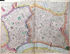
[CENTRAL LONDON]. Very large (wall) map of Central London from Bacon's Large Scale Ordnance Survey Atlas, printed on twelve large map sheets in original colour, forming a large wall map of 169x186cm when joined. Extent: City of London, reaching to Hampstead, Hackney, Isle of Dogs, Dulwich, Chelsea and Kensington Gardens. 9-inch scale. Printed for
Ordnance Survey Atlas / Bacon, G. W.
From Garwood & Voigt, Sevenoaks, United Kingdom
Seller rating 5 out of 5 stars
![]()
AbeBooks Seller since 25 November 2013


