
Order Total (1 Item Items):
Shipping Destination:

World Maps Finding Direction Distance by David King (4 results)
Skip to main search results
Product Type
- All Product Types
- Books (4)
- Magazines & Periodicals
- Comics
- Sheet Music
- Art, Prints & Posters
- Photographs
- Maps
-
Manuscripts &
Paper Collectibles
Condition
Binding
Collectible Attributes
Seller Location
Seller Rating
-
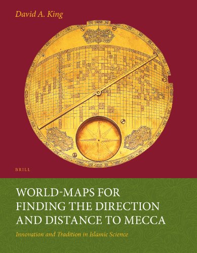
World-maps for Finding the Direction and Distance to Mecca: Innovation and Tradition in Islamic Science
Published by Brill Academic Pub, 2014
ISBN 10: 9004259872ISBN 13: 9789004259874
Book Print on Demand
Paperback. Condition: Brand New. reprint edition. 638 pages. 10.50x8.00x1.25 inches. In Stock. This item is printed on demand.
-

World-maps for Finding the Direction and Distance to Mecca : Innovation and Tradition in Islamic Science
Published by Leiden, Brill, 1999. XXVIII,638 pp. Col. & b./w. ills., 1999
Original cloth with dustjacket. Edges of dustjacket slightly worn, else a very good copy. Please see description or ask for photos.
-
World-Maps for Finding the Direction and Distance to Mecca: Innovation and Tradition in Islamic Science
Published by Brill, Leiden, 1999
ISBN 10: 9004113673ISBN 13: 9789004113671
Book First Edition
Hardcover. Condition: Fine. First Edition. First printing. 4to. 638 pp. Blue cloth. Fine. Lacking dust jacket.
-
World-maps for Finding the Direction and Distance to Mecca : Innovation and Tradition in Islamic Science
Published by Brill 1999, 1999
Hardcover, 638 pages, ENG, 295 x 230 x 40 mm, book is in very good condition !, dustjacket is included but in bad shape, however the book is better without it, illustrated in colour / b/w . ISBN 9789004113671. Two remarkable Iranian world-maps were discovered in 1989 and 1995. Both are made of brass and date from 17th-century Iran. Mecca is at the centre and a highly sophisticated longitude and latitude grid enables the user to determine the direction and distance to Mecca for anywhere in the world between Andalusia and China. Prior to the discovery of these maps it was thought that such cartographic grids were conceived in Europe ca. 1910. This richly-illustrated book presents an overview of the ways in which Muslims over the centuries have determined the sacred direction towards Mecca (qibla) and then describes the two world-maps in detail. The author shows that the geographical data derives from a 15th-century Central Asian source and that the mathematics underlying the grid was developed in 9th-century Baghdad. 2760 g.
