
Order Total (1 Item Items):
Shipping Destination:

Large Scale Digital Mapping by Bao Deng (3 results)
Skip to main search results
Product Type
- All Product Types
- Books (3)
- Magazines & Periodicals
- Comics
- Sheet Music
- Art, Prints & Posters
- Photographs
- Maps
-
Manuscripts &
Paper Collectibles
Condition
Binding
- All Bindings
- Hardcover
- Softcover
Collectible Attributes
- First Edition
- Signed
- Dust Jacket
- Seller-Supplied Images (2)
- Not Printed On Demand
Seller Location
Seller Rating
-

LI Yu-bao. large scale digital mapping technology forward of Southwest Jiaotong University(Chinese Edition)(Old-Used)
Published by Southwest Jiaotong University, 2000
ISBN 10: 7811044242ISBN 13: 9787811044249
Book
paperback. Condition: Good. Ship out in 2 business day, And Fast shipping, Free Tracking number will be provided after the shipment.Paperback. Pub Date :2006-09-01 Pages: 298 Publisher: the Southwest Jiaotong basic information title: large-scale digital mapping technology List Price: 28.50 yuan Author: Li Yu Bao ed Publisher: Southwest Jiaotong University Publication Date :2006-9-1ISBN : 9787811044249 word count: 476.000 yards: 298 Edition: 1 Binding: Paperback: Weight: Editor's Choice SUMMARY The book follows a theoretically comprehensive content closer to the actual principle. systematic exposition of a large-scale digital mapping theory. methods and application of technology. The book is divided into five chapters. respectively. as: Overview of Chapter 1 of the digitized measured Figure; Chapter 2 computer graphics foundation; Chapter 3 large-scale digitized topographic measurements; Overview of Chapter 4 CASS7.0 terrain land cadastral mapping software; Chapter 5 CASS7. 0 digital topographic map editing and engineering applications. Author many years engaged in the digitized mapping theory and practice of teaching. research cornerstone ed. content depth. practical. Therefore. in addition to the students as surveying and mapping engineering. geographic information systems. master surveying the basic theory of learning digital mapping professional course materials are also available for the professional and technical personnel engaged in the work of digital surveying and mapping reference. Catalog Chapter 1 digitized measured Figure Overview 1.1 digital technology mapping concept 1.2 digitized mapping system of composition 1.3 digital measurement diagram of the advantages of 1.4 full-field Digital Mapping Status and Prospects Chapter 2 computer graphics foundation 2.1 window. view their coordinate conversion 2.10 regular pattern algorithm 2.8 2.2 2.4 draw an arbitrary line segment 2.3 draw circles and arcs curve 2.5 2D graphic cut 2.6 graphical symbols drawn automatically draw 2.7 computer-generated contour terrain feature symbols encoded 2.9 elevation point interpolation algorithm the geometry correct the 2.11 two-dimensional graphic geometric transformation 2.12 area and volume calculation Chapter 3 large-scale digital topographic measuring 3.1 digitizing field measurement equipment 3.2 digitized measuring instrument of the use of 3.3 digital measuring technology design 3.4 digitized measured diagram control measuring 3.5 digitize mapping data acquisition 3.6 surveying and mapping results inspection and acceptance Chapter 4 CASS7.0 topographical cadastral mapping software Overview 4.1 CASS7.0 System Introduction 4.2 CASS7.0. mounting 4.3 CASS7.0 of main interface 4.4 file (File) 4.5 tools (Tool) 4.6 edit ( Edit) 4.7 (View) 4.8 data (Data) 4.9 graphics processing (W) 4.10 cadastral (J) 4.11 Land Use (L) 4.12 Feature Editing (A) 4.13 check storage (G) 4.14 mapsheet Management (M) 4.15 CASS7.0 right side of the screen menu a 4.16 CASS7.0 toolbar Chapter 5 CASS7.0 digital terrain diagram editor and Engineering Application 5.1 digital terrain map editing Overview 5.2 measurement data into 5.3 CASS7.0 compiled into a map the 5.4 graphics editing processing The basic method 5.5 digital topographic map drawing method 5.6 digital topographic maps framing. finishing 5.7 digital topographic map of engineering applications the 5.8 CASS7.0 raster vector oriented a 5.9 CASS7.0 encoding Appendix Topographic Map Editing FAQs the references of introduction Digest preambleFour Satisfaction guaranteed,or money back.
-
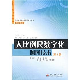
paperback. Condition: New. The paperback. Pub Date: 2009 Pages: 343 in Publisher: Southwest Jiaotong University Press of ordinary institutions of higher learning in the 21st century planning textbook Surveying and Mapping Professional: large-scale digital mapping technology (2) follow Theoretically system comprehensive. the principle of the actual content close to the production. systematic exposition of the theory. methods and application of large-scale digital mapping technology. Ordinary institutions of higher learn.
-

Large-scale digital mapping technology (3rd Edition)(Chinese Edition)
Published by Southwest Jiaotong University Press, 2014
ISBN 10: 7564330074ISBN 13: 9787564330071
Book
paperback. Condition: New. Paperback. Pub Date :2014-04-01 Pages: 352 Language: Chinese Publisher: Southwest Jiaotong University Press. Large Scale Digital Mapping Technology (3rd Edition) follows a comprehensive theoretical system. content. the principle of two close to the actual production . a more systematic exposition of the theory. methods and application of large-scale technology of digital mapping. Book is divided into seven chapters. each mapping outlined the digitization Chapter 1. Chapter 2 computer graphics.