
Order Total (1 Item Items):
Shipping Destination:

Katalog Dawnych Map Rzeczypospolitej Polskiej (4 results)
Skip to main search results
Product Type
- All Product Types
- Books (3)
- Magazines & Periodicals
- Comics
- Sheet Music
- Art, Prints & Posters
- Photographs
- Maps (1)
-
Manuscripts &
Paper Collectibles
Condition
Binding
Collectible Attributes
- First Edition (1)
- Signed
- Dust Jacket
- Seller-Supplied Images (3)
- Not Printed On Demand
Seller Location
Seller Rating
-
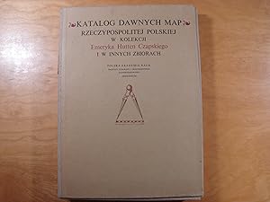
Katalog dawnych map Rzeczypospolitej Polskiej w kolekcji Emeryka Hutten Czapskiego i innych zbiorach. T.1: Mapy XV-XVI wieku/Catalogue of early maps of the Polish Commonwealth in the collection of Emeryk Hutten Czapski and in others
Published by Wroclaw [etc.]: Zaklad Narodowy im. Ossolinskich, 1978, 1978
Book
@ Co-Authors / Wspolautorzy: Opracowal Wojciech Kret; Polska Akademia Nauk. Instytut Geografii i Przestrzennego Zagospodarowania.; @ Blurb / Notka wydawnicza: Wroclaw [etc.]: Zaklad Narodowy im. Ossolinskich, 1978; @ Size of the book block / Wymiar bloku: 34 cm; @ Circulation / Naklad: 2000; @ Weight / Waga: 1880; @ Pages / Strony: Teka: 164s., [28]k. tabl. zloz.; @ Thematic categories / Kategorie tematyczne: historia Polski XVI wiek - h. Polski XVII wiek - h. Polski, kartografia opracowania - kartografia, varia katalogi zbiorow / history of Poland 16th century 17th century, cartography elaborations/compilations, general / Geschichte Polens 16. Jh. 17. Jh., Kartografie Bearbeitungen, Allgemein ; Pozycja w bardzo ladnym stanie. Oprawa wydawnicza polplotno (teka).
-
Katalog dawnych map Rzeczypospolitej Polskiej w kolekcji Emeryka Hutten Czapskiego i w innych zbiorach. Tom I. Mapy XV-XVI wieku
Published by Ossolineum, Wroclaw, 1978
Map
Hardcover. Condition: New. In Polish language. 164 pages. Reprints on separate pages of 28 maps described in the catalogue. Cardboard box. Heavy item. Additional postage applies.
-
![Stock image for KATALOG DAWNYCH MAP RZECZYPOSPOLITEJ POLSKIEJ W KOLEKCJI EMERYKA HUTTEN CZAPSKIEGO: MAPY XVII WIEKU for sale by P�rtico [Portico]](https://pictures.abebooks.com/isbn/9788304032200-uk-300.jpg)
KATALOG DAWNYCH MAP RZECZYPOSPOLITEJ POLSKIEJ W KOLEKCJI EMERYKA HUTTEN CZAPSKIEGO: MAPY XVII WIEKU
Published by OSSOLINEUM (ZAKLAD NARODOWY OSSOLINSKICH, WROCLAW, 1992
ISBN 10: 8304032201ISBN 13: 9788304032200
Book First Edition
Tapa blanda. Condition: New. 1� edici�n. PACKO, T. / D. STACHNAL-TALANDA / E. GOLAB, EDS.: KATALOG DAWNYCH MAP RZECZYPOSPOLITEJ POLSKIEJ W KOLEKCJI EMERYKA HUTTEN CZAPSKIEGO: MAPY XVII WIEKU. WROCLAW, 1992, 250 p. mapas, 2710 gr. Encuadernacion original. Nuevo. (GG-1-7) 2710 gr. Libro.
-
Katalog dawnych map Rzeczypospolitej Polskiej w kolekcji Emeryka Hutten Czapskiego i innych zbiorach. T. 1: Mapy XV-XVI wieku. T. 2: Mapy XVII wieku [complete set]
Published by Ossolineum, Wroclaw, 1978
Book
Hardcover. Condition: Near Fine. 2 folders 34 x 24 cm, 164 pp, 28 folding maps; 250 pp, 48 folding maps. Cloth backed folders (minor shelf wear). A catalog of early maps of the Polish-Lithuanian Commonwealth from the collection of Emeryk Hutten Czapski (1822-1896), a significant coin, book, and map collector. His esteemed collections have been transferred to the National Museum in Krakow, where they are currently exhibited in the Hutten Czapski House. Volume 1 encompasses maps from the XV to XVI centuries, while Volume 2 features maps from the XVII century.
![Seller image for Katalog dawnych map Rzeczypospolitej Polskiej w kolekcji Emeryka Hutten Czapskiego i innych zbiorach. T. 1: Mapy XV-XVI wieku. T. 2: Mapy XVII wieku [complete set] for sale by Leopolis](https://pictures.abebooks.com/inventory/md/md18141909531.jpg)