
Order Total (1 Item Items):
Shipping Destination:

Huntingdon by Ordnance Survey (128 results)
Skip to main search results
Product Type
- All Product Types
- Books (113)
- Magazines & Periodicals
- Comics
- Sheet Music
- Art, Prints & Posters
- Photographs
- Maps (15)
-
Manuscripts &
Paper Collectibles
Condition
Binding
Collectible Attributes
- First Edition
- Signed
- Dust Jacket (1)
- Seller-Supplied Images (50)
- Not Printed On Demand
Free Shipping
Seller Location
Seller Rating
-
Paperback. Condition: Very Good. The book has been read, but is in excellent condition. Pages are intact and not marred by notes or highlighting. The spine remains undamaged.
More buying choices from other sellers on AbeBooks
Used offers from � 0.80
-
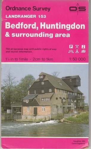
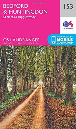
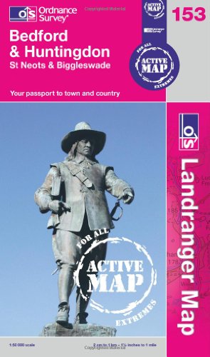
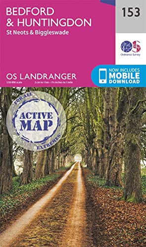
Bedford, Huntingdon, St. Neots and Biggleswade (OS Landranger Map): Sheet 153
Published by Ordnance Survey, 2009
ISBN 10: 0319231720ISBN 13: 9780319231722
Book
Paperback. Condition: Very Good. The book has been read, but is in excellent condition. Pages are intact and not marred by notes or highlighting. The spine remains undamaged.
More buying choices from other sellers on AbeBooks
Used offers from � 1.68
-
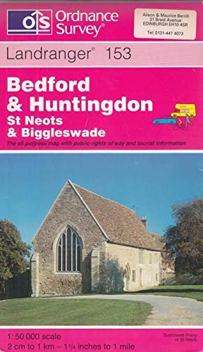
Bedford and Huntingdon, St.Neots and Biggleswade: Sheet 153 (Landranger Maps)
Published by Ordnance Survey, 1998
ISBN 10: 0319223736ISBN 13: 9780319223734
Book
Paperback. Condition: Very Good. The book has been read, but is in excellent condition. Pages are intact and not marred by notes or highlighting. The spine remains undamaged.
More buying choices from other sellers on AbeBooks
Used offers from � 1.68
-
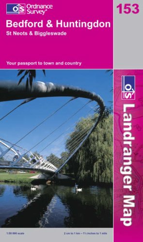
Bedford and Huntingdon, St.Neots and Biggleswade: Sheet 153 (Landranger Maps)
Published by Ordnance Survey, United Kingdom, Hants, 2003
ISBN 10: 0319228479ISBN 13: 9780319228470
Book
Paperback. Condition: Very Good. This map is part of the Landranger (Pink) series and is designed for people who really want to get to know an area. It includes the following information: tourist information, camping and caravan sites, picnic areas and viewpoints, selected places of interest and rights of way information for England and Wales. Each map in the series covers an area of 40 km by 40 km (25 miles by 25 miles) and like other Ordnance Survey maps, National Grid squares are provided so that any feature can be given a unique reference number. Perfect for planning ahead and local excursions, these maps are full of useful information that will help you really get to know an area. The book has been read, but is in excellent condition. Pages are intact and not marred by notes or highlighting. The spine remains undamaged.
More buying choices from other sellers on AbeBooks
Used offers from � 1.84
-
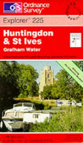
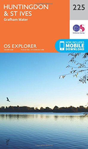
Huntingdon and St.Ives: Sheet 225 (Explorer Maps)
Published by Ordnance Survey, 1999
ISBN 10: 0319218562ISBN 13: 9780319218563
Book
Paperback. Condition: Very Good. The book has been read, but is in excellent condition. Pages are intact and not marred by notes or highlighting. The spine remains undamaged.
More buying choices from other sellers on AbeBooks
Used offers from � 2.76
-
Condition: Good. 1971. Unpaginated. Orange and white pictorial paper cover. Sheet 134. Map is bright and clear with some light foxing and tanning. Slight creases to corners. Paper cover is lightly rub worn and thumbed with light shelf wear to edges and corners. Light creases to corners and spine. Tanning to spine and edges.
-
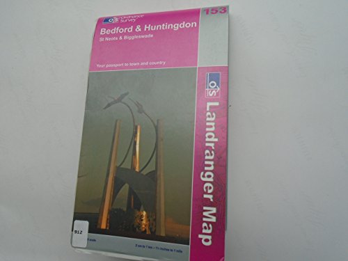
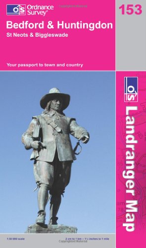
Bedford and Huntingdon, St.Neots and Biggleswade (Landranger Map 153): Sheet 153
Published by Ordnance Survey, 2002
ISBN 10: 0319227537ISBN 13: 9780319227534
Book
Paperback. Condition: Very Good. The book has been read, but is in excellent condition. Pages are intact and not marred by notes or highlighting. The spine remains undamaged.
-
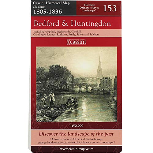
Bedford and Huntingdon: No. 153 (Cassini Old Series Historical Map)
Published by GARDNERS VI BOOKS AMS006, 2006
ISBN 10: 190556855XISBN 13: 9781905568550
Book
Paperback. Condition: Very Good. The book has been read, but is in excellent condition. Pages are intact and not marred by notes or highlighting. The spine remains undamaged.
More buying choices from other sellers on AbeBooks
Used offers from � 3.56
-

Illustrated Card Covers. Condition: Very Good. No Jacket. Clean bright and tight.
-
Paperback. Condition: Fine. Dust Jacket Condition: VG+. Ordnance survey map in magneta and white laminate folder (No photo to front). Sheet 165. 1: 50 000 first series. Fine/VG+. Map is as new; folder has rubbing, bumping and light curl at all corners.
-
Paperback. Condition: Good. The book has been read but remains in clean condition. All pages are intact and the cover is intact. Some minor wear to the spine.
More buying choices from other sellers on AbeBooks
New offers from � 13.97
Used offers from � 5.64
Also find Softcover
-
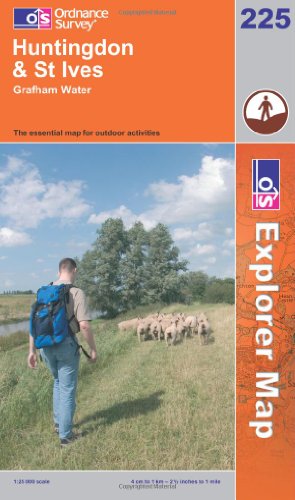
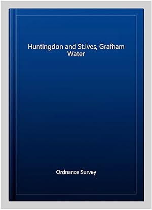
Huntingdon and St.Ives, Grafham Water (Explorer Maps): Sheet 225 (OS Explorer Map)
Published by Ordnance Survey, 2006
ISBN 10: 0319237931ISBN 13: 9780319237939
Book
Paperback. Condition: Very Good. The book has been read, but is in excellent condition. Pages are intact and not marred by notes or highlighting. The spine remains undamaged.
More buying choices from other sellers on AbeBooks
Used offers from � 6.48
-
Paperback. Condition: Very Good. The book has been read, but is in excellent condition. Pages are intact and not marred by notes or highlighting. The spine remains undamaged.
More buying choices from other sellers on AbeBooks
New offers from � 13.73
Used offers from � 7.14
Also find Softcover
-
Paperback. Condition: Very Good. The book has been read, but is in excellent condition. Pages are intact and not marred by notes or highlighting. The spine remains undamaged.
-
Condition: Good. Most items will be dispatched the same or the next working day. Ex library copy with usual stamps & stickers.
More buying choices from other sellers on AbeBooks
New offers from � 17.07
Used offers from � 8.15
Also find Softcover
-
Huntingdon and St.ives, Grafham Water
Published by Ordnance Survey, 2015
ISBN 10: 0319470970ISBN 13: 9780319470978
Book
Condition: As New. Unread book in perfect condition.
More buying choices from other sellers on AbeBooks
New offers from � 17.06
Used offers from � 15.15
Also find Softcover
-
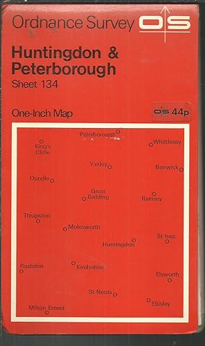
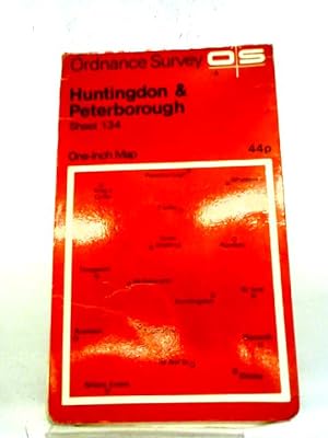
National Grid. One Inch Map of Great Britain, Huntingdon & Peterborough Sheet 134.
Published by Fully revised 1966, Published 1961. (Roads revised 1971.), 1971
Seller: Saintfield Antiques & Fine Books, Northern Ireland, United Kingdom
Seller Rating:

Map
No Binding. Condition: Very Good. 21.5 x 13 cm. Scale one inch to one statute mile, paper copy, folded, card covers, index map on rear cover, covers red , in very good condition.
-
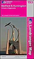
Bedford and Huntingdon, St.Neots and Biggleswade (Landranger Maps) (OS Landranger Map)
Published by Ordnance Survey, 2006
ISBN 10: 031922919XISBN 13: 9780319229194
Book
Paperback. Condition: New. Same / next day dispatch (Monday - Friday),
-
Ordnance Survey One-Inch Map. Sheet 24 Huntingdon
Published by Ordnance Survey, London, 1911
Map
Cream limp linen cover. Reprint. 180mm x 90mm (7" x 4"). 24 panels. Linen-backed map. G: in Good condition without dust jacket as issued. Slight foxing.
-
![Seller image for Ordnance Survey Contoured Road Map [One-inch Popular Edition], sheet 74, Kettering and Huntingdon. for sale by Cornell Books Limited](https://pictures.abebooks.com/inventory/md/md31088186727.jpg)
Ordnance Survey Contoured Road Map [One-inch Popular Edition], sheet 74, Kettering and Huntingdon.
Published by Southampton: Ordnance Survey, 1930., 1930
Map
First printed in 1920, this copy is a reprint from 1930 (print code 2500/30). Mounted on cloth and folded in the original covers, with a front cover illustration by Ellis Martin. The map and the covers are in very good condition. Also covers Corby, Oundle, Wellingborough, Thrapston, Higham Ferrers, Godmanchester and Kimbolton.
-
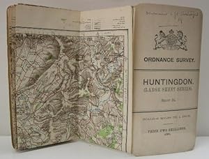
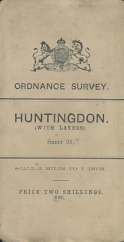
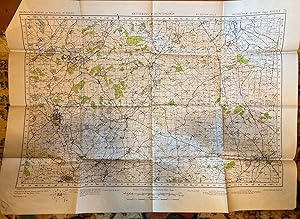
Map : Huntingdon, Sheet 24, 1907 (Large Sheet Series), with Layers
Published by Ordnance Survey, Southampton, 1907
Soft cover. Condition: Very Good. White covers, cloth backed coloured OS map centred on Huntingdon. Negligible foxing on cloth backing, neat ink inscription on front. Scale 2 miles to 1 inch, reduced from the 1" Map of 1897-1905. Original price two shillings.
-

Original 1922 County Map: Suffolk, Cambridgeshire, Huntingdon
Published by Ordnance Survey, UK, 1922
Book
Softcover. Condition: Very Good. 1922. A generally very presentable map, laid down onto linen and bearing a central, vertical fold line as originally presented. Some minor bumps and handling marks around the outer edges, but the print itself remains clear and unmarked, suitable for framing or display. Why on Amazon do most sellers not describe their actual book? Buy with confidence and support a genuine Independent Bricks & Mortar Real Bookshop. We are Maynard & Bradley CAMBO & PBFA(now lapsed) members here in Leicester City Centre. Size: 750 x 345 mm. 1. Item Type: Book. Quantity Available: 1. Shipped Weight: 1-2 kilos. Category: Geography & Maps; Britain/UK; 1920s; Inventory No: 40194.
-
Ordnance Survey Huntingdon (with layers). Sheet 24.: scale - 2 miles to 1 inch
Published by Ordnance Survey, Southampton, 1911
Book
Condition: G+. White cloth, linen backed. In 24 segments. Original Price Two Shillings (Net). Reduced from the One Inch Map of 1904 - 07. Covers a little grubby but despite mild foxing clean and sound internally.
-
No Binding. Condition: Very Good. No Jacket. 5th or later Edition. A very good copy of this single sheet (74), paper, colour, OS map, described as 5th Edition Style, Second War Revision,1940, first published at the War Office,1940. In very good condition for its age; outside has very neat pencil lettering 'Kettering & Huntingdon sheet 74', but really very clean; folded out map very clean and bright with little or no sign of wear. All folds intact, no damage. 55 cm x 76 cm.
-
![Seller image for Ordnance Survey sheet 52 [Kettering, Wellingborough, Thrapston, Higham Ferrers, Huntingdon, Kimbolton, Molesworth, Upton, Northampton, Olney, Harrold, Souldrop, Bedford, St. Neots, Potton, Roxton, Yelling - Northamptonshire Vales, Yardley Whittlewood Ridge, Bedfordshire and Cambridgeshire Claylands, East Midlands] for sale by Antiqua Print Gallery](https://pictures.abebooks.com/inventory/md/md31583242087.jpg)
Condition: Good. OS #52 Northamptonshire Vales & Bedfordshire Claylands. Huntingdon 1835 map. Antique folding hand coloured survey map, dissected and laid down on linen; Engraved at the Ordnance Map Office, Tower of London. Engraved by Benjamin Baker and assistants. Published by Thomas Frederick Colby. (1835). 65.5 x 97.5cm, 25.75 x 38.25 inches; this is a folding map. Condition: Good. There is nothing printed on the reverse side, which is plain. The genesis of the Ordnance Survey's original one-inch per mile survey occurred in 1783 when the Royal Societies of Paris and London agreed to connect their two great cities by the use of triangulation to settle the dispute of their relative positions. This triangulation, completed by 1790, together with the outbreak of war with France in 1793, acted as a catalyst for the surveying of England. The survey began in Kent and by the end of the Napoleonic Wars in 1815 most of southern England had been mapped. By 1844, publication of the Old Series, one inch to one mile, was complete for the whole of Great Britain south of Preston and Hull. In spite of concerns about the cost of the survey, work continued until by 1870 the whole of England and Wales had been mapped.
-
Ordnance Maps of England, No. 52, Northampton, Wellingborough, Huntingdon, St. Neots, Bedford
Published by Published by the Ordnance Map Office and sold by Letts, Son & Steer, London, 1835
Map
, linen backed Ordnance map detailing Northampton, Wellingborough, Huntingdon, St. Neots, Bedford, has a scale of 1 inch to a Mile, colour borders between counties , corners and edges rubbed, small tears in the joints of the linen backing, covers marked slightly, good condition , cloth backed paper map with black titles , 21.5 x 12 (folded) 95 x 64.5 cm Map ISBN:
-
5 Ordnance Survey One Inch Maps; Sheet 24 Huntingdon 2 miles to an inch; Gloucestershire Sheet XLI NW Haresfield 1903 [7 maps]
Published by Published by Ordnance Survey and Edward Stanford 1890-1914, Southampton and London, 1890
Map
, Ordnance Survey One Inch Maps in colour: Sheet 106 Oxford and Henley on Thames 1914; Sheet 107 Watford and High Wycombe 1910; Sheet 115 Windsor 1911; Sheet 116 Canterbury and Margate 1913; New 1 inch Ordnance Survey Map of England and Wales Sheet 285 Aldershot and Guildford in black and white with red roads, c1890; Sheet 24 Huntingdon 2 miles to an inch, in colour 1911; Gloucestershire Sheet XLI NW Haresfield 1903 six inches to one mile with manuscript annotated acerage marks, black and white Mixed editions , light rubbing to covers, Canterbury and Margate slightly cockled, foxing to linen and to one map, good condition , linen backed maps , 19 x 11 cm (folded); Maps ISBN:

![Seller image for 5 Ordnance Survey One Inch Maps; Sheet 24 Huntingdon 2 miles to an inch; Gloucestershire Sheet XLI NW Haresfield 1903 [7 maps] for sale by Keoghs Books](https://pictures.abebooks.com/inventory/md/md30707309126.jpg)