
Order Total (1 Item Items):
Shipping Destination:

rucksack readers united kingdom dunblane (2 results)
Skip to main search results
Product Type
- All Product Types
- Books (2)
- Magazines & Periodicals
- Comics
- Sheet Music
- Art, Prints & Posters
- Photographs
- Maps
-
Manuscripts &
Paper Collectibles
Condition
- All Conditions
- New
- Used
Binding
- All Bindings
- Hardcover
- Softcover
Collectible Attributes
- First Edition
- Signed
- Dust Jacket
- Seller-Supplied Images
- Not Printed On Demand
Seller Location
Seller Rating
-
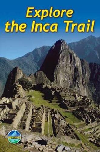
Explore the Inca Trail
Published by Rucksack Readers, United Kingdom, Dunblane, 2011
ISBN 10: 1898481466ISBN 13: 9781898481461
Book
Paperback. Condition: Good. The third edition of this popular guidebook contains everything the walker needs to plan and enjoy hiking the Inca trail to Machu Picchu in Peru, with three routes taking from 2-7 days. It includes advice on how to prevent and manage altitude sickness; background on Inca culture and the ruins; and advice on planning in the light of new Trail regulations. This 2011 edition has been released for the centenery of Bingham's "discovery" of Machu Picchu. It contains everything you need to plan and enjoy hiking a choice of three Inca Trails to Machu Picchu in Peru. Step-by-step sections cover the Classic trail (4-5 days), the longer, more strenuous trek from Mollepata (6-7 days) and the Shortest option (2 days). The book includes a drop-down map showing all three trails (three panels), plus a detailed site plan of Machu Picchu ruins (two panels); detailed description of Machu Picchu, with side-trips and photographs; background on Inca culture and stonework, Andean wildlife and modern Peru; advice on planning and preparation, including packing checklist and updated Trail regulations; medical advice on how to prevent and manage altitude symptoms; and a phrasebook in Spanish, Quechua and English. The book is in full colour, with over 80 photographs, printed on waterproof paper. The book has been read but remains in clean condition. All pages are intact and the cover is intact. Some minor wear to the spine.
-
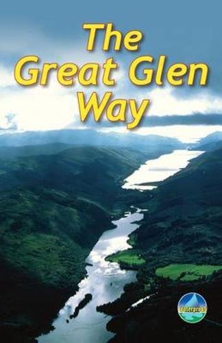
The Great Glen Way: Walk or cycle the Great Glen Way
Published by Rucksack Readers, United Kingdom, Dunblane, 2010
ISBN 10: 1898481393ISBN 13: 9781898481393
Book
Paperback. Condition: Very Good. This guidebook (fully updated in 2020) contains all you need to plan and enjoy a holiday walking or cycling along Scotland's historic Great Glen (77 miles/124 km). The Way runs between Fort William and Inverness, passing beside Scotland's highest mountain, along its historic Caledonian Canal and alongside beautiful lochs, including Loch Ness with its famous monster legend and Urquhart Castle. This sixth edition has fresh mapping at 1:38,000 on 13 pages, with detailed relief contours and colouring; on rainproof paper throughout; in full colour, with 100+ photos; visitor attractions and hills to climb including Ben Nevis; town plans of Fort William and Inverness; background on local geology, history and wildlife; summary of each section showing distance, terrain, altitude profile and food/drink stops; planning information for travel by car, train, bus or plane. This guidebook contains all you need to plan and enjoy the Great Glen Way - on foot or on a bike: detailed mapping on 13 pages at 1:38,000 hill and mountain side-trips including Ben Nevis background on canal heritage, clan history and wildlife detailed description for each section walked from Fort William to Inverness summaries showing distance, terrain, food/drink stops and altitude profile planning information for walkers and cyclists town plans of Fort William and Inverness in full colour, with 100+ photos, many of them new rucksack-friendly and on rainproof paper. The book has been read, but is in excellent condition. Pages are intact and not marred by notes or highlighting. The spine remains undamaged.