
Order Total (1 Item Items):
Shipping Destination:

discovery walking guides ltd northampton (59 results)
Feedback
Skip to main search results
Search filters
Product Type
- All Product Types
- Books (59)
- Magazines & Periodicals (No further results match this refinement)
- Comics (No further results match this refinement)
- Sheet Music (No further results match this refinement)
- Art, Prints & Posters (No further results match this refinement)
- Photographs (No further results match this refinement)
- Maps (No further results match this refinement)
- Manuscripts & Paper Collectibles (No further results match this refinement)
Condition
Binding
Collectible Attributes
- First Edition (No further results match this refinement)
- Signed (No further results match this refinement)
- Dust Jacket (No further results match this refinement)
- Seller-Supplied Images (34)
- Not Print on Demand (59)
Free Shipping
Seller Rating
-

Walk Dartmoor
Published by Discovery Walking Guides Ltd, United Kingdom, Northampton, 2006
ISBN 10: 1904946127 ISBN 13: 9781904946120
Seller: WorldofBooks, Goring-By-Sea, WS, United Kingdom
Seller rating 5 out of 5 stars

Paperback. Condition: Very Good. Walk! Dartmoor with Kate and Alan Hobbs covers walks of varying length across Dartmoor - from the dramatic high moors, gentle riversides, idyllic country lanes, unspoilt villages, to sites of ancient archaeology and former industries, and all with spectacular views. This user friendly illustrated guide has a summary of walking routes and is rated by time, effort, distance and hills, as well as the availability of refreshments en route and the vertigo risk.Each walk is described in full and there are timings listed in the book to help with navigation and progress. Walk! Dartmoor contains a 1:40,000 scale Ordnance Survey map for each route. --Devon Life May 2006 Book Description Within the heart of Devon lies Dartmoor's 365 square miles of natural beauty, one of the largest areas of exposed granite in southern England. Apart from its spectacular scenery, Dartmoor is rich in flora and fauna. Come with us to explore Dartmoor's dramatic high moors, gentle riversides, idyllic country lanes and unspoilt villages, discovering spectacular views, ancient archaeology and traces of bygone industries. All 40 walking routes include: walking route summary, ratings for Effort Time Distance Ascents/Descents Refreshments and Vertigo risk, fully detailed walk description including frequent timings to aid navigation and check your progress, GPS waypoints at every key point on every route, full colour 1:40,000 scale Ordnance Survey licenced mapping for each route, short walk and stroll alternatives. The book has been read, but is in excellent condition. Pages are intact and not marred by notes or highlighting. The spine remains undamaged.
-

Tenerife Bus & Touring Map (Folded)
Published by Discovery Walking Guides Ltd, Northampton, 2020
ISBN 10: 1782750703 ISBN 13: 9781782750703
Folded. Condition: new. Folded. Tenerife Bus & Touring Map, the island's most popular map, is now back in its new 7th edition for 2020 now that TITSA (island bus company) has finished reorganising its routes and bus stations, and the island authorities have completed their road numbering system; extended motorway system and junctions numbered by their kilometer marker. Tenerife island map at 1:100k scale along with updated large scale street plans for Las America/Los Cristianos, Santa Cruz, Puerto de la Cruz, Los Gigantes/Puerto Santiago/Playa la Arena, Golf del Sur/Amarilla Golf, Las Galletas/Costa del Silencio. Masses of Titsa bus routes and timetable information including the Ten+ discount bus tickets used on Titsa buses; saving up to 50% on the already pocket-money fares. Tenerife island map has been drawn with particular emphasis on navigation by road and Titsa bus routes. Extensive place name index makes finding your destination on the island quick and easy, while our bus terminus and bus route numbering helps you find the routes you need to go where you want to go. Tenerife Bus & Touring Map is your best choice for exploring the stunning landscapes of the Island of Eternal Spring and is the travel essential for everyone visiting this exciting island in the Canaries. 860mm by 660mm makes Tenerife Bus & Touring Map a big map but thanks to our specialist 'concertina map fold' it is easy to open, and more importantly easy to refold to its convenient pocket size. Tenerife Bus & Touring Map, the island's most popular map, is now back in its new 7th edition for 2020 now that TITSA (island bus company) has finished reorganising its routes and bus stations, and the island authorities have completed their road numbering system; extended motorway system and junctions numbered by their kilometer marker. Shipping may be from multiple locations in the US or from the UK, depending on stock availability.
More buying choices from other sellers on AbeBooks
New offers from � 7.70
-
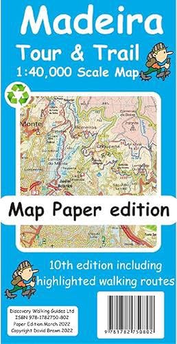
Madeira Tour and Trail Map paper edition (Folded)
Published by Discovery Walking Guides Ltd, Northampton, 2022
ISBN 10: 1782750800 ISBN 13: 9781782750802
Folded. Condition: new. Folded. For your best adventures, use the best map. Madeiras favourite map is now in its 10th edition including the new Palheiro golf development, goodbye to the abandoned Ponta Pargo golf course, final sections of the VE3 road, loads of minor road updating especially in the south west. For hikers we have added several new highlighted walking routes. Madeira Tour and Trail Map is a large 960mm by 700mm double sided map sheet. Specialist concertina map folding means the 960mm by 700mm double sided map folds quickly to its 235mm by 120mm pocket size. This most detailed map of Madeira includes our Tour and Trail level of detail ranging from major roads to secondary roads to minor roads to streets and camino rural narrow country roads, plus dirt roads and walking trails. Altitude background colouring is designed to clearly show the altitude range when travelling across the island by car or on foot. 100 metre and 50 metre contours are clearly shown on the map along with a large number of individual height points and all of the official Trig points. Tour and Trail attention to detail is legendary as is our useful symbol range including miradors, picnic areas, petrol stations, bar restaurants and parking areas where you can pull off the road safely. You will easily identify springs, caves, sports grounds, cemetries, churchs, chapels, lighthouses, towers and forts, camping areas, wind turbines, hotels etc. For adventurers on foot Tour and Trail Maps are researched and designed by hikers for use by hikers. Our comprehensive gps ground surveys produce the best mapping available but the value of this on the ground research becomes even more important when you leave the tarmac. All of our DWG walking routes are accurately gps surveyed giving you confidence in the accuracy of our Tour and Trail Maps. All the walking routes from Madeira Walks volumes 1 and 2 by Shirley Whitehead highlighted in Red while other published walking routes (printed guide books and reliable web publications) are highlighted in Green. It all adds up to the most useful map of Madeira that you can buy anywhere. In use maps have a very tough life so you will appreciate our specialist concertina map fold that allows you to quickly open the map, and more importantly fold it back up to its pocket size after use. Paper maps will always suffer from the repeated unfolding, folding to the section you want to use, and then refolding. Now in its 10th edition including the new Palheiro golf development, goodbye to the abandoned Ponta Pargo golf course, final sections of the VE3 road, loads of minor road updating especially in the south west. For hikers we have added several new highlighted walking routes. Shipping may be from multiple locations in the US or from the UK, depending on stock availability.
More buying choices from other sellers on AbeBooks
New offers from � 9.55
-

National 3 Peaks Challenge Maps (Map)
Published by Discovery Walking Guides Ltd, Northampton, 2019
ISBN 10: 1782750541 ISBN 13: 9781782750543
Map. Condition: new. Map. National 3 Peaks Challenge Maps. Ben Nevis, Scafell Pike and Snowdon at 20k scale. Waterproof, tearproof and 100% recyclable 820mm by 420mm double sided map sheet. Taking OS mapping at 50k scale we expand the mapping to produce 20k scale maps of the three challenge peaks, Ben Nevis, Scafell Pike and Snowdon. By expanding the OS mapping the features of names, roads, tracks and trails are more than doubled in size making them easier to read under Challenge conditions. We then add the Challenge Routes, specially highlighted to make them stand out against the OS map background information and add in additional information that will help your challenge. Each map covers the region to show the access roads as well as the walking routes. Ben Nevis includes the Glen Nevis Information Centre starting point and Glen Nevis Youth Hostel starting point. Scafell Pike includes the Wasdale and Seathwaite Challenge Routes. Snowdon includes the Pyg Track, Miners Track and Llamberis Challenge Routes. Each peak is a 420mm by 420mm OSlike map mounted on a double sided map sheet of 840mm by 420mm. The map designs are then printed on a 100 micron plastic substrate using UV cured inks on the UK's only press capable of using this latest technology. The result is a lightweight map that is both waterproof and tearproof, and fully recyclable, that will survive anything your 3 Peaks Challenge can throw at it and afterwards will fold up like new. National 3 Peaks Challenge Maps. Ben Nevis, Scafell Pike and Snowdon at 20k scale. Waterproof, tearproof and 100% recyclable 820mm by 420mm double sided map sheet. Shipping may be from multiple locations in the US or from the UK, depending on stock availability.
More buying choices from other sellers on AbeBooks
New offers from � 10.52
-

Walk! Lanzarote
Published by Discovery Walking Guides Ltd, United Kingdom, Northampton, 2017
ISBN 10: 1782750436 ISBN 13: 9781782750437
Seller: WorldofBooks, Goring-By-Sea, WS, United Kingdom
Seller rating 5 out of 5 stars
Paperback. Condition: Very Good. Lanzarote's most popular walking guide book just got even better. Walk! Lanzarote 4th edition builds on the reputation of our earlier editions with more walks and comprehensive updating so that it caters for the needs of the increasing number of people who would like to combine some walking with a holiday on the Fire island. Walk Lanzarote explodes the myth that there is nowhere worth walking on the island as we range through strolling on coastal promenades, walking across alpine style meadows, striding over the lava sea, dropping into volcanoes, sitting on high mountain seats - quite simply you will be amazed at the wide variety of stunning landscapes the Fire island has to offer the adventurous leisure walker. New for the 4th edition; new extended coastal route from Arrieta to Los Cocoteros to Costa Teguise, new Playa Blanca to Las Brenas to Yaiza on the GR131, which also updates our Yaiza to Las Brenas circular, newly revised Tabayesco circular, Montana Blanca and Montana Soo are circular adventures in new locations, revised Helechos Cirrcular now starting at Guinate, Yaiza - Uga Circular including a section of the GR131, El Golfo Circular in detail and available as a Timanfaya guided walk, Mirador del Rio, and the revised Corona's Northern Tour. Walk Lanzarote's forty one main walking routes provide a wide variety of adventures with routes ranging from family friendly costal promenades through a surprising range of landscapes up to some serious hiking. Every route is an adventure that will make you eager to explore further on this spectacular island. Walk Lanzarote is produced to our highest standards with walk summary and rating, fully detailed description, frequent timings so you can check your progress, compass directions, and gps waypoints for all country routes. Each country route has full 1:40,000 scale colour mapping and gps waypoints dedicated to that route, while our Teguise town walk uses a large scale street plan. All routes are illustrated with colour photos. Culture and agriculture are included along with a Thingy section on modern art. We've emphasised the Access by Bus sections for each walk along with our Access by Car information for each walking route. Map sections for each route are taken from the Lanzarote Tour & Trail Super-Durable Map 5th edition. For gps users the gps waypoint files are available as a free downloadable zip file on the Discovery Walking Guides website. Quite simply the best book of Lanzarote that you can buy. If this is your first visit to Lanzarote then Walk! Lanzarote plus Lanzarote Tour & Trail Map will give you a series of adventures that will have you returning to the Fire island to experience more. The book has been read, but is in excellent condition. Pages are intact and not marred by notes or highlighting. The spine remains undamaged.
-

Menorca Tour and Trail Map (Folded)
Published by Discovery Walking Guides Ltd, Northampton, 2018
ISBN 10: 1782750509 ISBN 13: 9781782750505
Folded. Condition: new. Folded. For the best adventures, use the best map. Menorca Tour & Trail Super-Durable Map covers this beautiful island at 40k scale resulting in the most detailed and toughest map of Menorca that you can buy. Menorca is a large island (700 sq kms) resulting in a large, 840mm by 600mm, double sided map sheet with East on one side and the West on the reverse. A generous common overlap reduces the need to turn the map over when navigating. Our special `concertina map fold' makes the map easy to unfold and refold to its pocket size, 215mm by 120mm. Super-Durable Maps include a 2 year adventurous use wear and tear guarantee. At 40k scale, the level of detail we can include on Menorca Tour & Trail Super-Durable Map is awesome. Building on our previous editions, we have our legendary level of Tour & Trail detail including the named archaeological sites. New in 2018 for our 7th edition are the road widening works on the ME-1 main road across the island, 30 new Official Walking Routes and 20 Official Cycling Routes. These new routes, along with Walk! Menorca walking routes and the Cami de Cavalls, are specially highlighted on the map making them easier to find and to follow on the ground. We've checked that `Menorca Landscapes' routes are correctly shown on our map. Whichever source you use for your hiking or cycling adventures, Menorca Tour & Trail Super-Durable Map will be your map of choice. Quite simply, Menorca Tour & Trail Super-Durable Map is the toughest, most usable map of the island that you can buy. Digital editions of Tour & Trail Maps for phone apps and Garmin users are available on the dwgwalking website. For the best adventures, use the best map. Menorca Tour & Trail Super-Durable Map covers this beautiful island at 40k scale resulting in the most detailed and toughest map of Menorca that you can buy. Digital editions of Tour & Trail Maps for phone apps and Garmin users are available on the dwgwalking website. Shipping may be from multiple locations in the US or from the UK, depending on stock availability.
More buying choices from other sellers on AbeBooks
New offers from � 11.67
-

Western Crete Tour & Trail Super-Durable Map (Paperback)
Published by Discovery Walking Guides Ltd, Northampton, 2023
ISBN 10: 178275086X ISBN 13: 9781782750864
Paperback. Condition: new. Jan Kostura (illustrator). Paperback. For your best adventures, use the best map. Water-proof, split-proof, tear-proof. Western Crete Tour & Trail Super-Durable Map is simply the toughest, most accurate, easy to read, easy to use map that you can buy at any price. A large 960mm by 694mm double sided map sheet at 1:40,000 scale covers area of over 1600km2, from Paleochora in the west to Preveli beach in the east. The map covers the most important hiking regions in the western Crete, including the famous Samaria Gorge, Lefka Ori (White Mountains) and much more. Our legendary 'Tour & Trail' level of detail ranges from major roads to secondary roads to minor roads to streets and narrow country roads, plus dirt roads, tracks and walking trails. Place names are in English and Greek to aid your navigation. Altitude shading is designed to clearly show the altitude range when travelling across the island by car or on foot. 20-metre and 100-metre contours combined with altitude shading bring this beautiful landscape to life. There are plenty of individual height points and all of the official 'Trig' points are on the map. Tour & Trail attention to detail includes our useful symbol range including viewpoints, picnic areas, petrol stations, bar/restaurants and parking areas where you can pull off the road safely. You will easily identify springs, caves, sports grounds, cemeteries, monasteries, churches, chapels, lighthouses, forts, camping areas, waterfalls, wind turbines, windmills, hotels etc. For walkers, the E4 long distance walking route is specially highlighted on the map in red. Published walking routes are highlighted in green. It all adds up to the most detailed, most durable map of Western Crete that you can buy anywhere. 'Super-Durable' means a waterproof, tear-proof, map that can take the roughest treatment and still folds up like new after your adventures. Super-Durable Maps come with a 2-year adventurous use 'Wear and Tear' guarantee. DWG's special concertina map fold makes our map easy to open and easy to refold back to its 232mm by 120mm size. Digital editions of our Western Crete Tour & Trail Map are available as in-app purchases for Outdooractive, Locus Map and Avenza apps For your best adventures, use the best map. Water-proof, split-proof, tear-proof. Western Crete Tour & Trail Super-Durable Map is simply the toughest, most accurate, easy to read, easy to use map that you can buy at any price. Shipping may be from multiple locations in the US or from the UK, depending on stock availability.
-

Madeira Tour and Trail Map (Map)
Published by Discovery Walking Guides Ltd, Northampton, 2021
ISBN 10: 1782750754 ISBN 13: 9781782750758
Map. Condition: new. Map. For your best adventures, use the best map. Madeira's favourite map just got a whole lot better. Now in its 10th edition including the new Palheiro golf development, goodbye to the abandoned Ponta Pargo golf course, final sections of the VE3 road, loads of minor road updating especially in the south west. For hikers we have added several new highlighted walking routes. Madeira Tour & Trail Map is a large 960mm by 700mm double sided map sheet. Super-Durable edition comes with a 2 year adventurous use guarantee. Specialist concertina map folding means the 960mm by 700mm double sided map folds quickly to its 235mm by 120mm pocket size. This most detailed map of Madeira includes our 'Tour & Trail' level of detail ranging from major roads to secondary roads to minor roads to streets and camino rural narrow country roads, plus dirt roads and walking trails. Altitude background colouring is designed to clearly show the altitude range when travelling across the island by car or on foot. 100 metre and 50 metre contours are clearly shown on the map along with a large number of individual height points and all of the official 'Trig' points. Tour & Trail attention to detail is legendary as is our useful symbol range including miradors, picnic areas, petrol stations, bar/restaurants and parking areas where you can pull off the road safely. You will easily identify springs, caves, sports grounds, cemetries, churchs, chapels, lighthouses, towers and forts, camping areas, wind turbines, hotels etc. For adventurers on foot Tour & Trail Maps are researched and designed by hikers for use by hikers. Our comprehensive gps ground surveys produce the best mapping available but the value of this on the ground research becomes even more important when you leave the tarmac. All of our DWG walking routes are accurately gps surveyed giving you confidence in the accuracy of our Tour & Trail Maps. Madeira Tour & Trail Map includes all the walking routes from 'Madeira Walks' volumes 1 & 2 by Shirley Whitehead highlighted in Red while other published walking routes (printed guide books and reliable web publications) are highlighted in Green. It all adds up to the most useful map of Madeira that you can buy anywhere. In use maps have a very tough life so you will appreciate our specialist concertina map fold that allows you to quickly open the map, and more importantly fold it back up to its pocket size after use. Paper maps will always suffer from the repeated unfolding, folding to the section you want to use, and then refolding. We recommend everybody to obtain our Super-Durable editions printed with 100% oxygenation inks on Polyart by the UK's leading map printer, which produces a map that feels like silk but will stand up to the roughest treatment of outdoor adventuring and yet fold up like new at the end of your adventure. Tour & Trail Super-Durable Maps are more expensive than paper maps, but represent better value as they produce a lightweight map that feels like silk while being both water-proof and incredibly tough so that after even the toughest of adventures your Tour & Trail Super-Durable Map will fold up like new. Digital editions of Madeira Tour & Trail Map for phone apps and Garmin users are available on the dwgwalking website. Madeira's favourite map just got a whole lot better. Now in its 10th edition including the new Palheiro golf development, goodbye to the abandoned Ponta Pargo golf course, final sections of the VE3 road, loads of minor road updating especially in the south west. For hikers we have added several new highlighted walking routes. Shipping may be from multiple locations in the US or from the UK, depending on stock availability.
More buying choices from other sellers on AbeBooks
New offers from � 11.80
-

Zakynthos (Zante) Tour & Trail Map (Map)
Published by Discovery Walking Guides Ltd, Northampton, 2019
ISBN 10: 1782750665 ISBN 13: 9781782750666
Map. Condition: new. Map. For the best adventures, use the best map. Water-proof, split-proof, tear-proof, adventure-proof. Zakynthos (Zante) Tour & Trail Super-Durable Map is simply the toughest, most accurate, easy to read, easy to use map of the island you can buy at any price. Super-Durable Maps come with a 2 year adventurous use `Wear and Tear' guarantee. A large 840mm by 694mm double sided map sheet has Zakynthos (Zante) at 1:35,000 scale with the North-West of the island on the cover side and the South-East on the reverse. There is a very generous overlap between the two sides so the only time you need to turn the map over is if you are driving from Cape Skinari (NW) to Cape Gerakas (SE) at the opposite end of the island. Our special concertina map fold makes our map easy to use and easy to refold to its 235mm by 120mm pocket size. You can also download the digital Custom Map edition of our Zakynthos Tour & Trail Map for use with Garmin gps units and software; simply follow the instructions on the map sheet. Our legendary 'Tour & Trail' level of detail ranges from major roads to secondary roads to minor roads to streets and narrow country roads, plus dirt roads and walking trails. Place names are in English and Greek to aid your navigation. Altitude shading is designed to clearly show the altitude range when travelling across the island by car or on foot. 100 metre and 20 metre contours are clearly shown on the map along with individual height points and all of the official 'Trig' points. Tour & Trail attention to detail includes our useful symbol range including viewpoints, picnic areas, petrol stations, bar/restaurants and parking areas where you can pull off the road safely. You will easily identify springs, caves, sports grounds, cemeteries, churches, chapels, lighthouses, towers and forts, camping areas, wind turbines, hotels etc. We have ensured that all the walking routes from the Sunflower walking guide book are highlighted (red) on the maps. It all adds up to the most detailed, most durable, most useful map of Zakynthos (Zante) that you can buy anywhere. Digital editions are available for phone apps and Garmin users from the Discovery Walking Guides website. A large 840mm by 694mm double sided map sheet has Zakynthos (Zante) at 1:35,000 scale with the North-West of the island on the cover side and the South-East on the reverse. Zakynthos (Zante) Tour & Trail Super-Durable Map is simply the toughest, most accurate, easy to read, easy to use map of the island you can buy at any price. Shipping may be from multiple locations in the US or from the UK, depending on stock availability.
More buying choices from other sellers on AbeBooks
New offers from � 12.52
-

Coast to Coast Challenge Map (Folded)
Published by Discovery Walking Guides Ltd, Northampton, 2019
ISBN 10: 1782750630 ISBN 13: 9781782750635
Folded. Condition: new. Folded. The whole 'Wainwright' Coast to Coast on one double sided, 960mm by 694mm, map sheet. All 193 miles (308 kilometres) of the Wainwright route along with its alternatives are highlighted across 9 map sections at 40k scale. Ordnance Survey accuracy is combined with Tour & Trail map design to produce 40k scale map sections which are easy to read. OS 50k Landranger mapping is expanded to 40k scale making the text and features over 40% larger making them easy to read and understand. Wainwright's C2C walking routes, and their alternatives, are specially highlighted in Tour & Trail style making the routes easy to find on the map and on the ground. Public `Rights of Way' paths and bridleways are also highlighted in Tour & Trail style making them easy to recognise and find. Coast 2 Coast Challenge Map design is then printed on Polyart using 100% oxygenation inks to produce a lightweight, Super-Durable, waterproof map that is tough enough to shrug off the worst that the C2C can subject it to and still fold up like new at the end of each day. In addition to the Super-Durable printed map, Discovery Walking Guides offers you a free `C2C Digital Resources Package'. Simply follow the instructions on the map to receive a download link to the zip file, which contains all 9 map sections as digital Custom Map editions in kmz file format along with 13 gpx waypoint files covering the 13 stages of the C2C. Combining the Super-Durable Map with the Digital Resources Package gives you trouble free navigation for the whole C2C Challenge route from St Bees to Robin Hood's Bay. The whole Coast to Coast on one double sided, 960mm by 694mm, map sheet. All 193 miles (308 kilometres) of the Wainwright route along with its alternatives are highlighted across 9 map sections at 40k scale. Ordnance Survey accuracy is combined with Tour & Trail map design to produce 40k scale map sections which are easy to read. Shipping may be from multiple locations in the US or from the UK, depending on stock availability.
More buying choices from other sellers on AbeBooks
New offers from � 12.57
-

Kefalonia Tour and Trail Map (Folded)
Published by Discovery Walking Guides Ltd, Northampton, 2020
ISBN 10: 178275072X ISBN 13: 9781782750727
Folded. Condition: new. Folded. Kefalonia was popularised and made famous by Captain Corelli's Mandolin. For your best adventures, use the best map. Water-proof, split-proof, tear-proof, adventure-proof. Kefalonia and Ithaca Tour and Trail Super Durable Map is simply the toughest, most accurate, easy to read, easy to use map of the island you can buy at any price. A large 960mm by 690mm double sided map sheet has both Kefalonia and Ithaca at 1:40,000 scale with the North-West of Kefalonia on the cover side and the South-East of Kefalonia with neighbouring island Ithaca on the reverse. A generous common overlap of Kefalonia reduces the need to turn the map over when navigating. Our special concertina map fold makes your map easy to open and easy to refold to its 230mm by 120mm pocket size. Our legendary 'Tour & Trail' level of detail ranges from major roads to secondary roads to minor roads to streets and narrow country roads, plus dirt roads, tracks and walking trails. Place names are in English and Greek to aid your navigation. Altitude shading is designed to clearly show the altitude range when travelling across the island by car or on foot. 20 metre and 100 metre contours combined with altitude shading bring this beautiful landscape to life. There are plenty of individual height points and all of the official Trig points are on the map. Tour and Trail attention to detail includes our useful symbol range including viewpoints, picnic areas, petrol stations, bar/restaurants and parking areas where you can pull off the road safely. You will easily identify springs, caves, sports grounds, cemeteries, monasteries, churches, chapels, lighthouses, castles, camping areas, wind turbines, hotels etc. Published walking routes are clearly highlighted on the map. It all adds up to the most detailed and most durable map of Kefalonia and Ithaca that you can buy anywhere. Super Durable means a waterproof, tear-proof, map that can take the roughest treatment and still folds up like new after your adventures. Super Durable Maps come with a 2 year adventurous use Wear and Tear guarantee. Digital editions of our Kefalonia and Ithaca Tour and Trail Map are available for phone apps and Garmin users from our Discovery Walking Guides website. Water-proof, split-proof, tear-proof, adventure-proof. Kefalonia and Ithaca Tour & Trail Super Durable Map is simply the toughest, most accurate, easy to read, easy to use map of the island you can buy at any price. Shipping may be from multiple locations in the US or from the UK, depending on stock availability.
More buying choices from other sellers on AbeBooks
New offers from � 12.60
-

Costa Blanca Mountains Tour and Trail Map (Map)
Published by Discovery Walking Guides Ltd, Northampton, 2018
ISBN 10: 1782750495 ISBN 13: 9781782750499
Map. Condition: new. Map. For better adventures, use the best map. Costa Blanca Mountains Tour & Trail Super-Durable Map 2nd edition is the essential map for everyone looking to explore the exciting mountainous hinterland of the Costa Blanca. Whether you are exploring on foot, bike or horse this is your first choice map. Scale 1:40,000 2.5cms = 1km. Double-sided 780mm by 600mm folded to 21cm by 12cm. For the 2nd edition we have carried out a thorough makeover while also adding a large number of walking tracks and trails. Walk! the Costa Blanca Mountains' 37 walking routes are highlighted in red, Official PR/GR walking routes are highlighted in green. For the 2nd edition we have added 72 walking routes from the Costa Blanca Mountain Walkers website maintained by Bob and Jean Hall, these are highlighted in blue. Our red/green/blue highlighting makes it easy to identify your walking routes on the new map. We have also checked that Costa Blanca by Landscapes 13 walking routes are correctly shown, along with 27 walking routes from Costa Blanca by Rother. All the usual details of Tour & Trail Maps are included: Roads; Motorway, major roads, secondary roads, minor roads & tarmacked lanes including latest road numbering system. Tracks & Trails; Unsurfaced (dirt) roads and walking trails. Heights; 100 & 20 metre contours, height & trig points in metres, height background colours in 200 metre colour bands. UTM 1km Grid with WGS84 Datum. The map region is divided into North and South sheets with a generous overlap, and configured so that for the continuation North-South, or South-North, you simply turn the map sheet towards, or away, from you. Super-Durable means we print this map on a special material, using special inks combined with a unique curing to give a map that is as `tough as old boots' and which will take you through the toughest adventures and still fold up like new. DWG back Super-Durable Maps with a 2 Year Adventurous Use guarantee, see our website for details. A special map concertina map fold means your map unfolds easily and more importantly folds back easily to pocket sized folded format. Tour & Trail Super-Durable Maps are fully recyclable. Digital editions of our Costa Blanca Mountains Tour & Trail Map for phone app and Garmin users are available on our Discovery Walking Guides website. Costa Blanca Mountains Tour & Trail Super-Durable Map is the essential map for everyone looking to explore the exciting hinterland of the Costa Blanca. For exploring this is your first choice map. Shipping may be from multiple locations in the US or from the UK, depending on stock availability.
More buying choices from other sellers on AbeBooks
New offers from � 12.63
-

Mallorca Mountains Walking Guide
Published by Discovery Walking Guides Ltd, United Kingdom, Northampton, 1998
ISBN 10: 1899554408 ISBN 13: 9781899554409
Seller: WorldofBooks, Goring-By-Sea, WS, United Kingdom
Seller rating 5 out of 5 stars
Paperback. Condition: Very Good. A walking guide to the region around Soller/Puerto Soller, designed so that the landscapes of Mallorca can be enjoyed. The book has been read, but is in excellent condition. Pages are intact and not marred by notes or highlighting. The spine remains undamaged.
-
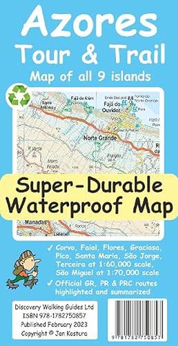
Azores Tour & Trail Super-Durable Map (2nd edition) (Folded)
Published by Discovery Walking Guides Ltd, Northampton, 2023
ISBN 10: 1782750851 ISBN 13: 9781782750857
Folded. Condition: new. Folded. For your best adventures, use the best map. Water-proof, split-proof, tear-proof, adventure-proof. Azores Tour & Trail Super-Durable Map is the most detailed, accurate, toughest, large scale map of these 9 islands that you can buy. 1:60,000 scale for each island, Sao Miguel at 70,000 scale, produces a double sided map sheet of 960mm by 694mm; big enough to show masses of detail but compact enough to use in the car or on the trail. Our special concertina map fold means your map is easy to unfold, and more importantly easy to refold back to its pocket size. Faial, Pico, Santa Maria and Sao Jorge are on the facing sheet of the map, with Corvo, Flores, Graciosa, Sao Miguel and Terceira on the reverse side. You get the most detailed map of the Azores islands that is produced, including our Tour & Trail level of detail ranging from major roads to secondary roads to minor roads to streets and narrow country roads, plus dirt tracks and walking trails. Altitude shading is designed to clearly show the altitude range when travelling across the island by car or on foot. 20 metre and 100 metre contours combined with altitude shading bring this beautiful landscape to life. There are plenty of individual height points and all of the official 'Trig' points are on the map. Tour & Trail attention to detail includes our useful symbol range including viewpoints, picnic areas, petrol stations, bar/restaurants and parking areas where you can pull off the road safely. You will easily identify springs, caves, sports grounds, cemeteries, monasteries, churches, chapels, lighthouses, castles, camping areas, wind turbines, windmills etc. All of the official GR, PR and PRC walking routes are specially highlighted on the map, with summaries for each island, including distances, timings and grades of difficulty. It all adds up to the most detailed, most durable map of the Azores that you can buy anywhere. 'Super-Durable' means a waterproof, tear-proof map that can take the roughest treatment and still folds up like new after your adventures. Super-Durable Maps come with a 2 year adventurous use 'Wear and Tear' guarantee. For your best adventures, use the best map. Water-proof, split-proof, tear-proof, adventure-proof. Azores Tour & Trail Super-Durable Map is the most detailed, accurate, toughest, large scale map of these 9 islands that you can buy. Shipping may be from multiple locations in the US or from the UK, depending on stock availability.
More buying choices from other sellers on AbeBooks
New offers from � 12.82
-

La Gomera and El Hierro Tour and Trail Maps (Map)
Published by Discovery Walking Guides Ltd, Northampton, 2019
ISBN 10: 1782750614 ISBN 13: 9781782750611
Map. Condition: new. Map. Quite simply La Gomera and El Hierro Tour & Trail Maps are the most detailed, accurate, toughest, easy to read, large scale maps of La Gomera and El Hierro that you can buy. Our map sheet is 840mm by 680mm. On the cover side you get the latest 35k scale 8th edition La Gomera Tour & Trail Map by David Brawn. On the reverse side is our 35k scale 1st edition El Hierro Tour & Trail Map by Jan Kostura. Both maps are produced to our 'Tour & Trail' level of detail ranging from major roads to secondary roads to minor roads to streets and camino rural narrow country roads, plus dirt roads and walking trails. Walking trails are specially highlighted, GR (Gran Recorido trails in green) and Walk La Gomera (in red), making them easier to identify on the maps and easier to find on the ground. Altitude background colouring is designed to clearly show the altitude range when traveling across each island by car or on foot. 100 metre and 50 metre contours, 100m and 20m on El Hierro, are clearly shown on the map along with a large number of individual height points and all of the official 'Trig' points. Tour & Trail attention to detail is legendary as is our useful symbol range including miradors, picnic areas, petrol stations, bar/restaurants and parking areas where you can pull off the road safely.You will easily identify springs, caves, sports grounds, cemeterys, churchs, chapels, lighthouses, towers and forts, camping areas, wind turbines, hotels and those all important information offices. For adventurers on foot Tour & Trail Maps are researched and designed by hikers for use by hikers. Our comprehensive gps ground surveys produce the best road mapping available but the value of this on the ground research becomes even more important when you leave the tarmac. Digital editions of these maps are available on the dwgwalking website. These Super-Durable Maps are printed using UV cured inks printed onto a 100 micron plastic substrate. This produces a Super-Durable map sheet that feels like silk but will stand up to the roughest treatment of outdoor adventuring and yet fold up like new at the end of your adventure. DWG's special concertina map fold means your map is easy to unfold, and easy to fold back to its folded pocket size. Super-Durable Maps come with a 2 year adventurous use wear and tear guarantee. For your best adventures, choose the best map. La Gomera and El Hierro Tour & Trail Maps are the most detailed, accurate, toughest, easy to read, large scale maps of La Gomera and El Hierro that you can buy. Digital editions of Tour & Trail Maps for phone apps and Garmin users are available on the dwgwalking website. Shipping may be from multiple locations in the US or from the UK, depending on stock availability.
More buying choices from other sellers on AbeBooks
New offers from � 16.88
-

Walk! La Palma
Published by Discovery Walking Guides Ltd, United Kingdom, Northampton, 2005
ISBN 10: 1904946062 ISBN 13: 9781904946069
Seller: WorldofBooks, Goring-By-Sea, WS, United Kingdom
Seller rating 5 out of 5 stars
Paperback. Condition: Very Good. Walk! La Palma includes 34 fully detailed walking route itineraries. Each walking route itinerary includes:- - walking route summary - ratings for Effort, Time, Distance, Ascents/Descents, Refreshments and Vertigo risk - fully detailed walk description, including frequent timings to aid navigation and check your progress - GPS Waypoints at every key point on every route where there is good gps reception - full colour 1:40,000 scale map of the route - short walk and stroll alternatives There are some easy routes. There are some challenging routes for fit experts. With Charles Davis' excellent walk descriptions you'll know which routes are for you - and all of them are a true adventure. The steepest island in the world, the deepest crater, the clearest skies: volcanoes you can climb without being shot into orbit; a subtropical forest minus the slimy things slinking up your trouser leg; black beaches, blue seas, high mountains, vegetation that is literally flamboyant, everything linked by 1080 kilometres of waymarked paths; and all virtually untouched by tourism. If this sounds divine or like some lost paradise, you're not the first to think so, previous commentators have identified La Palma as the prototype for both the Elysian Fields and Atlantis! The fanciful stuff aside, the island is a walker's idyll, utterly tranquil, verdant and almost unspoiled. Full GPS Track and Waypoint files for Walk! La Palma are included on the Personal Navigator Files CD published by Discovery Walking Guides. Synopsis 34 detailed walking route itineraries. Each of it includes:- walking route summary; ratings for Effort, Time, Distance, Ascents/Descents, Refreshments and Vertigo risk; and more. It also provides background information along with details of accommodation, buses, official walking routes, mountain biking, museums, and information offices. The book has been read, but is in excellent condition. Pages are intact and not marred by notes or highlighting. The spine remains undamaged.
-

Walk! Tenerife (2nd edition)
Published by Discovery Walking Guides Ltd, United Kingdom, Northampton, 2012
ISBN 10: 1904946828 ISBN 13: 9781904946823
Seller: WorldofBooks, Goring-By-Sea, WS, United Kingdom
Seller rating 5 out of 5 stars
Paperback. Condition: Very Good. A new edition of Walk! Tenerife is due to be published in September 2017 with completely revised and new walking routes. Comprehensive walking guide book to Tenerife's best walking. 46 fully detailed walking routes with 1:25,000 scale maps and GPS Waypoints. A real 'Rolls Royce' of a walking guide to the authors' home island. Contents:- The Authors. Introduction. Map Information. Walk Locator Maps. Map Notes & Legend. Walking Information: Using GPS on Tenerife.Symbols Rating Guide. THE WALKS. WALKS IN THE NORTH 1 Flora Loop - 3 walker, 1 hour, 3.8 kilometres, ascents & descents 180 metres, 3 refreshments (circular) 2 Downhill to La Florida - 2 walker, 11/2 hours, 5.5 kilometres, ascents 50 metres, descents 620 metres, 2 refreshments (linear) 3 Choza Classic - 4 walker, 2-21/2 hours, 9 kilometres, ascents & descents 320 metres, 2 refreshments (circular) 4 Chimoche Loop - 3 walker, 2 hours, 6 kilometres, ascents & descents 240 metres, 2 refreshments (circular) 5 Mighty Mountain Path - Los Organos - 5 walker, 41/2 hours, 13 kilometres, ascents & descents 650 metres, vertigo risk, 2 refreshments (circular) 6 King of the North - 4 walker, 51/2-6 hours, 21 kilometres, ascents 400 metres, descents 1000 metres, 1 refreshments (linear) WALKS IN THE SOUTH Geranium Walk 7 Life in the Raw - 3 walker, 2 hours, 7 kilometres, ascents & descents 150 metres, 2 refreshments (figure of eight) 8 Barren Grandeur - 3 walker, 3A hours, 14. 7 kilometres, ascents & descents 200 metres, 4 refreshments (linear) Alternative Finish - Faro de Rasca to Los Cristianos 9 Mount Guaza - 4 walker, 21/2 hours, 9 kilometres, ascents & descents 430 metres, 0 refreshments (pan-handle circular) 10 Coastal Escapism - 3 walker, 3.hours, 14 kilometres, ascents & descents100 metres, 4 refreshments (linear) 11 Picos Las Americas - 3 walker, 1 hour, 3 kilometres (one way), ascents & descents 350 metres, 0 refreshments (linear) 12 Down to Town - 3 walker, 21/2 hours, 8.5 kilometres, ascents 130 metres, descents 650 metres, 0 refreshments (linear) 13 Adeje Skywalker & The White House - 4 walker, 3-3A hours, 12 kilometres, ascents 300 metres, descents 400 metres, vertigo risk, 0 refreshments (linear) Alternative (Drivers): Torviscas Alto The White House - 2/3 walker, 70 mins, 4.5 kilometres, ascents & descents 100 metres, 0 refreshments (linear) 14 Taucho Tour (La Quinta) - 3 walker, 11/2-2 hours, 6 kilometres, ascents & descents 300 metres, 0 refreshments (circular) 15 Wow!Spectacular to Adeje - 4 walker, 4 hours, 12 kilometres, ascents 150 metres, descents 1000 metres, vertigo risk, 0 refreshments (linear) 16 Queen of the South - 4 walker, 41/2 hours, 14 kilometres, ascents 250 metres, descents 900 metres, 2 refreshments (linear) 17 Walkers Who Lunch - new route 2012 - 2 walker, 31/2 hours, 15 kilometres, ascents 70 metres, descents 960 metres, 4 refreshments (linear) 18 Fantasia - 4 walker, 3 hours, 9 kilometres, ascents & descents 550 metres, 4 refreshments (circular, with linear option) 19 Table Mountain - 4 walker, 31/2 hours, 11 kilometres, ascents & descents 450 metres, 0 refreshments (linear) 20 GR131 Vilaflor - Ifonche - Arona - 4 walker, 51/2 hours, 18 kilometres, ascents 450 metres, descents 1200 metres, vertigo risk, 5 refreshments (linear) WALKS IN THE WEST 21 Wild West Tour - 3 walker, 2 hours, 7 kilometres, ascents 130 metres, descents 470 metres, 2 refreshments (linear) 22 An OK Corral - 3 walker, 1A hours, 5 kilometres, ascents & descents 170 metres, 0 refreshments (linear) 23 True Grit - updated version 2012 - 4 walker, 2A hours, 9 kilometres, ascents & descents 430 metres, 3 refreshments (circular) 24 Lasso La Hoya - new route 2012 - 3 walker, 1. 5 hours, 5 kilometres, ascents & descents 450 metres, 2 refreshments (circular) 25 Laurel & Hardy - 3 walker, 2 hours, 6.5 kilometres, ascents & descents 300 metres, 4 refreshments (circular) 26 Saddle Up and Round That Mountain - 4 walker, 3 hours, 9 kilometres, ascents & descents 450 metres, vertigo risk, 0 refreshments (circular) 27 Picnic at Hanging Rock & Guegue - 4 walker, 21/2 hours, 10 kilometres, ascents & descents 400 metres, vertigo risk, 0 refreshments (linear) 28 Survival of the Fittest - 6 walker, 6 hours, 17 kilometres, ascents& descents 600 metres, vertigo risk, 4 refreshments (linear) 29 The Scenic Route to Masca - 3 walker, 3 hours, 9 kilometres, ascents 300 metres, descents 850 metres, slight vertigo risk, 3 refreshments (linear) CENTRAL HIGH ALTITUDE WALKS 30 Toffee Mountain - 3/4 walker, 3 hours, 13.5 kilometres, ascents & descents 200 metres, 1 refreshments (circular) 31 Arenas Negras: Black Sand Surprise - 3 walker, 21/2 hours, 9 kilometres, ascents & descents 300 metres, 0 refreshments (circular) 32 La Fortaleza - 4 walker, 4 hours, 15 kilometres, ascents & descents 250 metres, 1 refreshments (linear) 33 Roques de Garcia - 3 walker, 1.hours, 4 kilometres, ascents & descents 140 metres, 1 refreshments (circular) 34 Paisaje Lunar: a Tenerife Classic - 3-5 walker, 2 hours, 7 kilometres, ascents & descents 320 metres, 0 refreshments (circular) 35 Lunar Orbit 2 - 3 walker, 21/2 hours, 9. 5 kilometres, ascents & descents 370 metres, 0 refreshments (circular) 36 Mighty Guajara - 5 walker, 41/2 hours, 10 kilometres, ascents & descents 720 metres, 1 refreshments (linear/circular) 37 Siete Canadas - 3/4 walker, 4 hours, 16.4 kilometres, ascents & descents 200 metres, 1 refreshments (linear) 38 The Big One - Crater Rim Challenge - 5 walker, 61/2 hours, 18 kilometres, ascents 300 metres, descents 900 metres, vertigo risk, 2 refreshments (linear) 39 Parador - Degollada de Guajara - Paisaje Lunar - Vilaflor - 5 walker, 6 hours, 18 kilometres, ascents 300 metres, descents 1000 metres, 2 refreshments (linear) 40 On Top of the World - Mount Teide - 4/5 walker, 4 hours, 10 kilometres, ascents 180 metres, descents 1200 metres, 0 refreshments (linear) ANAGA MOUNTAIN WALKS 41 Las Mercedes - Llano de los Loros - 3 walker, 11/2 hours, 5 kilometres, ascents & descents 150 me.
-

Lanzarote Tour & Trail Super-Durable Map
Published by Discovery Walking Guides Ltd, United Kingdom, Northampton, 2016
ISBN 10: 1782750274 ISBN 13: 9781782750277
Seller: WorldofBooks, Goring-By-Sea, WS, United Kingdom
Seller rating 5 out of 5 stars
Paperback. Condition: Very Good. This map is about to be replaced by a new edition in mid-September 2017. Make sure you are buying the latest edition. Lanzarote Tour & Trail Super-Durable Map 4th edition covers this big island at a scale of 1:40,000 resulting in the most detailed and toughest map of Lanzarote that you can buy. New for the 4th edition of Lanzarote's favourite map are; Arrecife Circunvalacion (bypass) now upgraded to motorway status with elevated roundabout junctions, GR131 official long distance walking route mapped in full and specially detailed for every step of the way on trails, tracks, dirt roads, country lanes, streets and roads from Orzola to Haria to Teguise to Montana Blanca to Yaiza to its finish in Playa Blanca. All the country walking routes from Walk! Lanzarote are clearly detailed in a new enhanced format similar to the GR131 - GR in Green Walk! routes in Red. New font specifications make place names easier to read and identify where you want to go. 20 metre contour mapping gives a detailed view of the terrain of this interesting island. Also included is a full island map of La Graciosa at 1:40,000 scale for those people adventuring or staying on the island.Getting such a large island onto one map sheet at 1:40,000 scale means that we have had to split the island into a North-East section on one side and a South-West section on the other side, with a generous overlap between the sections. At 1:40,000 scale the level of detail we can include on the map is awesome compared to any other map of the island that you can buy. In addition to the usual high level of detail on our Tour & Trail Maps we have special 'Lava' fills to define the lava fields and a 'Zocos' fill to define the famous La Geria region. The result is the definitive map of Lanzarote. Super-Durable version is produced on a special polymer substrate (Polyart) using 100% oxygenation inks which results in a map that is virtually tear proof, water proof, baby proof, almost dog proof and our special 'map folding' means that the map opens easily, and more importantly folds up easily to pocket size after your adventures. Super-Durable means that this map will outlast any paper map many times over. Digital editions are available from Discovery Walking Guides for Garmin users and from Viewranger and MyTrails for use with their apps. The book has been read, but is in excellent condition. Pages are intact and not marred by notes or highlighting. The spine remains undamaged.
-

GPS. The Easy Way.
Published by Discovery Walking Guides Ltd., Northampton, UK., 2003
ISBN 10: 1899554467 ISBN 13: 9781899554461
Seller: J J Basset Books, bassettbooks, bookfarm.co.uk, Peter Tavy, United Kingdom
Seller rating 4 out of 5 stars

Glossy Pictorial Card. Condition: Very Good (AVERAGE). No Jacket. Pictorial Illustrations Throughout. (illustrator). This is the first edition. POSTED AT OUR STANDARD RATES FULLY INSURED! (UK ONLY). FEEL FREE TO E-MAIL FOR PHOTOGRAPHS AND FURTHER DETAILS. FROM A DEALER WHO TELLS YOU WHO THEY ARE AND WHAT THEIR TELEPHONE AND ADDRESS CONTACT DETAILS ARE! Size: 8vo - over 7�" - 9�". Not Signed or Inscribed. Mass Market Paperback.
-

Sierra de Aracena Tour & Trail Map (Folded)
Published by Discovery Walking Guides Ltd, Northampton, 2016
ISBN 10: 1782750347 ISBN 13: 9781782750345
Folded. Condition: new. Folded. 1:40,000 scale topographical map covering the Sierra de Aracena region in northern Huelva/Andalucia. All walking routes from Sierra de Aracena - a Walk! Guidebook; are clearly highlighted. Discover the hidden Spain of western Andalucia which is a delight for leisure walkers who appreciate the natural world and 1st class culinary delights; the Jabugo pata negra ham and local setas make for a unique dining experience. 2nd edition includes 1 minute Lat/Long grid, road and development updates and specially highlighted walking trails. Produced to Tour & Trail standards resulting in a map of outstanding accuracy and clarity. Whether you are driving, walking, hiking, horse riding or mountain biking this is the map to carry with you. Digital editions of Tour & Trail Maps for phone apps and Garmin users are available on the dwgwalking website. New 2nd edition of Sierra de Aracena Tour & Trail Map. Digital editions of Tour & Trail Maps for phone apps and Garmin users are available on the dwgwalking website. Shipping may be from our Sydney, NSW warehouse or from our UK or US warehouse, depending on stock availability.
-

Tenerife Hikers Maps (Folded)
Published by Discovery Walking Guides Ltd, Northampton, 2019
ISBN 10: 178275055X ISBN 13: 9781782750550
Folded. Condition: new. Folded. For the best adventures, use the best map. Our latest hiking research on Tenerife has resulted in new editions of Walk! Tenerife and Tenerife Hikers' Super-Durable Maps. Thanks to Jan Kostura's research we have several new hiking adventures described in detail in Walk! Tenerife. Jan's gps records of his research for new routes and updating of current routes has provided the detailed information to produce our new fourth edition of Tenerife Hiker's Super-Durable Maps.Note that Tenerife Hikers' Super-Durable Maps is a collection of four 30k scale map sections on a double sided sheet of 840mm by 600mm which folds up to 220mm by 120mm. It is not a map of all of Tenerife. You will find 30k scale maps covering Valle de Orotava, West, Anaga and Adeje/Arona - Teide printed on a double sided map sheet. We have combined two previous maps into a single map section; El Portillo and Valle de Orotava (and all the area between) is now a single map section covering the Orotava Valley from Aguamansa to beyond El Portillo and it also includes 4 new walking routes from Walk! Tenerife (2017) including the GR131 El Portillo to La Caldera, and two ascents of Montana Limon.Our 'Las Canadas-Adeje/Arona' map is now extended northwards beyond Teide so it now also includes Pico del Teide, Montana Blanca, Pico Viejo and Montana Rajada as well as the full Las Canadas crater. The 'West' map includes the latest TF-1 road along with the rerouting of three walking routes in this region. Not a lot changes in the Anaga except that Jan's research has produced three new hiking routes; Igueste - Chamorga, Igueste - Semaforo, and Cruz del Carmen - Punta del Hidalgo.Tenerife Hikers' Super-Durable Maps is produced using our 'Tour & Trail' level of detail ranging from major roads to secondary roads to minor roads to streets and camino rural narrow country roads, plus dirt roads and walking trails.Altitude background colouring is designed to clearly show the altitude range when travelling across the regions by car or on foot. 100 metre and 50 metre contours are clearly shown on the map along with a large number of individual height points and all of the official 'Trig' points. Our useful symbol range includes miradors, picnic areas, petrol stations, bar/restaurants and parking areas where you can pull off the road safely. You will easily identify springs, caves, sports grounds, cemeterys, churchs, chapels, lighthouses, towers and forts, camping areas, wind turbines, hotels and those all important information offices. Our 'Special Concertina Map Fold' makes Tour & Trail Maps easy to use, and more importantly easy to fold back to their handy pocket size.'Super-Durable' means you get a map printed on Polyart with 100% oxygenation inks by a UK leading map printer. This gives you a map that feels like silk but will stand up to the roughest treatment of outdoor adventuring and yet fold up like new at the end of your adventure. Polyart is made of high-density polyethylene (HDPE) and is therefore 100% recyclable in category 2 HDPE. For more information see the Polyart website. Digital editions of Tour & Trail Maps for phone apps and Garmin users are available on the dwgwalking website. For the best adventures, use the best map. This updated 4th edition is a collection of four 30k scale map sections on a double sided sheet of 840mm by 600mm which folds up to 220mm by 120mm. Highly detailed maps cover Valle de Orotava, West, Anaga and Adeje/Arona - Teide. Printed on waterproof, tearproof recyclable material. Shipping may be from our Sydney, NSW warehouse or from our UK or US warehouse, depending on stock availability.
-

Formentera Tour and Trail Super Durable Map (Folded)
Published by Discovery Walking Guides Ltd, Northampton, 2016
ISBN 10: 178275024X ISBN 13: 9781782750246
Folded. Condition: new. Folded. For better adventures, use the best map. Water-proof, split-proof, tear-proof, adventure-proof. Formentera Tour & Trail Super-Durable Map is simply the toughest, most accurate, easy to read, easy to use map of the island you can buy at any price. David & Ros Brawn surveyed this beautiful island carrying out their 'gps ground survey' pinpointing all the details needed to produce the definitive map of Formentera. Large, 25k scale, easy to read map sheet includes a wealth of useful details. 20 metre and 100 metre contours combined with altitude shading bring the Formentera landscape to life. All of the legendary Tour & Trail attention to detail is included so that you will find those petrol stations, mirador viewpoints with parking, refreshment stops with parking and accurate road numbering that are so essential when adventuring by hire car; 'watts' new and unique to Formentera we have included the 'Electric hire car' recharging points making sure you never run out of go. 'Off-Tarmac' Formentera Tour & Trail Map is in a league of its own thanks to all the gps information for the cycling and walking trails plus all of the island's famous beaches are shown and named.Printed on a large 840mm by 620mm super-durable map sheet the island of Formentera at 25,000 scale is on the facing page of the map sheet which folds back to a pocketable 235mm by 120mm when folded.On the reverse side of the map sheet you will find large scale street plans along with a host of useful information to make the most of your time on the island. 'Super-Durable' means a waterproof, tear-proof, map that can take the roughest treatment and still folds up like new after your adventures. Printed on Polyart using specialist 100% oxygenation inks produces a lightweight map that feels like silk but is a tough as old boots as it shrugs off water, resists tearing and damage better than any other map. 'Super-Durable' combined with our special concertina map fold means this 'near indestructible' Tour & Trail Map unfolds easily for use, and more importantly folds back up easily to its compact pocket size even after the toughest use. Digital editions for phone apps and Garmin users are available on the Discovery Walking Guides website. For better adventures, use the best map. Discover Formentera with the most detailed and toughest map that you can buy. Digital editions for phone apps and Garmin users are available on the Discovery Walking Guides website. Shipping may be from our Sydney, NSW warehouse or from our UK or US warehouse, depending on stock availability.
-

Costa del Sol (Axarquia) Tour and Trail Map (Map)
Published by Discovery Walking Guides Ltd, Northampton, 2017
ISBN 10: 1782750398 ISBN 13: 9781782750390
Map. Condition: new. Map. For better adventures, use the best map. Costa del Sol (Axarquia) Tour & Trail Super-Durable Map comes with a 2 year adventurous use wear and tear guarantee against splitting or falling apart, see Discovery Walking Guides website for details. Custom Map digital editions for gps phone apps and Garmin users are available from the Discovery Walking Guides website. Our large 1:40,000 scale, combined with splitting the region into West and East sections with a generous overlap, produces double sided map whose total size is 840mm by 700mm that folds to a pocketable 240mm by 120mm. Costa del Sol (Axarquia) covers the region from Ventas de Zafarraya in the North-West to Almunecar in the South-East; approx 3 42'W to 4 08'W and 36 43'N to 36 58'N. You get the most detailed map of the region that is produced including our 'Tour & Trail' level of detail ranging from major roads to secondary roads to minor roads to streets and narrow rural country roads, plus dirt roads and walking trails. Altitude background colouring is designed to clearly show the altitude range when travelling across the region by car or on foot. 100 metre and 50 metre contours are clearly shown on the map along with a large number of individual height points.Tour & Trail attention to detail is legendary as is our useful symbol range including miradors, picnic areas, petrol stations, bar/restaurants and parking areas where you can pull off the road safely. You will easily identify springs, caves, quarrys, sports grounds, cemeterys, churchs, chapels, lighthouses, towers and forts, camping areas, wind turbines, hotels and golf courses. For adventurers on foot Tour & Trail Maps are researched and designed by hikers for use by hikers. Our comprehensive gps ground surveys produce the best road mapping available but the value of this on the ground research becomes even more important when you leave the tarmac. All of our DWG walking routes are accurately gps surveyed giving you confidence in the accuracy of our Tour & Trail Maps. Costa del Sol (Axarquia) Tour & Trail Super-Durable Map includes all the walking routes from Walk! the Costa del Sol (Axarquia) which are specially highlighted (red outline) while the official GR (Gran Recorido) long distance trails are also specially highlighted (green outline) along with other local hiking routes.It all adds up to the most detailed, most durable, most useful map of the Costa del Sol (Axarquia) that you can buy anywhere. Super-Durable Maps are printed with 100% oxygenation inks on Polyart by the UK's leading map printer, which produces a map that feels like silk but will stand up to the roughest treatment of outdoor adventuring and yet fold up like new at the end of your adventure. 'Special Concertina Map Fold' makes Tour & Trail Maps easy to use, and more importantly easy to fold back to their handy pocket size. Polyart is made of high-density polyethylene (HDPE) and is therefore 100% recyclable in category 2 HDPE. For more information see the Polyart website. For better adventures, use the best map. Costa del Sol (Axarquia) Tour & Trail Super-Durable Map is the most detailed, most durable, most useful map of the Costa del Sol (Axarquia) that you can buy anywhere. Custom Map digital edition for phone app and Garmin users is available from the Discovery Walking Guides website. Shipping may be from our Sydney, NSW warehouse or from our UK or US warehouse, depending on stock availability.
-

Lefkada, Paxos and Antipaxos Tour and Trail Maps (Folded)
Published by Discovery Walking Guides Ltd, Northampton, 2021
ISBN 10: 1782750770 ISBN 13: 9781782750772
Folded. Condition: new. Folded. For your best adventures, use the best map. Water-proof, split-proof, tear-proof, adventure-proof. Lefkada, Paxos and Antipaxos Tour & Trail Maps are simply the toughest, most accurate, easy to read, easy to use maps of these Ionian islands that you can buy at any price. A large 840mm by 690mm double sided map sheet has Lefkada at 1:40,000 scale on one side, with Paxos and Antipaxos islands at 1:25,000 scale on the reverse. The Lefkada map sheet also covers Meganisi island and a large area of the adjacent mainland peninsula, as far as Voulkaria lake in the NE and Pogonias village in the SE, with its interesting castles and ancient sites. The peninsula is connected to Lefkada via a road bridge, which offers an additional 100km2 of the mainland for more touring and discovering. We have also included a street plan of the capital town Lefkada at 1:7,000 scale. DWG's special concertina map fold makes our map easy to open and easy to refold to its 230mm by 120mm pocket size. Our legendary Tour & Trail level of detail ranges from major roads to secondary roads to minor roads to streets and narrow country roads, plus dirt roads, tracks and walking trails. Place names are in English and Greek to aid your navigation. Altitude shading is designed to clearly show the altitude range when travelling across the island by car or on foot. 20 metre and 100 metre contours combined with altitude shading bring this beautiful landscape to life. There are plenty of individual height points and all of the official 'Trig' points are on the map. Tour and Trail attention to detail includes our useful symbol range including viewpoints, picnic areas, petrol stations, bar/restaurants and parking areas where you can pull off the road safely. You will easily identify springs, caves, sports grounds, cemeteries, monasteries, churches, chapels, lighthouses, castles, camping areas, wind turbines, hotels etc. Published walking routes are specially highlighted on the maps. It all adds up to the most detailed, most durable maps of Lefkada, Paxos & Antipaxos that you can buy anywhere. Super Durable means a waterproof, tear-proof, map that can take the roughest treatment and still folds up like new after your adventures. Super Durable Maps come with a 2 year adventurous use Wear and Tear guarantee. Digital Custom Map editions of our Lefkada, Paxos and Antipaxos Tour and Trail Maps are available for phone apps and Garmin gps units from the Discovery Walking Guides website. Lefkada, Paxos & Antipaxos Tour & Trail Super-Durable Maps are simply the toughest, most accurate, easy to read, easy to use maps of these Ionian islands that you can buy at any price. Lefkada at 1:40,000 scale on one side, with Paxos and Antipaxos islands at 1:25,000 scale on the reverse. Shipping may be from our Sydney, NSW warehouse or from our UK or US warehouse, depending on stock availability.
-

Alpujarras Tour and Trail Map (Map)
Published by Discovery Walking Guides Ltd, Northampton, 2020
ISBN 10: 1782750746 ISBN 13: 9781782750741
Map. Condition: new. Map. For the best adventures, use the best map. The Moorish white villages of the Alpujarras are well known to day trippers from the Costa del Sol. For walkers this is an idyllic region with stone-laid donkey trails linking the tipico villages and stretching up the southern slopes of the Sierra Nevada to Mulhacen; at 3,483 metres the highest mountain peak on mainland Spain. From Spring to the end of Autumn this is a paradise for hikers, whether you are walking from village to village sampling the local delicacies or tackling the challenging major ascents. One thing you will know is that using the Alpujarras Tour & Trail Map will help you plan, and get the best out of, your adventures. On a large 960mm by 700mm, double sided, map sheet at 40k scale this map has all the detail you need including 20 and 100 metre contours, combined with altitude shading, giving you a true feel to this impressive landscape stretching from west of Lanjaron to Ohanes in the east taking in the Poqueira and Trevelez valleys, while going north to include Mulhacen and Veleta mountain peaks along with the Sierra Nevada ski area. The GR240, GR142 & GR7 (official long distance hiking routes) are specially highlighted (in green) along with all the walking routes from Walk! the Alpujarras guidebook (in red). Our new edition Alpujarras Tour & Trail Map covers an area of 70 kms (E-W) by 28 kms (N-S); more than twice the land area of our earlier editions. A special 'Concertina Map Fold' makes Tour & Trail Maps easy to use, and more importantly easy to fold back to their handy pocket size. Digital editions of Alpujarras Tour & Trail Map are available for phone apps and Garmin users on our Discovery Walking Guides website. Tour & Trail Super-Durable Maps are printed on a specially finished plastic substrate using special inks which produces a lightweight map that feels like silk while being both water-proof and incredibly tough so that after even the toughest of adventures your Tour & Trail Super-Durable Map will fold up like new. Super-Durable Maps come with a 2 year adventurous use wear and tear guarantee. All the materials used for this map are 100% recyclable in category 2 HDPE. For the best adventures, use the best map. The Moorish white villages of the Alpujarras are well known to day trippers from the Costa del Sol. For walkers this is an idyllic region with stone-laid donkey trails linking the tipico villages and stretching up the southern slopes of the Sierra Nevada to Mulhacen Shipping may be from our Sydney, NSW warehouse or from our UK or US warehouse, depending on stock availability.
-

Walk Lanzarote (Paperback)
Published by Discovery Walking Guides Ltd, Northampton, 2022
ISBN 10: 1782750711 ISBN 13: 9781782750710
Paperback. Condition: new. Paperback. Lanzarote's most popular walking guide book just got even better. Walk! Lanzarote 5th edition builds on the reputation of our earlier editions with comprehensive updating so that it caters for the needs of the increasing number of people who would like to combine some walking with a holiday on the Fire island. Walk Lanzarote explodes the myth that there is nowhere worth walking on the island as we range through strolling on coastal promenades, walking across alpine style meadows, striding over the lava sea, dropping into volcanoes, sitting on high mountain seats - quite simply you will be amazed at the wide variety of stunning landscapes the Fire island has to offer the adventurous leisure walker. For the 5th edition we've checked several routes and updated them where necessary. Walk Lanzarote's forty one main walking routes provide a wide variety of adventures with routes ranging from family friendly costal promenades through a surprising range of landscapes up to some serious hiking. Every route is an adventure that will make you eager to explore further on this spectacular island. Walk Lanzarote is produced to our highest standards with walk summary and rating, fully detailed description, frequent timings so you can check your progress, compass directions, and gps waypoints for all country routes. Each country route has full 1:40,000 scale colour mapping and gps waypoints dedicated to that route, while our Teguise town walk uses a large scale street plan. All routes are illustrated with colour photos. Culture and agriculture are included along with a Thingy section on modern art. We've emphasised the Access by Bus sections for each walk along with our Access by Car information for each walking route. Map sections for each route are taken from the Lanzarote Tour & Trail Super-Durable Map 5th edition. For gps users the gps waypoint files are available as a free downloadable zip file on the Discovery Walking Guides website. Quite simply the best book of Lanzarote that you can buy. If this is your first visit to Lanzarote then Walk! Lanzarote plus Lanzarote Tour & Trail Map will give you a series of adventures that will have you returning to the Fire island to experience more. Quite simply the best book of Lanzarote that you can buy. If this is your first visit to Lanzarote then Walk! Lanzarote plus Lanzarote Tour & Trail Map will give you a series of adventures that will have you returning to the Fire island to experience more. Shipping may be from our Sydney, NSW warehouse or from our UK or US warehouse, depending on stock availability.
-

GR221 Mallorca's Long Distance Walking Route (Paperback)
Published by Discovery Walking Guides Ltd, Northampton, 2009
ISBN 10: 1904946488 ISBN 13: 9781904946489
Paperback. Condition: new. Paperback. Walk! GR221 Mallorca's Long Distance Trail - The Dry Stone Way. If you want to get away from it all , there is no surer way than strapping on your boots, shouldering your backpack, and embarking on a long distance path; and there are few long distance paths more beguiling and more crammed with adventure than Mallorca s GR221, La Ruta de Pedra en Sec or The Dry Stone Way. Anybody who has visited Mallorca will appreciate the justice of the GR221's title. Following ancient bridleways along the length of the Tramuntana range, from Port d'Andratx in the southwest to Pollenca in the northeast, the GR221 touches on dry stone in its every manifestation, from the raw rock of the peaks and sweeping fields of karst to the tailored stones that have always been the island's building material of choice. In some cases, we use immaculately paved trails, at other times we walk on bare rock below looming cliffs, and everywhere we cross the rocky passes that have always been the portals between the Mallorca's otherwise isolated communities.En route, we see dry-stone huts, dry-stone springs, dry-stone threshing circles, dry-stone snowpits, dry-stone walls, dry-stone limekilns, dry-stone byres, dry-stone stiles, dry-stone bread ovens, dry-stone wells .basically, anything you can prefix with 'dry-stone', we get it. Moreover, there is enough variety packed into this trail to fill an itinerary twice as long, the dry stone being broken up by plains of citrus groves, terraces of olive trees, forests of Holm Oak, exquisite pastoral enclaves, and spectacular valleys laced with glittering threads of mountain torrents, all of it backed by the broad blue palette of the Mediterranean. In the course of its 115 kilometres, the Ruta de Pedra en Sec takes walkers into places most tourists never see and offers us a bird's eye view of this magnificent landscape, giving visitors a complete picture of the Tramuntana range in a single holiday, freeing one from constraints of time and transport, and lending a coherence to the experience that day walks can only achieve over the course of a far longer and more costly trip. Features of Walk! GR221: Full details concerning the state of the route and accommodation options.Specific advice and comprehensive practical information to help you plan your trip. Detailed walking descriptions for each stage of the itinerary, including frequent timings to aid navigation and check your progress. GPS waypoints for every key point on the route. Full colour 1:40,000 scale maps drawn from our own surveys. Coloured photos illustrating each stage and dedicated photo pages so you can see at a glance what to look forward to each day. Walking route summaries including ratings for Effort, Time, Distance, Ascents/Descents, Refreshments and Vertigo risk. Altitude profiles drawn from our own GPS records. Alternative itineraries. Links to other walks. Town sketches describing the settlements en route. Gobbets giving background information about the island's history and culture. Note that this book is matched with the Mallorca North & Mountains Tour & Trail Map (paper & Super-Durable editions). If you want to get away from it all , there is no surer way than strapping on your boots, shouldering your backpack, and embarking on a long distance path; and there are few long distance paths more beguiling and more crammed with adventure than Mallorca's GR221, La Ruta de Pedra en Sec or The Dry Stone Way. Shipping may be from our Sydney, NSW warehouse or from our UK or US warehouse, depending on stock availability.
-

Walk! Costa del Sol (Axarquia) (Paperback)
Published by Discovery Walking Guides Ltd, Northampton, 2017
ISBN 10: 1782750452 ISBN 13: 9781782750451
Paperback. Condition: new. Paperback. We celebrate a Costa del Sol that does not correspond to the cliches, a Costa del Sol that is all right rather than all wrong, a playground of green valleys and gilded mountain tops, a hidden idyll unknown to most visitors, a haven for dedicated walkers and adventurous tourists alike, a place in which every nook is graced with some gratifying discovery and every outing is a great adventure. The majority of walks are aimed at the adventurous leisure walker, people who will on the whole have some experience of hiking in mountains, are happy to invest a certain amount of effort for a corresponding reward. Covering the best preserved stretch of coastline, the prettiest villages, and most spectacular mountains, Walk! Costa del Sol explores the Axarquia region east of Malaga, an area blessed with grand summits, dizzying pinnacles, dramatic crags, deep ravines, delightful streams, stunning views, and the finest coves on the Costa del Sol, and all of it knitted together by a network of paths, trails, tracks and lanes so beguiling that walking is by far the best way to explore this lovely landscape. THE COAST: TORRE DEL MAR, TORROX COSTA, NERJA, MARO are well-placed for accessing the itineraries between Canillas de Aceituno and Competa. THE MOUNTAINS: THE SIERRAS DE TEJEDA and ALMIJARA The Sierra is a discrete massif defined by cliffs, gullies and gorges, and culminating in the Iberian Peninsula's westernmost 2000 metre summit (La Maroma, Walk 35), while the Sierra Almijara comprises numerous mini-ranges separated by canyons. The traditional dividing point between the two sierras is Puerto de Competa, which we visit in Walk 36. The joys of these mountains are manifold, including bulbous karstic domes and vertiginous pinnacles, dramatic cliffs draped with ragged crags and grand ridges dominating the glittering blue sea; there are uplands patched with ancient pastures and dotted with the ruins of remote cortijos (farmhouses), there are terraces stippled with olive and almond trees, hillsides swaddled in a buttery blanket of yellow-flowering shrubs, valleys flanked by shady forests of conifer and cork oak, and fabulous ravines twisting between towering chicanes (known as cahorros) and tipping over spectacular waterfalls into deep plunge pools, all accessible within 15 minutes of the coast. THE WHITE VILLAGES The Pueblos Blancos of Andalusia with their whitewashed walls and red-tiled roofs are justly famous and the Axarquia does not disappoint in this respect. The best known pueblos blancos and the main gateway destinations for walkers are Competa and Frigiliana. West of Competa are some of the region's prettiest villages, the two Canillas (Aceituno and Albaida), Sedella, Salares and Archez. Walk! Costa del Sol (Axarquia) together with Costa del Sol Tour & Trail Map will give you a series of adventures you'll never forget.Each walk is fully described and accompanied by a detailed map and colour photos, plus an information bar that helps you easily choose the right routes for you, based on difficulty, distance, time needed, ascents and descents and more. Walk! Costa del Sol explores the Axarquia region east of Malaga, an area blessed with grand summits, dizzying pinnacles, dramatic crags, deep ravines, delightful streams, stunning views, and the finest coves on the Costa del Sol, via network of paths, trails, tracks and lanes. 34 wonderful, varied routes to discover. Shipping may be from our Sydney, NSW warehouse or from our UK or US warehouse, depending on stock availability.
-

Walk! the Lake District South (Spiral)
Published by Discovery Walking Guides Ltd, Northampton, 2006
ISBN 10: 190494616X ISBN 13: 9781904946168
Spiral. Condition: new. Spiral. The Lake District is to leisure walking what Vienna is to the waltz, Venice to canalization, Bletchley to code-breaking, Chicago to the blues, and Dublin to the brewing of porter. None of these places invented the related pursuit, but in each the activity was honed to a fine art. With superb lakes carved into spectacularly sculpted valleys, long rugged ridges blessed with imposing panoramas, jagged crags dangling from grand peaks, sweeping dales cradling remote hamlets, and barren fells tonsured with arcane henges and ancient ruins, the Lake District has everything the dedicated wilderness seeker could desire. All 37 walking routes include: walking route summary, ratings for Effort Time Distance Ascents/Descents Refreshments and Vertigo risk, fully detailed walk description including frequent timings to aid navigation and check your progress, GPS waypoints at every key point on every route, full colour 1:40,000 scale Ordnance Survey licenced mapping for each route, short walk and stroll alternatives Synopsis Including GPS Waypoint lists and a Place Name Index, this 160-page colour book contains walking routes within the Lake District South region. Wire-O spiral binding allows it to lay flat and be folded back on itself without damage. It features: route summary of exertion rating; refreshments rating; time, distance, ascents/descents; and more. Including GPS Waypoint lists and a Place Name Index, this 160-page colour book contains walking routes within the Lake District South region. Wire-O spiral binding allows it to lay flat and be folded back on itself without damage. It features: route summary of exertion rating; refreshments rating; time, distance, ascents/descents; and more. Shipping may be from our Sydney, NSW warehouse or from our UK or US warehouse, depending on stock availability.
-

Walk! La Palma (Paperback)
Published by Discovery Walking Guides Ltd, Northampton, 2018
ISBN 10: 1782750487 ISBN 13: 9781782750482
Paperback. Condition: new. Paperback. Revised and updated 4th edition of Walk! La Palma including the latest Tour & Trail Mapping. Walk! La Palma includes 37 fully detailed walking route itineraries. Each walking route itinerary includes:- - walking route summary - ratings for Effort, Time, Distance, Ascents/Descents, Refreshments and Vertigo risk - fully detailed walk description, including frequent timings to aid navigation and check your progress - GPS Waypoints at every key point on every route where there is good gps reception - full colour 1:40,000 scale map of the route - short walk and stroll alternatives There are some easy routes. There are some challenging routes for fit experts. With author/researchers Charles Davis' and Jan Kostura's excellent walk descriptions you'll know which routes are for you - and all of them are a true adventure. The steepest island in the world, the deepest crater, the clearest skies: volcanoes you can climb without being shot into orbit; a subtropical forest minus the slimy things slinking up your trouser leg; black beaches, blue seas, high mountains, vegetation that is literally flamboyant, everything linked by 1080 kilometres of waymarked paths; and all virtually untouched by tourism. If this sounds divine or like some lost paradise, you're not the first to think so, previous commentators have identified La Palma as the prototype for both the Elysian Fields and Atlantis! The fanciful stuff aside, the island is a walker's idyll, utterly tranquil, verdant and almost unspoiled. GPS Waypoint files (in gpx file format) for Walk! La Palma are available as a free zip file download on Discovery Walking Guides website. Synopsis 37 detailed walking route itineraries. Each route includes:- walking route summary; ratings for Effort, Time, Distance, Ascents/Descents, Refreshments and Vertigo risk; and more. It also provides background information along with details of accommodation, buses, official walking routes, mountain biking, museums, and information offices. Revised/updated 4th ed. 37 fully detailed walking itineraries. Routes include summary, ratings for Effort, Time, Distance, Ascents/Descents, Refreshments and Vertigo risk. Detailed walk description includes frequent timings. GPS Waypoints at every key point on every route where GPS reception allows. Full colour 1:40,000 scale map of the route. Shipping may be from our Sydney, NSW warehouse or from our UK or US warehouse, depending on stock availability.