Order Total (1 Item Items):
Shipping Destination:

Ogilby John Bowen Emanuel Owen (4 results)
Skip to main search results
Product Type
- All Product Types
- Books (2)
- Magazines & Periodicals
- Comics
- Sheet Music
- Art, Prints & Posters
- Photographs
- Maps (2)
-
Manuscripts &
Paper Collectibles
Condition
- All Conditions
- New
- Used
Binding
- All Bindings
- Hardcover (2)
- Softcover
Collectible Attributes
- First Edition (1)
- Signed (1)
- Dust Jacket
- Seller-Supplied Images (3)
- Not Printed On Demand
Seller Location
Seller Rating
-
Leaf from Britannia Depicta; or, Ogilby Improv'd; Stony Stratford to Haverborough (Northampton) and from Kibworth / Leichester to Derby, (Mounted, Framed, Under glass)
Published by Thomas Bowles, St Pauls Churchyard, London, 1720
Map
Maps. Condition: As New. [British Road Atlas of Leicester, Derby, Northampton] Original copper engraved plate from Bowen's early road atlas. 7 1/2 X 5 in. Each map with finely engraved coat of arms. Framed so that both pages 99 and 100 are shown in full. In fine condition. (not exampled out of glass).
-
Britannia Depicta or Ogilby Improv'd; Being a Correct Coppy of Mr. Ogilby's Actual Survey of all ye Direct & Principal Cross Roads in England and Wales: Wherein are exactly Delineated & Engraven All ye Cities, Towns, Villages, Churches, Seats &c.
Published by London Tho. Bowles 1736, 1736
Seller: Chaucer Bookshop ABA ILAB, Canterbury, United Kingdom
Seller Rating:

Map
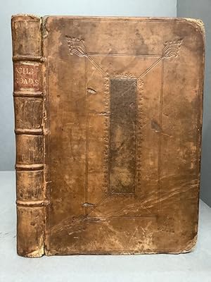
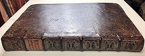
Fourth Edition Small 4to. (approx. 20.5 x 13.5cm) hardback in full 18th century calf with raised bands, dark red title label, gilt to spine and blind-embossed decorative borders to boards. Title page, 8pp. Table or Index of the Cities and Market Towns, 273pp. Maps and Coats of Arms (Strip road maps and 54 County maps). Ink name and date (1778) to verso of title page. Light foxing to prelims. First gather of Map section and ffep partially detached. Small hole to ffep. Horizontal crease across lower fifth of upper board with matching split to front pastedown (please see photos). Boards and spine somewhat rubbed and worn. Overall a GOOD+ copy internally in Sound but shabby covers. (A possible candidate for a rebind). (Shelf 130) ** Pictures available upon request, if not already displayed here.** The shop is open 7 days a week. Over 20,000 books in stock - come and browse. PayPal, credit and most debit cards welcome. Books posted worldwide. For any queries please contact us direct.
-

4to., (8 x 5 6/8 inches). 4 leaves of tables. Engraved title-page and 273 engraved road maps after Emanuel Bowen. Contemporary calf gilt (a bit rubbed). Provenance: 19th-century North Library bookplate of the Earls of Macclesfield on the front paste-down dated 1860, discreet blind-stamp on first three leaves. Fourth edition, first published in 1720 in its current format, but a reduced version of Ogilby's "Britannia" first published in London in 1675. "Ogilby secured the. title of His Majesty's Cosmographer early in 1671 [and] drew upon the support of the King and other patrons in the production and publication of Britannia., the work for which he became best known. Chiefly a road atlas, it was securely based on contemporary and collaborative research. Ogilby drew out 2519 miles of road in the form of 100 strip maps, a technique that was widely imitated throughout the following century. Measuring distances by waywiser (his "great wheel"), he made allowance for roads that ascended hills yet had to be depicted in two dimensions on paper, and his surveys helped to standardize the mile at 1760 yards throughout the kingdom. Britannia marked the first major advance in cartography in England since the Tudor period, though it did echo earlier traditions. It was republished in 1698, 1719, and 1720, and on subsequent occasions up to modern times" (DNB). This is one of Emanuel Bowen's earlier works, and his contribution to eighteenth-century world and British atlases would be substantial. Using contemporary sources, he published and drew maps for the "Complete System of Geography" (2 vols., 1744-7), "The Maps and Charts to the Modern Part of the Universal History" (published in 1766 under Thomas Kitchin's name), the celebrated maps for John Harris's "Navigantium atque itinerantium bibliotheca" (1744-8), and all twenty-two new plates in the final edition (1754) of Patrick Gordon's "Geography Anatomized", the county maps in his "Large English Atlas" (1760) the first to cover England and Wales on a large scale, and subsequently reduced by Bowen and Kitchin for their "Royal English Atlas" (ca.1763) and then by Emanuel and Thomas Bowen for "Atlas Anglicanus" (1767-8), published after Emanuel Bowen's death by Kitchin. "All three works are characterized by detailed texts in the spaces surrounding the maps and by elegant rococo decoration, which became the hallmark of his engraving" (Iolo Roberts and Menai Roberts for DNB). From the celebrated library of the Earls of Macclesfield at Shirburn Castle, Oxfordshire, England, accumulated from the early 18th century by generations of of the Parker family, and sold (over successive sales) by Sothebys. The first Earl of Macclesfield was Thomas Parker, 1st Baron Parker, made Viscount Parker, of Ewelm in the County of Oxford, and Earl of Macclesfield, in the County Palatine of Chester in 1716. He was Lord Chief Justice of the Queen's Bench from 1710 to 1718 and Lord High Chancellor from 1718 to 1725. Probably acquired by Thomas Augustus Wolstenholme Parker, 6th Earl of Macclesfield (17 March 1811 - 24 July 1896) Conservative Member of Parliament for Oxfordshire from 1837 until 1841.
-
Britannia. Volume the First: or an Illustration of the Kingdom of England and Dominion of Wales: By a Geographical and Historical Description of the Principal Roads thereof.
Published by London: Printed by the Author at his House in White-Fryers, 1675, 1675
First Edition Signed
Folio (16 x 10 1/2 in.; 40.6 x 26.7 cm). Engraved frontispiece by Wencelaus Hollar after Francis Barlow, letterpress title-page printed in red and black, double-page map of England and Wales signed James Moxon in lower left corner, 100 double-page engraved road maps, engraved headpieces and historiated initials. BINDING/CONDITION: Some browning and foxing to text, about 15 maps browned, paper flaw in upper left corner of map 8 and so printed, map 45 and text partially sprung from text block, left margin of map 51 cropped slightly affecting first portion of the route, lower margins of maps 69 and 100 shaved costing plate number. Contemporary calf; covers scuffed, rebacked, some edges renewed. (64F5A) FIRST EDITION OF "THE FIRST SURVEY OF THE ROADS OF ENGLAND AND WALES" (Chubb). The second issue, with catchword "132" on D1r and without the dedication to Archbishop Gilbert. All published. Ogilby's work was composed of 73 major roads and cross-roads, presented in a continuous strip form. For the first time in England, an atlas was prepared on a uniform scale, at one inch to a mile, based on the statute mile of 1,760 yards to the mile. Villages and mansions along the roads are identified, and in some cases the names of the residents are also given. According to one source, Ogilby claimed that 26,600 miles of roads were surveyed in the course of preparing the atlas, but only about 7,500 were actually depicted in print. "In its comprehensiveness, its incorporation of new devices of computation and delineation, and its opulence of paper, design and decoration, it immediately set a new standard for map-making in England.this volume was an attempt at a scientific study not only of the roads but also the terrain and habitations on either side of the roads" (K.S. Eerde, "John Ogilby and the Taste of his Times," 1976, p. 137). PROVENANCE: The Dukes of Buccleuch (small engraved armorial ticket of Ditton Park on pastedown and shelfmark) REFERENCES: Chubb CI; ESTC R483348; Wing O-168.