
Order Total (1 Item Items):
Shipping Destination:

Kartographische Kommunale Verlagsgesellschaft Mbh (80 results)
Feedback
Skip to main search results
Search filters
Product Type
- All Product Types
- Books (78)
- Magazines & Periodicals (No further results match this refinement)
- Comics (No further results match this refinement)
- Sheet Music (No further results match this refinement)
- Art, Prints & Posters (No further results match this refinement)
- Photographs (No further results match this refinement)
- Maps (2)
- Manuscripts & Paper Collectibles (No further results match this refinement)
Condition
Binding
- All Bindings
- Hardcover (No further results match this refinement)
- Softcover (1)
Collectible Attributes
- First Edition (No further results match this refinement)
- Signed (No further results match this refinement)
- Dust Jacket (No further results match this refinement)
- Seller-Supplied Images (68)
- Not Print on Demand (80)
Free Shipping
Seller Rating
-

Bad Gandersheim: Rad- und Wanderkarte (rei�- und wetterfest)
Published by Kartographische Komm. Ver, 2021
ISBN 10: 3869732032 ISBN 13: 9783869732039
Condition: good. Befriedigend/Good: Durchschnittlich erhaltenes Buch bzw. Schutzumschlag mit Gebrauchsspuren, aber vollst�ndigen Seiten. / Describes the average WORN book or dust jacket that has all the pages present.
-

Wandern und Radwandern zwischen Eder und Schwalm: Rei�- und Wetterfest
Published by Kartographische Komm. Ver, 2023
ISBN 10: 3869732598 ISBN 13: 9783869732596
Condition: good. Befriedigend/Good: Durchschnittlich erhaltenes Buch bzw. Schutzumschlag mit Gebrauchsspuren, aber vollst�ndigen Seiten. / Describes the average WORN book or dust jacket that has all the pages present.
-
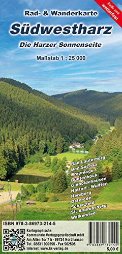
S�dwestharz - Die Harzer Sonnenseite: Rei�- und Wetterfest
Published by Kartographische Komm. Ver, 2021
ISBN 10: 3869732148 ISBN 13: 9783869732145
Condition: good. Befriedigend/Good: Durchschnittlich erhaltenes Buch bzw. Schutzumschlag mit Gebrauchsspuren, aber vollst�ndigen Seiten. / Describes the average WORN book or dust jacket that has all the pages present.
-

Mittlerer Th�ringer Wald : Rad- und Wanderkarte
Published by Kartographische Komm. Ver M�r 2019, 2019
ISBN 10: 3869731699 ISBN 13: 9783869731698
Karte. Condition: Neu. Neuware - Die Region zwischen Frauenwald bis Eisfeld und Schmiedefeld bis Steinach liegt mit einer H�he von 400 bis �ber 800 m NN zentral im Th�ringer Wald. Neben den ausgedehnten W�ldern bilden die Gegens�tze zwischen den H�henz�gen und den tiefen T�lern den Reiz dieser Landschaft. Eine Vielzahl von Highlights l�dt zum entdecken ein.Unweit des Heilklimatischen Kurortes Masserberg in der Abgeschiedenheit des Th�ringer Waldes liegt das Pumpspeicherwerk Goldisthal im Oberen Schwarzatal. Ein Rundwanderweg schl�ngelt sich um die Talsperre und zeigt die Sch�nheit der Natur und das imposante Bauwerk.Die neue Detailwanderkarte Mittlerer Th�ringer Wald stellt im �bersichtlichen Ma�stab die Region mit dem vollst�ndigen Rad- und Wanderwegenetz dar. Ein Ortsplan von Masserberg und ein Stadtplan von Neuhaus runden das Angebot ab. Ein integriertes UTM-Gitter erm�glicht die Orientierung im Gel�nde mit Hilfe eines GPS- Ger�tes und eine Gel�ndeschummerung visualisiert das Mittelgebirge.
-

Bad Lobenstein - Blankenstein - Lehesten - Wurzbach 1:35 000 : Rad- und Wanderkarte (rei�- und wetterfest)
Published by Kartographische Komm. Ver Sep 2021, 2021
ISBN 10: 3869732369 ISBN 13: 9783869732367
Karte. Condition: Neu. Neuware - S�dlich des Th�ringer Waldes schlie�t der Naturpark Frankenwald mit der Rennsteigregion an das Th�ringer Schiefergebirge und das 'Th�ringer Meer' an. Neben dem Rennsteig gibt es ein weit verzweigtes Rad- und Wanderwegenetzes was diese waldreiche Region zu einem Eldorado f�r alle Wanderer und Radfahrer macht.Die neue wetterfeste Rad- und Wanderkarte 'Bad Lobenstein - Blankenstein - Lehesten -Wurzbach' stellt die Region mit dem vollst�ndigen Rad- und Wanderwegenetz vor. So wird insbesondere der Rennsteig mit den Rennsteigleitern sowie den Alternativrouten vorgestellt. Die Karte ist Bestandteil vom 4-teiligen Kartenset 'Rennsteig'.
-

Edersee: Rad- und Wanderkarte
Published by Kartographische Komm. Ver, 2022
ISBN 10: 3869732547 ISBN 13: 9783869732541
Gut/Very good: Buch bzw. Schutzumschlag mit wenigen Gebrauchsspuren an Einband, Schutzumschlag oder Seiten. / Describes a book or dust jacket that does show some signs of wear on either the binding, dust jacket or pages.
-

Bodetal 1 : 25 000 : Rad- und Wanderkarte (rei�- und wetterfest) Detailkarte Hexentanzplatz 1:10 000
Published by Kartographische Komm. Ver Apr 2022, 2022
ISBN 10: 3869732423 ISBN 13: 9783869732428
Karte. Condition: Neu. Neuware - Als Bodetal wird der ca. 10 Kilometer lange, schluchtartige Talabschnitt der Bode zwischen Treseburg und Thale bezeichnet. Die am Brocken entspringende Bode hat sich dort in den harten Ramberggranit eingeschnitten. Die Schlucht ist bei Treseburg ca. 140 Meter tief und bei Thale ca. 280 Meter tief. Ein etwa 10 Kilometer langer Wanderweg, Bestandteil des Harzer-Hexen-Stieges, erschlie�t die Bodeschlucht zwischen Thale und Treseburg. An Engstellen wird der Weg in steilen Kehren und als Fu�pfad �ber Felsen gef�hrt. Hier ergeben sich oft hervorragende Ausblicke in die Schlucht. Eine Radwegef�hrung ist auf Grund der Enge der Schlucht nicht m�glich.Die neue wetterfestes Detailwanderkarte 'Bodetal' stellt �bersichtlich die Region des Bodetales von Blankenburg bis Bad Suderode und von Hasselfelde bis Alexisbad mit dem vollst�ndigen Rad- und Wanderwegenetz vor. Sie schlie�t damit an die Wanderkarte Stadt Oberharz an. Eine Detailkarte von Thale bis zum Hexentanzplatz im Ma�stab 1:15 000 erleichtert dem Besucher die Orientierung. Eine Gel�ndeschummerung visualisiert das Mittelgebirge und ein UTM-Gitter erm�glicht die Nutzung eines GPS-Ger�tes.
-

Th�ringer Meer : Rad- und Wanderkarte (Rei�- und wetterfest) 1:33 000
Published by Kartographische Kommunale Okt 2020, 2020
ISBN 10: 3869732199 ISBN 13: 9783869732190
sonst. B�cher. Condition: Neu. Neuware - Das Th�ringer Meer ist Deutschlands gr��te Stauseeregion. Die fjord�hnliche Wasserlandschaft entlang der Saale verbindet 5 Stauanlagen. Ein Paradies zum Wandern, Radwandern, Schifffahren, Tauchen, Angeln, Surfen u.v.m. Eingebettet in das waldreiche Tal der Saale finden Sie hier noch richtig idyllische Flecken und das mitten in Deutschland. Die 2 gr��ten Stauseen sind der Bleilochstausee und der Hohenwarte Stausee. Die neue rei�- und wetterfeste Rad- und Wanderkarte Th�ringer Meer stellt im �bersichtlichen Ma�stab 1:33 000 die Rad- und Wanderregion rund um den Hohenwarte Stausee und die Bleiloch Talsperre vor. Neben dem vollst�ndigen Rad- und Wanderwegenetz wird z. B. auch der Hohenwarte Stausee Weg mit seinen 76 km L�nge rund um den Stausee detailliert als Qualit�tswanderweg vorgestellt. Dar�ber hinaus werden die zum Wasserwandern notwendigen Information wie Ein- und Ausstiegsstellen, Wehre und Schleusen �bersichtlich dargestellt. Ein integriertes UTM-Gitter erm�glicht die Orientierung im Gel�nde mit Hilfe eines GPS- Ger�tes. Eine Gel�ndeschummerung visualisiert das Mittelgebirge.
-

Goslar - Bad Harzburg - Torfhaus - Altenau 1:33 000 : Rad- und Wanderkarte (rei�- und wetterfest)
Published by Kartographische Komm. Ver Sep 2021, 2021
ISBN 10: 3869732350 ISBN 13: 9783869732350
Karte. Condition: Neu. Neuware - Die Tourismusregion Oberharz mit Bad Harzburg, Goslar, Torfhaus und Altenau war jahrhundertelang durch den Bergbau bestimmt, der die Region nachhaltig gepr�gt hat.Neben der alten zum Weltkulturerbe geh�renden Kaiserstadt Goslar und dem Sole Heilbad - Bad Harzburg geh�ren Altenau und das Torfhaus zu den beliebtesten Ausflugs- und Wanderzielen im Harz. Der Tourismusort Torfhaus ist mit 700 m �. NN die h�chstgelegene Siedlung in Niedersachsen und liegt in einer kleinen so genannten Nutzungszone des Nationalparks Harz.Der Name stammt aus dem sporadisch erfolgten Torfabbau, der 1786 aufgegeben wurde.Heute ist Torfhaus ein beliebter Ausgangspunkt f�r Wanderungen, z. B. auf dem Goetheweg, der Teil des Harzer-Hexen-Stiegs ist, f�r Wanderungen zum Brocken oder zum Dreieckigen Pfahl und nach Braunlage.Die neue, wetterfeste Rad- und Wanderkarte 'Goslar - Bad Harzburg ' stellt im Ma�stab 1: 33 000 die Wanderregion von Goslar �ber Altenau und das Torfhaus bis nach Clausthal-Zellerfeld und Bad Grund mit dem vollst�ndigen Rad- und Wanderwegenetz vor. Sie schlie�t damit an die Wanderregion Osterode - Herzberg an und erm�glicht den �bergang nach Braunlage und Sankt Andreasberg.Eine Gel�ndeschummerung visualisiert das Mittelgebirge und ein UTM-Gitter erm�glicht die Nutzung eines GPS-Ger�tes.
-

Eisenach - Bad Liebenstein - Ruhla - Tabarz : Rad- und Wanderkarte (Rei�- und Wetterfest)
Published by Kartographische Komm. Ver Mai 2022, 2022
ISBN 10: 3869732474 ISBN 13: 9783869732473
Karte. Condition: Neu. Neuware - Am Nordrand des Th�ringer Waldes gelegen ist die Wartburgstadt Eisenach eine der bedeutendsten Reformationsst�tten. Hier wo sich Martin Luther auf der Wartburg versteckte, l�dt mit dem Th�ringer Wald auch eine wundersch�ne Wanderregion zum entdecken ein.Die neue Rad- und Wanderkarte 'Eisenach - Bad Liebenstein - Ruhla - Tabarz' stellt die Region von H�rschel �ber Marksuhl bis Breitungen und Floh-Seligenthal mit dem vollst�ndigen Rad- und Wanderwegnetz vor.Neben dem historischen Rennsteig hat die Region ein umfangreiches Rad- und Wanderwegenetz wie den neuen Lutherweg oder den Rennsteigradweg.Die handliche, rei�- und wetterfeste Karte ist Bestandteil vom 4-teiligen wetterfesten Kartenset Rennsteig.
-

Wernigerode : Rad- und Wanderkarte mit Stadtplan (Rei�- und Wetterfest)
Published by Kartographische Komm. Ver Mai 2022, 2022
ISBN 10: 3869732490 ISBN 13: 9783869732497
Karte. Condition: Neu. Neuware - Am Nordostrand des Harzes liegt die historische Fachwerkstadt Wernigerode. Der historische Stadtkern mit seinen sch�nen Fachwerkh�usern und dem sehenswerten Rathaus l�dt zum entdecken ein. Hoch �ber der Stadt thront das Schlo� Wernigerode, das mit seinem beeindruckenden Schlossensemble und seinen vielf�ltigen Sonderausstellungen j�hrlich tausende Besucher anzieht. Wernigerode lockt mit vielf�ltigen kulturellen Angeboten, seiner N�he zum Brocken und mit einem umfangreichen Rad- und Wanderwegenetz.Die neue rei�- und wetterfeste Ausgabe der Rad- und Wanderkarte Wernigerode mit Stadtplan Wernigerode stellt im detaillierten Ma�stab die Wanderregion von Ilsenburg und Schierke bis Blankenburg mit dem vollst�ndigen Rad- und Wanderwegenetz vor. Auf der R�ckseite der Karte erm�glicht ein �bersichtlicher Stadtplan im Ma�stab 1:12 500 die Orientierung in der Stadt und den Ortsteilen.Ein Innenstadtplan erm�glicht die Orientierung in der historischen Innenstadt.Ein UTM-Gitter erm�glicht die Nutzung eines GPS-Ger�tesund eine Gel�ndeschummerung visualisiert das Mittelgebirge.
-

Witzenhausen 1: 25 000 : Rad- und Wanderkarte (rei�- und wetterfest)
Published by Kartographische Komm. Ver Apr 2018, 2018
ISBN 10: 3869731664 ISBN 13: 9783869731667
Karte. Condition: Neu. Neuware - Witzenhausen liegt am Rande des Kaufunger Waldes, im Geo-Naturpark Frau-Holle-Land, mitten im Werratal. Bekannt ist die Kirschen- und Universit�tsstadt als bedeutendes Anbaugebiet f�r Kirschen. Die sch�ne Altstadt zeigt mittelalterliche Kultur und Baukunst aus acht Jahrhunderten.Die ausgezeichneten Premium-Wege in Witzenhausen und dem Geo-Naturpark Frau-Holle-Land bieten eine sehr gute Wegeinfrastruktur mit sch�nen landschaftlichen H�hepunkten.Durch die direkte Lage am Werratal-Radweg zwischen Bad Sooden-Allendorf und Hann. M�nden bietet die Region auch vielf�ltige M�glichkeiten f�r die Pedalritter. In Witzenhausen kreuzen sich auch die Alternativroute des Herkules-Wartburg-Radweges und der Werra-Leine-Radweg.Die neue rei�- und wetterfeste Detailwanderkarte 'Witzenhausen' stellt im �bersichtlichen Ma�stab 1:25000 die Region von Hann. M�nden �ber Witzenhausen bis Bad Sooden-Allendorf mit dem vollst�ndigen Rad- und Wanderwegenetz dar. Sie schlie�t damit an unsere Wanderkarte Bad Sooden-Allendorf an. Durch den detaillierten Ma�stab wird die Rad- und Wanderregion im Werratal �bersichtlich und informativ dargestellt.Eine Gel�ndeschummerung visualisiert das Mittelgebirge und ein UTM-Gitter erm�glicht die Nutzung eines GPS-Ger�tes.
-

Bad Hersfeld - Rad- und Wanderkarte mit Stadtplan : Rad- und Wanderkarte mit Stadtplan (rei�- und wetterfest) 1 : 35 000
Published by Kartographische Komm. Ver Apr 2021, 2021
ISBN 10: 3869731907 ISBN 13: 9783869731902
Karte. Condition: Neu. Neuware - Die Festspiel- und Kurstadt Bad Hersfeld liegt im Nordosten von Hessen am Zusammenfluss von Fulda und Haune. S�dwestlich von Bad Hersfeld liegt das Vogelsberggebiet, im Nordwesten das Kn�llgebirge und im Nordosten der Seulingswald.�berregional bekannt sind die j�hrliche stattfindenden Bad Hersfelder Festspiele, Opernfestspiele, und die Festspielkonzerte. Sie finden zwischen Juni und August in der Stiftsruine statt.Durch die Lage zwischen drei waldreichen Mittelgebirgen, dem Kn�llgebirge, dem Seulingswald und der Rh�n, gibt es rund um Bad Hersfeld ein gut ausgebautes Netz von Rad- und Wanderwegen um die Region zu erkunden.Die neue rei�- und wetterfeste Rad- und Wanderkarte Bad Hersfeld stellt im �bersichtlichen Ma�stab 1:35 000 die Region rund um Bad Hersfeld von Kirchheim bis H�nebach und von Rotenburg an der Fulda bis Schenklengsfeld mit dem Rad- und Wanderwegenetz dar. Auf der R�ckseite rundet ein Stadtplan mit einem detaillierten Innenstadtplan das Angebot ab.
-

Inselsberg 1 : 25 000 : Rad- und Wanderkarte (wetterfest)
Published by Kartographische Komm. Ver Aug 2020, 2020
ISBN 10: 3869732016 ISBN 13: 9783869732015
Karte. Condition: Neu. Neuware - Im Nordwesten des Th�ringer Waldes erhebt sich weithin sichtbar der Inselsberg mit einer H�he von 916 m � NN. Der Gro�e Inselsberg ist zwar nicht der h�chste, aber der markanteste Berg des Th�ringer Waldes. Von seinem Plateau aus hat man einen weiten Rundblick �ber den Th�ringer Wald. Der einmalige Fernblick und der unmittelbar �ber die Bergkuppe verlaufende Rennsteig machen den Inselsberg zu einem beliebten Wanderziel.Ob von Brotterode oder von Tabarz, der Inselsberg kann aus allen Richtungen optimal erwandert werden. Das umfangreiche Rad- und Wanderwegenetz der Region wird in der neuen wetterfesten Ausgabe der Karte Inselsberg detailliert vorgestellt. Die Darstellung der neuen GeoRouten im GeoPark Inselsberg - Drei Gleichen macht diese Karte zum Muss f�r eine Entdeckungstour.
-

Hann. M�nden : Stadtplan mit Radkarte (rei�- und wetterfest)
Published by Kartographische Komm. Ver Apr 2022, 2022
ISBN 10: 3869732164 ISBN 13: 9783869732169
Karte. Condition: Neu. Neuware - Hann. M�nden (Abk�rzung von Hannoversch M�nden) ist die s�dlichste Stadt von Niedersachsen und liegt am Zusammenfluss von Fulda und Werra zur Weser. Die Kernstadt liegt im Grund und an den H�ngen der drei Flusst�ler. Hann. M�nden ist bekannt f�r seine historische Altstadt und seinem Bestand an restaurierten Fachwerkh�usern und mittelalterlichen Kirchen. Das Welfenschloss M�nden und das historische Rathaus im Stil der Weserrenaissance sind neben den vielen anderen Highlights immer einen Besuch wert. An der n�rdlichen Fassade des Rathauses befindet sich ein Glockenspiel, dass mit einem Figurenumlauf Szenen aus dem Leben des Doktor Eisenbarth zeigt. Der neue Stadtplan mit Radkarte Hann. M�nden stellt auf der Vorderseite die Stadt Hann. M�nden mit seinem Stra�ennetz vor. Ein vergr��erter Innenstadtplan stellt die historische Altstadt mit dem Stadtrundgang vor. Auf der R�ckseite der rei�- und wetterfesten Karte befindet sich eine Radkarte entlang der Weser der Region Beverungen - Bad Karlshafen bis Hann. M�nden mit dem Radwegenetz der Region und dem Weserradweg als zentralen Radweg. F�r Freunde des Wassersports werden die Wehre sowie die Ein- und Ausstiegsstellen dargestellt.
-

Erfurt : Stadtplan (Rei�- und wetterfest)
Published by Kartographische Komm. Ver M�r 2024, 2024
ISBN 10: 3869732709 ISBN 13: 9783869732701
Karte. Condition: Neu. Neuware - Erfurt, die Landeshauptstadt des Freistaates Th�ringen, ist mit knapp 215.000 Einwohnern die gr��te Stadt Th�ringen. Neben der Kr�merbr�cke stellt das einzigartige Ensemble von Dom und Severikirche eine der Hauptsehensw�rdigkeiten der beliebten Stadt dar. Die mittelalterlich gepr�gten Altstadt mit ca. 25 Pfarrkirchen, der barocken Zitadelle Petersberg, der �ltesten erhaltenen Synagoge in Mitteleuropa sowie zahlreichen Fachwerk- und anderen B�rgerh�usern zieht jedes Jahr tausende Besucher an.Der neue rei�- und wetterfeste Stadtplan Erfurt stellt im Ma�stab 1:15 000 die Kernstadt von Erfurt dar. Eine Vergr��erung des Innenstadtplanes erm�glicht die schnelle Orientierung.Ein Stra�enverzeichnis vervollst�ndigt den handlichen Stadtplan.
-

M�hlhausen : Rei�- und Wetterfeste Wanderkarte mit Stadtplan
Published by Kartographische Komm. Ver Mai 2022, 2022
ISBN 10: 3869732385 ISBN 13: 9783869732381
Karte. Condition: Neu. Neuware - Am geographischen Mittelpunkt Deutschlands gelegen galt M�hlhausen im Mittelalter, nach Erfurt, als bedeutendste Stadt Th�ringens. Die sch�ne Stadtanlage mit der gut erhaltenen und begehbaren Stadtmauer oder die Marienkirche zeugen von der wirtschaftlichen und kulturellen Bedeutung der einstigen Reichsstadt. M�hlhausen war Wirkungsst�tte von Johann Sebastian Bach und Thomas M�ntzer.Der M�hlh�user Stadtwald ist mit ca. 3 000 ha der gr��te Kommunalwald im Freistaat Th�ringen und liegt am Nordrand des Hainich. Er ist eines der �ltesten und wichtigsten Naherholungsgebiete der Region. Der Wald ist intensiv mit ausgeschilderten Wanderwegen erschlossen, die entlang der Forststra�en oder auf schmalen Fu�pfaden zu den verschiedenen Sehensw�rdigkeiten und Highlights f�hren.Die neue rei�- und wetterfeste Karte mit Stadtplan der Stadt M�hlhausen und Rad- und Wanderkarte des M�hlh�user Stadtwaldes stellt den Stadtwald und die Stadt im �bersichtlichen Detailma�stab mit dem vollst�ndigen Rad- und Wanderwegenetz dar und ist damit ein Muss f�r jeden Besucher der Stadt.
-

Selketal - Bodetal : Rad- und Wanderkarte (rei�- und wetterfest)
Published by KKV Kartographische Kommunale Verlagsgesellschaft Sep 2020, 2020
ISBN 10: 3869732180 ISBN 13: 9783869732183
Karte. Condition: Neu. Neuware - Das Selketal geh�rt zu den sch�nsten Ausflugszielen im Harz. Die niedrige Gebirgslage, sowie die breite �ffnung in das warme Harzvorland garantieren besonders milde klimatische Bedingungen sowie das Vorkommen w�rmeliebender Flora und Fauna. Zahlreiche seltene und gef�hrdete Tiere machen das Selketal zu einem besonderen Biotop innerhalb des Harzes.Das Selketal bietet insbesondere Wanderern und Radfahrern hervorragende M�glichkeiten in landschaftlich reizvoller Landschaft, aber mit geringem Schwierigkeitsgrad.Um das wundersch�ne Selketal einem breiten Interessentenkreis zug�nglich zu machen, wurde 2006 der 'Selketal-Stieg' geschaffen. Der Selketal-Stieg startet in Stiege und f�hrt �ber 67 km durch das Harzvorland nach Quedlinburg.Die neue 4. Ausgabe der rei�- und wetterfesten Rad- und Wanderkarte Selketal - Bodetal stellt diese sch�ne Wanderregion zwischen Blankenburg - G�ntersberge - Harzgerode und Quedlinburg im �bersichtlichen Ma�stab 1:25 000 mit dem vollst�ndigen Wander- und Radwanderwegenetz vor. Die neue rei�- und wetterfeste Ausgabe der beliebten Rad- und Wanderkarte wurde in enger Zusammenarbeit mit dem Harzklub und den Tourismusvereinen aktualisiert und �berarbeitet.Eine Gel�ndeschummerung visualisiert das Mittelgebirge und ein UTM-Gitter erm�glicht die Nutzung eines GPS-Ger�tes.
-

Duderstadt & G�ttingen : Rad- und Wanderkarte (rei�- und wetterfest)
Published by Kartographische Komm. Ver M�r 2024, 2024
ISBN 10: 3869732687 ISBN 13: 9783869732688
Karte. Condition: Neu. Neuware - Duderstadt liegt im Untereichsfeld im s�dlichen Harzvorland s�d�stlich vom Ohmgebirge. Das mittelalterliche Stadtbild wird gepr�gt von den beiden gro�en Stadtkirchen St. Cyriakus und St. Servatius, dem Westerturm mit seiner pr�gnant gedrehten Spitze, der restaurierten Stadtmauer sowie dem historischen Rathaus und den rund 600 B�rgerh�usern, haupts�chlich Fachwerkh�user verschiedener Stilepochen. Die Region rund um Duderstadt bis G�ttingen bietet ein umfangreiches Netz von Rad- und Wanderwegen. Die neue rei�- und wetterfeste Rad- und Wanderkarte 'Duderstadt & G�ttingen' stellt im �bersichtlichen Ma�stab 1:33 000 die Region vom Ohmgebirge �ber Duderstadt bis G�ttingen mit dem Rad- und Wanderwegenetz dar. Eine Gel�ndeschummerung visualisiert das Mittelgebirge und ein UTM-Gitter erm�glicht die Nutzung eines GPS-Ger�tes.Die handliche Karte ist ideal f�r die Entdeckung der Region zu Fu� oder mit dem Rad.
-

Bad Sachsa : Rad- und Wanderkarte & Stadtplan (Rei�- und wetterfest)
Published by Kartographische Komm. Ver Apr 2022, 2022
ISBN 10: 3869732407 ISBN 13: 9783869732404
Karte. Condition: Neu. Neuware - Der staatlich anerkannte heilklimatische Kurort Bad Sachsa mit seinem sch�nen Ortskern, vielen Caf�s und Restaurants und vielen Freizeitangeboten, liegt im S�dharz unweit vom weit sichtbaren Ravensberg (ca. 659 m � NN). Das dichte Wanderwegenetz mit den Rundwanderwegen rund um Bad Sachsa und bis zum Ravensberg wird auf der Vorderseite der neuen rei�- und wetterfesten Karte im �bersichtlichen Ma�stab 1:10 000 in 'Stadtplanformat' dargestellt. Auf der R�ckseite wird die erweiterte Region von Bad Lauterberg bis Ellrich incl. dem Oderstausee im �bersichtlichen Ma�stab 1:25 000 mit dem vollst�ndigen Rad- und Wanderwegenetz dargestellt. Die neue handliche Rad- und Wanderkarte ist ideal um die Region rund um Bad Sachsa zu entdecken.Ein UTM-Gitter erm�glicht die Nutzung eines GPS Empf�ngers und eine Gel�ndeschummerung visualisiert das Mittelgebirge.
-

Harz : Erlebnis- und Bikerkarte (rei�- und wetterfest)
Published by Kartographische Komm. Ver M�r 2023, 2023
ISBN 10: 3869732539 ISBN 13: 9783869732534
Karte. Condition: Neu. Neuware - Der Harz, dass h�chste Mittelgebirge Norddeutschlands, liegt am Schnittpunkt von Niedersachsen, Sachsen-Anhalt und Th�ringen. Das beliebte Urlaubsgebiet mit dem 1141 m hohen 'Brocken' hat neben einer Vielzahl von Wanderwegen und Radwegen f�r alle Interessen etwas zu bieten.So laden die Harzer Schmalspurbahnen zu einer Nostalgiefahrt durch das Selketal, zum Brocken oder quer �ber den Harz ein. Der Harz ist touristisch gepr�gt und es gibt eine Vielzahl von Ausflugszielen und Sehensw�rdigkeiten.Die neue Ausgabe der Erlebnis- und Bikerkarte Harz stellt den Harz und den angrenzenden Kyffh�user �bersichtlich im Ma�stab 1:125 000 mit dem vollst�ndigen Stra�ennetz und einer Gesamt�bersicht der Ausflugsziele im Harz vor. Auf der R�ckseite der Karte werden die wichtigsten Highlights mit Bild und Text vorgestellt.Damit ist die Karte eine ideale Grundlage f�r die Planung eines abwechslungsreichen Urlaub oder einer Bikertour durch den kurvenreichen Harz. Ein UTM-Gitter erm�glicht die Nutzung eines GPS Ger�tes und die integrierte Gel�ndeschummerung visualisiert das Mittelgebirge.
-

Naturpark S�dharz : Rad- und Wanderkarte - Rei�- und Wetterfest
Published by Kartographische Komm. Ver Feb 2023, 2023
ISBN 10: 386973261X ISBN 13: 9783869732619
Karte. Condition: Neu. Neuware - Im Norden Th�ringens liegt der ca. 267 km gro�e Naturpark S�dharz. Er grenzt im Osten an das Biosph�rereservat Karstlandschaft S�dharz und im Norden und im Nordwesten an den Naturpark Harz. Er umfasst Teile des S�dharzes, der Gipskarstlandschaft mit ihren Dolinen, Bachschwinden, Karstquellen, Erdfallseen und Gipssteilw�nden, und des sich anschlie�enden Zechsteing�rtels.In den vielen H�hlen leben zahlreich Fledermausarten und auf den Trockenrasenfl�chen bl�hen die Orchideen. Bei Wanderungen k�nnen Sie mit ein wenig Gl�ck den Feuersalamander beobachten und die S�dh�nge zeichnen sich durch eine besondere Arten- und Bl�tenpracht aus.Die ehemalige innerdeutsche Grenze, das Gr�ne Band, kann auf dem Harzer Grenzweg erwandert werden.Die neue aktualisierte, 2. Ausgabe der Rad- und Wanderkarte Naturpark S�dharz stellt im detaillierten Ma�stab 1:25 000 den gesamten Naturpark mit seinem Rad- und Wanderwegenetz vor. Die punktgenaue Darstellung der Stempelstellen der Harzer Wandernadel erleichtert den Wanderern das Auffinden der sch�nsten Ausflugsstellen im Harz.Ein integriertes UTM-Gitter erm�glicht die Orientierung im Gel�nde mit Hilfe eines GPS- Ger�tes und eine Gel�ndeschummerung visualisiert das Mittelgebirge.
-

Stadt Oberharz am Brocken : Rad- und Wanderkarte (rei�- und wetterfest)
Published by Kartographische Komm. Ver M�r 2023, 2023
ISBN 10: 3869732482 ISBN 13: 9783869732480
Karte. Condition: Neu. Neuware - Die junge Stadt Oberharz am Brocken wurde 2010 aus den Orten Elbingerode, Benneckenstein, Elend, Hasselfelde, K�nigsh�tte, R�beland, Sorge, Stiege, Tanne und Trautenstein gebildet. Regional grenzt die Stadt an den Nationalpark Harz mit dem Brocken, an die Region Braunlage mit dem Torfhaus und an das Bodetal. Die Wanderregion mit der Rappbodetalsperre, dem Bodetal und dem Oberharz bietet eine Vielzahl von Ausflugsm�glichkeiten, Wanderwegen und Radwegen.In Zusammenarbeit mit dem Harzklub und seinen Zweigvereinen sowie den Tourismusinformationen wurde das regionale Wanderwegenetz �berarbeitet und aktualisiert.Die neue Ausgabe der beliebten wetterfesten Rad- und Wanderkarte 'Stadt Oberharz am Brocken' stellt die Wanderregion von Torfhaus bis Blankenburg und von Wieda bis Allrode im �bersichtlichen und detaillierten Ma�stab 1:25 000 vor. Eine Gel�ndeschummerung visualisiert das Mittelgebirge und das UTM-Gitter erm�glicht die Nutzung eines GPS-Ger�tes.
-

Bad Lauterberg 1:25 000 : Rad- und Wanderkarte mit Innenstadtplan
Published by Kartographische Komm. Ver Sep 2021, 2021
ISBN 10: 3869732342 ISBN 13: 9783869732343
Karte. Condition: Neu. Neuware - Das staatlich anerkannte Kneipp-Heilbad Bad Lauterberg, mit rund 11 000 Einwohnern, liegt im S�dwesten des Harzes umgeben von den Bergen des Naturparkes Harz. Die ehemalige Bergbaustadt bietet alles f�r Ruhe und Erholung und ist ideal als Ausgangspunkt f�r eine Entdeckungstour in den Harz. Das dichte Rad- und Wanderwegenetz verkn�pft Bad Lauterberg mit dem Oberharz und dem Nationalpark Harz.So kreuzen z. B. der Karstwanderweg und auch der Harzer BaudenSteig die S�dharzstadt und auch die Radfahrer finden mit dem Harzrundweg einen guten Einstieg.Die neue rei�- und wetterfeste Rad- und Wanderkarte deckt die Region rund um Bad Lauterberg bis Sankt Andreasberg und von Bad Sachsa bis Herzberg ab. Mit Gel�ndeschummerung und GPS-Gitter ist die Karte ideal f�r eine Entdeckungstour rund um Bad Lauterberg. Ein detaillierter Innenstadtplan im Ma�stab 1:12 500 rundet das Angebot ab.
-

Landkreis Hildburghausen 1 : 50 000 Rad- und Wanderkarte
Published by Kartographische Komm. Ver Mai 2017, 2017
ISBN 10: 3869731451 ISBN 13: 9783869731452
Karte. Condition: Neu. Neuware - Im s�dlichen Teil des Th�ringer Waldes gelegen schlie�t der Landkreis Hildburghausen nahtlos an die Region Suhl und das Biosph�renreservat Th�ringer Wald an. Die waldreiche Landschaft erstreckt sich bis zu den Wiesen des Heldburger Unterlandes und trifft hier auf die Region Bad Rodach und Coburg. Ein umfangreiches Netz an Rad- und Wanderwegen l�dt zum Entdecken ein.Die neue Ausgabe der Rad- und Wanderkarte Landkreis Hildburghausen schlie�t an die Karte Schmalkalden - Meiningen und die Karte Coburger Land an und stellt im Ma�stab 1:50 000 das umfangreiche Rad- und Wanderwegenetzes dar. Eine Gel�ndeschummerung visualisiert das Mittelgebirge und ein UTM-Gitter erm�glicht die Nutzung eines GPS-Gitters.
-

Sondershausen : Stadtplan mit Rad- und Wanderkarte
Published by Kartographische Komm. Ver Jul 2023, 2023
ISBN 10: 3869732091 ISBN 13: 9783869732091
Karte. Condition: Neu. Neuware - In landschaftlich reizvoller und geschichtstr�chtiger Umgebung liegt Sondershausen. Die sch�ne Kreisstadt liegt in landschaftlich reizvoller und geschichtstr�chtiger Umgebung und hat eine lange und sehr reichhaltige Tradition als Musik-, Residenz-, Berg- und Garnisonsstadt. �ber Jahrhunderte pr�gte das Geschlecht der F�rsten zu Schwarzburg-Sondershausen die Stadt. Als Zeugnis der Residenzgeschichte thront weithin sichtbar das Schloss �ber Sondershausen.Die historischen R�ume des Schlosses sowie das restaurierte und erweiterte 'Haus der Kunst' bieten ein besonderes Ambiente f�r das Loh-Orchester einem Sinfonieorchester mit Jahrhunderterlanger Tradition.�Unmittelbar am Kyffh�user und am Naturpark Kyffh�user gelegen bietet die Region rund um Sonders-hausen eine Vielzahl von Rad- und Wanderwegen an.Der rei�- und wetterfeste Stadtplan mit Wanderkarte Sondershausen stellt die Stadt mit allen Ortsteilen und die Wanderregion Sondershausen detailliert vor. Die r�ckseitige Wanderkarte im �bersichtlichen Ma�stab 1:33 000 bietet eine vollst�ndige Darstellung des umfangreichen Rad- und Wanderwegenetzes.
-

Nordhausen 1:12 500 : Stadtplan mit Rad- und Wanderkarte (rei�- und wetterfest)
Published by Kartographische Komm. Ver Apr 2021, 2021
ISBN 10: 3869732083 ISBN 13: 9783869732084
Karte. Condition: Neu. Neuware - Die Kreisstadt Nordhausen liegt am S�drand des Harzes im Nordwesten der Goldenen Aue. N�rdlich angrenzend liegt der Naturpark S�dharz. Die �ber 1090 j�hrige Stadt besitzt zahlreiche Parkanlagen und Gr�nfl�chen und ist eine bis ins Zentrum durchgegr�nte Stadt. Ob zu Fu� oder mit dem Rad, ob auf dem Karstwanderweg oder auf dem Harzrundweg, die S�dharzlandschaft l�dt zum Entdecken ein.Die neue rei�- und wetterfeste 4. Ausgabe des Stadtplanes mit Wanderkarte Nordhausen stellt die Stadt Nordhausen mit den Ortsteilen und dem Wanderwegenetz vor. So werden auf der Stadtplanseite zus�tzlich die Rundwanderwege rund um Nordhausen vorgestellt. Die Detailwanderkarte auf der R�ckseite im Ma�stab 1:25 000 stellt die Wanderregion rund um Nordhausen mit dem vollst�ndigen Rad- und Wanderwegenetz dar. Die Darstellung der GPS-genauen Standorte der Stempelstellen der Harzer Wandernadel erleichtert das Auffinden der Stempelstellen und macht die 'Stempeljagd' zu einem Vergn�gen.Ein integriertes UTM-Gitter erm�glicht die Orientierung im Gel�nde mit Hilfe eines GPS- Ger�tes und eine Gel�ndeschummerung visualisiert das Mittelgebirge.
-

GrimmSteig 1:33 000 : Rad- und Wanderkarte (rei�- und wetterfest)
Published by Kartographische Komm. Ver Aug 2021, 2021
ISBN 10: 3869732105 ISBN 13: 9783869732107
Karte. Condition: Neu. Neuware - Im Geo-Naturpark Frau-Holle-Land gelegen bietet der Qualit�tswanderweg 'GrimmSteig' sch�ne Naturerlebnisse vom Kaufunger Wald bis zum Hohen Mei�ner. Der vom Deutschen Wanderverband als Qualit�tsweg ausgezeichnete Rundweg bietet auf ca. 80 km sch�ne Ausblicke und unvergessliche Naturerlebnisse.Die neue handliche Rad- und Wanderkarte stellt im Ma�stab 1:33 000 die Region von Kassel bis zum Hohen Mei�ner mit dem GrimmSteig und dem vollst�ndigen Rad- und Wanderwegenetz vor.Ein UTM-Gitter zur GPS-Nutzung und eine Gel�ndeschummerung zur Visualisierung des Mittelgebirges runden das Angebot ab.
-

Harzgerode : Rad- und Wanderkarte (rei�- und wetterfest)
Published by Kartographische Komm. Ver M�r 2023, 2023
ISBN 10: 3869732601 ISBN 13: 9783869732602
Karte. Condition: Neu. Neuware - Das Selketal ist eines der idyllischsten T�ler im Harz. Im nord�stlichen Harzvorland gelegen, ist die namensgebende ca. 64 km lange Selke ein Zufluss der Bode. Das mit heimischen Laubb�umen bewaldete Tal bietet einen Lebensraum f�r zahlreiche seltene und gef�hrdete Tiere.Mit ihrem Streckennetz entlang des Selketals verbindet die historische Selketalbahn die Welterbestadt Quedlinburg mit dem Quellgebiet der Selke in Stiege.Der staatlich anerkannte Erholungsort Harzgerode liegt im sch�nen Selketal zwischen dem Selketalstieg und den Wegen deutscher Kaiser und K�nige und ist ein Kreuzungspunkt f�r zahlreichen Wanderwege.Die neue rei�- und wetterfeste Rad- und Wanderkarte Harzgerode stellt im �bersichtlichen Ma�stab 1:33 000 die Region von Allrode �ber Bad Suderode bis Meisdorf und von Stolberg �ber Dankerode bis Wippra mit dem vollst�ndigen Rad- und Wanderwegenetz vor. Sie schlie�t damit an die Wanderregion Stolberg an. Eine Gel�ndeschummerung visualisiert das Mittelgebirge und ein UTM-Gitter erm�glicht die Nutzung eines GPS-Ger�tes.
-

Nordwestharz - Weltkulturerbe Oberharzer Wasserwirtschaft : Rei�- und Wetterfest
Published by Kartographische Komm. Ver Jul 2023, 2023
ISBN 10: 3869732628 ISBN 13: 9783869732626
Karte. Condition: Neu. Neuware - Die UNESCO Welterbest�tte 'Oberharzer Wasserwirtschaft' ist ein aus 107 historischen Teichen und 310 km langen Gr�ben bestehendes Wasserleitsystem, das vor mehr als 800 Jahren angelegt wurde um die Wasserkraft f�r den regionalen Bergbau zu nutzen. Mit Hilfe von Wasserr�dern wurden Pumpen betrieben, Erztonnen bewegt und Bergleute transportiert. Durch die stetige Wasserversorgung war der Betrieb der ehemals tiefsten Bergwerke der Welt m�glich. Die intensive Nutzung der Wasserenergie verhalf dem Harz sich zu einem der bedeutendsten Bergbauregionen zu entwickeln.Das Oberharzer Wasserregal wurde 2010 unter dem Namen 'Oberharzer Wasserwirtschaft' von der UNESCO zum Weltkulturerbe erkl�rt.Die rei�- und wetterfeste Detailwanderkarte 'Nordwestharz' stellt das regionale Rad- und Wanderwegenetz des Harzes und die Wasserwanderwege der Oberharzer Wasserwirtschaft �bersichtlich dar. Dar�ber hinaus stellt die neue 4. Ausgabe auch die Stempelstellen der Harzer Wandernadel dar und erm�glicht so dem Wanderer eine zielgerichtete Wanderung zu den Stempelstellen.Eine Gel�ndeschummerung visualisiert das Mittelgebirge und ein UTM-Gitter erm�glicht die Nutzung eines GPS-Ger�tes.