Order Total (1 Item Items):
Shipping Destination:

Blaeu, J Und C (8 results)
Skip to main search results
Product Type
- All Product Types
- Books (7)
- Magazines & Periodicals
- Comics
- Sheet Music
- Art, Prints & Posters (1)
- Photographs
- Maps
-
Manuscripts &
Paper Collectibles
Condition
Binding
Collectible Attributes
- First Edition (3)
- Signed
- Dust Jacket (2)
- Seller-Supplied Images (5)
- Not Printed On Demand
Free Shipping
Seller Location
Seller Rating
-
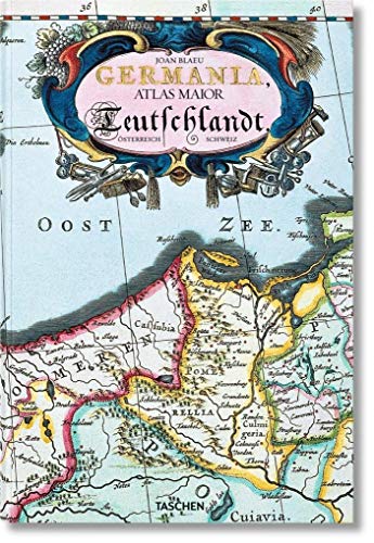
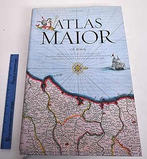
Germania : Atlas maior of 1665 ; 100 Tafeln mit Karten von Germanien, ųsterreich und der Schweiz, sowie Originaltexte von Joan Blaeu aus seinem Atlas Major von 1665, "dem gr÷ssten und prachtvollsten Atlas, der jemals ver÷ffentlicht wurde" ; nach dem Original aus der ųsterreichischen Nationalbibliothek, Wien = Deutschland / Joan Blaeu ; Einf³hrung und Texte von Peter van der Krogt ; directed and produced by Benedikt Taschen
Published by K÷ln : Taschen, 2015
ISBN 10: 3836522926ISBN 13: 9783836522922
Book
Broschur, 25,5 x 38 cm. Condition: Gut. 4. 1 Atlas (235 Seiten) ; 39 cm Gebraucht; gut. Leichte Gebrauchsspuren. 200737556 Sprache: Deutsch Gewicht in Gramm: 1600.
-
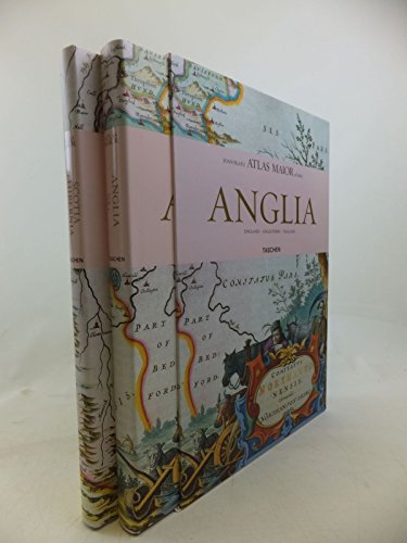
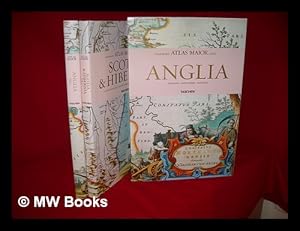
Atlas Maior of 1665: Anglia & Scotia & Hibernia (Two Volumes)
Published by Taschen, Koln, 2006
ISBN 10: 3822851043ISBN 13: 9783822851043
Book First Edition
hardcover. Profusely illustrated (illustrator). 1st edition. 4to, pp., Still shrink-wrapped from the publisher., Text in English, German and French. Fine copy in fine dust jacket & slipcase.
-

Atlas maior of 1665 / Joan Blaeu ; introduction and texts by Peter van der Krogt ; based on the copy in the Osterreichische Nationalbibliothek, Wien ; with a selection of original texts by Joan Blaeu ; directed and produced by Benedikt Taschen
Published by Hong Kong ; London : Taschen, 2006
First Edition
First Edition. Fine copy in the original gilt-blocked cloth boards in a slightly worn slip-case. Particularly and surprisingly well-preserved; tight, bright, clean and especially sharp-cornered. Physical description; 2 v. (392 p.) : ill. (chiefly col., col. maps, col. ports.) ; 39 cm. Notes; In slip case. "All 113 maps of England, Scotland and Ireland, and the original commentaries from Joan Blaeu's Atlas maior of 1665, 'the greatest and finest atlas ever published.'". Includes bibliographical references and index. Contents; Incomplete contents v. 1. Anglia = England -- v. 2. Scotia & Hibernia = Scotland and Ireland. Summary; This work contains maps of England, Ireland, and Scotland from Joan Blaeu's exquisite world atlas of 1665. "The Atlas Maior", the cartographical masterpiece of the Baroque period, was brought out between 1662 and 1665 by the Amsterdam publisher Joan Blaeu, one of Holland's leading cartographers. Originally appearing in Latin, the atlas comprised 594 maps in 11 volumes, which depicted the whole of the world as known to early modern Europe. It was the largest and most expensive book published during the 17th century. For more than 100 years, it remained the definitive atlas of the world, and today is among the most sought-after and valuable antiquarian rarities. This reprinted edition in six volumes is based on the hand-colored, gold-heightened copy in the "Osterreichische Nationalbibliothek" in Vienna, thus ensuring the best possible detail and quality. Alongside Joan Blaeu's original commentaries on the individual maps, a new text by Peter van der Krogt explains the historical and cultural associations and introduces the reader to the fascinating world of early modern cartography. This two-volume set features all 58 maps of England and 55 maps of Scotland and Ireland and the text is in English, French, and German. Subjects; Scales differ. England - Maps - Early works to 1800. Ireland - Maps - Early works to 1800. Scotland - Maps - Early works to 1800. Travel / road maps & atlases. Antiques & collectables: pictures, prints & maps. England ; Scotland ; Ireland. Reference / Atlases, Gazetteers & Maps. Technology & Engineering / Cartography. Technology & Engineering / History. 10 Kg.
-
Atlas maior of 1665
Published by Taschen, Koln, 2010
ISBN 10: 3822831255ISBN 13: 9783822831250
Seller: Mullen Books, ABAA, Marietta, PA, U.S.A.
Seller Rating:

Book
Hardcover. Condition: As New. Printed image paper covered boards, similarly7 printed dustjacket. 593 pp., profusely illustrated with vivid color reproductions of original maps and illustrations, a few folding. Measures 45 x 30 x 6.5 cm. shipping weight is 16 pounds. Texts and translations presented in English, German and French. Three and a half centuries before Google Maps there was. Joan Blaeu's atlas, the finest ever published The finest and most comprehensive baroque atlas was Joan Blaeu's exceptional Atlas Maior, completed in 1665. The original 11-volume Latin edition, containing 536 maps, put Blaeu ahead of his staunch competitor, mapmaker Johannes Janssonius, whose rivalry inspired Blaeu to produce a grandiose edition of the largest and most complete atlas to date. Covering Arctica, Europe, Africa, Asia, and America, Blaeu's Atlas Maior was a remarkable achievement and remains to this day one of history's finest examples of mapmaking. This reprint is made from the National Library of Vienna's complete, colored, gold-heightened copy, thus assuring the best possible detail and quality. The book's introduction, by the University of Utrecht's Peter van der Krogt, discusses the historical and cultural context and significance of the atlas; Krogt also provides detailed descriptions of the maps, allowing modern readers to fully appreciate Blaeu's masterwork.
-
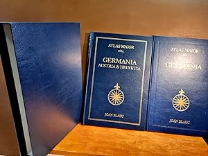
Atlas Maior of 1665: Germania + Germania, Austria et Helvetia. Sõmtliche 124 Karten von Germanien, ųsterreich und der Schweiz.Vol 1 + 2 ( 2 Bõnde )
Published by Taschen
( nach dem Original in der ųsterreichischen Nationalbitliothek, Wien. Mehrsprachige Ausgabe in Deutsch, Englisch und Franz÷sisch ) Mit zusammen 404 Seiten mit zahlreichen farbigen Karten. Jeweils in blauem, goldgeprõgten Oldr ( oder Kunstleder ? ) in einem blauen Ganzlederschuber ( oder Kunstlederschuber ? ), Folio ( 39 x 26 cm ). Von insgesamt guter und dekorativer Erhaltung. Zusammen 2 Bõnde. ( Gewicht 4000 Gramm ) ( Lagerort Gondel 3 )( Weitere Pics auf Anfrage - further images at request ).
-
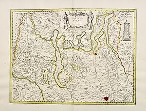
Haute Partie du Duch╚ de Milan
Published by Amsterdam, 1720
Seller: libreria antiquaria perini Sas di Perini, Verona, VR, Italy
Seller Rating:

Art / Print / Poster
Incisione in rame, colorata d'epoca, mm 375x500. Tiratura tarda dalla lastra originale di Blaeu, la cui lastra fu venduta dopo l'incendio che ne distrusse l'officina.Rispetto alla medesima carta pubblicata nel Seicento il cartiglio non viene colorato e si nota una crepa della lastra di rame al centro in alto. Cornelius Mortier si associ┌ a Johannes Covens nel 1721, dopo che il padre Pierre era morto nel 1711. La loro fu una delle pi? importanti aziende editoriali olandesi del Settecento. Ottimo esemplare. Nr.cat: Cod 2801.
-
![Stock image for The Atlas Blaeu-Van der Hem of the Austrian National Library [ An Illustrated and Annotated Catalogue ] ------ Complete set : 8 Vols for sale by Okmhistoire](https://pictures.abebooks.com/isbn/9789061942580-uk-300.jpg)
Couverture rigide. Condition: Neuf. Dust Jacket Condition: Neuf. 2Ķme ╔dition. Netherlands , Hes de Graaf Publishers , 1996. 8 Volumes/8. -- Volumes I-V compiled by Peter van der Krogt and Erlend de Groot; Volume VI compiled by Peter van der Krogt, Erlend de Groot and Martijn Storms; Volume VII by Erlend de Groot; Volume VIII edited by Koert van der Horst -------- A complete descriptive and illustrated catalogue of one of the largest and finest atlases ever assembled. Now housed in the ųsterreichische Nationalbibliothek in Vienna, the 46-volume atlas is an expanded version of Joan Blaeu's Atlas Maior or 'Great Atlas', published in Amsterdam between 1660 and 1663. Though the core of the atlas consists of the several hundred maps issued by Blaeu, the original owner of the atlas, Laurens van der Hem (1621-1678), added other maps, views, and drawings of his own choice, including four volumes of manuscript maps of Africa and Asia made for the Dutch East India Company (VOC). The practice of augmenting atlases was common in the seventeenth century, but few of these personalized atlases have survived the centuries. The catalogue in 7 volumes (plus a volume about the making of the facsimile) will include all the sheets in the atlas reproduced in black-and-white, with cartographical historical and arthistorical descriptions by P. van der Krogt and E. de Groot. Each volume will contain approximately 16 full-colour illustrations. ***************************** I. Spain, Portugal and France. Descriptive Catalogue of Volumes 1-8 of the Atlas. 1996. With about 700 illustrations. 632 pp. ISBN 978 90 6194 278 8 II. Italy, Malta, Switzerland and the Low Countries. Descriptive Catalogue of Volumes 9-17 of the Atlas. 1999. With about 700 illustrations. 732 pp. ISBN 978 90 6194 348 8 III. The British Isles, Northern and Eastern Europe. Descriptive Catalogue of Volumes 18-24 of the Atlas. 2002. With about 700 illustrations. 552 pp. ISBN 978 90 6194 189 7 IV. Holy Roman Empire, Hungary, Greece, Constantinople, Smyrna and Bible Maps. Descriptive Catalogue of Volumes 25-34 of the Atlas. 2004. Sm.folio. Cloth. With about 800 illustrations, including 16 in colour. 708 pp. ISBN 978 90 6194 179 8 V. Africa, Asia and America, Including the "Secret" Atlas of the Dutch East-India Company (VOC). Descriptive Catalogue of Volumes 35-46 of the Atlas. 2005. Sm. folio. Cloth. With about 700 illustrations, including 17 in colour. 640 pp. ISBN 978 90 6194 199 6 VI. The Supplemental Volumes (Ergõnzungsbõnde). Descriptive Catalogue of the Four Supplemental Volumes to the Atlas. 2008. Sm. Folio. Cloth. With about 300 illustrations. Approx. 500 pp. ISBN 978 90 6194 439 3 VII. The World of a Seventeenth-Century Collector. 2006. Sm. folio. Cloth, with full colour dustjacket. With 150 black & white and 16 colour illustrations. 395 pp. ISBN 978 90 6194 359 4 VIII. The History of the Atlas and the Making of the Facsimile. An accompanying publication with background information on the Atlas Blaeu-Van der Hem and the production of the facsimile. Cloth with full colour dust jacket. 244 pp. 137 full colour illustrations.