About this Item
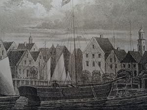
Mit der Karte vom Wattenmeer und den schönen Ansichten von Husum (Hafen), Nordstrandischmoor, Sylt (Morsumkliff, Hörnum, Rotes Kliff, Keitum, Westerland, Lister Dünen) und Föhr (Wyk und Boldixum) sowie zusätzlich die Karte des alten Nord-Frieslandes bis an das Jahr 1240 (nach J. Meyer) aus dem Verlag von F. Dröhse.;$$;Hansen, C.P. Das Schleswig'sche Wattenmeer und die friesischen Inseln. Glogau, Flemming, 1865. VIII, 277 p., 1 sheet. With 10 lithographic plates and 2 (!) multiple folded maps. Half cloth binding with gilt-stamped spine title (slightly rubbed). With the map of the Wadden Sea and the beautiful views of Husum (harbor), Nordstrandischmoor, Sylt (Morsumkliff, Hörnum, Rotes Kliff, Keitum, Westerland, Lister Dünen) and Föhr (Wyk and Boldixum) as well as the map of the old North-Friesland up to the year 1240 (after J. Meyer) from the publishing house of F. Dröhse. Sprache: Deutsch Gewicht in Gramm: 500. Seller Inventory # 61259
Contact seller
Report this item
![]()


